There’s no historic blizzard in the pipeline this week (darn!), but we are tracking two systems slated to impact Colorado. The first is weak but nonetheless worth discussing, while the second, later storm packs more moisture and also uncertainty.
Week starts off cloudy
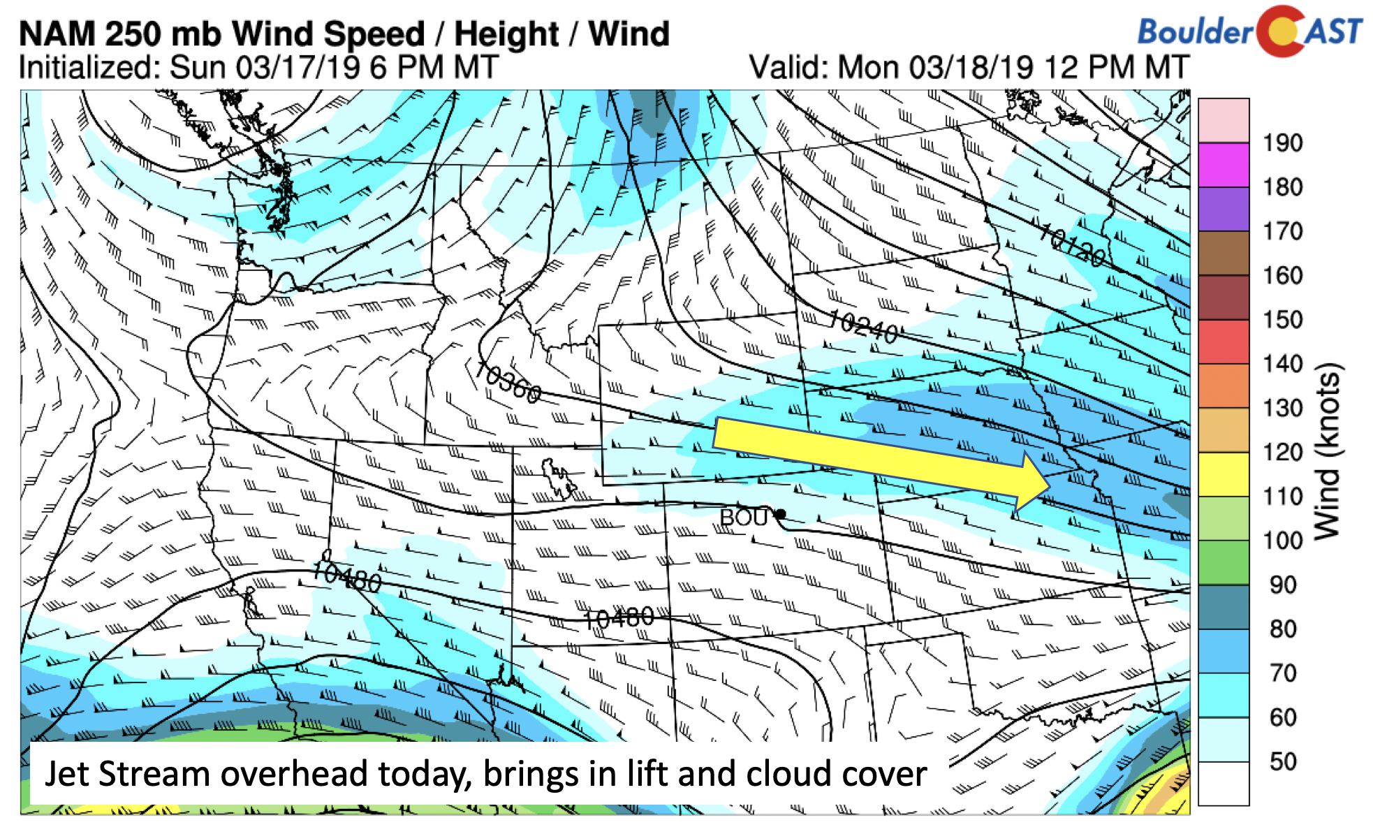
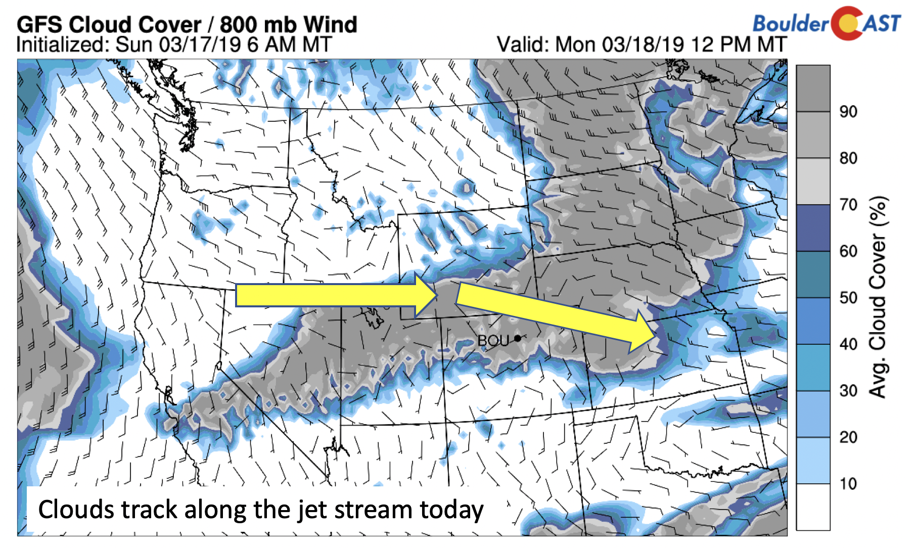
Monday starts off rather tranquil. Similar to yesterday, it will be quiet. The only difference compared to Sunday will be cloud cover. Clouds will be over us for much of the day, thanks to a stream of moisture and weak shortwave to our north. The jet is across the Colorado-Wyoming border, placing us in the right entrance region and favoring lift cloud development.
You’ll notice that the cloud forecast tracks quite closely with the upper-level jet pattern, as well as the lift east of the trough over the Dakotas. Our airmass is similar to or slightly warmer than yesterday – so even with the clouds, expect temperatures in the upper 40’s to lower 50’s.
Storm #1 Tuesday
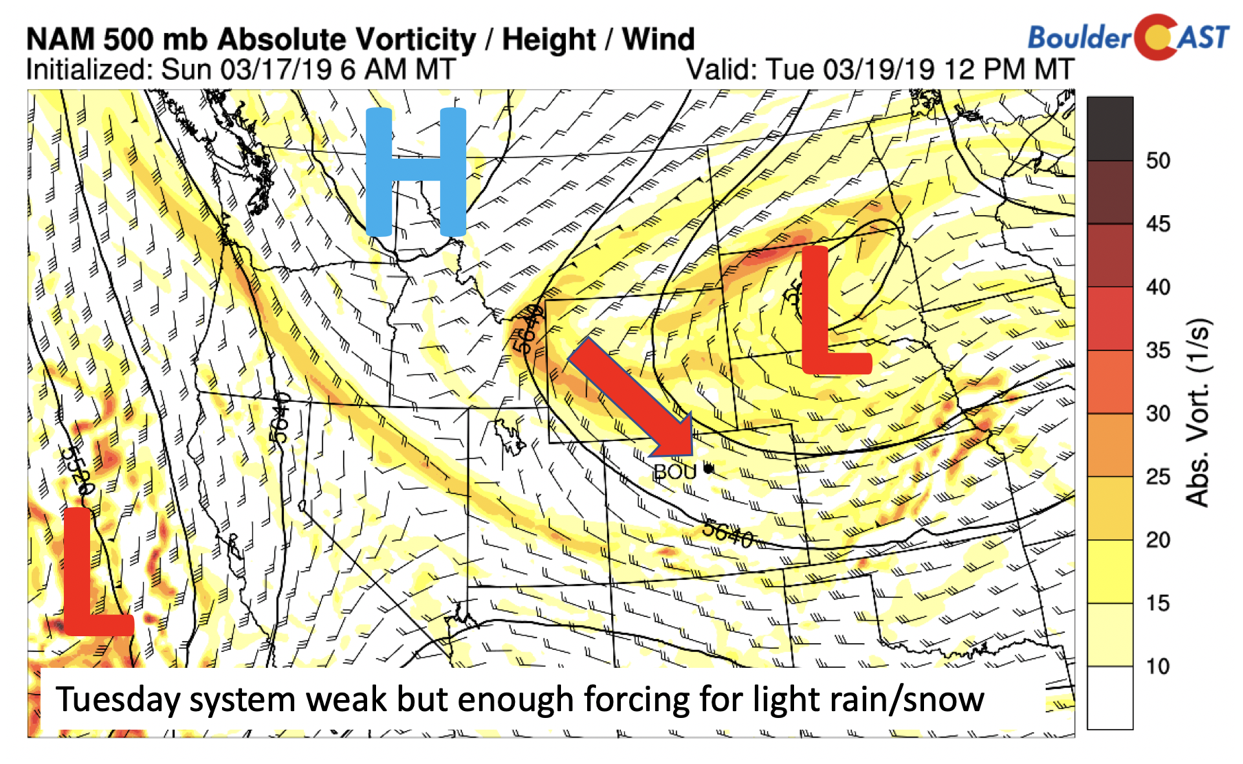
Late Monday night into Tuesday, the shortwave in the Dakotas will move southward and then southeast into Kansas. Along the route, it will create weak lift over northeast Colorado. This is not a worrisome storm, yet there is enough lift to warrant mentioning.
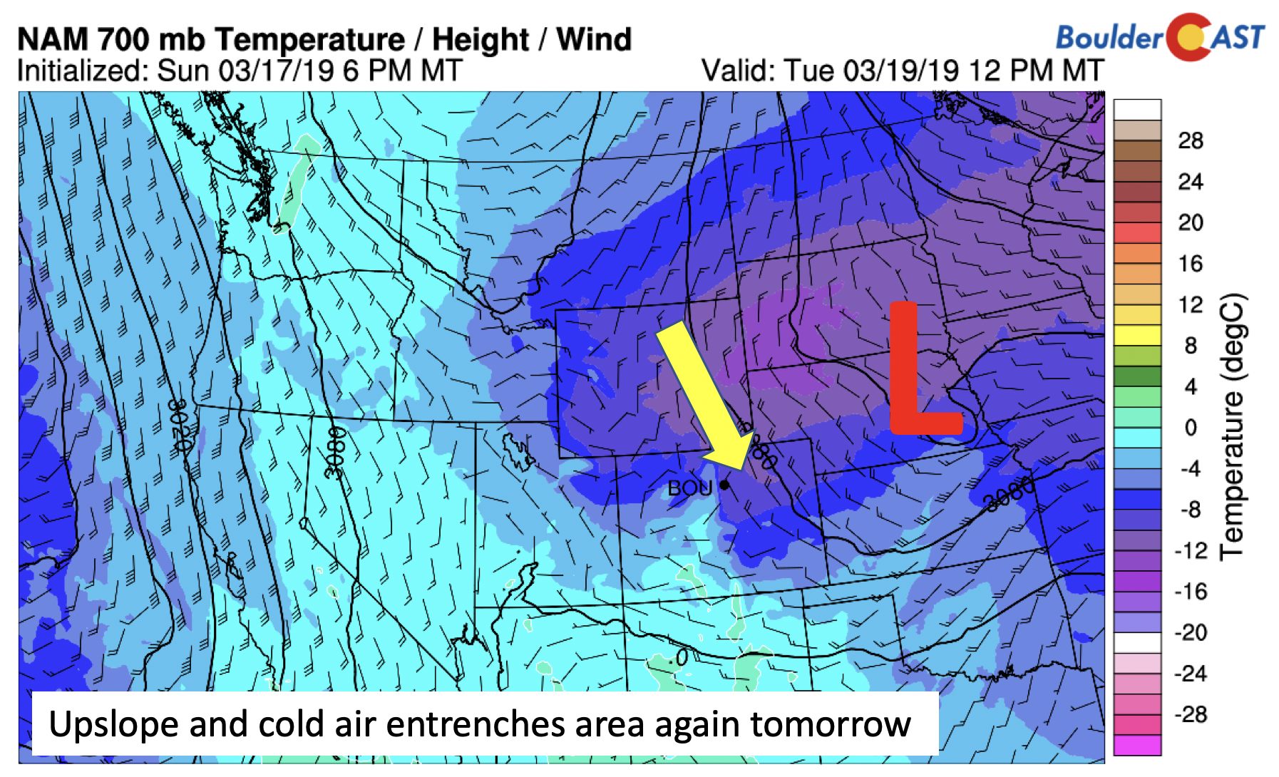
What this system has going for it is the upslope at both the surface and aloft, in addition to some colder air. The surface temperatures will be marginal (at or slightly above freezing) during the day Tuesday as well as limited moisture.
In fact, most of the forecast guidance keeps the precipitation light and/or along the Foothills and southern Colorado. The latest GFS guidance, however, as of last night, showed a much wider swath of precipitation during the day tomorrow over the Plains, with up to 1″ in some spots, perhaps due to the stronger orientation of the shortwave.
Either way you look at it, it should be a weak system. The snow levels will be borderline, hence why we are forecasting a mix of rain/snow showers. Overall, our forecast calls for some light rain showers/sprinkles starting late Monday night. Early Tuesday, the cold front passes through and lowers temperatures to the low to middle 30’s by sunrise Tuesday. It is possible that fog and some light freezing drizzle may occur which could hamper the morning commute. Then a chance of rain/snow showers in the morning/afternoon, with any precipitation tapering off by the early evening with temperatures hovering in the upper 30’s to lower 40’s. At most, we’d be looking at a light dusting on the Plains and up to 1″ in the Foothills. This is a weak storm by ALL accounts.
Wednesday tranquil again
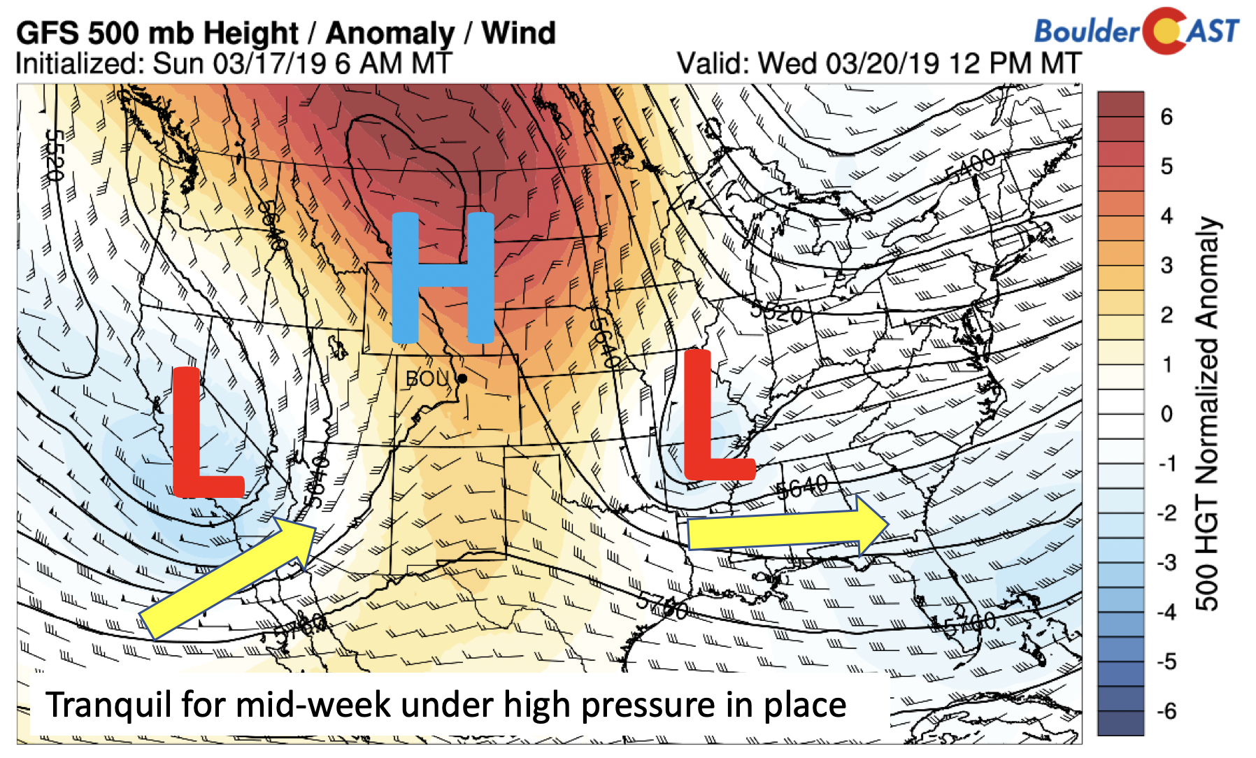
On Wednesday, the atmosphere takes a break, and we return to benign weather again. High pressure dominates the Montana area, which encompasses much of the Colorado region and southward into New Mexico (below). Highs in the 50’s return for mid-week. Tuesday’s system tracks into Arkansas, while a second one churns over California, our player for Thursday/Friday.
Storm #2 Thursday/Friday
On Thursday, the system that is progged to be over California on Wednesday moves onshore and cuts off from the flow over northwestern Arizona and eastern Nevada (below). Certainly the first impacts from this storm, if all comes to fruition, will be more snowfall for the higher terrain over western and southwestern Colorado.
The snowfall forecast shows this quite clearly, with amounts by Saturday over a foot in southwestern Colorado.
The entire state is above average already in terms of snowpack, as measured by the snow water equivalent (below), with the San Juans sitting pretty at 150 to 160% of normal.
As you can see below, the state average snowpack was only slightly above the median at the beginning of March. However, the state has seen a quick spike in the snowpack from last week’s major storm system, which pushed the snow water equivalent to 20 inches – great news for Colorado spring snowmelt and our reservoirs. And if this late week system comes as planned, it will further bolster snowpack, particularly across southern Colorado.
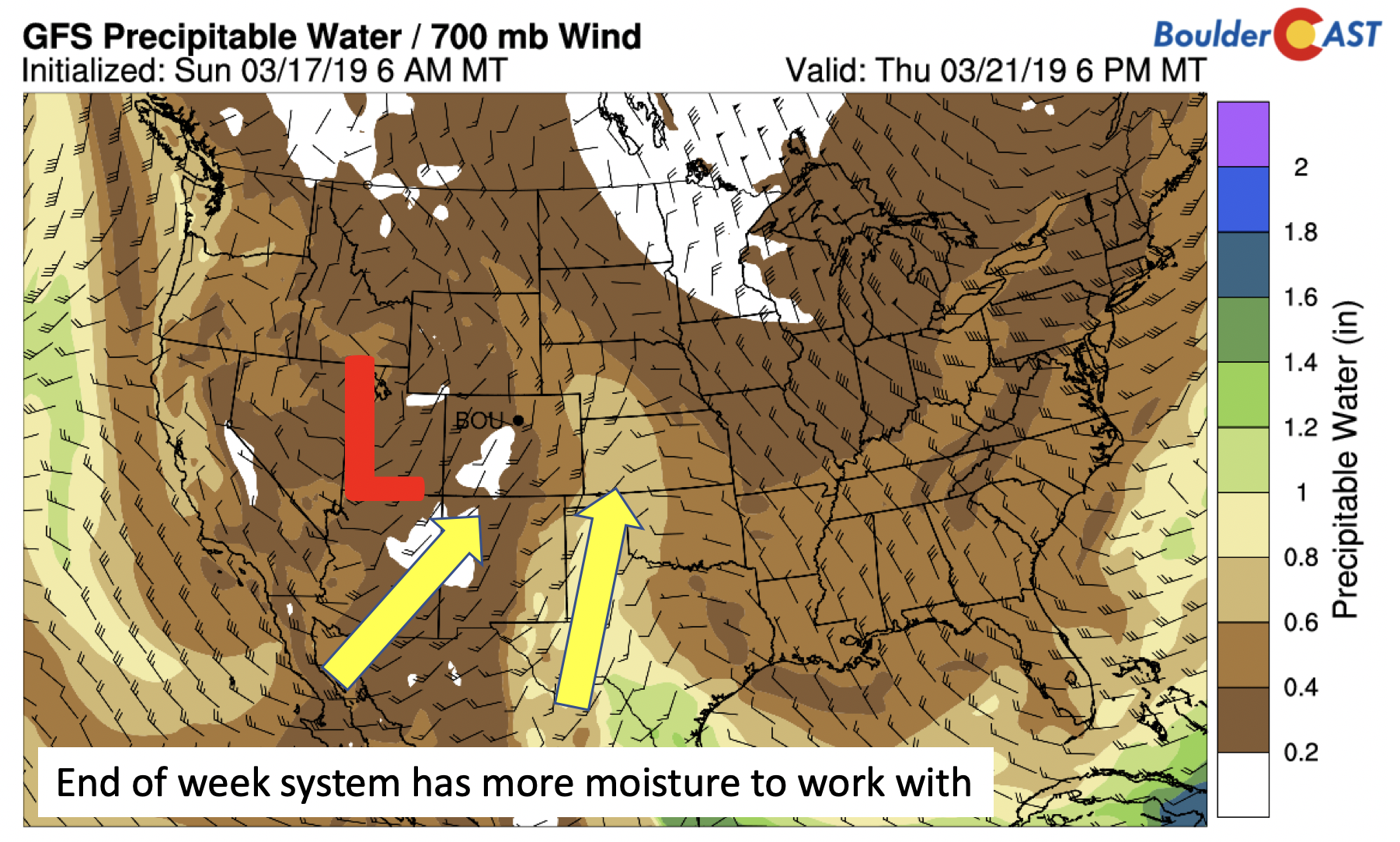
This second system has much more moisture to work with, which is one reason it is worth keeping an eye on. The moisture source (below) for Colorado will be from both the Pacific and Gulf of Mexico, a nice strong fetch from the south, as opposed to a dry northwest flow pattern from the first storm.
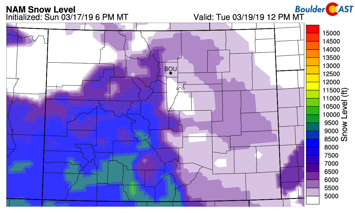
As for the impacts to the Plains, it will be something to watch closely. The system tracks eastward Thursday night and Friday, during which time it will likely transition from rain to possibly a rain/snow mix. However, given that it’s a spring storm with a southerly push of warm air, the cold air is quite limited. That places snow levels marginal once again (below). But if the system becomes wrapped-up enough, it is possible snow could end as the precipitation type Friday night to Saturday – but confidence is low at the moment. Expect warmer weather Thursday and Friday in the low to middle 50’s with increasing clouds. Rain chances are more likely late Thursday and on Friday.
Finally, if you missed our recap of the historic blizzard last week, we do encourage you to check it out. We may never see another storm like in our area!
Forecast Specifics:
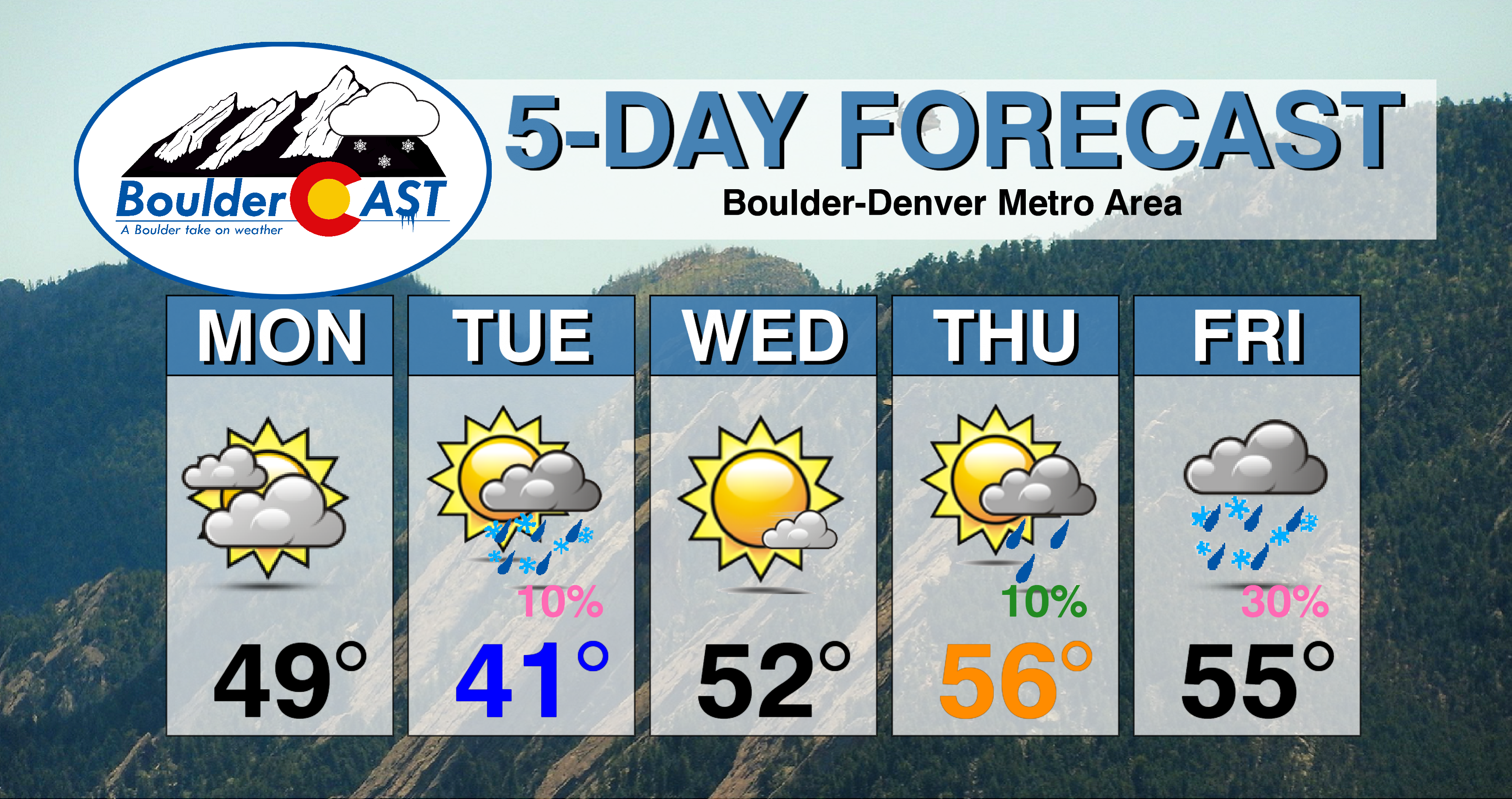
Monday: Mostly cloudy skies with high temperatures in the upper 40’s to lower 50’s on the Plains and lower 40’s in the Foothills.
Tuesday: Patchy morning fog and possibly light drizzle or freezing drizzle, then an isolated rain and snow showers in the morning through the afternoon. No accumulation expected. Highs in the upper 30’s to lower 40’s on the Plains and lower 30’s in the Foothills.
Wednesday: Mostly sunny skies and warmer, with highs in the lower 50’s on the Plains and lower 40’s in the Foothills.
Thursday: Morning sunshine, then mostly cloudy skies and chance of isolated evening rain showers. Highs in the middle 50’s on the Plains and middle 40’s in the Foothills.
Friday: Mostly cloudy with scattered rain showers likely, possibly ending as a mix of rain/snow by early Saturday. Highs in the upper 50’s. For the Foothills, highs in the lower 40’s.
High Country: Look for quiet weather for much of the higher terrain until late Wednesday night. Storm system will bring snow starting in southwestern Colorado Wednesday night, encompassing much of the High Country Thursday and part of Friday. Snow totals late in the week from this will be close to a foot in spots, and higher amounts possible in southwestern Colorado. Check PowderCAST for updated forecasts for all the Colorado ski resorts.
DISCLAIMER: This weekly outlook forecast was created Monday morning and covers the entire upcoming week. Accuracy will decrease as the week progresses as this post is NOT updated. To receive daily updated forecasts from our team, subscribe to BoulderCAST Premium.
.
Share our forecast!








You must be logged in to post a comment.