Despite the first day of summer arriving on Thursday, it sure feels like mid-spring! Temperatures have dropped into the middle 50’s with low clouds, drizzle, and fog hanging around as of Monday morning. A frontal boundary has backed into northeast Colorado and will be major player in a wet start to our week, along with the potential for severe weather as well. We do have a few dry days in the extended forecast, however.
Stormy first half of the week
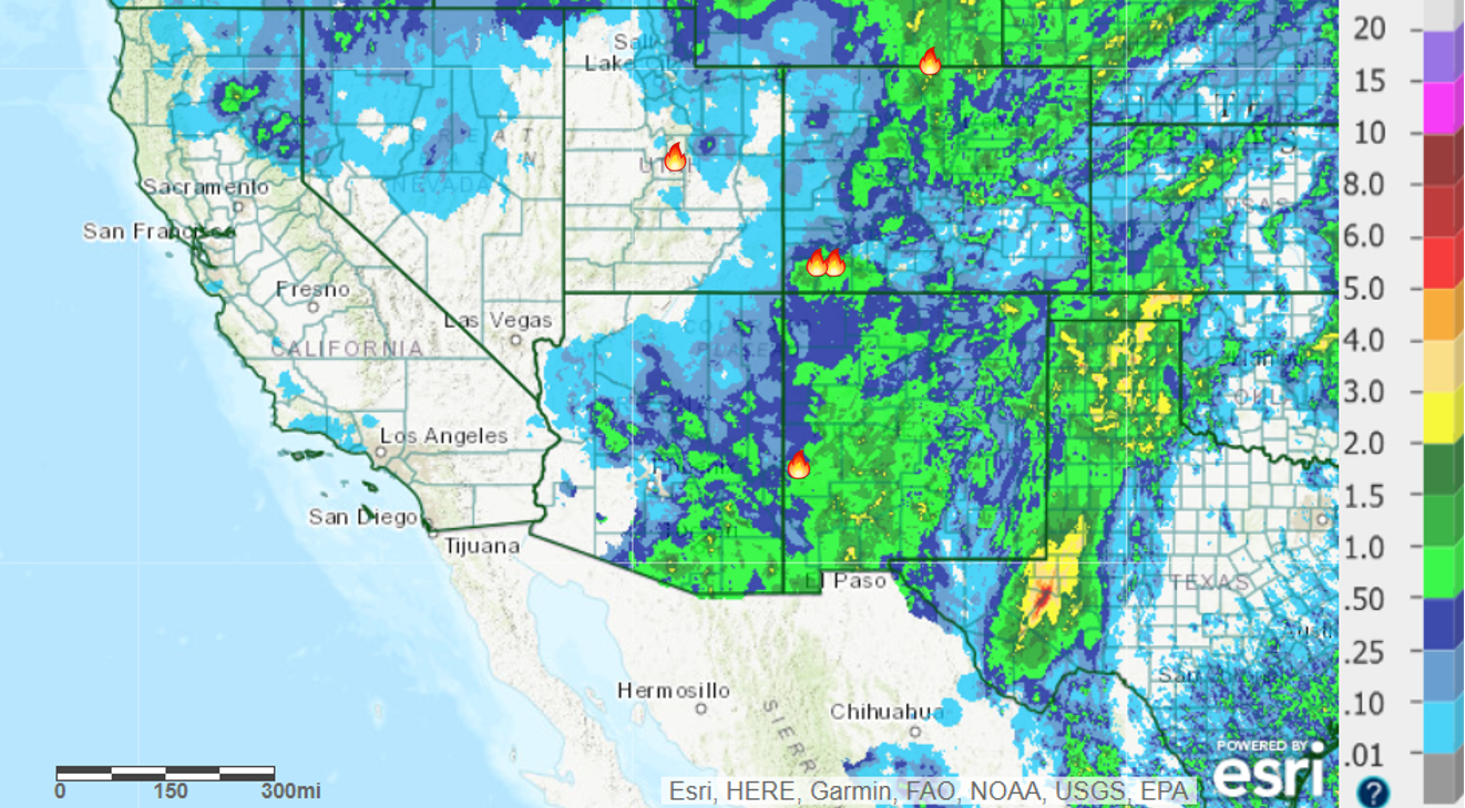
The conglomeration of moisture sources, including the remains of once Category 4 Hurricane Bud, delivered beneficial rainfall to much of Colorado over the weekend. More than 1″ of rain has fallen in Boulder, with some areas in the Foothills reporting more than 1.5″. Even better, a lot of this rain was the showery type and lightning activity was suppressed overall. Great for the ongoing wildfire efforts in southwestern Colorado. Reports from around Durango indicate about 1″ of rain fell across the extent of the 416 Fire.
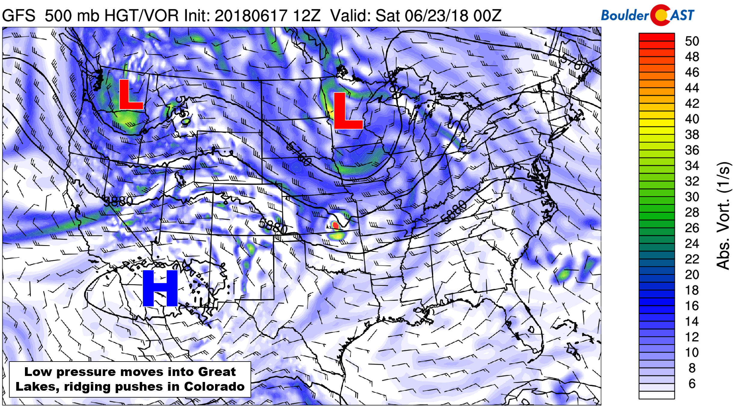
Rainy conditions will continue across the Front Range for the next several days with a stagnant weather pattern set up across our region. In the mid-levels of the atmosphere, a large cut-off low pressure will be in place across the northern Rockies, slowly wobbling eastward through the week. The Denver Metro area will be on the southern fringe of this trough throughout the week, allowing for several embedded waves of energy to pass overhead.
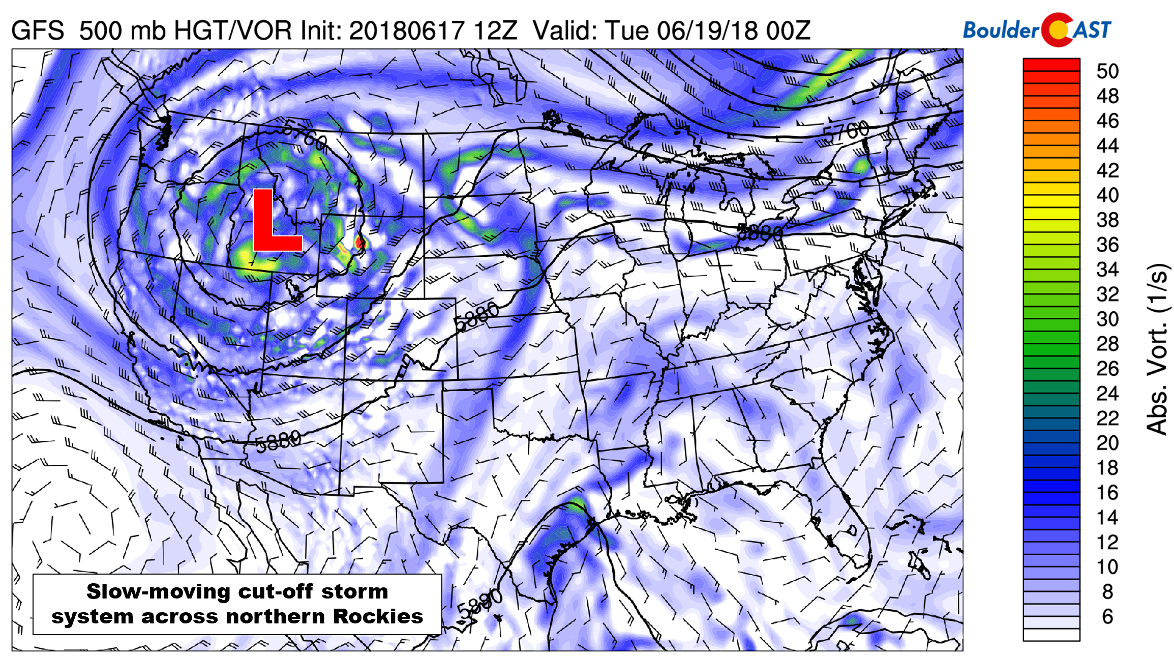
GFS 500 mb vorticity map for Monday evening showing the strong cut-off low across Idaho with a trough engulfing much of the western United States.
Working in collaboration with that large low pressure system is a near-stationary surface frontal boundary that moved into northeast Colorado early Sunday morning. It will meander back and forth a little bit through the week, but in general, it will remain parked across northeast Colorado.
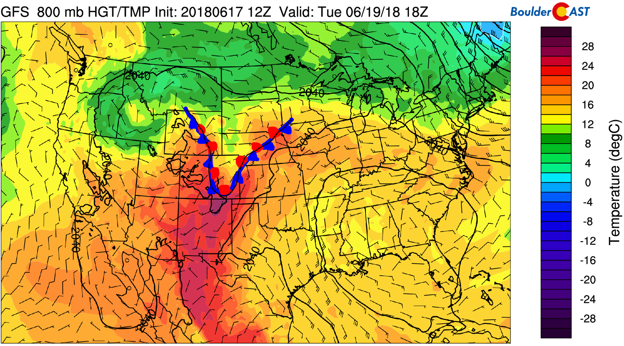
GFS 800 mb temperature map for Tuesday afternoon. A stalled cold front will remain draped across eastern Colorado.
This front will provide a few things for us:
- Persistent upslope and reinforcement of low-level moisture banking up again the Foothills each night and morning. This moisture will contribute to added afternoon instability for storm formation, and also may lead to patchy morning fog.
- Low-level upslope will contrast mid-level winds from the southwest and west producing a favorable shear environment for the development of strong to severe storms each day. The main concern will be large hail.
The aforementioned set-up will control our weather through Wednesday. Expect a rinse-and-repeat scenario of patchy morning fog giving way to some sunshine, with storms then developing by late afternoon continuing into the evening hours. Chances for rain will be in the 30 to 50% realm each day through Wednesday. The focus for hail-producing thunderstorms will be east of Denver, but we do see the potential for a few cells to initiate across the Front Range as well, especially on Monday and Tuesday. Keep an eye (or two) to the sky early in the week!
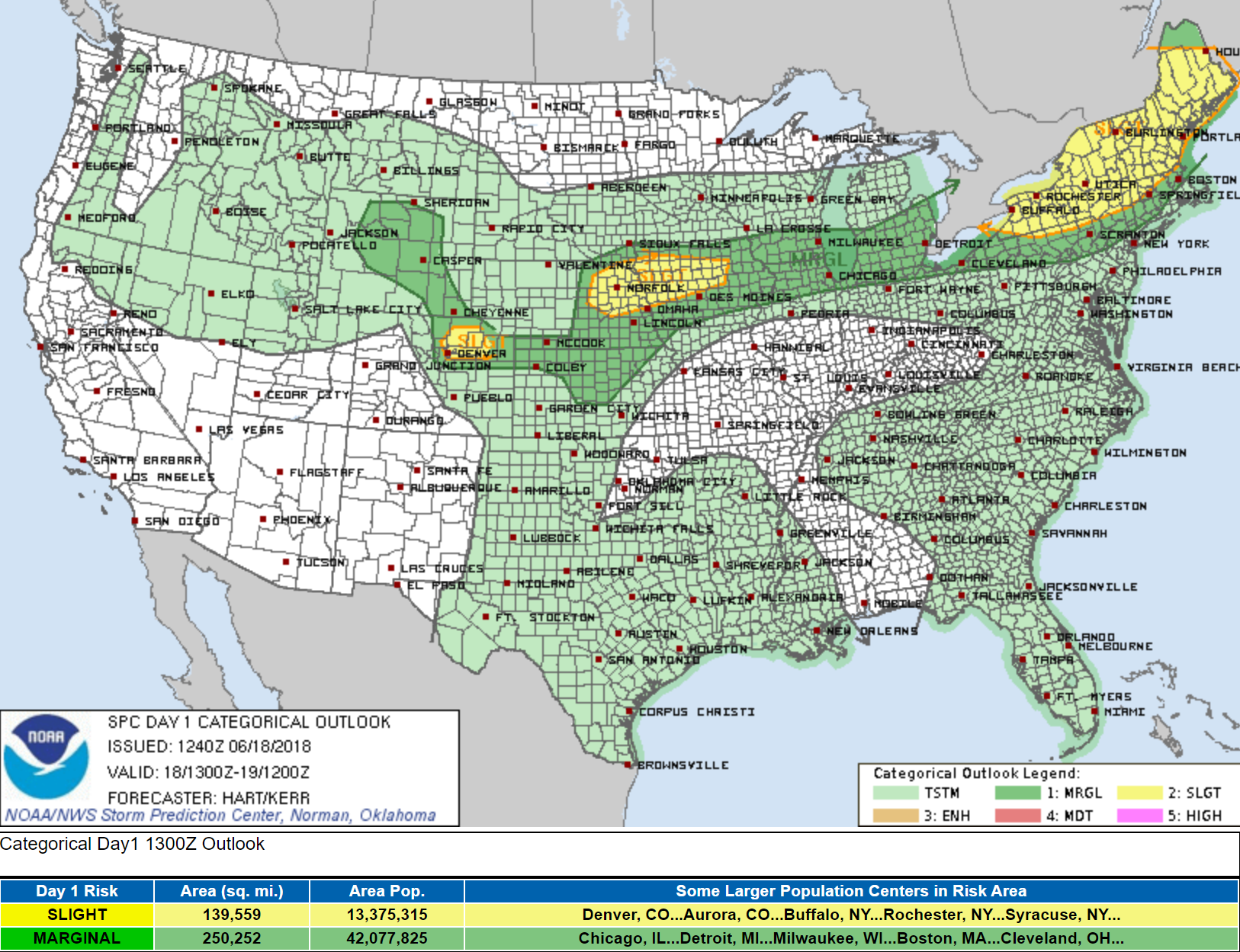
Severe storm outlook for Monday afternoon and evening from the SPC. Denver is included in the “slight” potential for supercell development, with large hail the main threat.
Clearing up Thursday & Friday
By Thursday, we should finally start to see things dry out across the region as the slow-moving low pressure pushes further east. This will turn winds across Colorado to be west-northwesterly in the middle atmosphere…a drier and tamer direction this time of year.
Although we can’t rule out a stray afternoon and evening storm Thursday and Friday either, storm coverage will definitely be much lower than the first half of the week if we do see anything. Temperatures will also be warming back up to near or slightly above seasonal normals. Impeccable timing for the first two days of summer!
Forecast Specifics:
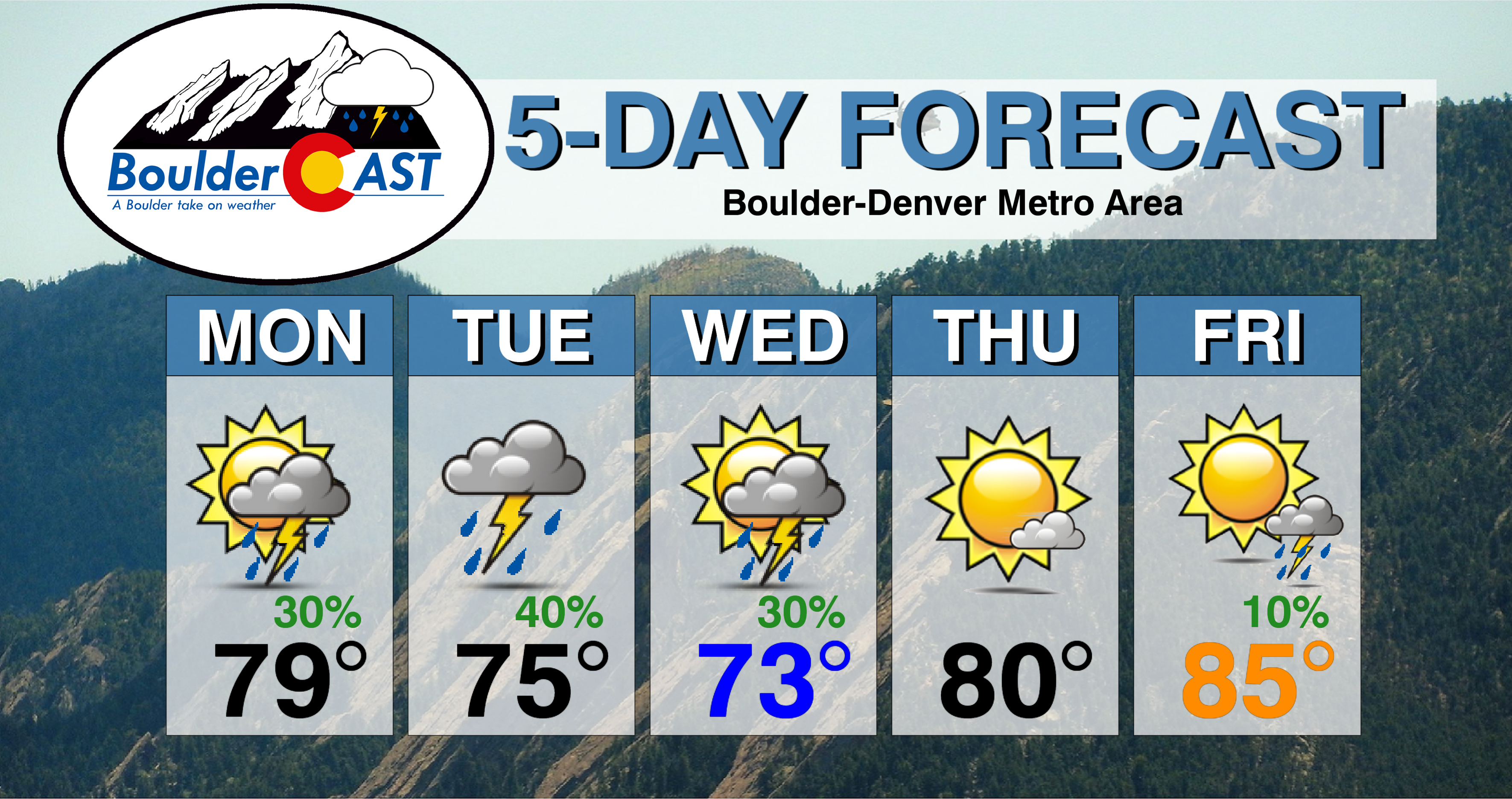
Monday: Overcast skies, drizzle, and patchy fog becoming partly sunny by afternoon. Widely scattered afternoon showers and storms will develop, with a focus northeast of Denver. A few storms could produce 1 to 2″ diameter hail. High temperatures in the mid to upper 70’s for the Plains, with mid 60’s in the Foothills.
Tuesday: Patchy morning fog and mist, then mostly cloudy and cool with scattered afternoon and evening thunderstorms. Some storms could produce large hail, primarily north and east of Denver. Highs temperatures reaching into the mid 70’s across the Plains, with middle 60’s in the Foothills.
Wednesday: Sunny early, then increasing afternoon clouds with scattered afternoon and evening thunderstorms. Highs in the lower to middle 70’s on the Plains and low 60’s in the Foothills.
Thursday: Mostly sunny and warmer. Expect highs near 80 degrees for the Plains with upper 60’s in the Foothills.
Friday: Partly cloudy and even warmer with isolated afternoon and evening thunderstorms possible. Highs are expected to push into the the middle 80’s for the Plains, with low 70’s in the Foothills.
High Country: The Mountains will largely escape thunderstorms this week as the focal point of moisture and energy will be across the lower elevations along the stalled frontal boundary. The exception will be near and east of the Continental Divide where isolated storms will be possible every day this week. Be sure to check out SummitCAST for twice daily updated forecasts for over 100 Colorado hiking destinations!
DISCLAIMER: This weekly outlook forecast was created Monday morning and covers the entire upcoming week. Accuracy will decrease as the week progresses as this post is NOT updated. To receive daily updated forecasts, subscribe to BoulderCAST Premium.
.
Share our forecast!




You must be logged in to post a comment.