
We start this week on the cold and snowy side with an area of low pressure off to our east in Kansas. However, a welcomed ridge of high pressure will take over through much of the remainder of the week and lead to a really nice warm-up. We’re also tracking the potential for a more active weather pattern towards the weekend. Read on for all the details of the weather week ahead.
We start off chilly and snowy
Below shows an animated satellite image of the storm impacting our region from yesterday (click to animate).
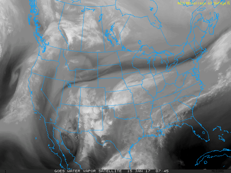
Water vapor satellite image on Sunday afternoon, with the area of low pressure over Texas
This system has tracked northward into eastern Kansas (see below). Even though the low is well to our east, the Plains and Foothills will be under upslope flow for at least the first part of the day, with a gradual trend to west-northwest downslope flow in the afternoon.
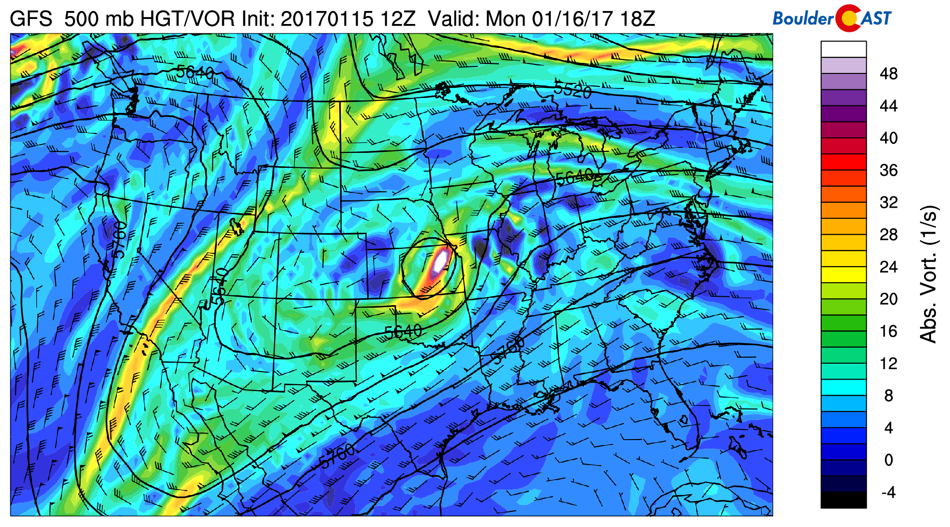
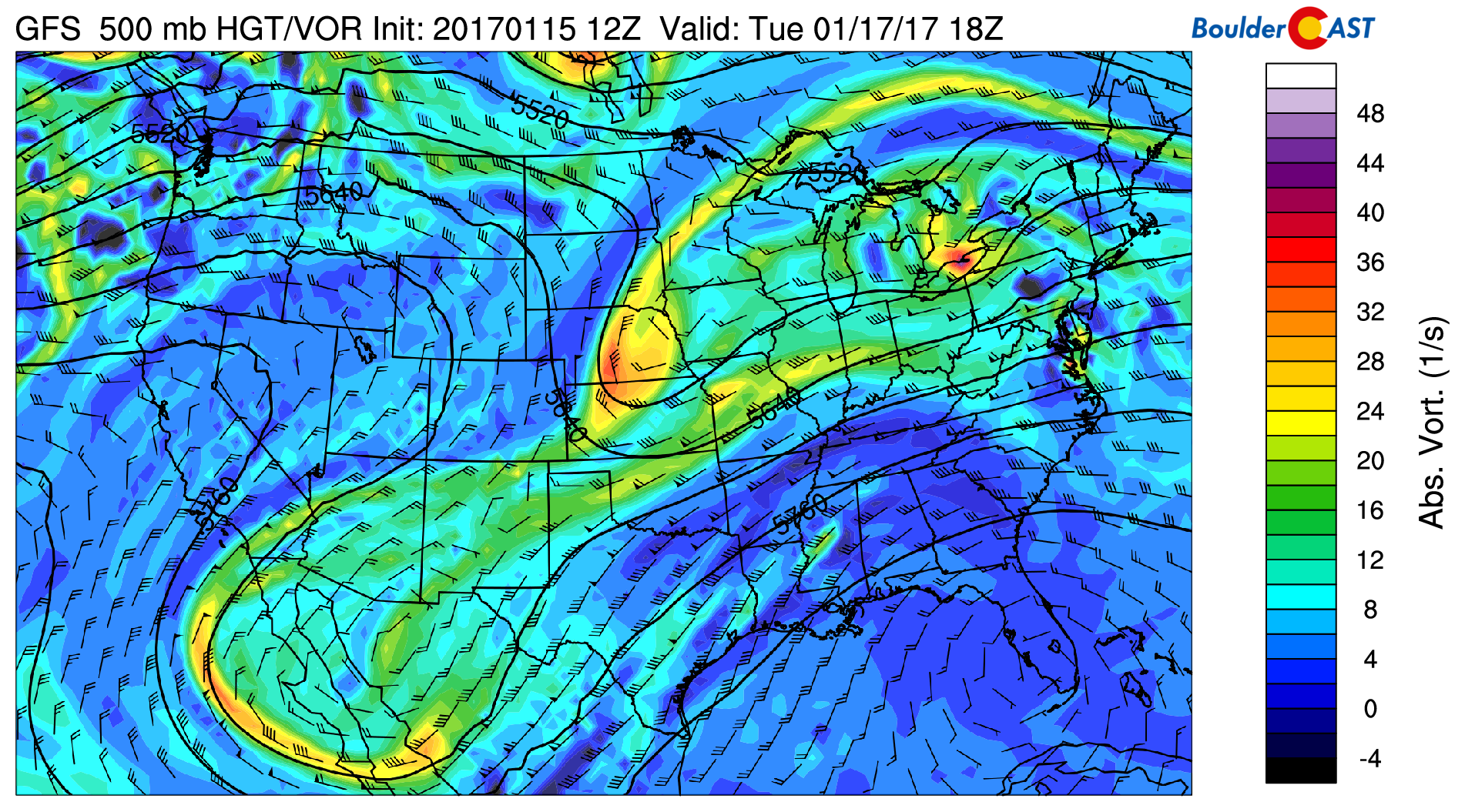
GFS 500 mb absolute vorticity and heights for this afternoon
With the upslope flow, expect light snow showers during the morning hours, lending to drier conditions in the afternoon. The HRRR high resolution model shows precipitation around morning rush-hour on the Plains…
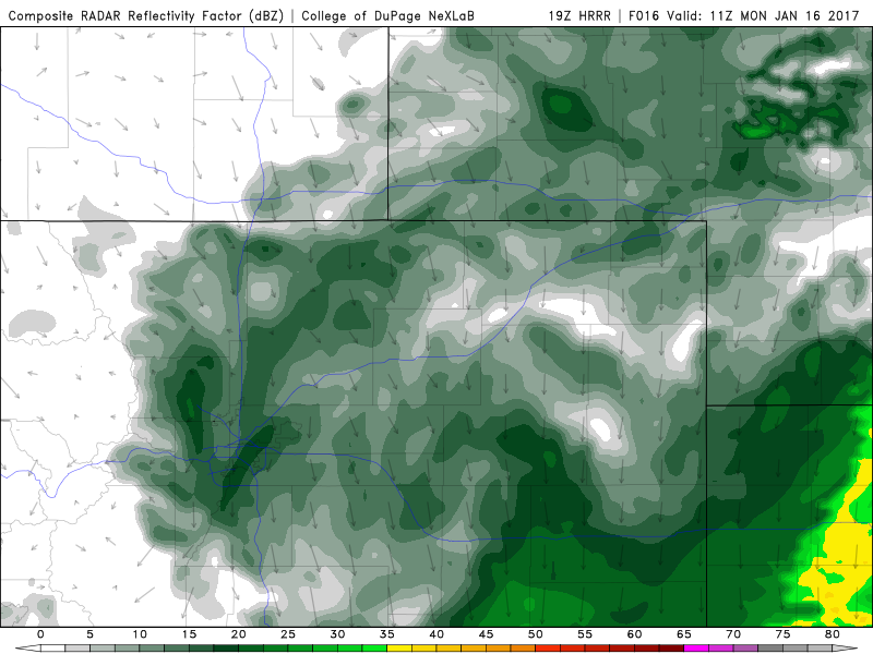
HRRR high-resolution forecast model for this morning, showing light snow across the Plains and Foothills. Image courtesy of DuPage Weather.
Below also shows the NAM model snowfall forecast ending this evening. It predicts 2-3″ over the southern Denver Metro, with maybe ~ 1″ in Boulder. We know at this point (6am Monday), most areas will see storm total accumulations in the 1 to 4″ range (a little higher than forecast!). The ski resorts are also expected to pick up 1-3″ additional inches with the westerly upslope flow today. After drier weather takes hold this afternoon, clouds will likely remain with temperatures hovering in the mid 30’s.
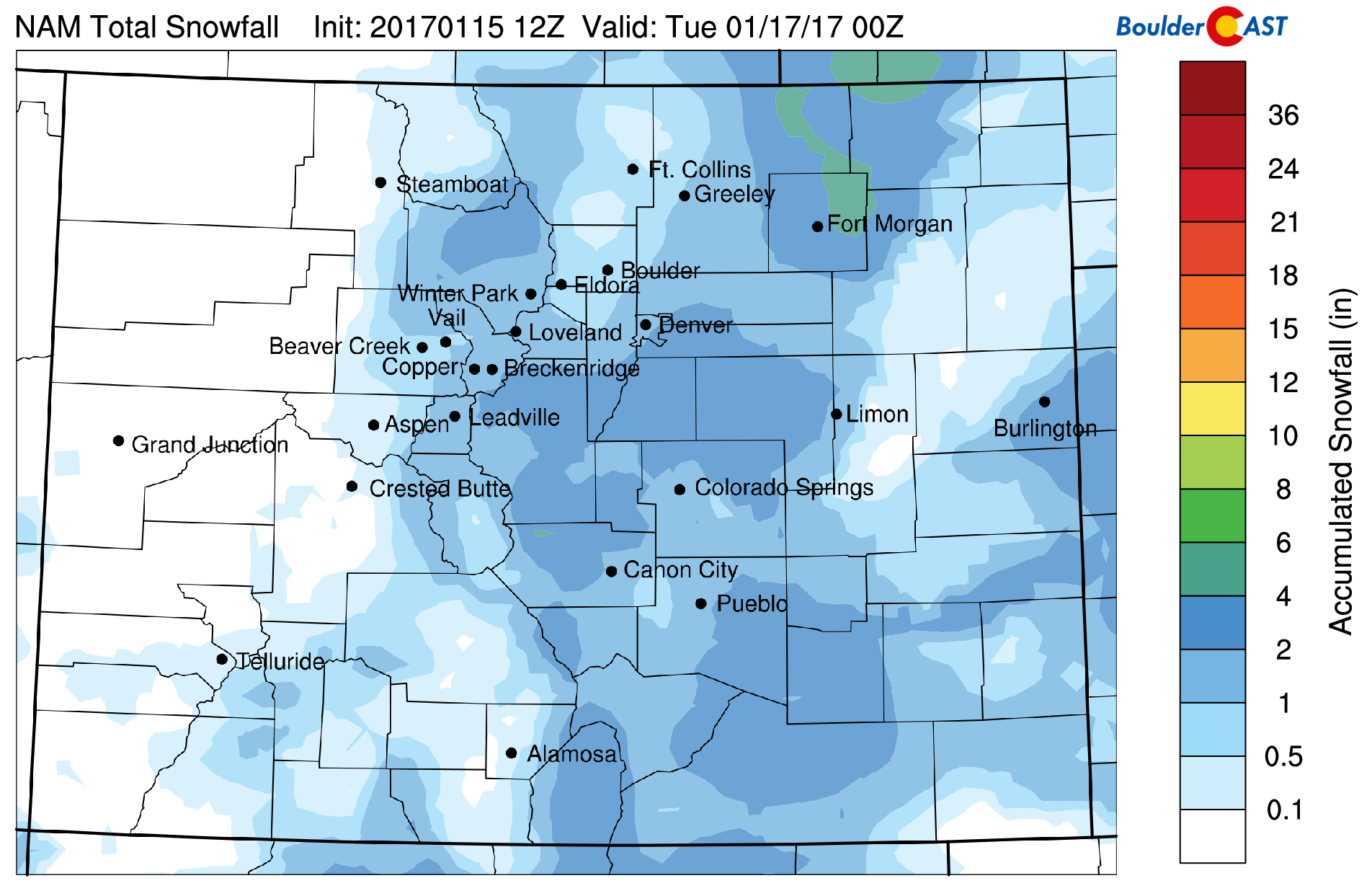
NAM model total snowfall accumulation today
Tuesday and Wednesday are warmer
On Tuesday, a ridge of high pressure builds in from the west. This is evident in the map below, showing the center of the ridge over Nevada and Utah. To the east of Colorado, a shortwave disturbance is apparent, but will not affect us.
GFS 500 mb atmospheric flow for Tuesday
With the high pressure on Tuesday, downslope flow will take over allowing temperatures to rise to near 50 degrees on the Plains. This is a result of the airmass over Colorado warming by about 4 degC. The image below also shows a tight height gradient over the Foothills west of Boulder. The downslope flow will likely lead to gusty winds in the Foothills up to 45 mph. As for skiing on Tuesday, most resorts will see partly sunny skies and generally light winds; a great day to ski with some fresh powder too.
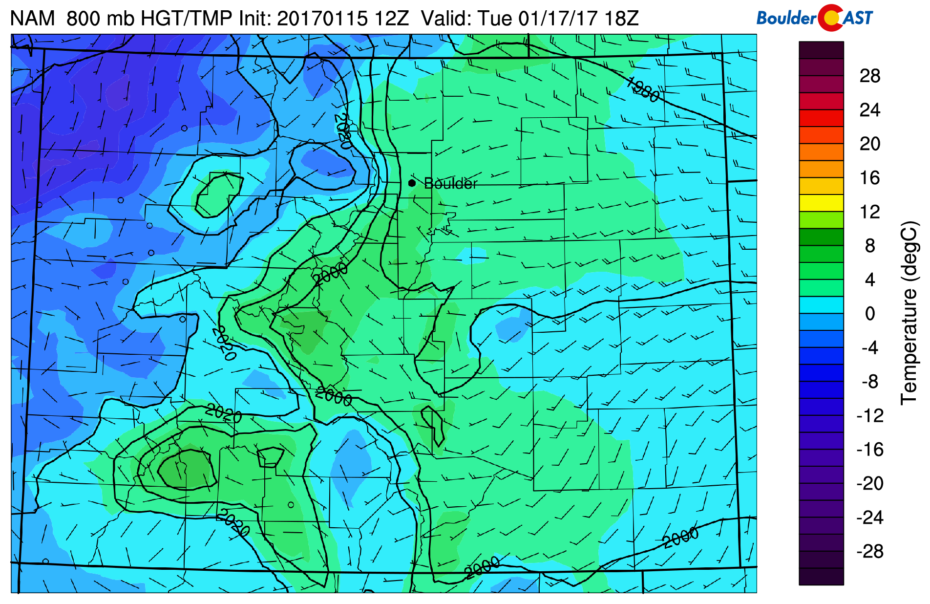
NAM low-level temperature and wind for Tuesday afternoon
On Wednesday, the ridge moves further eastward and the airmass warms by 7 degC, giving us elevated confidence that we should reach the mid to upper 50’s Wednesday thanks to the downslope flow. Lots of sunny skies as well for much of the state.
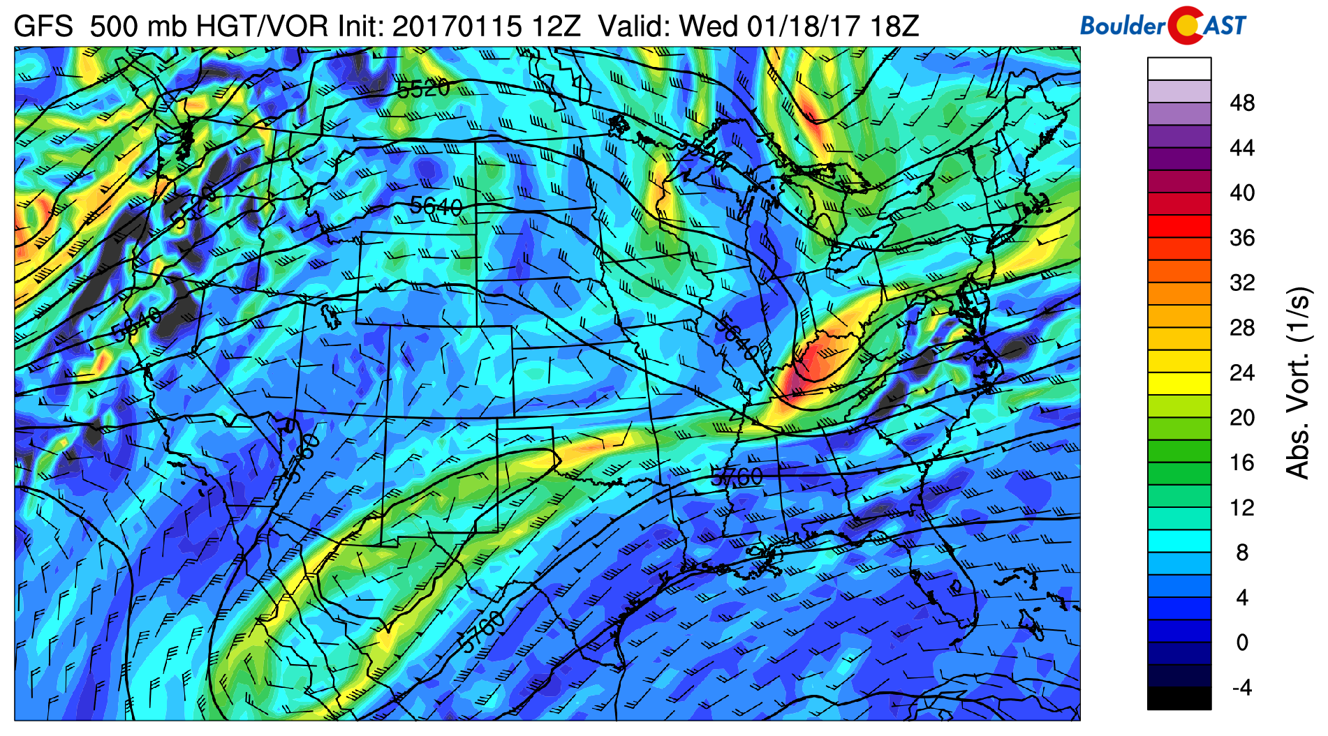
GFS mid-level 500 mb flow for Wednesday. The high pressure region is centered over Colorado
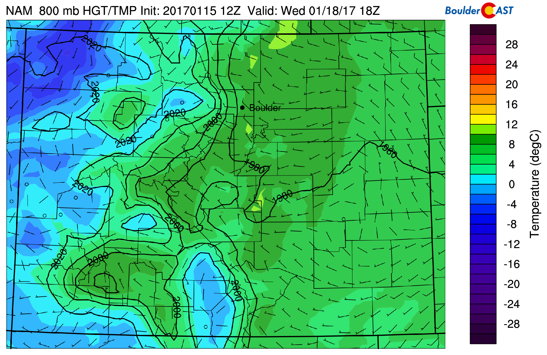
NAM model low-level airmass temperatures and winds for Wednesday, showing a warm airmass compared to Monday thanks to downslope flow
Thursday and Friday less certain…
On Thursday and Friday, the forecast looks less certain. We’ll do our best to discuss the reasoning for this below. The airmass in place on Thursday is almost identical to that on Wednesday. However, there will be a weak low-pressure system over the panhandle of Texas (see below image). If this forecast verifies, the Plains will likely see a transition from downslope flow to a weak easterly upslope flow. We don’t expect a drastic change in the weather Thursday, but if upslope flow ensues, temperatures will be a few degrees cooler than Wednesday in the mid 50’s. Of course if the track of this weak system changes, we could be cooler or warmer.
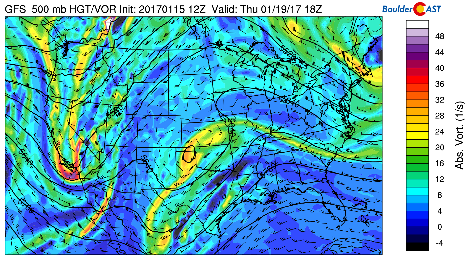
GFS mid-level 500 mb flow for Thursday
On Friday, another storm system that moved through California on Thursday (see above image) will impact the Colorado High Country (below 500 mb vorticity plot). A shortwave is evident on Friday in both the GFS and Euro models, showing a location centered around northern Arizona. This system would eventually track northeast into Colorado through the day on Friday and into early Saturday. The uncertainty lies in its track and intensity. If the track is further north, we could be seeing snow on Plains and Mountains. As of now, though, it looks to be just a snow producer for the ski resorts, with potential for 2-6″ of snow in the High Country. With all that said, we’re expecting cooler temperatures Friday with the system moving in with predicted cloud cover and highs in the middle 40’s.
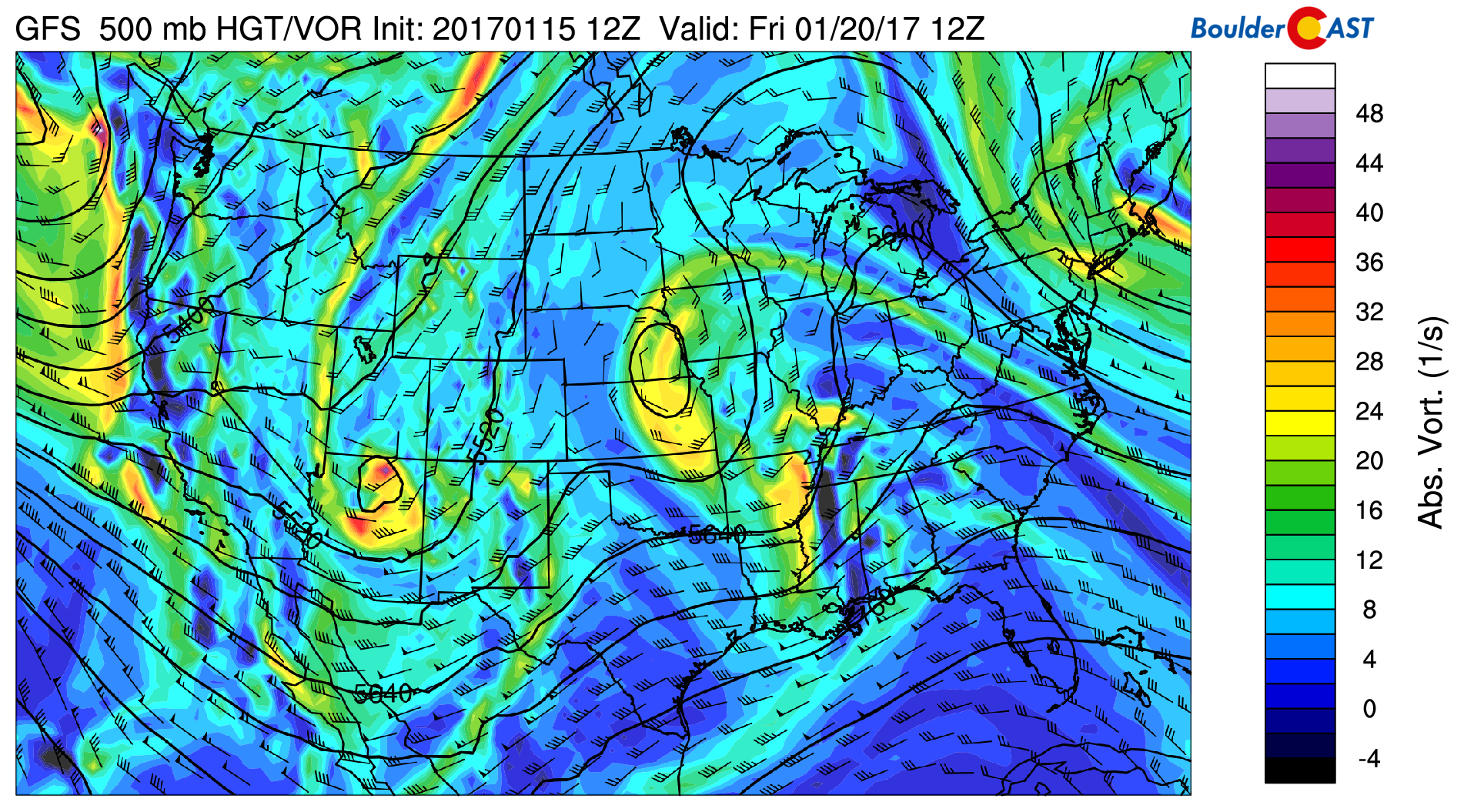
GFS mid-level 500 mb flow for Friday
Extended outlook looks active
The extended outlook could potentially turn active again after a relatively quiet week. The weather looks rather interesting over the weekend and especially next week. Below shows an animated forecast from Saturday through next Wednesday. Of note is the system Friday into Saturday as mentioned above. Of more interest is the forecasted system early next week into Tuesday. The jet stream moves south again and cold air digs in with a potential low-pressure system to impact the state. How this may impact the Plains is quite uncertain at the moment. Though, it’s probably safe to say that the ski resorts will once again see powder next week.
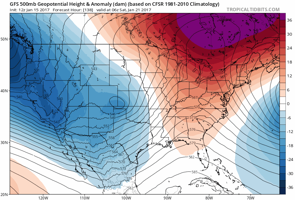
GFS extended forecast animation from Saturday through next Wednesday. Courtesy of Tropical Tidbits
Forecast Specifics:
Monday: Snow showers in the morning, tapering off in the afternoon with cloud cover and possibly partial sunshine. Highs in the mid 30’s on the Plains and middle 20’s in the Foothills. Snow accumulations will generally range from 1 to 4″ across the region.
Tuesday: Mostly sunny. West winds a little gusty at times at 25 mph and up to 45 mph in the Foothills. Temperatures reaching the 50-degree mark over the Plains and upper 30’s in the Foothills.
Wednesday: Full sunshine across much of the state, with the exception of a few high clouds. Temperatures in the upper 50’s and upper 40’s in the Foothills.
Thursday: Partly cloudy skies. Temperatures potentially a few degrees cooler in the mid to upper 50’s on the Plains and middle 40’s in the Foothills.
Friday: Cooler weather and increasing clouds across the state, though uncertainty remains. Initial forecast calls for middle 40’s on the Plains and lower 30’s in the Foothills. This could change given the potential evolution of the forecast as we go through the week.
High Country: Ski resorts will likely pick up an additional 1-3″ of snow on Monday. A lull in the snow is expected through Thursday. Snow looks to make a comeback late Thursday, Friday, and potentially over the weekend and early next week, with several more inches of powder possible.
Extended: As discussed earlier, the extended outlook looks more active than this week. However, things could drastically change, as we have seen many times so far this winter. The potential exists for a storm early next week, so stay tuned…
Mon
Tue
Wed
Thu
Fri


Temperature
36
50
59
57
45


Precip Chc (Plains)
70%(am)
0%
0%
0%
10%


You must be logged in to post a comment.