Get ready — we’ll have shades of both summer and fall this week! An anomalous ridge of high pressure over the southern Great Plains will lead to a dry and hot first few days. However, a strong storm system out West and its attendant cold front will bring well below normal temperatures and rain showers Wednesday into Thursday, our first taste autumn perhaps. The late-week period will turn more seasonal for Colorado. Read on for all the details.
This week’s highlights include:
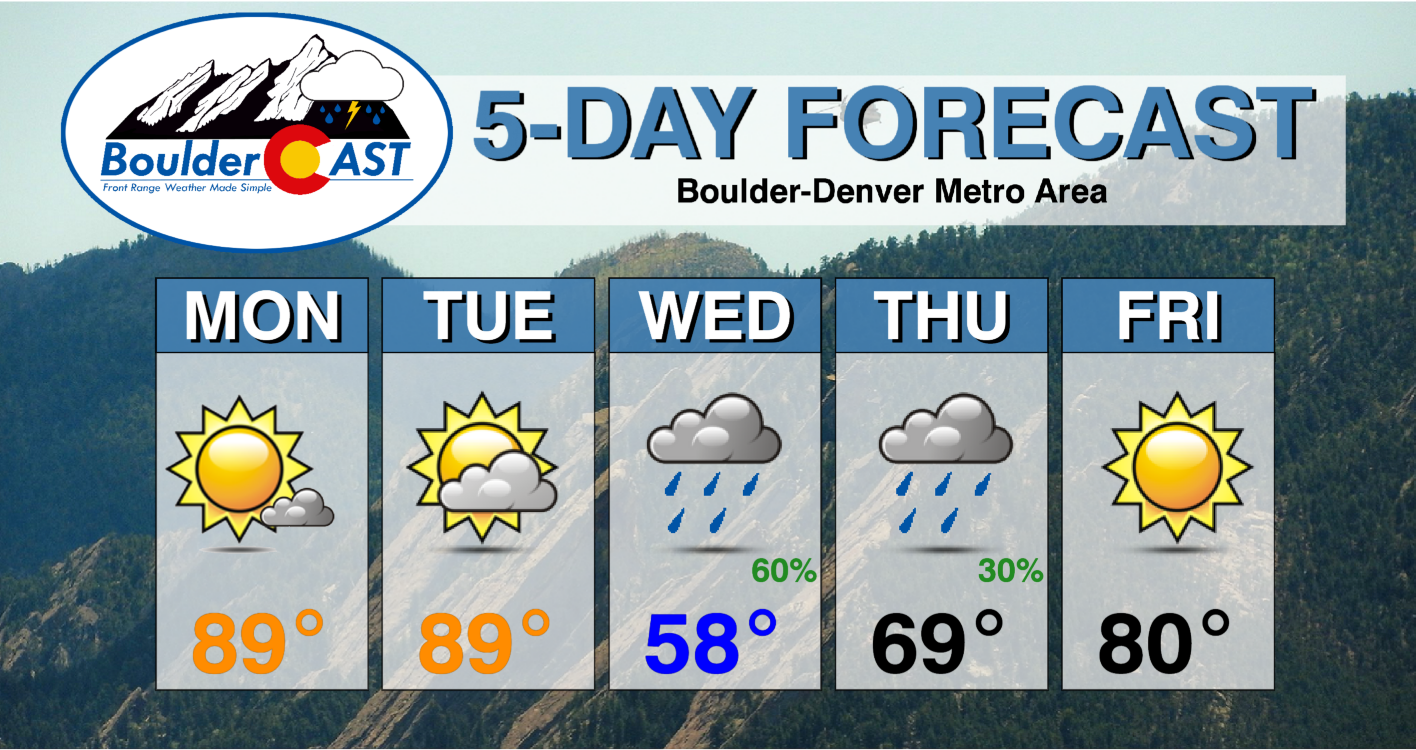
- Early in the week a big ridge to our southeast pumps in well above average temperatures more typical for July
- Upper 80s to to near 90 start the first two days of the work week
- A strong storm system with well above normal moisture combines with a strong cold front Wednesday
- Likely rain showers Wednesday, with temperatures more common in late October October
- The week ends with more seasonal and drier weather
DISCLAIMER: This weekly outlook forecast is created Monday morning and covers the entire upcoming week. Accuracy will decrease as the week progresses as this post is NOT updated. To receive daily updated forecasts from our team, among many other perks, subscribe to BoulderCAST Premium.

The final days of summer will sure feel like it
The weather week ahead in Colorado is going to be a rollercoaster! We start off the week under the influence of two major synoptic systems. The main one is a strong and anomalous ridge of high pressure over the southern Plains of Texas. This 588 decameter ridge will pump very warm air into the state and record heat across the mid-Mississippi Valley. A second feature is the large and anomalously deep trough off the coast of California.
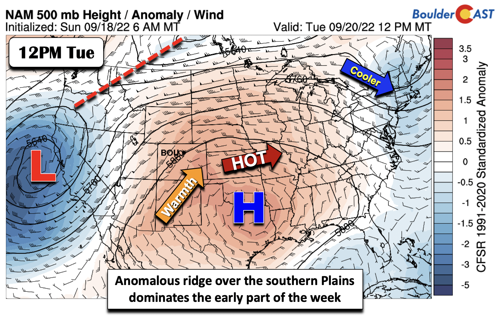
The trough and ridge combined together will amplify the flow of warm air into the Front Range from the south the next few days (see the animation below of the southerly surge). The trough will also be a player for us come midweek, but more on that a bit later…
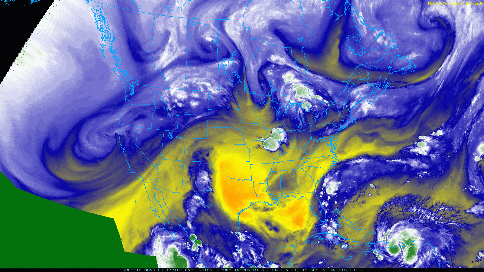
GOES-East water vapor animation from Monday morning across the nation
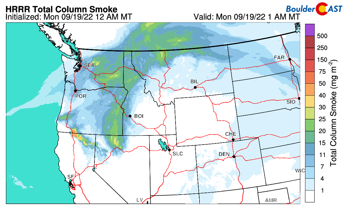
This wet and cool trough has already been helping to quell some of the largest and most active wildfires burning across the Pacific Northwest and California. Smoke has decreased across the West considerably in the last few days with bluer skies and better visibility returning to the Denver area this week.
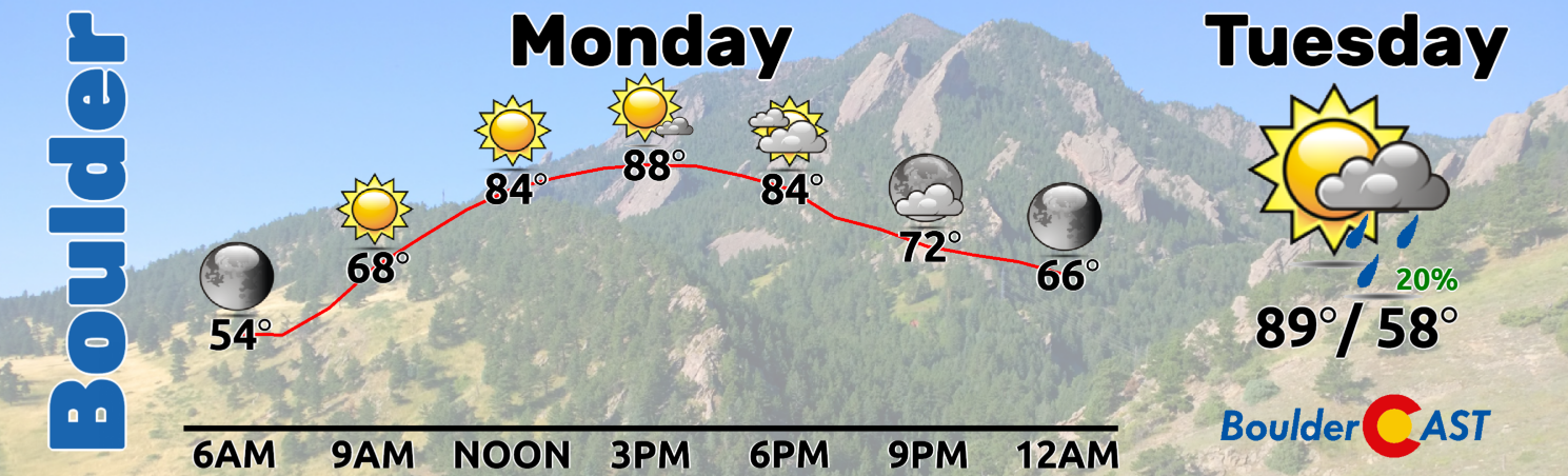
We’ll start our week in the upper 80s in Boulder to the low 90s in Denver on Monday. On Tuesday, a pre-frontal trough will drop down from the north which could shave off a degree or so from Monday’s highs. However, we’re still looking at highs typically seen in July in the upper 80s to near 90 across the Denver Metro — only fitting for the last few days of official summer!
Turning much cooler by midweek
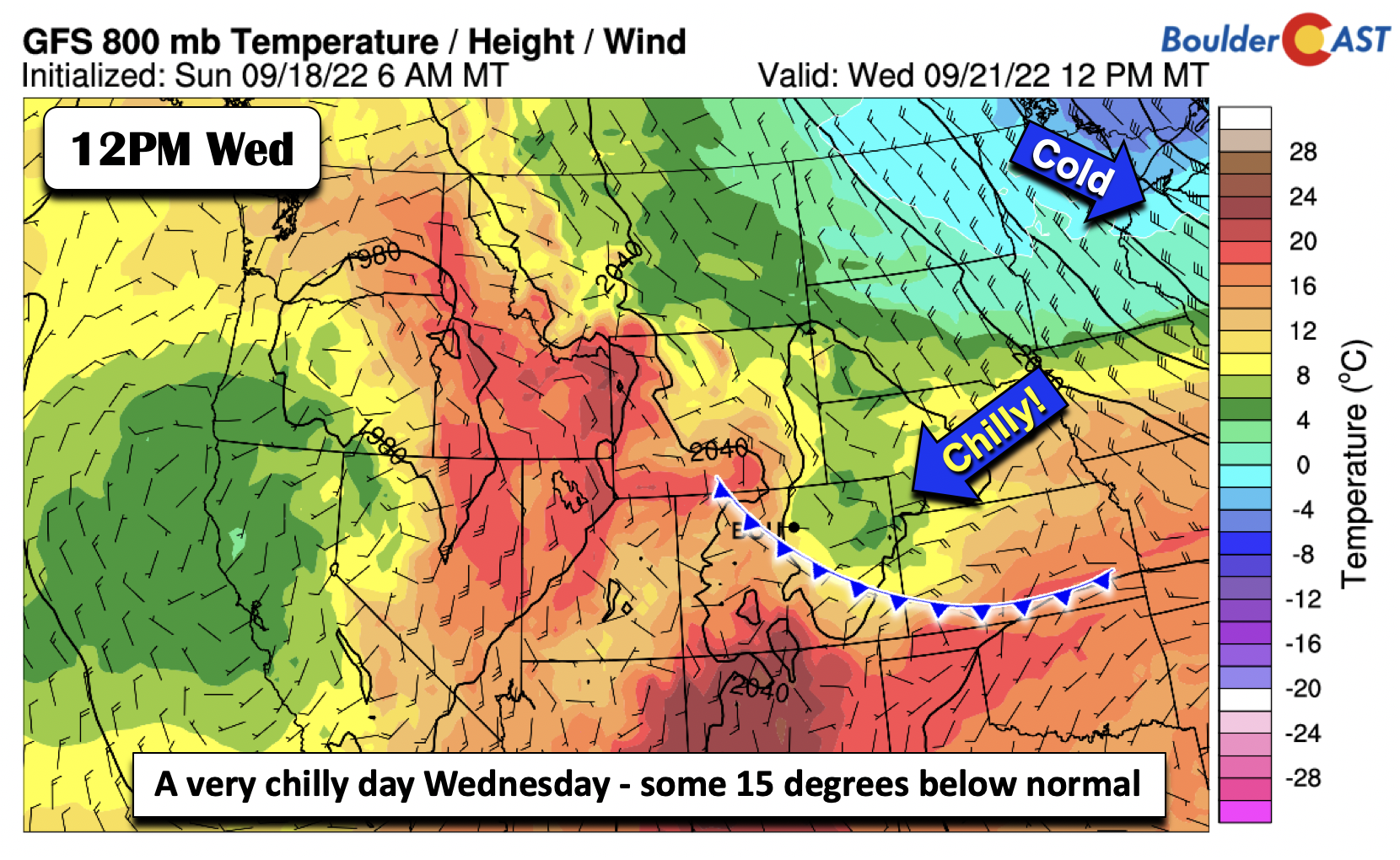
Big changes are on the way! A strong cold front is advertised throughout much of the model guidance, moving through the region late Tuesday night into early Wednesday morning. The airmass is characterized by well-below normal temperatures, which we’ll get to in a second.
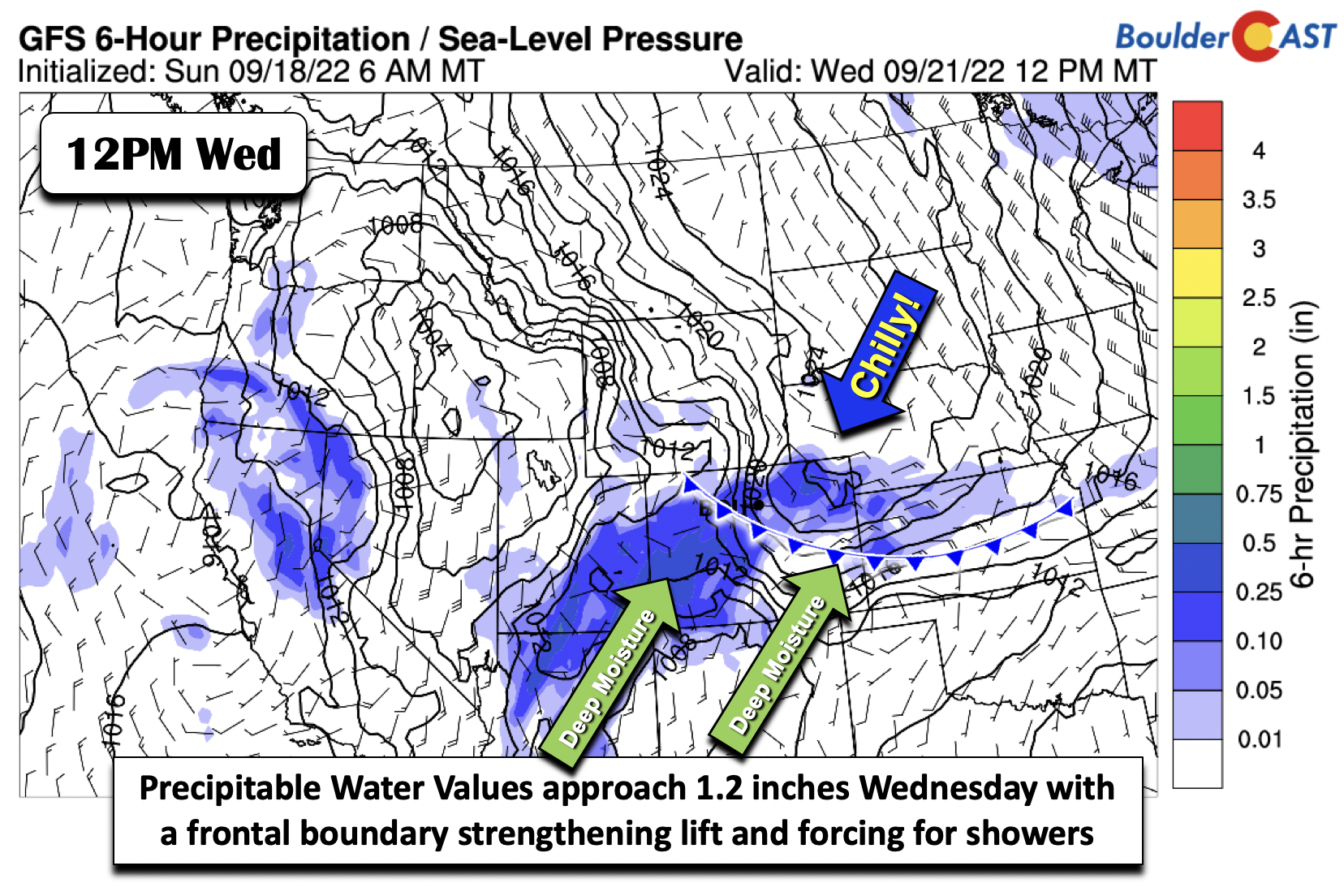
Amid the frontal passage early Wednesday, the trough mentioned earlier will move inland into northern California. Lift and energy well east of its center will ride overtop the surface and produce an elevated frontal boundary across northeast Colorado to spur widespread showers and even some storms over the western part of the state Tuesday night and Wednesday. There will also be a jet across the northern Plains that could add additional lift in the Front Range.
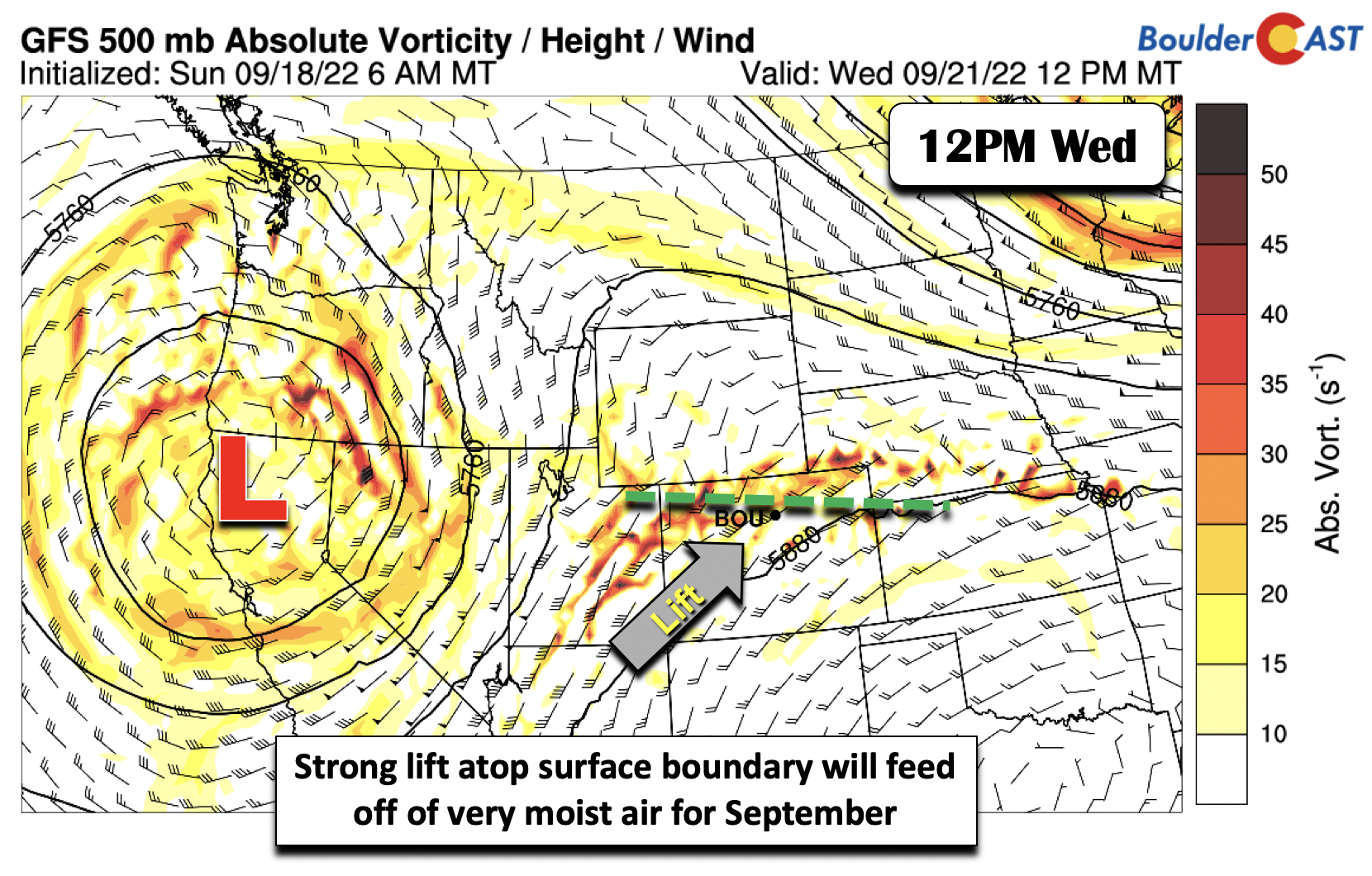
Precipitable water values with this wave of forcing on Wednesday will exceed the daily maximum record at Denver. The maximum is 1.03 inches. The forecast precipitable water values are projected to reach 1.1 to 1.2 inches for us, well above the 95th percentile. So yes, this is a very moist airmass pushing into the area which could favor isolated flash flooding mainly across burn scars and flood prone areas of the High Country. For reference, during the 2013 Flood, precipitable water values peaked around 1.4″ in the Boulder area!
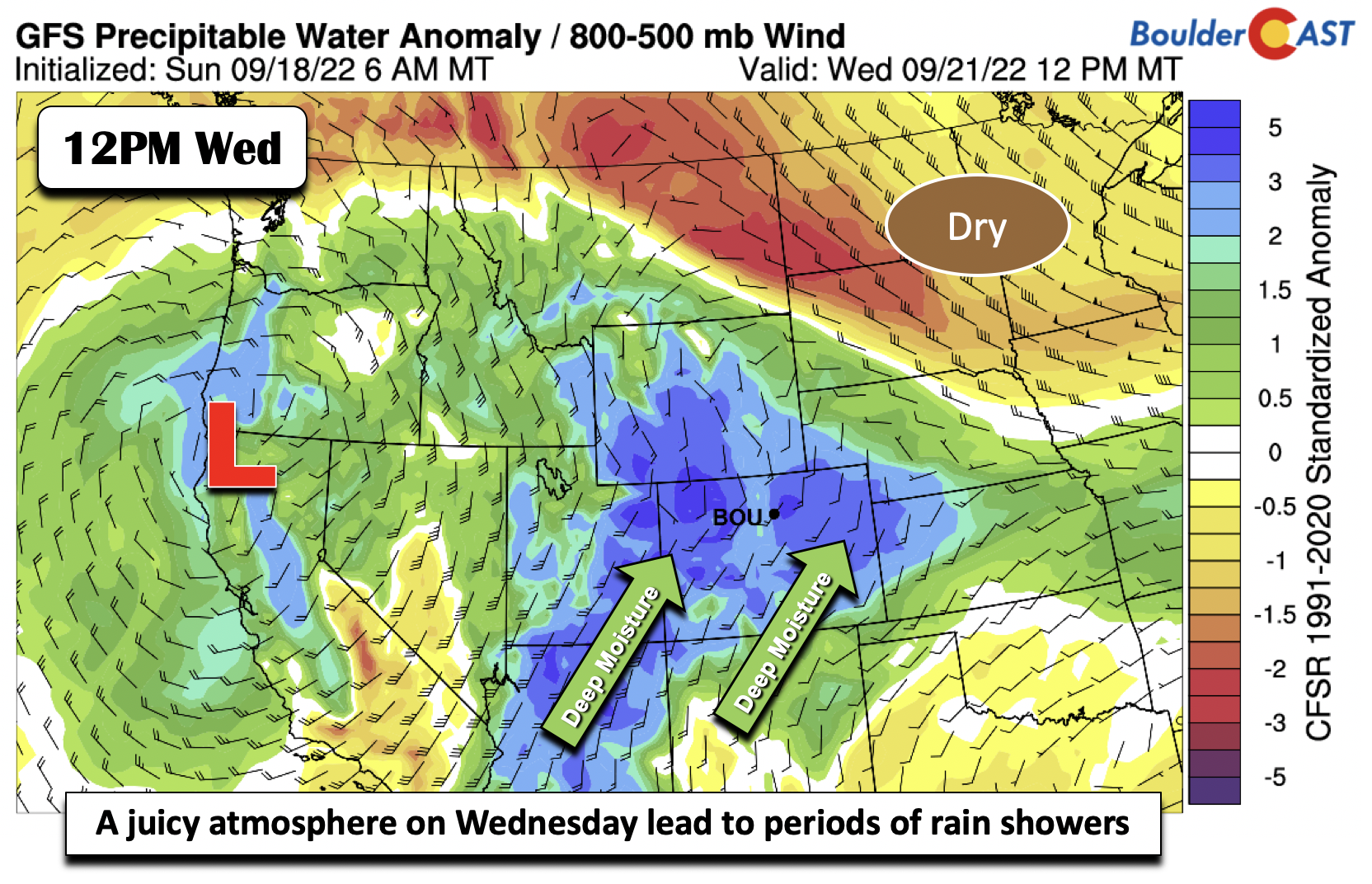
Rain showers will likely get started late Tuesday night and increase in coverage Wednesday morning and through the day. The presence of upslope will favor plentiful low clouds and drizzle outside of the shower activity. No sun is forecast on this wet day for Wednesday.
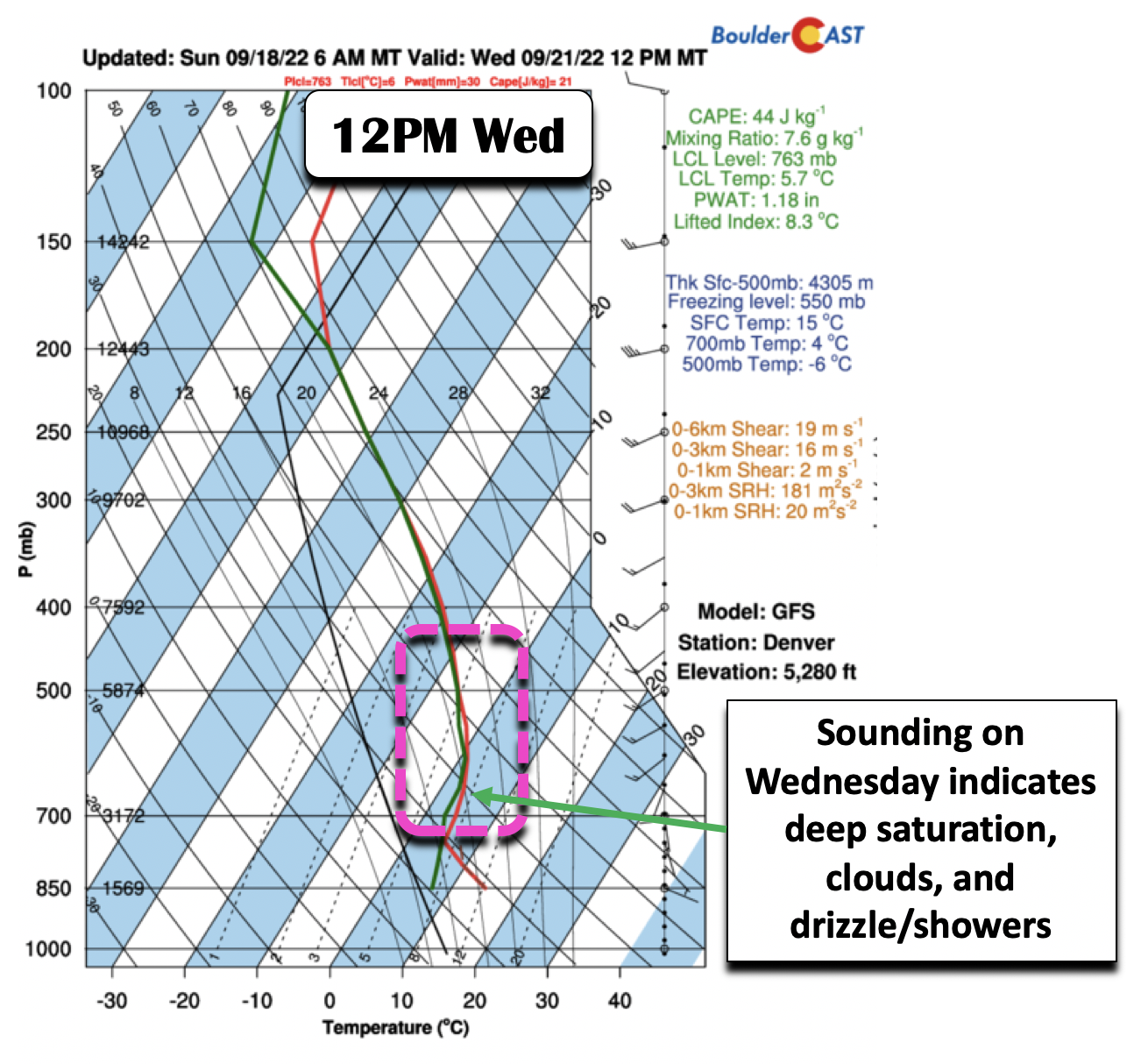
A look at a forecast sounding for Denver on Wednesday via the GFS model indicates deep saturation from the surface to the upper-levels. The passage of the front will lead to highs not typically seen until late October in the upper 50s during the day. Temperatures, though, may start out in the 60s early in the morning, dropping into the upper 50s in the morning and afternoon (some 15 degrees below normal) as the stable atmosphere traps the clouds and limits sunshine. That, along with rain showers most of the day, will mean you’ll want to stay inside for the most part and enjoy a movie fireside!
Trending more seasonal by week’s end
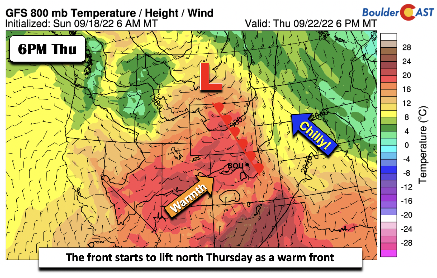
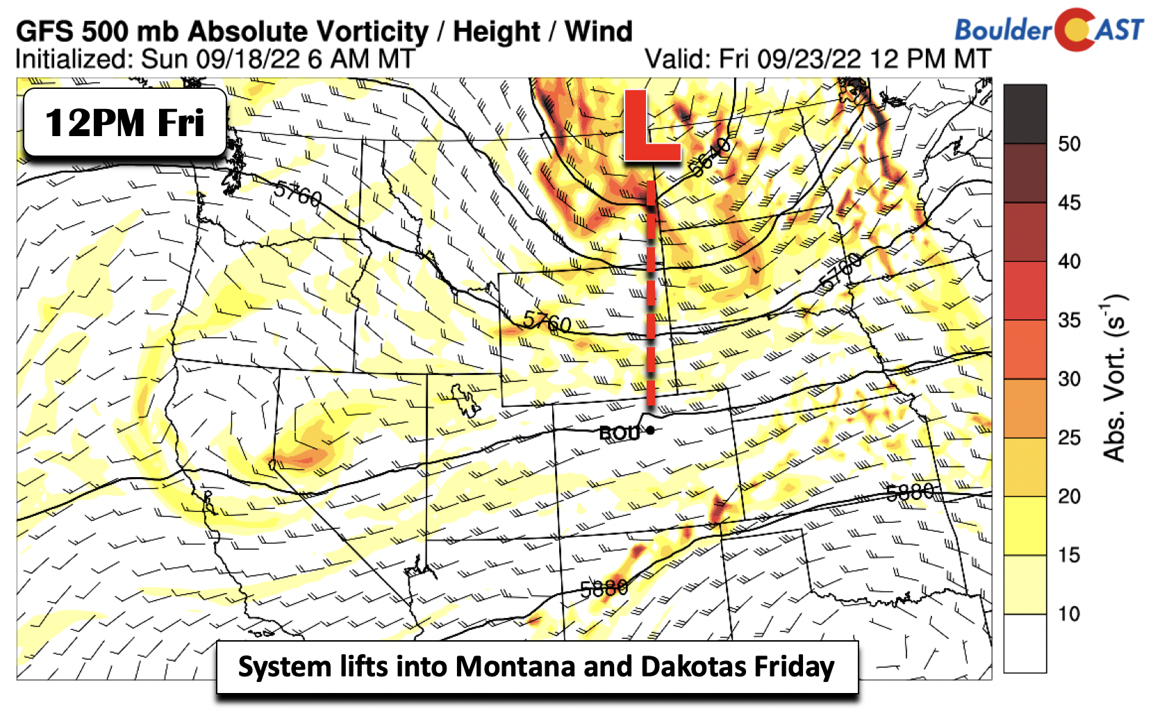
Towards the latter part of the week, the frontal boundary will start to lift back north as a warm front on Thursday, though likely not through fully until early Friday. The trough will start to push into Montana by then. We cannot rule out some afternoon showers/storms in peak heating with the boundary still around and some mid-level disturbances tracking in from the southwest, but chances will lower at about 20-30%. Temperatures will get closer to seasonal averages in the upper 60s to lower 70s.
By Friday, the trough will reach the Dakotas, with westerly downslope flow ensuing over the state. This should translate into a much drier day and temperatures rising in the upper 70s with lots of sunshine.
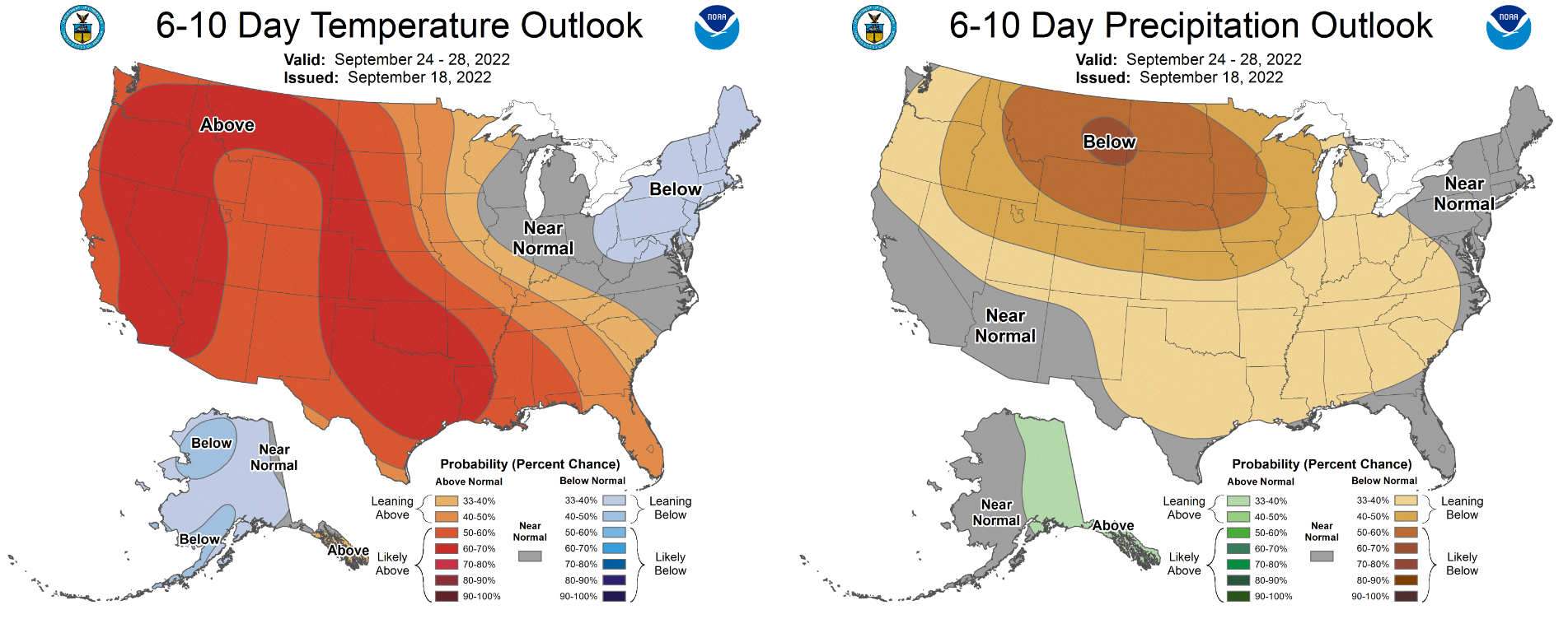
The upcoming weekend will feature west-northwest flow over the area, which should keep temperatures near normal and dry in the 70s. Beyond that, ensemble model guidance and CPC outlooks have Colorado likely remaining warm and dry next week. Have a great first week of fall or final week of summer, however you prefer to call it!
Forecast Specifics:
Monday: Mostly sunny and hot with highs in the upper 80s to low 90s on the Plains and upper 70s to near 80 in the Foothills.
Tuesday: Partly cloudy skies and warm with upper 80s to near 90 for the Plains and upper 70s in the Foothills. Rain showers are expected to move in Tuesday night so get ready!
Wednesday: Periods of rain showers, fog and drizzle under overcast skies. Much cooler with temperatures hovering in the upper 50s during the day on the Plains and upper 40s in the Foothills.
Thursday: A chance of morning showers, then a chance of scattered showers and a few storms in the afternoon/evening. Decreasing clouds with highs in the upper 60s to lower 70s on the Plains and upper 50s in the Foothills.
Friday: Dry and sunny with temperatures near normal in the mid to upper 70s for the Plains and middle 60s in the Foothills.
High Country: There will be a chance of showers/storms Monday and Tuesday across the mountains of western Colorado. Widespread showers with embedded thunder is likely Wednesday. Some of the storms could produce isolated flash flooding given the moisture availability. Drier weather returns Thursday and Friday, though isolated storms cannot be ruled out, especially on Thursday.
Help support our team of Front Range weather bloggers by joining BoulderCAST Premium. We talk Boulder and Denver weather every single day. Sign up now to get access to our daily forecast discussions each morning, complete six-day skiing and hiking forecasts powered by machine learning, first-class access to all our Colorado-centric high-resolution weather graphics, bonus storm updates and much more! Or not, we just appreciate your readership!
Spread the word, share the BoulderCAST forecast!


You must be logged in to post a comment.