After a sunny and warm start to the week, the Front Range will trade blue skies for gray as a sluggish low-pressure system settles into northeast Colorado for several days. Rain chances build Tuesday and linger through Thursday, with well below normal temps and a few rounds of storms in the mix. But don’t expect a soaking: rainfall totals may vary widely, with the heaviest action likely landing northeast of Boulder and Denver towards Nebraska. The storm exits sometime Thursday leaving behind drier and warmer weather for the weekend.
This week’s highlights include:
- Warm Start: Monday brings sunshine and highs in the low to mid 80s — surely the warmest day of the week — with spotty storm clouds and virga developing by evening.
- Low Pressure Arrives: A slow-moving low pressure from Idaho drifts into northeast Colorado Tuesday through Thursday, triggering several days of unsettled weather.
- Rain Chances: Best shot at rain is midday Tuesday through Wednesday evening; showers may linger into Thursday depending on how quickly the storm pulls east late in the week.
- Model Disagreement: European ensemble shows <0.25″ of rain for Boulder/Denver, while the GFS ensemble suggests >0.5″ — either way the best rain is likely to occur north and east of the Denver Metro.
- Cooler Temps: A chilly upslope flow sets in Tuesday, keeping highs in the 60s and 70s through Thursday; Friday warms back into the upper 70s.
- Storm Timing: Expect late-day thunderstorms Tuesday, gloomy skies and showers Wednesday, and lingering chances Thursday before clearing out Friday.
DISCLAIMER: This weekly outlook forecast is created Monday morning and covers the entire upcoming week. Accuracy will decrease as the week progresses as this post is NOT updated. To receive daily updated forecasts from our team, among many other perks, subscribe to BoulderCAST Premium.

Go Premium, get all the perks.
Daily Forecast Updates
Get our daily forecast discussion every morning delivered to your inbox.
All Our Model Data
Access to all our Colorado-centric high-resolution weather model graphics. Seriously — every one!
Ski & Hiking Forecasts
6-day forecasts for all the Colorado ski resorts, plus more than 120 hiking trails, including every 14er.
Smoke Forecasts
Wildfire smoke concentration predictions up to 72 hours into the future.
Exclusive Content
Weekend outlooks every Thursday, bonus storm updates, historical data and much more!
No Advertisements
Enjoy ad-free viewing on the entire site.
The cool, unsettled week ahead
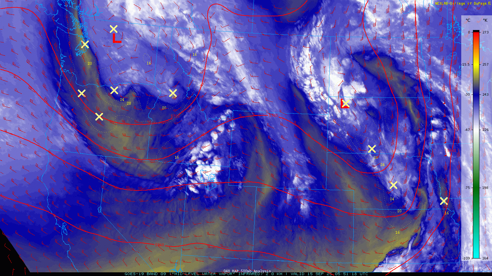
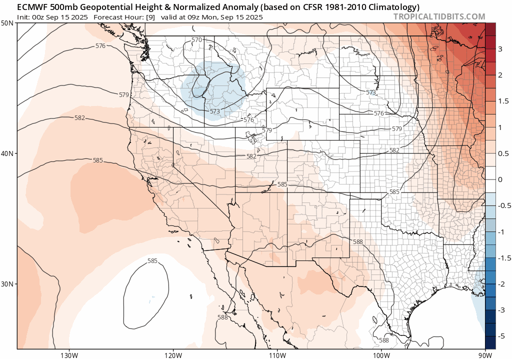
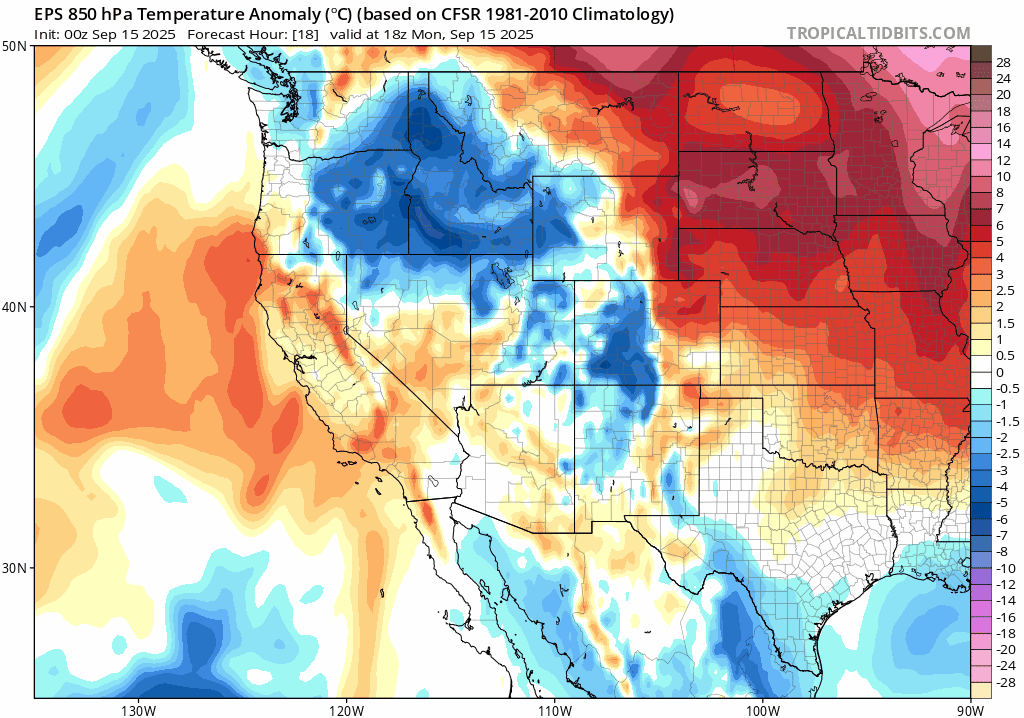
We’re kicking off the week under a relatively calm zonal flow across Colorado — that is, west-to-east winds keeping things relatively quiet. But that won’t be the case for long. As of Monday morning, two weak low-pressure systems are parked to our north: one over the Idaho Panhandle and another in western North Dakota. The Idaho low is the one to watch — it’s poised to become the main driver of our weather this week in the Front Range.
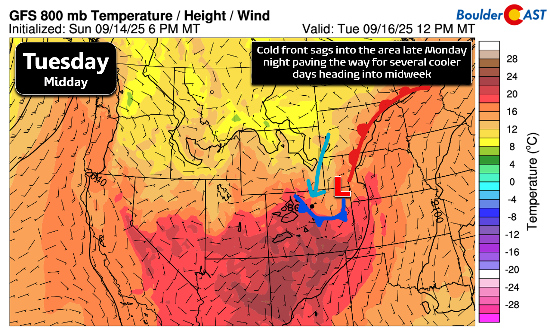
By Tuesday, that low begins a slow drift southward into northeast Colorado. This sluggish movement sets the stage for several days of unsettled weather, with rain chances ramping up Tuesday afternoon and lingering through Thursday.
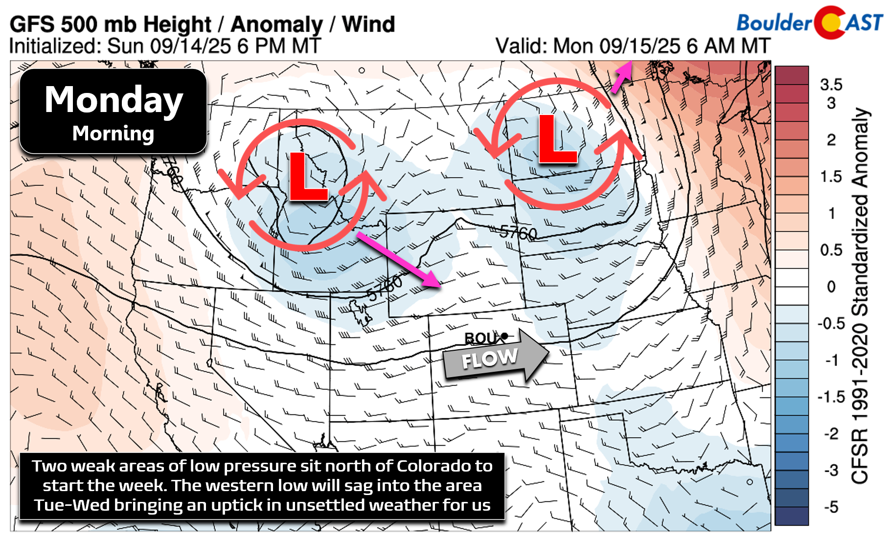
The low will be centered across western Wyoming Tuesday morning, then slide directly over northeast Colorado by early Wednesday.
Expect the most consistent rain from midday Tuesday through Wednesday evening, though showers could hang on into Thursday depending on how quickly the system exits eastward. Recent model trends have slowed this departure.
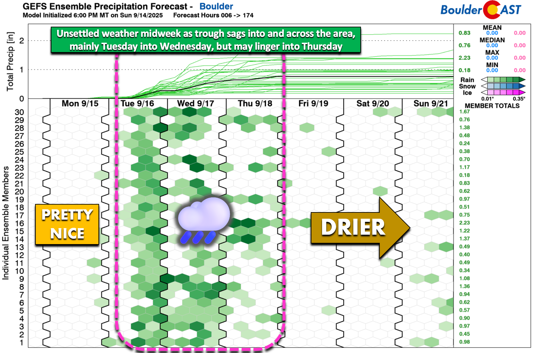
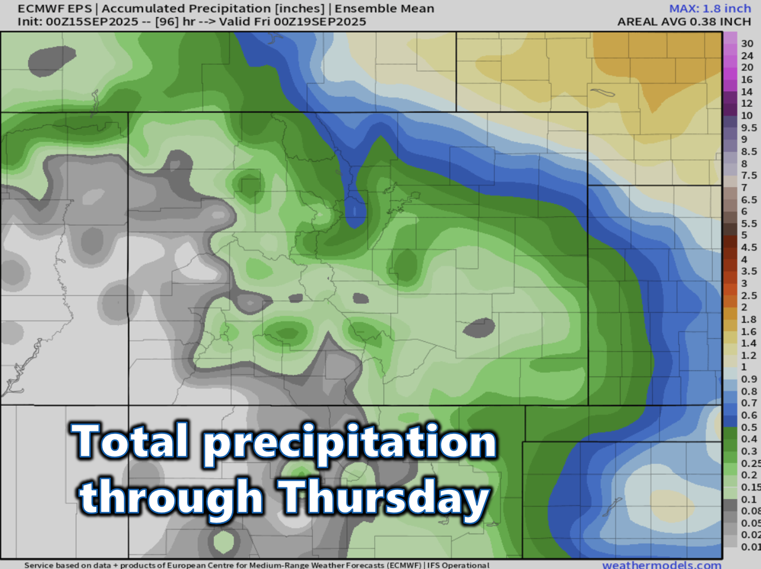
Even with multiple days of gloomy skies, rainfall totals may underwhelm in Boulder and Denver. The best lift and moisture look to align just north and east of the Metro area. The European ensemble is the least generous, showing less than 0.25″ for most of the Front Range, but more than 0.5″ just to our northeast.
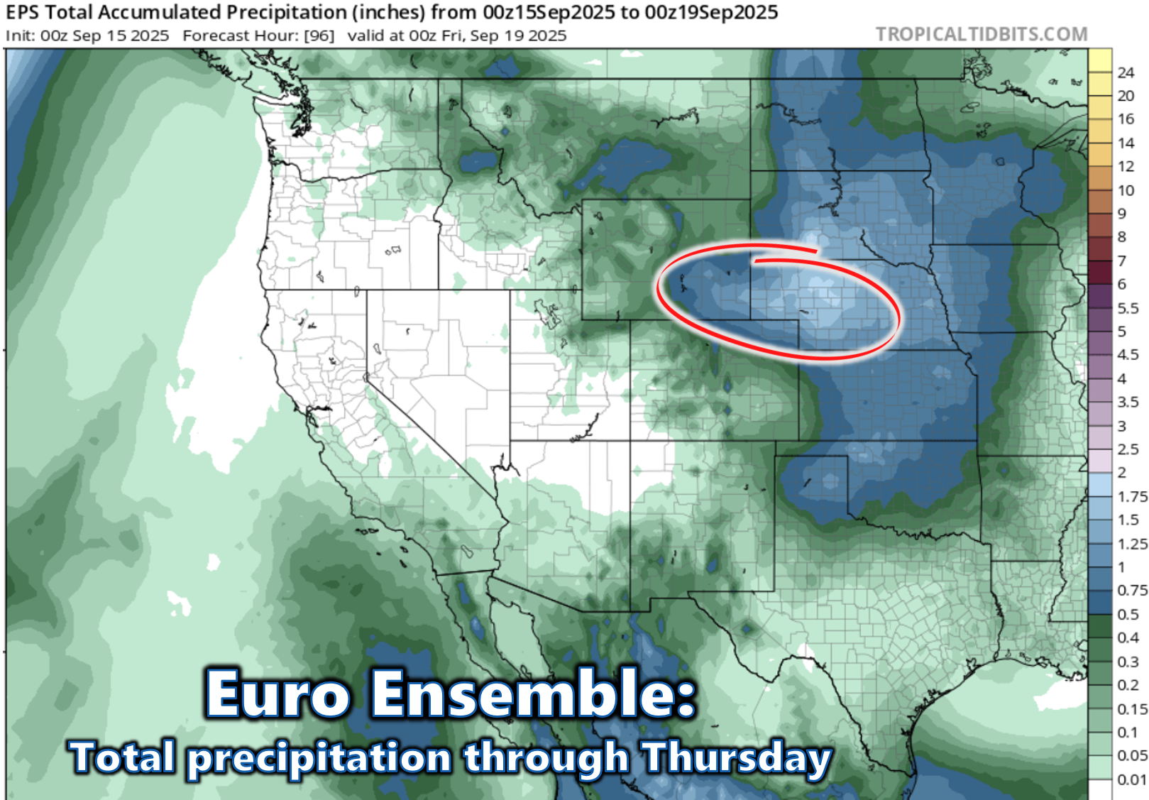
Here’s a closer look at the European ensemble mean precipitation forecast through Thursday in the Centennial State:
The GFS ensemble paints a wetter picture, with over 0.5″ across the region. Bottom line: the heaviest rain this week is likely to fall northeast of Boulder and Denver, but we’ll still see several damp, dreary days locally.

Alongside the rain, a chilly pool of air will settle in behind the trough, keeping temperatures below normal through Thursday. It’s not until Friday that we may see readings inch back up towards normal.
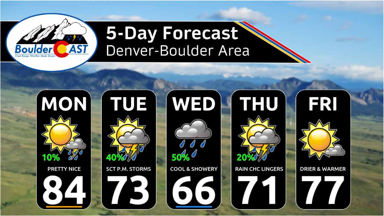
Monday will be the warmest day of the week, with highs in the low to mid 80s and plenty of morning sunshine. Clouds will build by late-afternoon with a tiny chance of a late-day gusty storm, but more likely virga.
Late Monday night, a cold front will sweep through as the low develops over northeast Colorado. This will usher in a north-to-northeast upslope flow starting Tuesday morning — a setup that tends to favor cloud cover and precipitation along the Front Range. Expect this upslope pattern to persist into Thursday.
Given the pesky upslope, expect a stretch of cooler days across the Front Range, with highs dipping into the 60s and 70s through midweek. Tuesday brings a round of late-day thunderstorms, followed by a more overcast, showery setup on Wednesday. While the low pressure system begins to exit on Thursday, most models suggest a lingering northwest flow could keep showers and storms in play. By Friday, we finally break out of the dreary pattern and warm back up into the mid to upper 70s — a welcome return to more typical September weather. Enjoy the week!
Fresh snow this morning in Rocky Mountain National Park, even below treeline. 🏞️ ❄️. #cowx
— BoulderCAST Weather 🏔️⛈️ (@bouldercast.com) September 14, 2025 at 10:31 AM
Forecast Specifics:
Monday: Morning sun with increasing clouds. One or two weak storms may move through by afternoon and evening with gusty winds the main risk. Virga may be more common than actual rain showers. Highs in the low to middle 80s for the Plains with lower 70s in the Foothills.
Tuesday: Cooler behind a front. Scattered showers and thunderstorms will move through during the afternoon and evening. Highs cooler in the lower 70s on the Plains with lower 60s in the Foothills. Spotty showers may persist through the overnight.
Wednesday: Overcast and cool with scattered showers. Highs in the 60s for the Plains with 50s in the Foothills.
Thursday: A bit warmer but still unsettled. Partly cloudy with widely scattered late-day showers and a few storms. Temperatures top out around 70 degrees on the Plains with upper 50s in the Foothills.
Friday: Likely drier and warmer with highs returning to the mid to upper 70s and sunny skies. The Foothills warm into the middle 60s.
Weekend: Warmer with highs in the low to middle 80s. There’s a slight chance for weak disturbances creating some spotty storms, but overall lots of dry time and limited rain potential.
DISCLAIMER: This weekly outlook forecast is created Monday morning and covers the entire upcoming week. Accuracy will decrease as the week progresses as this post is NOT updated. To receive daily updated forecasts from our team, among many other perks, subscribe to BoulderCAST Premium.
Go Premium, get all the perks.
Daily Forecast Updates
Get our daily forecast discussion every morning delivered to your inbox.
All Our Model Data
Access to all our Colorado-centric high-resolution weather model graphics. Seriously — every one!
Ski & Hiking Forecasts
6-day forecasts for all the Colorado ski resorts, plus more than 120 hiking trails, including every 14er.
Smoke Forecasts
Wildfire smoke concentration predictions up to 72 hours into the future.
Exclusive Content
Weekend outlooks every Thursday, bonus storm updates, historical data and much more!
No Advertisements
Enjoy ad-free viewing on the entire site.
Enjoy our content? Give it a share!


You must be logged in to post a comment.