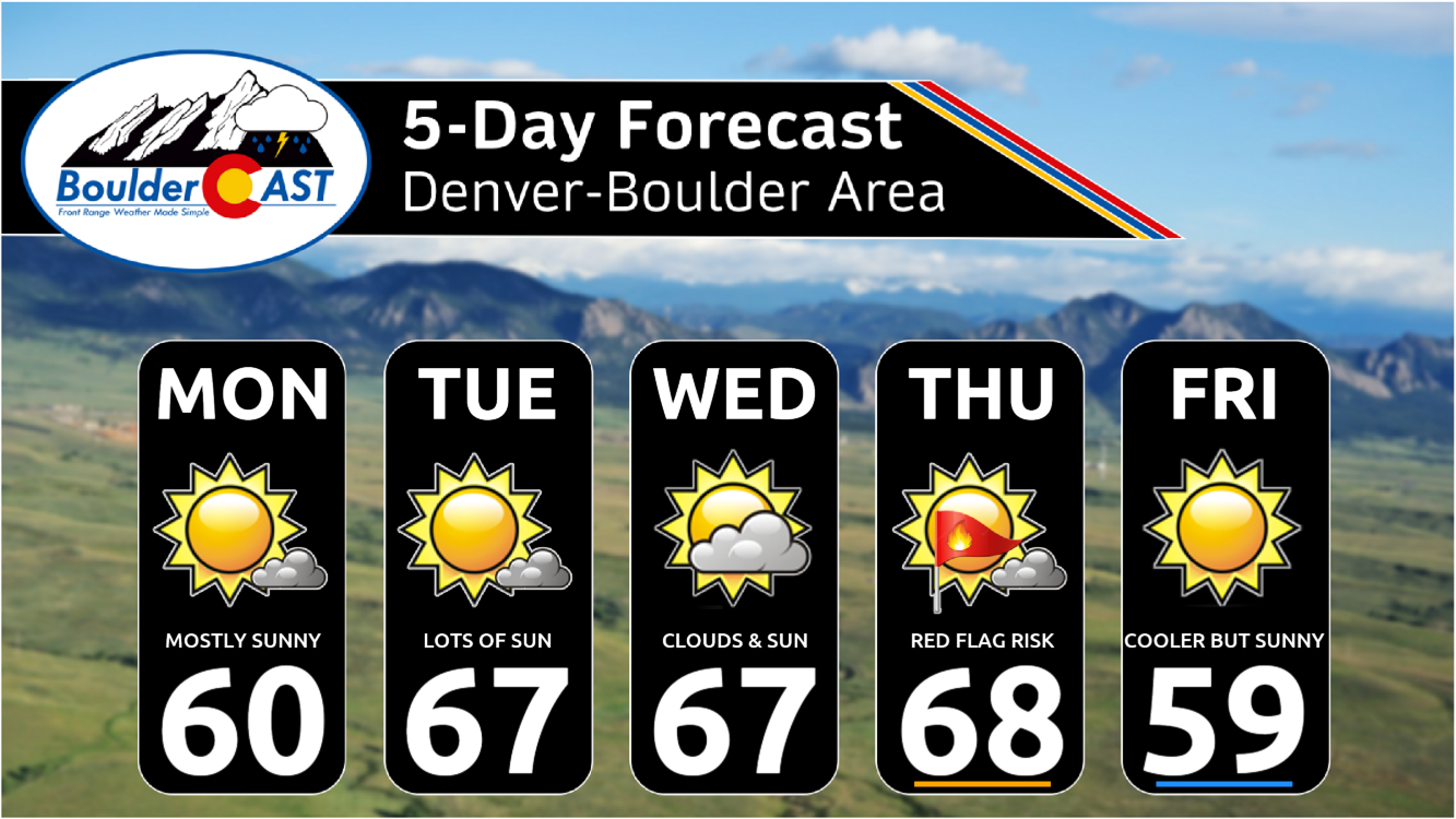
A quiet and mild weather pattern will be in place this week. Highs will largely be in the mid to upper 60s with a fair amount of sunshine most days. A late-week cold front Thursday into Friday will initially bring fire danger to the area followed by a slight drop in temperatures. We are watching a closed upper-low which could impact the state over the upcoming weekend with rain/snow showers in tow, but model uncertainty remains. Read on for more details.
This week’s highlights include:
- High temperatures will largely hover in the 60s this week, warmest Tuesday through Thursday and coolest on Friday
- These temperatures are some 10 to 15 degrees above normal for mid-November
- A totally dry forecast is in store this week
- A late-week cold front drops temperatures down a tad for Friday but we still stay close to 60 degrees. Prior to the frontal passage, fire danger will be elevated on Thursday with gusty winds
- We are watching a closed upper-low for the weekend, but model uncertainty results in lower confidence in this precipitation threat
DISCLAIMER: This weekly outlook forecast is created Monday morning and covers the entire upcoming week. Accuracy will decrease as the week progresses as this post is NOT updated. To receive daily updated forecasts from our team, among many other perks, subscribe to BoulderCAST Premium.
Daily Forecast Updates
Get our daily forecast discussion every morning delivered to your inbox.
All Our Model Data
Access to all our Colorado-centric high-resolution weather model graphics. Seriously — every one!
Ski & Hiking Forecasts
6-day forecasts for all the Colorado ski resorts, plus more than 120 hiking trails, including every 14er.
Smoke Forecasts
Wildfire smoke concentration predictions up to 72 hours into the future.
Exclusive Content
Weekend outlooks every Thursday, bonus storm updates, historical data and much more!
No Advertisements
Enjoy ad-free viewing on the entire site.
Quiet & mild for the most part this week
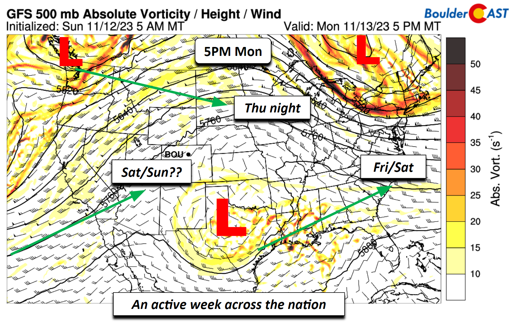
The weather this week will largely be quiet and mild for us here in the Front Range, but there are several noteworthy aspects of the forecast, especially across the nation as a whole and what could impact us for the late-week and into the weekend. The figure below shows the mid-level pattern across the CONUS Monday afternoon and evening. There are several things to see in this forecast figure. There is an area of low pressure across central Texas that will be moving east-northeast through the week and could impact the Carolinas over the upcoming weekend. A trough over the Pacific Northwest will eventually move into the northern Plains late this week, bringing a cold front through our area late Thursday night. Lastly, a deep and large area of low pressure offshore of California is forecast by the models to eventually move onshore late this week. Current indications are that it could impact our state this weekend but we’ll discuss its uncertainty at the end of this post.
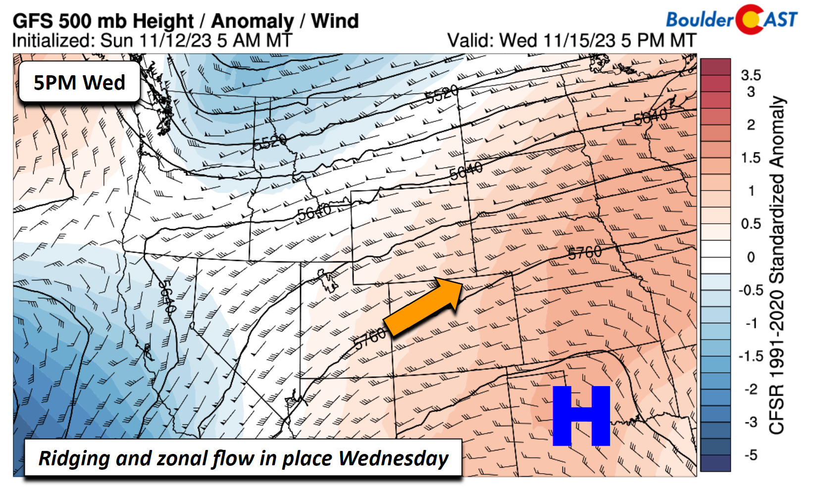
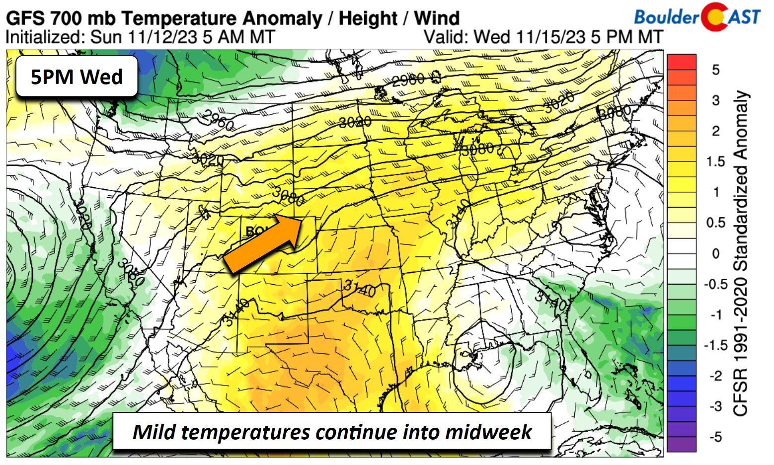
With all that said, this week is going to be relatively benign and mild. High pressure ridging will be in place to start, transitioning to a quasi-zonal westerly flow into midweek. The figure below shows the 500-mb height pattern for Wednesday. We’ll be seeing highs most of this week in the 60s, about 10 to 15 degrees above normal for mid-November.
These above normal temperature anomalies will not only be felt in Colorado, but also across much of the central US and Upper Mississippi valley. Our warmest temperatures look to be in the mid to upper 60s, with the warmest days in the Tuesday to Thursday period.
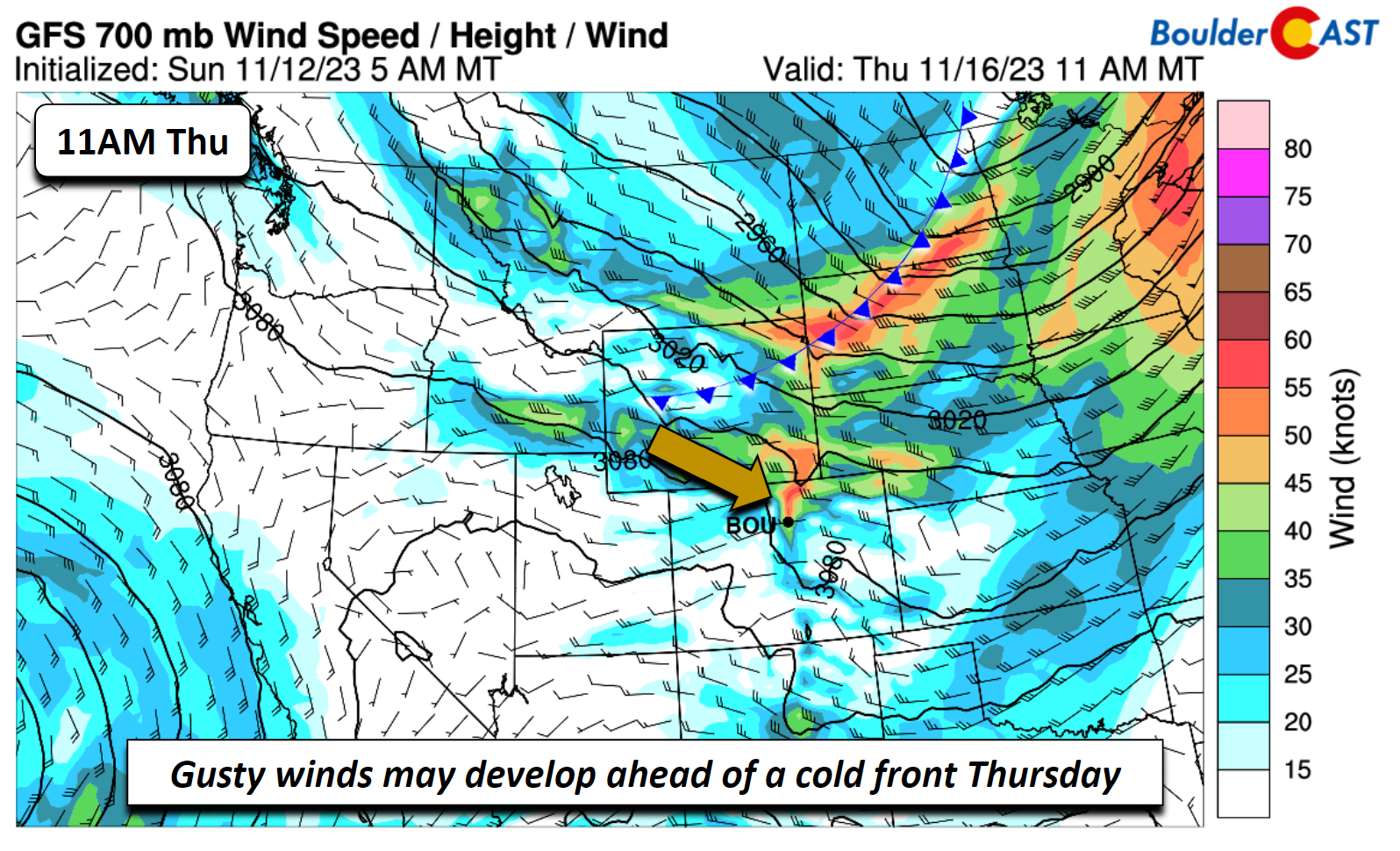
Systems will be passing through both to our north and south this week, so we can expect passing mid/high clouds from time to time, but likely not enough to impact a fair amount of sunshine. Ahead of a late-week cold front Thursday, there could be some gusty winds in a stronger downslope flow pattern and tighter pressure gradient (below). Gusts up to 30 MPH or higher may be possible over the Plains and/or Foothills leading to elevated fire danger.
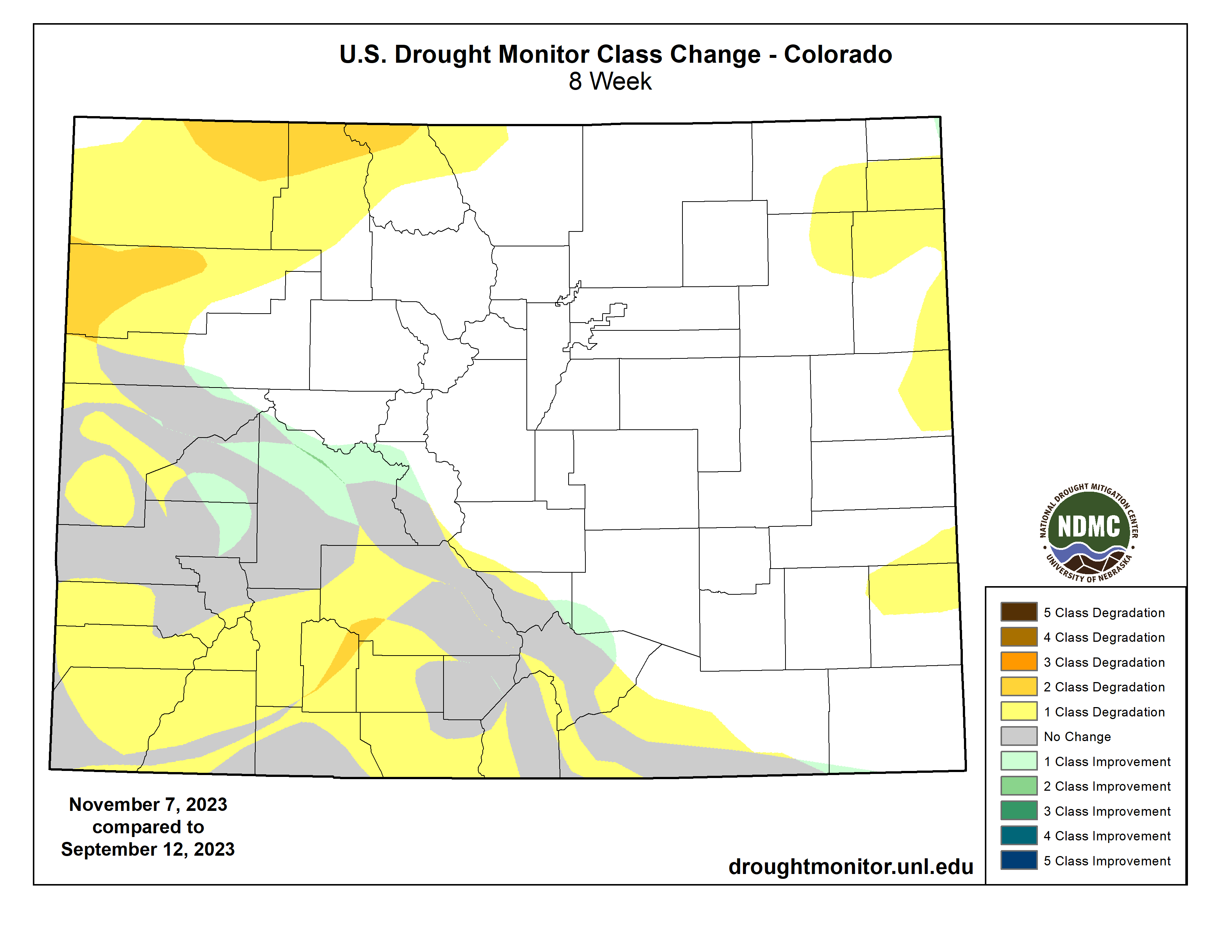
As you know, it’s been a mostly dry affair across northeast Colorado the past few months. The Boulder-Denver areas has been lucky to pick up some precipitation here and there. Areas further east and west haven’t been as fortunate with drought looming or already in place — locations in yellow/orange below have seen 1 to 2 levels of drought classification degradation in the past two months. With our windiest time of year knocking on the door (November to April), this certainly isn’t a good situation.
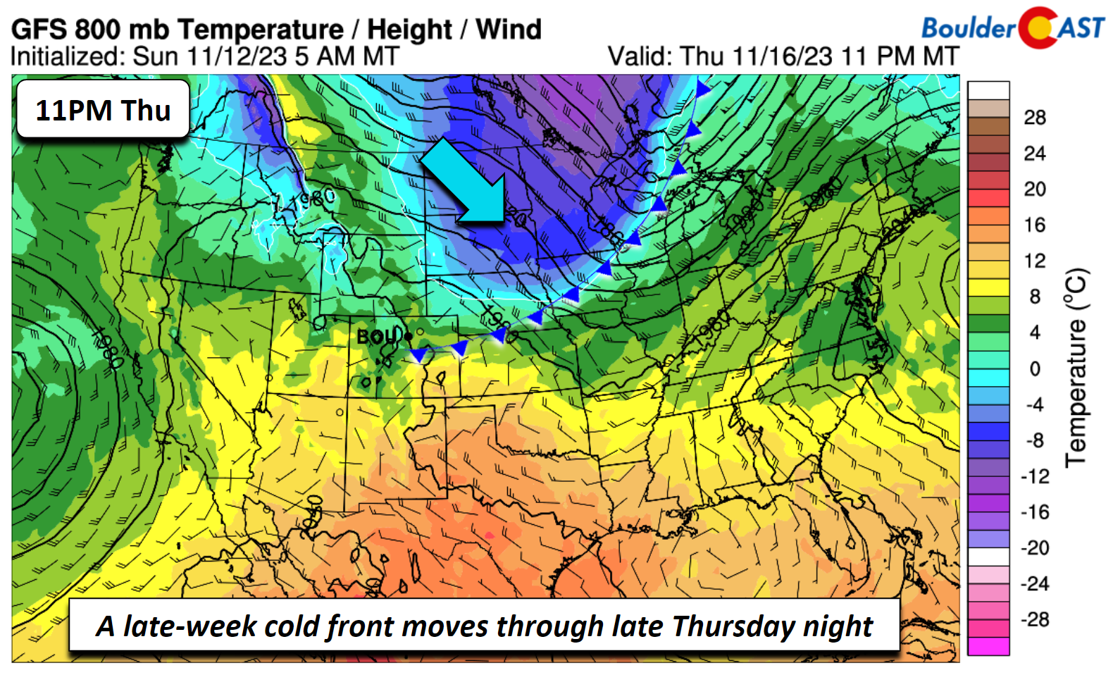
In any case, the cold front is forecast by most of the models to move through sometime late Thursday night. The image below shows the GFS frontal position forecast for 11 PM Thursday, stretching from northeast Colorado into the upper Great Lakes. This frontal passage is likely to be a dry one, as there is barely moisture or lift associated with it over our area. Also worth noting is that the coldest air behind this front won’t even reach Colorado — with a bulk of it heading off into the northern Plains and Great Lakes.
On the backside of this cold front, high temperatures on Friday will fall back into the upper 50s or so — hardly enough of a tumble to warrant the term “cold front”, don’t you think?
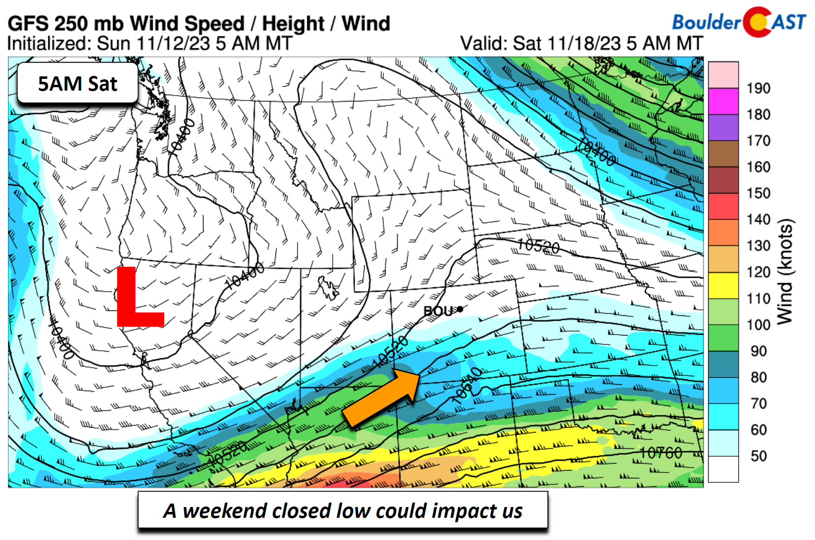
Watching a weekend closed upper-low
There is a bit less agreement in the model guidance on a late-week to weekend closed upper-low that could bring precipitation to the state. The aforementioned low offshore of California will eventually move onshore late this week. Where it tracks and its timing is uncertain at this point. For example, the Euro model brings it into our area from the southwest sometime late Friday and Saturday, while the Canadian and GFS bring it near us sometime Saturday or Sunday — plus these models are in disagreement on whether it gets far enough north to bring us any precipitation. We know this, however, that if it does impact us, there is not much cold air to work with such that any potential precipitation would be rain for the Plains but likely rain/snow for the higher terrain.
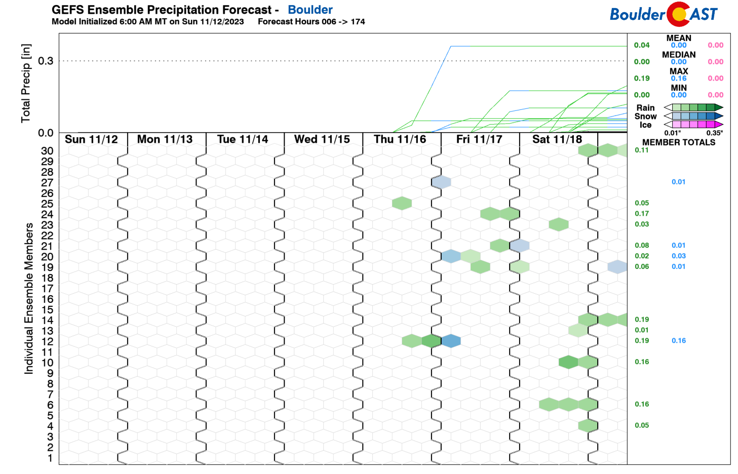
A look at the GEFS plumes show the uncertainty in precipitation for the weekend, with very few ensemble members actually indicating the rain potential.
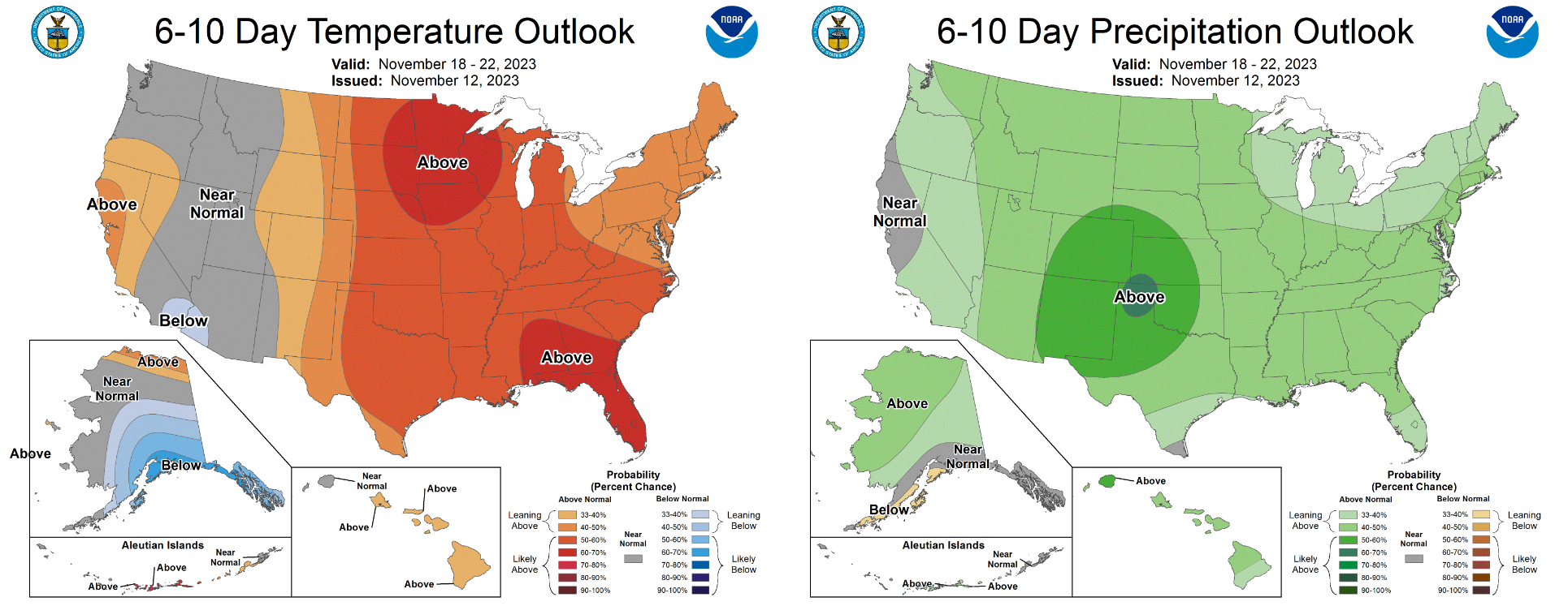
For what its worth, the Climate Prediction Center does include our area in the “bullseye” for above normal precipitation in their 6-10 day outlook which encompasses the upcoming weekend and early part of next week. This is mainly due to yet another storm tracking in from the Pacific Northwest around Monday though.
Overall, yet another boring week in weather lies ahead for the Front Range, but perhaps things will turn more interesting next week…
Get BoulderCAST updates delivered to your inbox:
Forecast Specifics:
Monday through Thursday: Highs in the 60s for the Plains and 50s in the Foothills with more clouds than sunshine. Gusty winds are possible on Thursday of 30 mph or higher which could support critical fire conditions for some or all of the area Thursday during the day.
Friday: A touch cooler with highs near 60 degrees for the Plains and lower 50s in the Foothills.
DISCLAIMER: This weekly outlook forecast is created Monday morning and covers the entire upcoming week. Accuracy will decrease as the week progresses as this post is NOT updated. To receive daily updated forecasts from our team, among many other perks, subscribe to BoulderCAST Premium.
Daily Forecast Updates
Get our daily forecast discussion every morning delivered to your inbox.
All Our Model Data
Access to all our Colorado-centric high-resolution weather model graphics. Seriously — every one!
Ski & Hiking Forecasts
6-day forecasts for all the Colorado ski resorts, plus more than 120 hiking trails, including every 14er.
Smoke Forecasts
Wildfire smoke concentration predictions up to 72 hours into the future.
Exclusive Content
Weekend outlooks every Thursday, bonus storm updates, historical data and much more!
No Advertisements
Enjoy ad-free viewing on the entire site.
Enjoy our content? Give it a share!




You must be logged in to post a comment.