Much needed precipitation is the main story for the week across Colorado! There are two systems of note that will bring beneficial rainfall and Mountain snow to the region, with the second system a little less certain than the first already ongoing on this Monday. With the precipitation chances, temperatures will largely be below seasonal normals, coolest on Monday, with even a few snowflakes possibly mixing in at times. The forecast turns drier and much warmer to close out the week. Read on for the full details.
This week’s highlights include:
- Welcomed rain today with a strengthening low pressure system to our east — perhaps some snow mixed in as well
- Another storm system will bring rain around midweek, but this is less certain
- Temperatures largely below average for the week, with a return of the warmth by Friday
- Fire concerns will be mostly suppressed this week with increased precipitation chances, higher relative humidity, and less gusty winds
DISCLAIMER: This weekly outlook forecast is created Monday morning and covers the entire upcoming week. Accuracy will decrease as the week progresses as this post is NOT updated. To receive daily updated forecasts from our team, among many other perks, subscribe to BoulderCAST Premium.

Beneficial rain and chilly to start the week
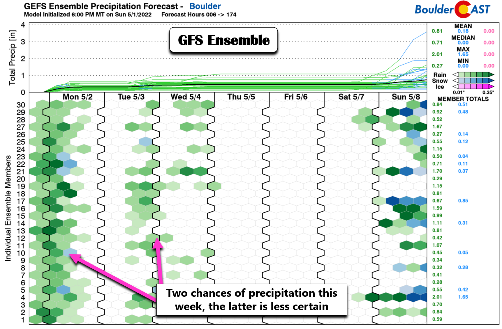
Much needed rainfall will arrive this week, fueled by two mid-level storm systems and their associated surface low pressures. The first rain event today is already ongoing across the Front Range. This will be a big help given our drought and fire concerns the last several weeks and months. Below is the GEFS ensemble forecast, showing the main two chances of rain – the first today and the second comes Tuesday into Wednesday. We’ll discuss all this as we go along in this weekly outlook.
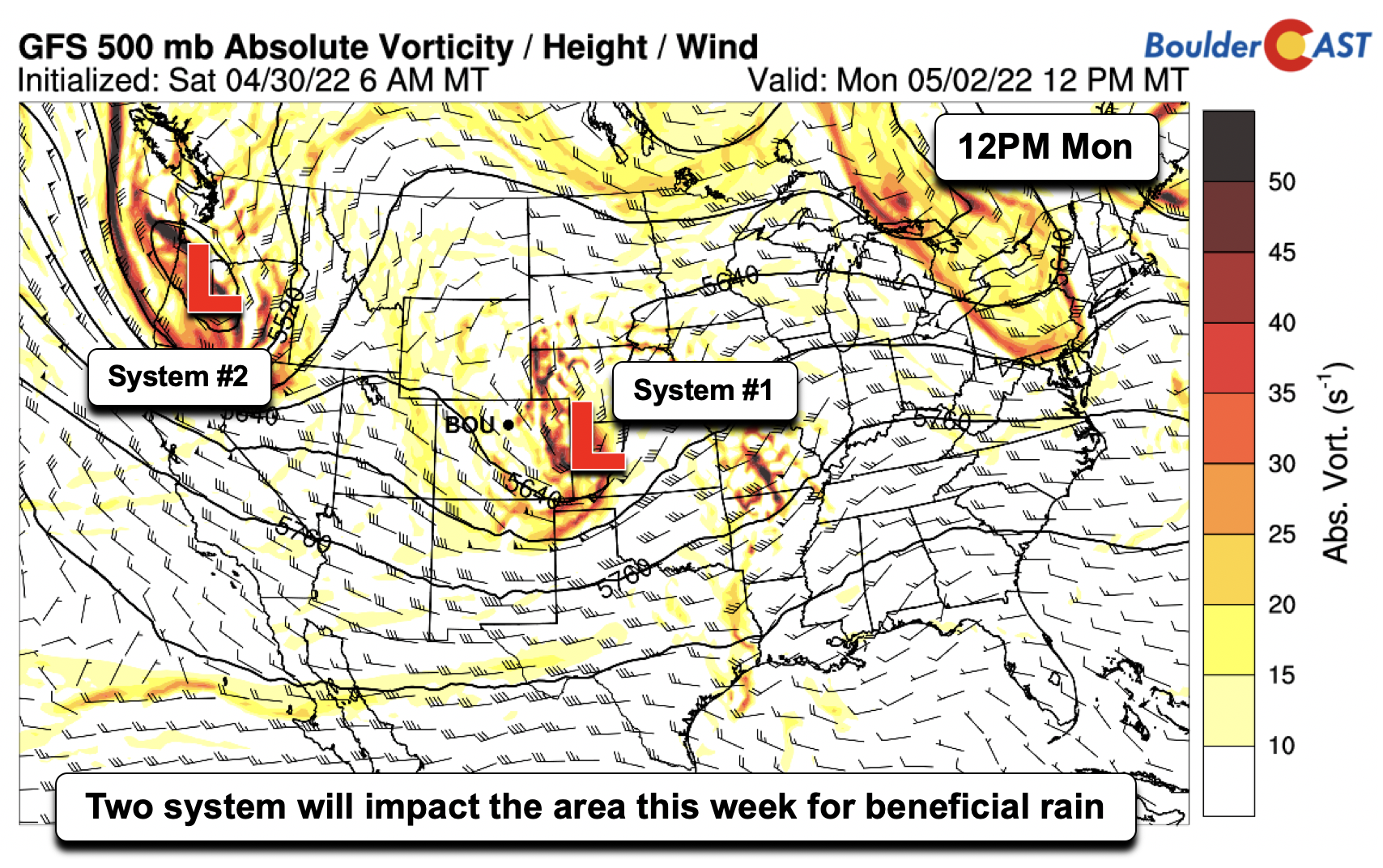
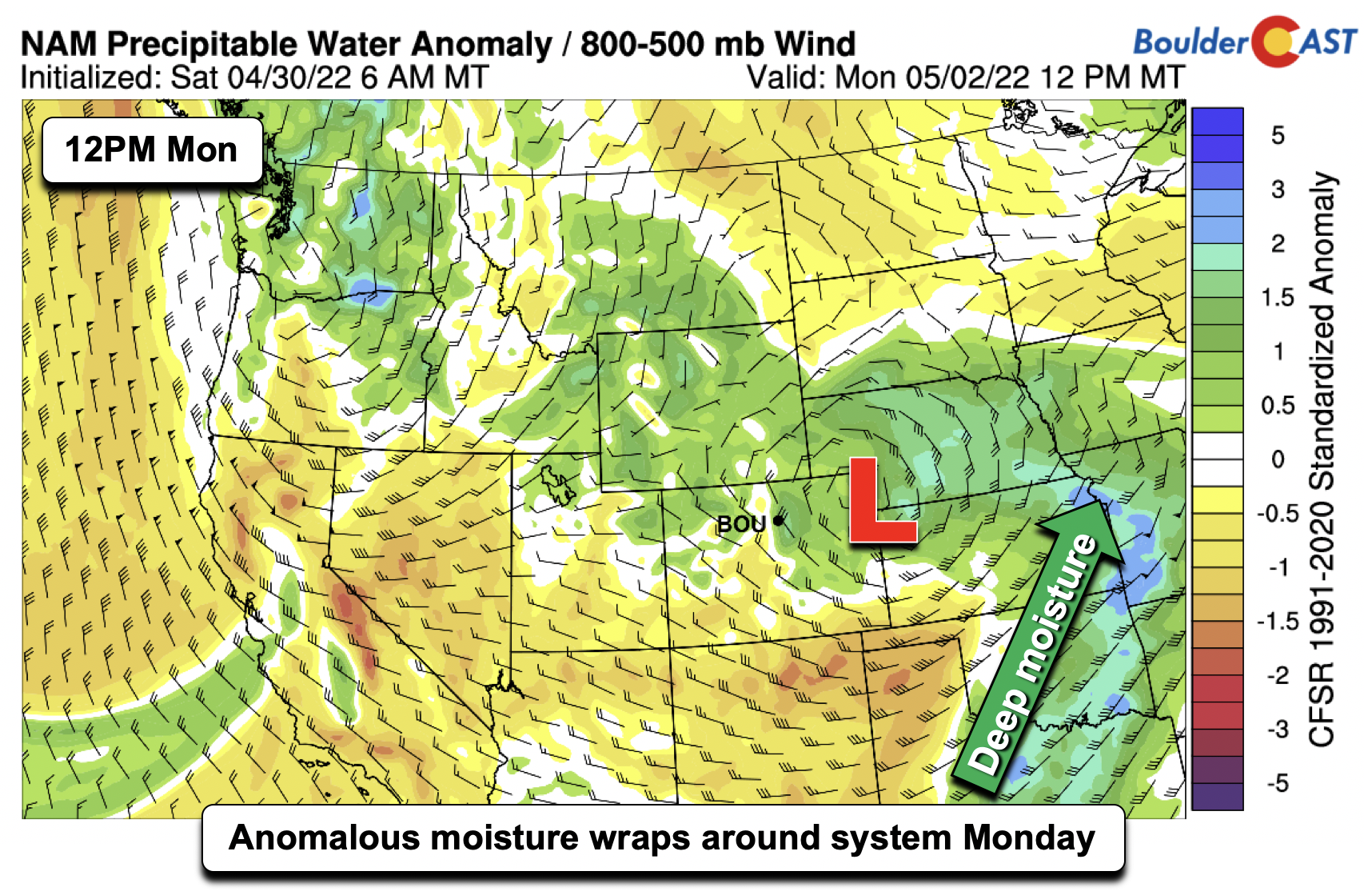
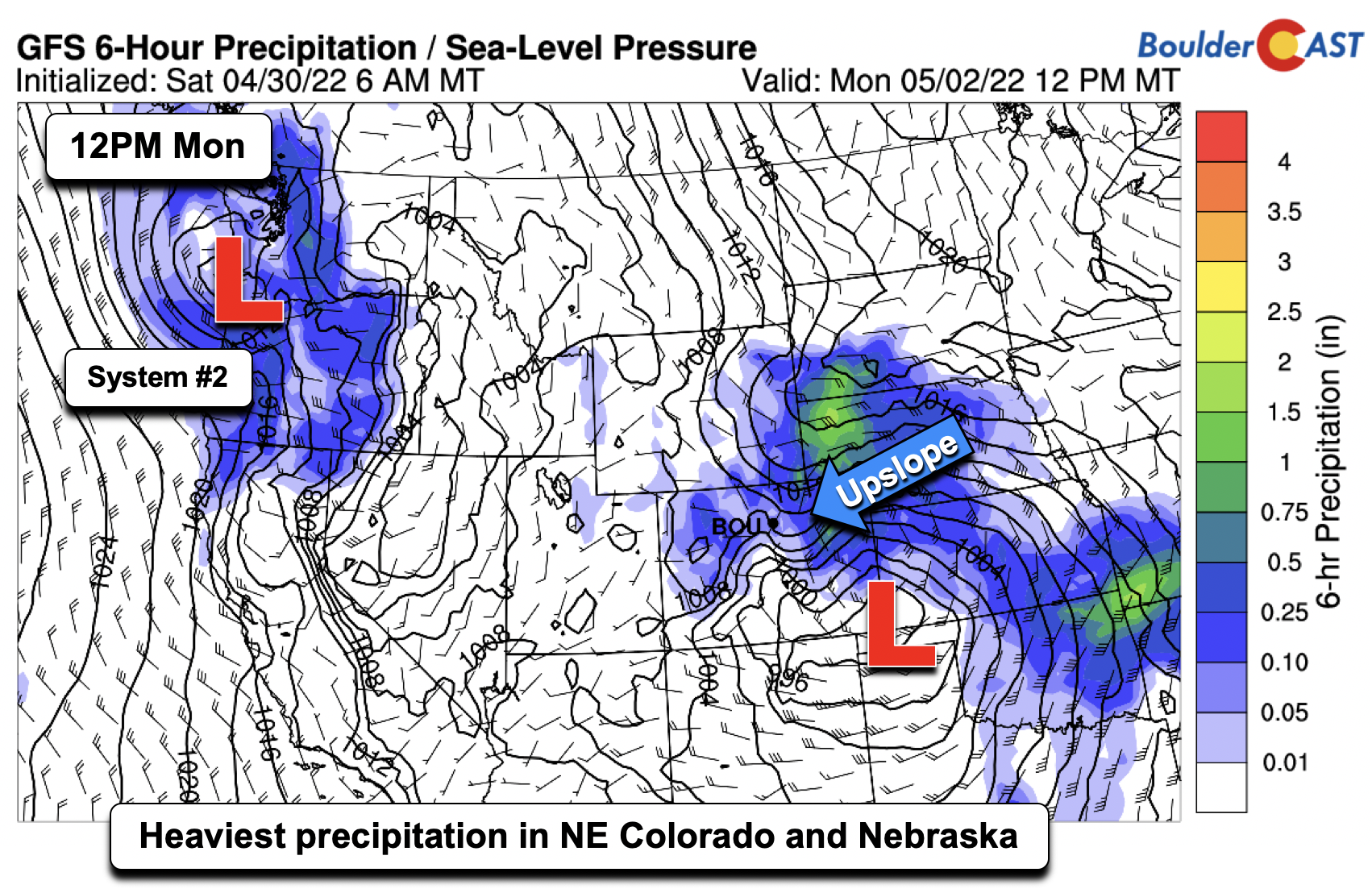
The first system will take a track from southern Colorado into western Kansas and eventually into Nebraska. The track of the low has brought upslope flow to the region, as well as wrap-around moisture to the north and west of the low. A second system is waiting in the wings over the state of Oregon this morning, which will make its way into the area as early as late Tuesday, but primarily watch for this disturbance in the Wed/Thu time frame.
As the mid-level system today takes a northeastward track this afternoon and evening, deep moisture will wrap around the low pressure system into most of northeast Colorado and Nebraska, bringing widespread showers and even some snow in the coldest regions north of the low.
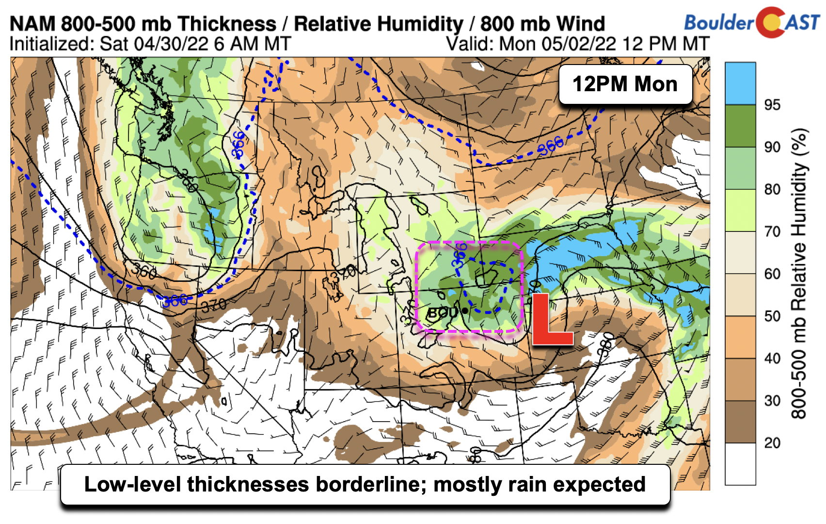
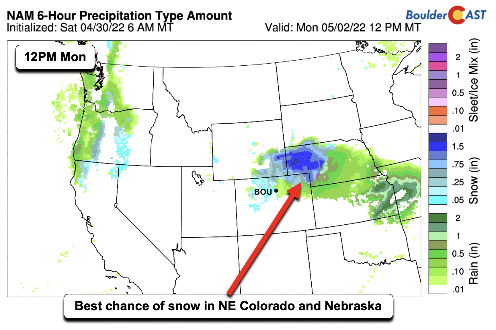
Speaking of snow, low-level thicknesses drop to borderline values during the day Monday over northeast Colorado, to where some snow may mix in with the wrap-around precipitation. As we’ll see later, the chance of snow is marginal at best in the Denver Metro given borderline temperatures and the freezing line.
While there will be good upslope in the low-levels over the Front Range, higher up in the atmosphere the flow turns northwesterly on the backside of the system (below). This will inhibit the Denver/Boulder area from seeing the best rainfall amounts — those are likely to be found further east on the Plains.
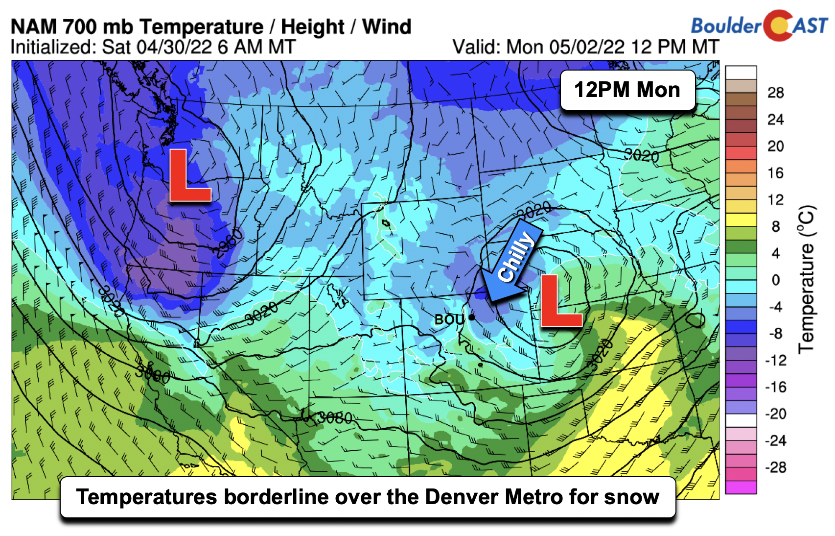
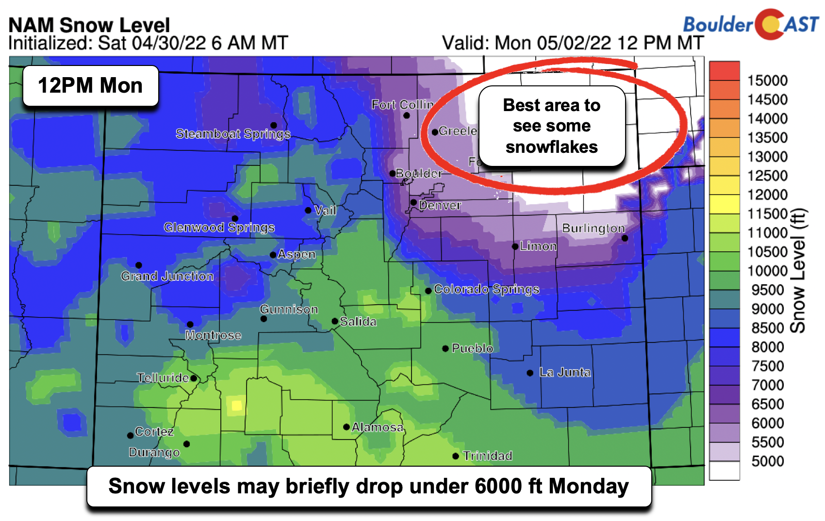
With rain showers and clouds from the upslope flow at the surface, it will be a very chilly day in the low to middle 40s at best across the region. Further to our north and east near Greeley and Fort Morgan, highs will struggle to get out of the 30s! These temperatures are about 25 or so degrees below normal for early May! Snow levels today may briefly drop below 6000 feet on the Plains with colder air building in from the north. We think there is a chance of some flakes mixing in with the rain across portions of the Boulder and Denver area, but the better chance of snowflakes will be in northeast Colorado, where colder air will be and where snow levels drop below 5000 feet.
We think the region for the heaviest precipitation will be in northeast Colorado and over western Nebraska, in the area of stronger upper-divergence from the jet, as well as less influence of detrimental downslope from the mountains with northwest flow higher up in the atmosphere. System #2 is waiting to approach the area for midweek, currently out in the Pacific Northwest.
The NAM model, which is the coldest of the solutions for today, shows the best chance of snow in the region we expect, over western Nebraska and northeast Colorado. If you see flakes today, feel free to tag us on Twitter!
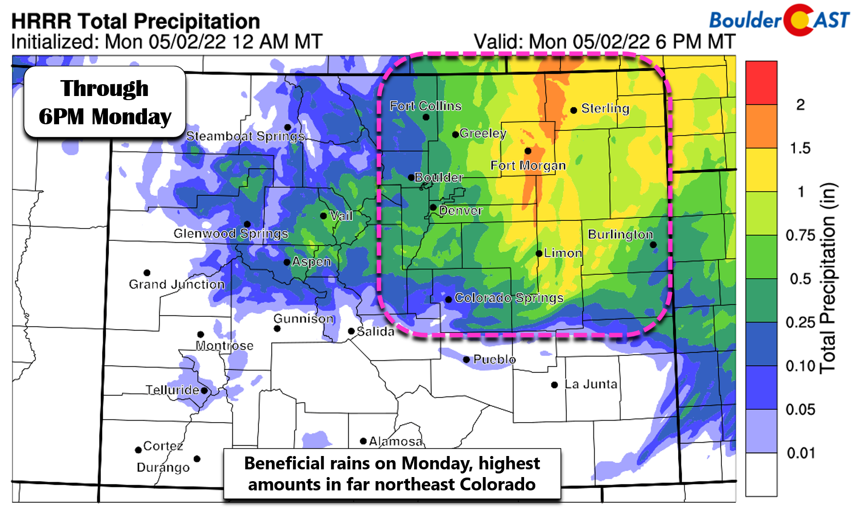
As for precipitation amounts today, there will be a large spread, with the highest amounts in northeast Colorado of more than 1″. Lesser amounts are expected in Denver and Boulder — generally around 0.25″ to 0.5″ for most areas. As of 6:00AM, Denver International Airport has already seen 0.77″, the wettest day since last April officially for the city of Denver. Light rain (possibly mixed with some snow) will continue through Monday being most widespread east of I-25. Precipitation will fully come to an end by late afternoon and evening Monday.
Another chance of rain midweek, but details still somewhat uncertain
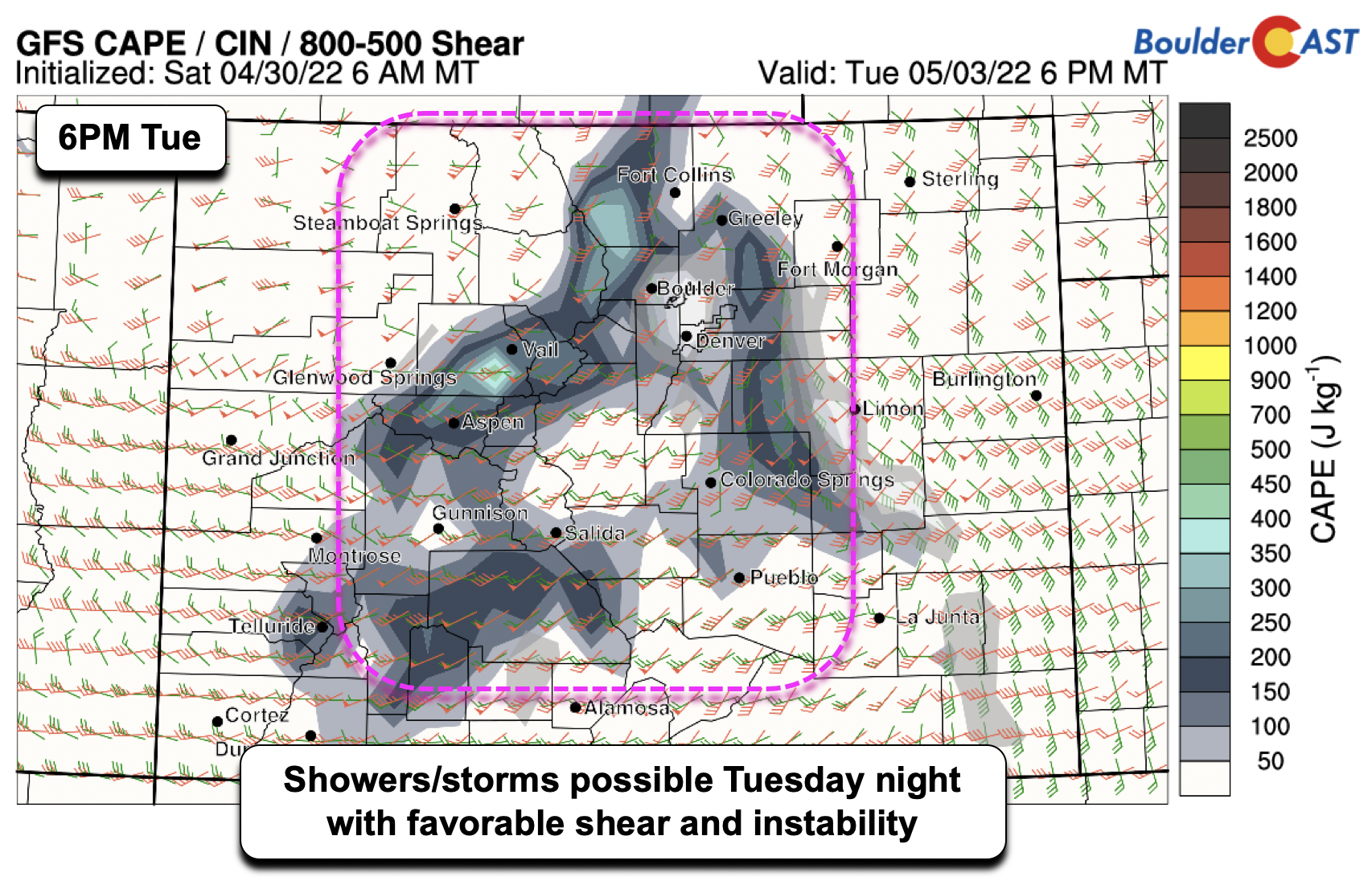
As we go into Tuesday, system #2 will be approaching the area from the west. Return southeasterly flow will develop at the surface, while aloft a strong jet will traverse the state. There will also be some developing instability in the early evening hours, with favorable low and deep-layer shear. While we’re not convinced on any severe threat currently, it warrants a watchful eye. Highs will rebound into the middle 60s with partly sunny skies and late-day showers on Tuesday.
By Wednesday, the second system will start to approach the area. Although, there remains some uncertainty in regards to its track and timing. The plots below are from the GFS (left) and ECMWF (right), which illustrate some of the uncertainty. The GFS is the furthest north with its track, taking the system across Wyoming and Nebraska, leaving most of the Front Range in downslope flow. This would mainly lead to isolated afternoon/evening showers/thundershowers. The ECMWF/Canadian are further south, taking the system in a similar track to the Monday event — that is, across central to southern Colorado and into Kansas. This second solution is also slower, not exiting until late Thursday, while the GFS exits the system by early Thursday. The second solution would also mean more beneficial upslope rain.
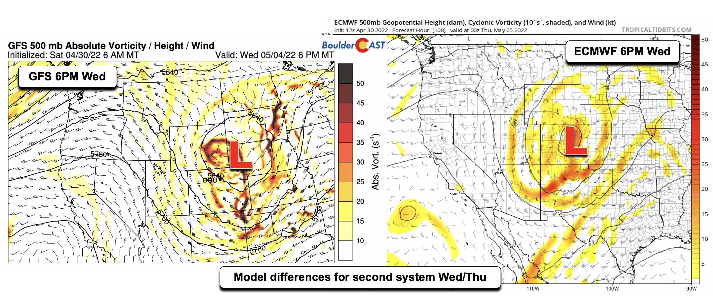
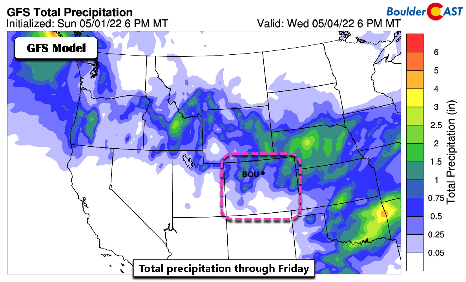
These uncertainties also lead to less confidence in the total rainfall amounts this week, with again the highest amounts expected over northeast Colorado, where up to 2 inches may fall! Let’s hope system #2 also takes a favorable track. Given the pattern differences, highs will be a little tricky but should stay below normal in the low to middle 60s (perhaps 50s if rain is more widespread on Wednesday). This second system appears largely too warm for snow.
Drying out and more seasonal to end the week
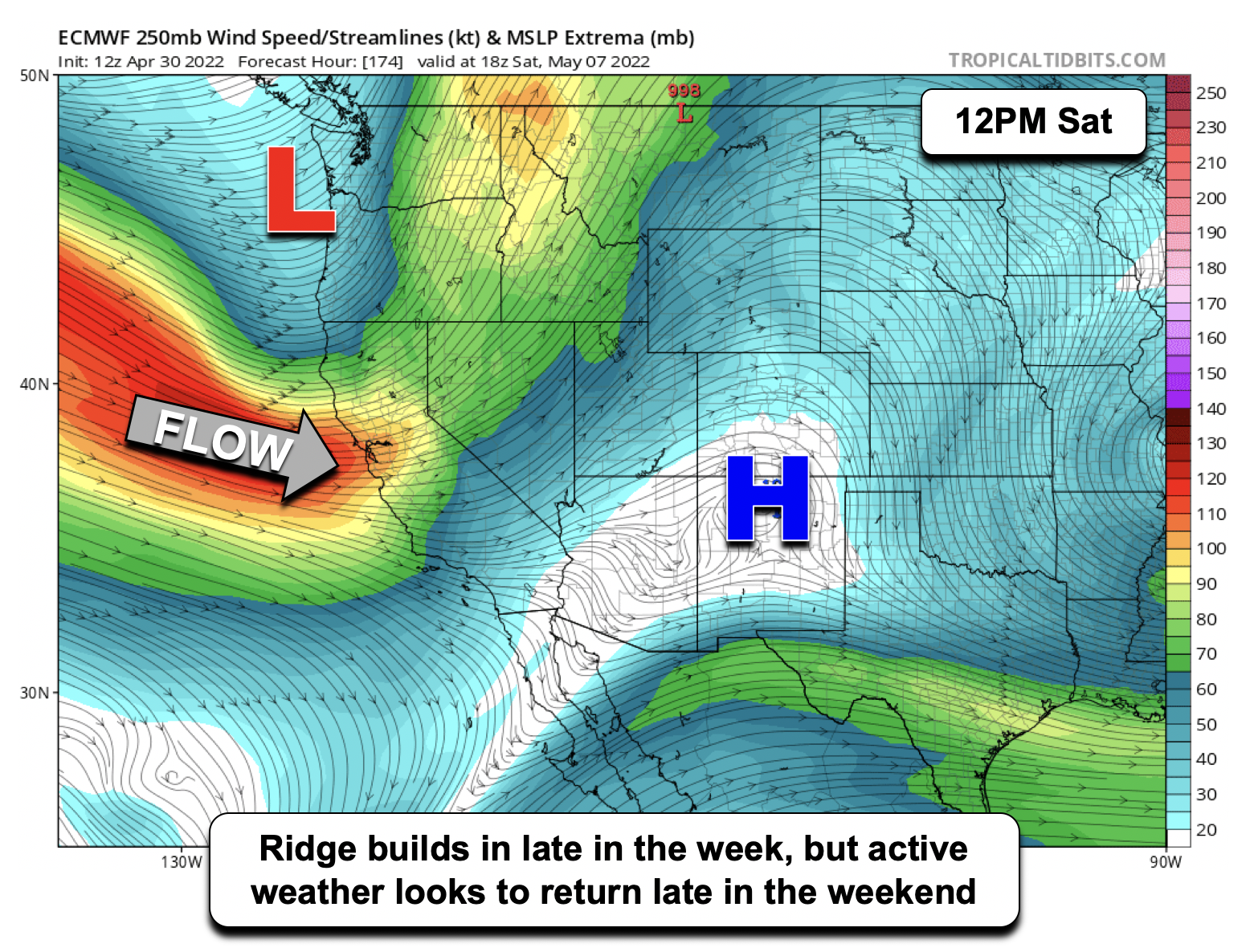
Higher confidence is found late in the week, as in the wake of system #2 a ridge will set up over the Intermountain West. That will allow moderating temperatures into the 70s (and even 80s) with sunshine. However, a more active pattern looks in-store for the late weekend ahead with another onshore system moving into the region. The GFS is a tad faster than other models so we have kept the forecast dry through Friday (at least). Friday and Saturday may see the return of elevated fire danger, but it’s too far out to say for sure at this time.
Forecast Specifics:
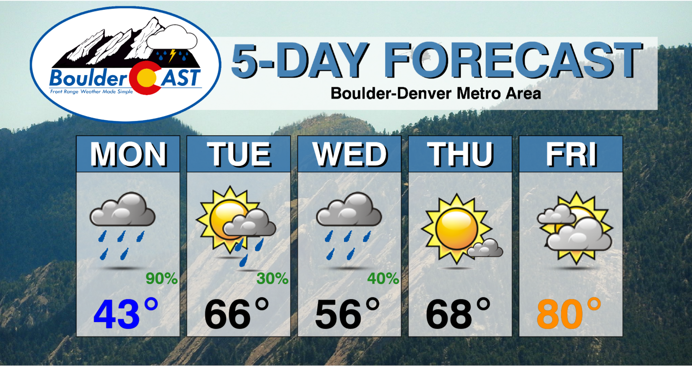
Monday: Overcast and gloomy with off and on rain showers until early evening, and perhaps some snow mixed in at times in outlying areas north and northeast of Denver. Highs rather chilly in the low to middle 40s on the Plains and middle 30s in the Foothills. Snow accumulation in the higher Foothills of 1 to 3 slushy inches.
Tuesday: Partly cloudy with late day scattered showers and a few storms possible. Highs in the middle 60s on the Plains and middle 50s in the Foothills.
Wednesday: A good chance of rain showers with some embedded thunder also possible. Temperatures in the upper 50s to lower 60s on the Plains and lower 50s in the Foothills.
Thursday: Mostly sunny, dry and seasonal. Highs in the upper 60s on the Plains and middle 50s in the Foothills.
Friday: Mostly cloudy and warmer with highs around 80 degrees on the Plains and middle 60s in the Foothills.
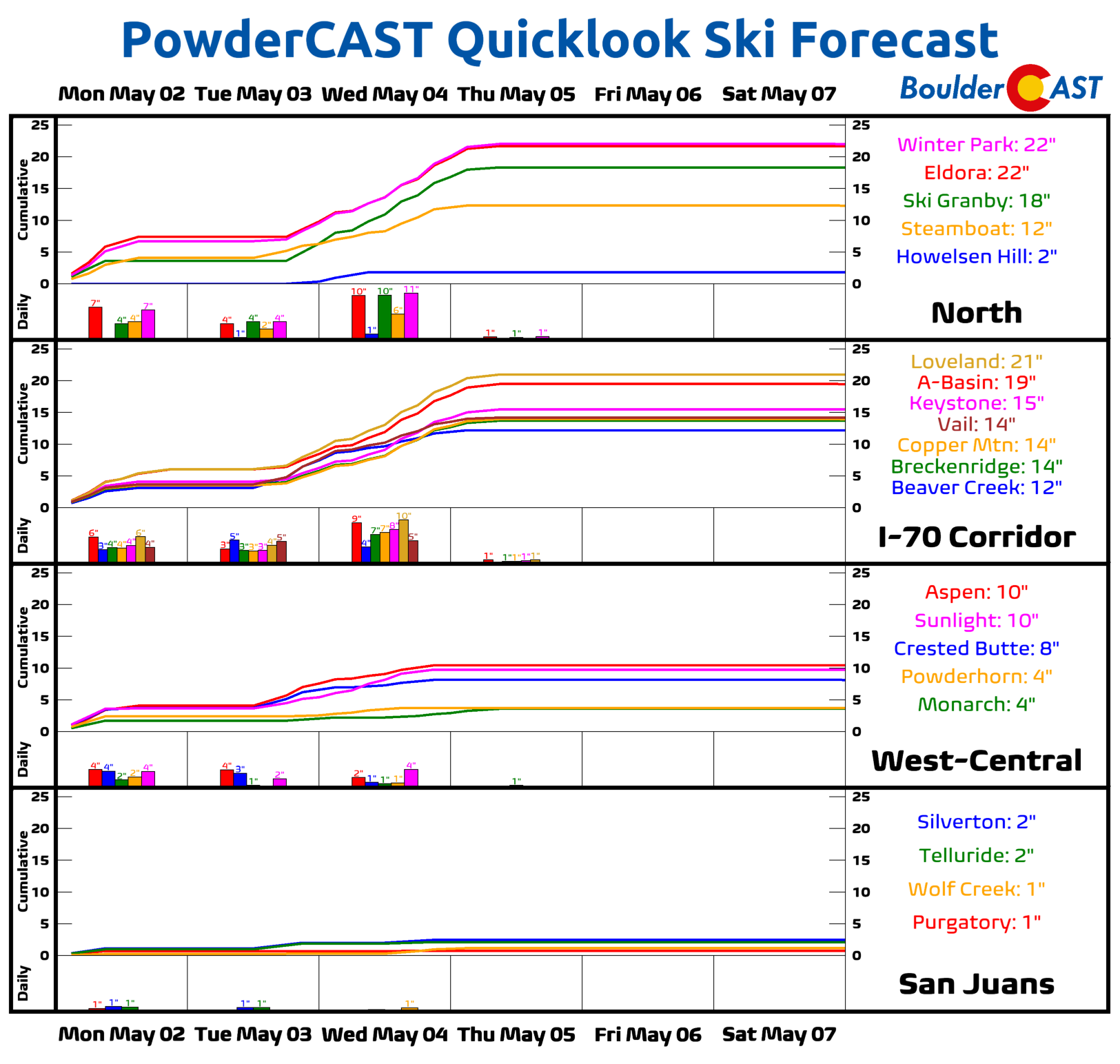
Mountains: Rain/snow will be likely Monday over the High Country and again along the higher peaks Tuesday into Wednesday. Total snow accumulations may reach 10 to 16+” in areas above 10,000 feet. Drier and warmer weather will take over late Thursday and Friday.
Help support our team of Front Range weather bloggers by joining BoulderCAST Premium. We talk Boulder and Denver weather every single day. Sign up now to get access to our daily forecast discussions each morning, complete six-day skiing and hiking forecasts powered by machine learning, first-class access to all our Colorado-centric high-resolution weather graphics, bonus storm updates and much more! Or not, we just appreciate your readership!
Spread the word, share the BoulderCAST forecast!


