After a hot and somewhat dry last week or so, monsoon season rapidly ramps up this week across Colorado! Deep and anomalous subtropical moisture will surge into the area potentially reaching record levels which will carry the threat of flash flooding across the Front Range. By the latter part of the week, there are some signs that the ridge may move northwestward, possibly pushing the deepest monsoonal flow to our north aiding in some drying. Nevertheless, showers and storms will exist in the forecast every single day this week, especially Monday through Wednesday when flash flooding will be a major concern. Let’s discuss this wet setup!
This week’s highlights include:
- Monsoonal flow ramps up this week, reaching its peak on Monday and Tuesday
- Deep and anomalous moisture surges in reaching near-record levels by Tuesday
- Flash flooding is the primary threat this week — every day through at least Wednesday
- There are some indications of less widespread storms late in the week, but moist flow will keep wet weather in our forecast
- Highs in the low 90s Monday will cool off into the 80s for the rest of week with clouds and precipitation abound
DISCLAIMER: This weekly outlook forecast is created Monday morning and covers the entire upcoming week. Accuracy will decrease as the week progresses as this post is NOT updated. To receive daily updated forecasts from our team, among many other perks, subscribe to BoulderCAST Premium.

Go Premium, get all the perks.
Daily Forecast Updates
Get our daily forecast discussion every morning delivered to your inbox.
All Our Model Data
Access to all our Colorado-centric high-resolution weather model graphics. Seriously — every one!
Ski & Hiking Forecasts
6-day forecasts for all the Colorado ski resorts, plus more than 120 hiking trails, including every 14er.
Smoke Forecasts
Wildfire smoke concentration predictions up to 72 hours into the future.
Exclusive Content
Weekend outlooks every Thursday, bonus storm updates, historical data and much more!
No Advertisements
Enjoy ad-free viewing on the entire site.
Monsoon ramps up into midweek with flash flooding possible
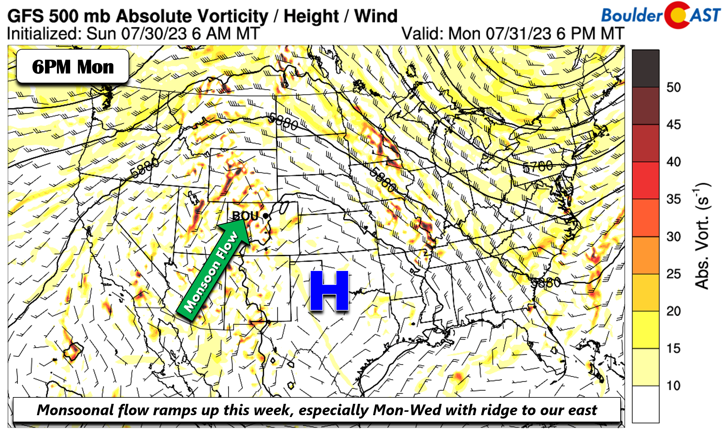
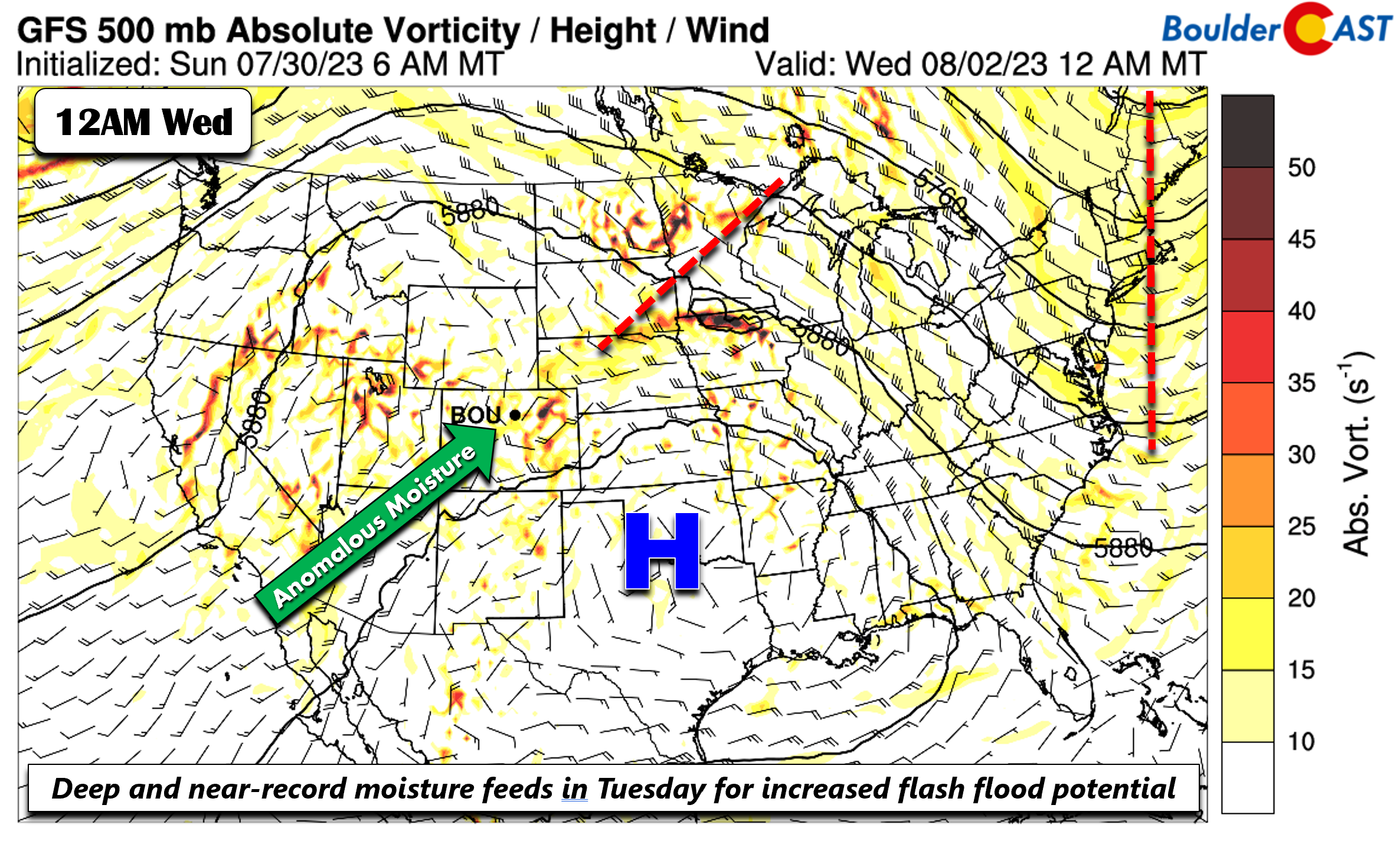
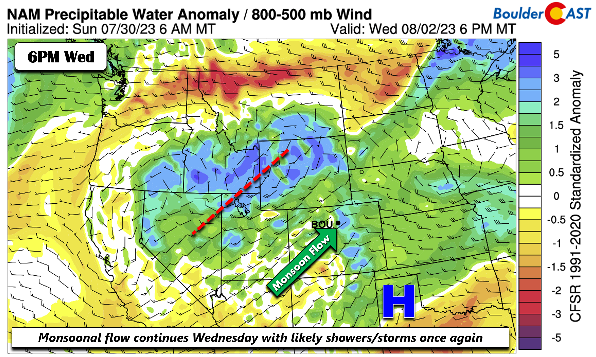
The monsoonal flow really ramps up in the days ahead, perhaps reaching its summertime peak around Tuesday or Wednesday of this week. A potent ridge at the mid-levels will largely remain to our southeast into midweek over the southern Plains (below). This placement of the ridge will allow a strong and anomalous monsoonal flow to push into the Intermountain West and into Colorado. At the same time, this moisture will be fueled by a weak area of low pressure near Baja California that will move inland towards midweek and bring near-record moisture levels to eastern Colorado Tuesday into Wednesday.
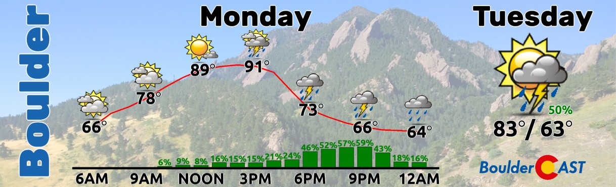
After some morning sunshine, anomalous moisture northwest of the ridge will favor likely showers/storms Monday afternoon and evening, with coverage greater than we had on Sunday.
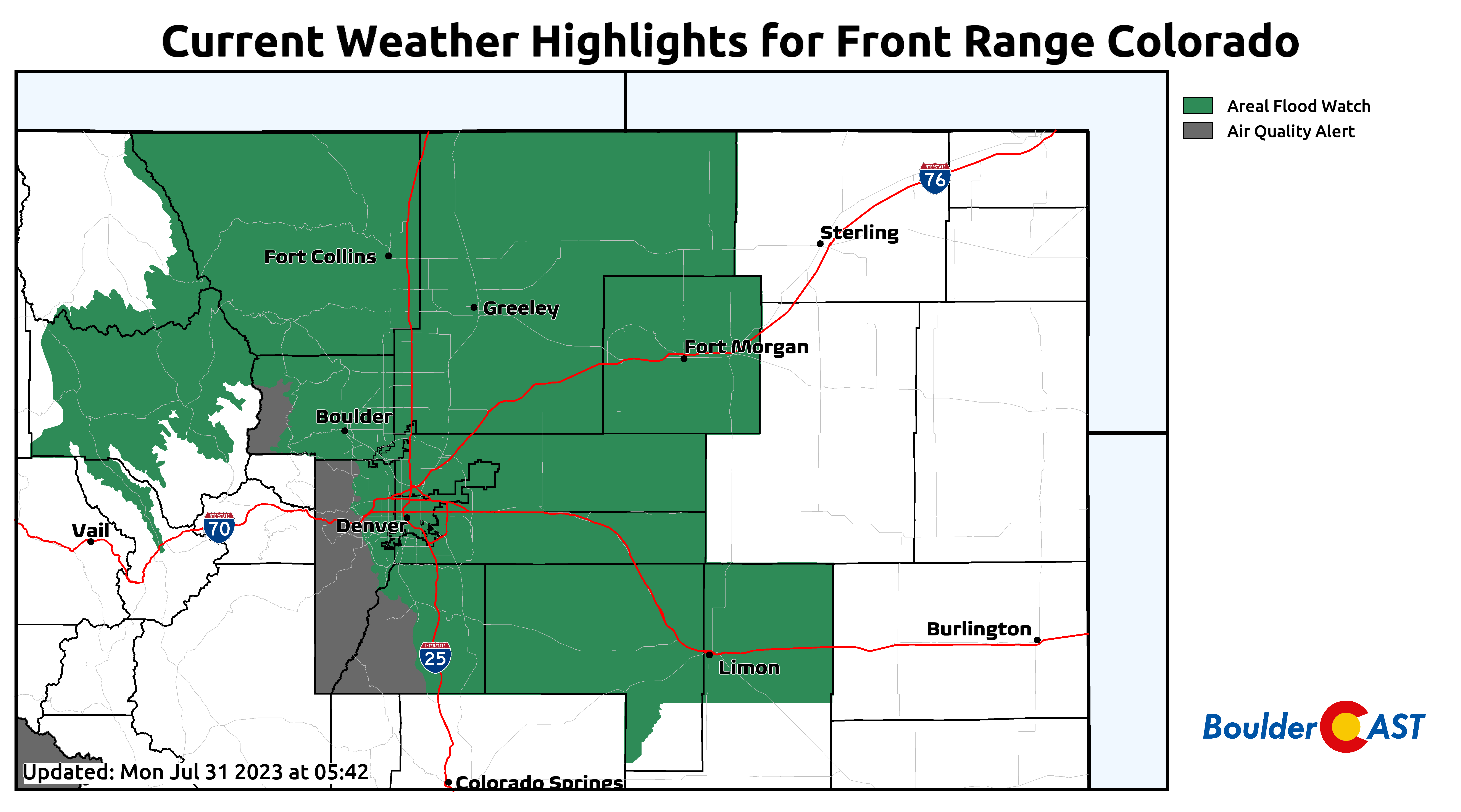
Slow-moving storms may lead to flash flooding Monday, especially in the burn scars across the higher terrain. Flash Flood Watches are in effect for basically the entire area from 4PM to Midnight on Monday!
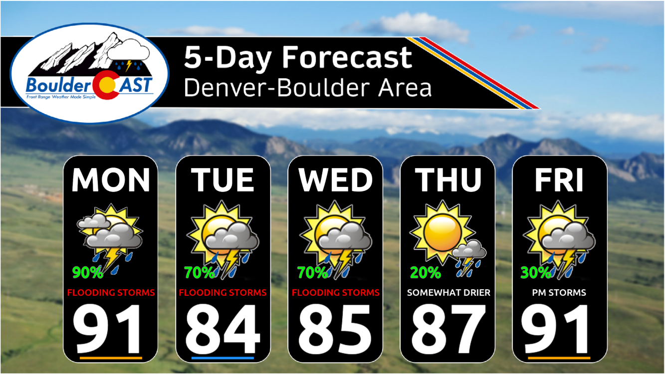
Finally, we should see highs once again in the lower 90s on Monday. The good news is that this could very well be our only 90-degree day of the week!
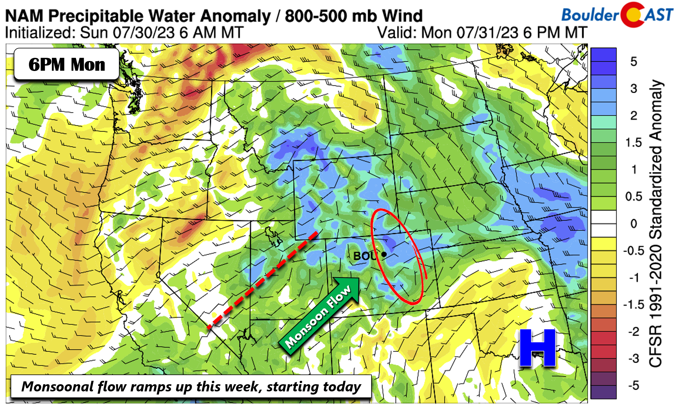
On Tuesday the ridge moves little and hence the monsoonal moisture flux is unchanged. The weak low pressure from the Baja moves into the western United States, allowing for a greater flux of deep moisture to penetrate into eastern Colorado.
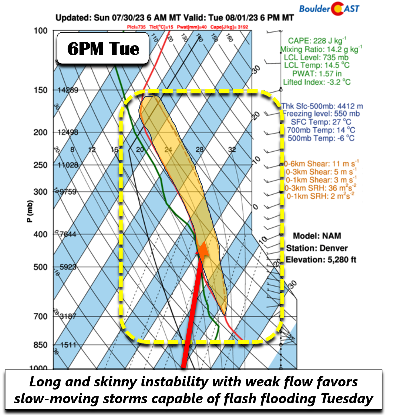
With that, near-record precipitable water values may occur across our area Tuesday. The image below shows that values may reach ~3.5 standard deviations above normal for the first of August!
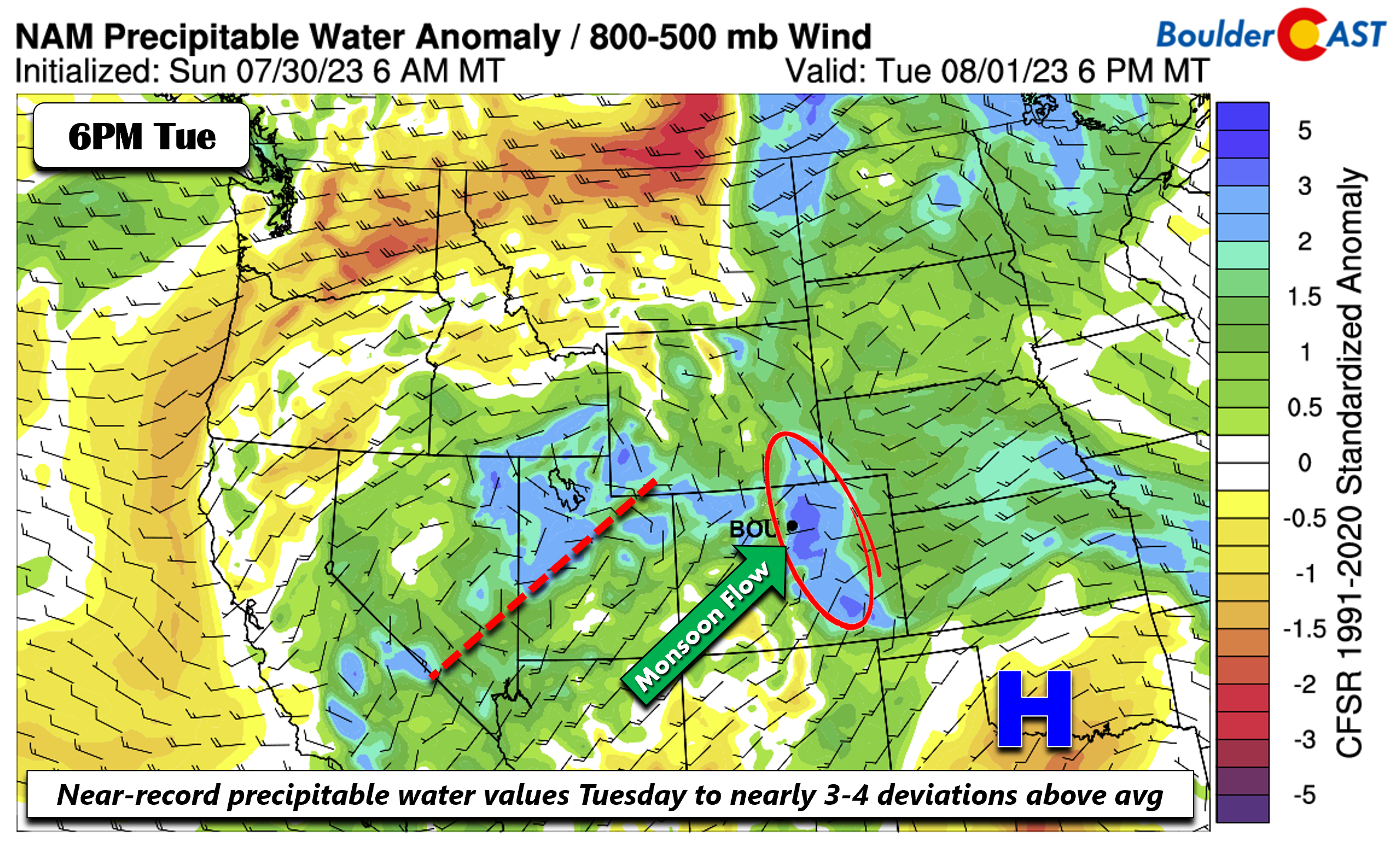
What does that deviation actually equate to? Well, the NAM model for example, shows precipitable water values near 1.6 inches! That’s impressive and should not be taken lightly — even in the peak of our wet season. In addition, the skew-T graph below shows long and skinny instability from the surface to the upper-levels of the atmosphere (orange shaded region). The model below also highlights the weak flow aloft, only about 15 MPH or so. Combine these two factors together with the aforementioned very high moisture and we foresee an enhanced risk of slow-moving (aka, training) storms that will be quite efficient at producing heavy rainfall. Thus, flash flooding will be an even greater risk on Tuesday. The National Weather Service will likely issue more Flash Flood Watches for portions of the Plains throughout the week, including Tuesday, so stay tuned. High temperatures on Tuesday will be in the middle 80s.
Come Wednesday, that big ridge moves only slightly westward. The weak disturbance to our west becomes a shear-axis that will continue to aid a strong monsoonal push of moisture for another round of widespread showers and storms Wednesday afternoon/evening. Flash flooding will again be favored both over the higher terrain and Metro area with highs in the middle 80s.
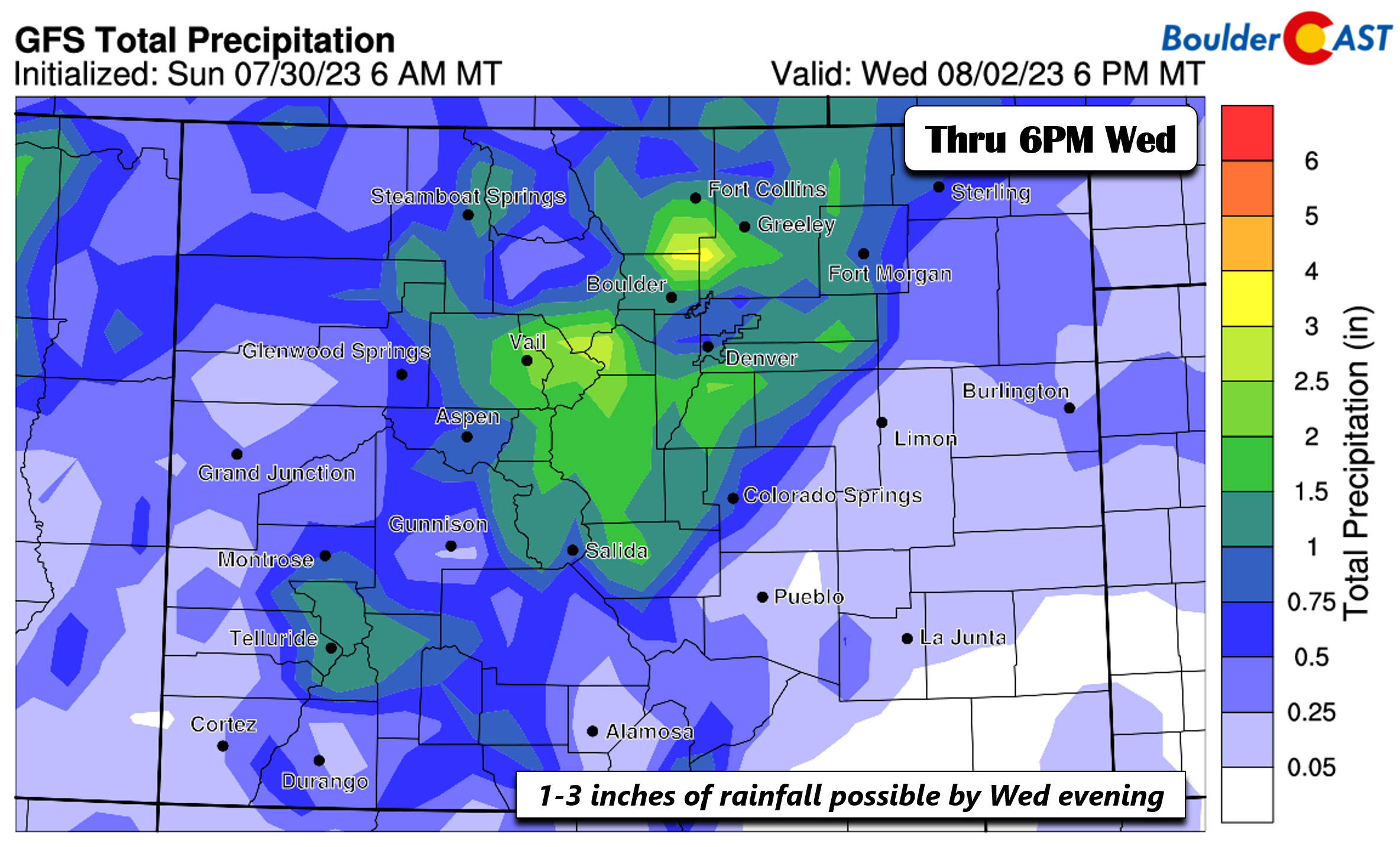
The GFS forecast total precipitation through Wednesday evening ranges from 1 to nearly 3 inches of rain across portions of the Denver Metro area. Keep in mind this model does not capture small-scale features that the HRRR/NAM-NEST would better handle. Thus, localized amounts could be higher or lower, depending on where more intense storms end up pummeling.
Still unsettled but perhaps somewhat drier by week’s end
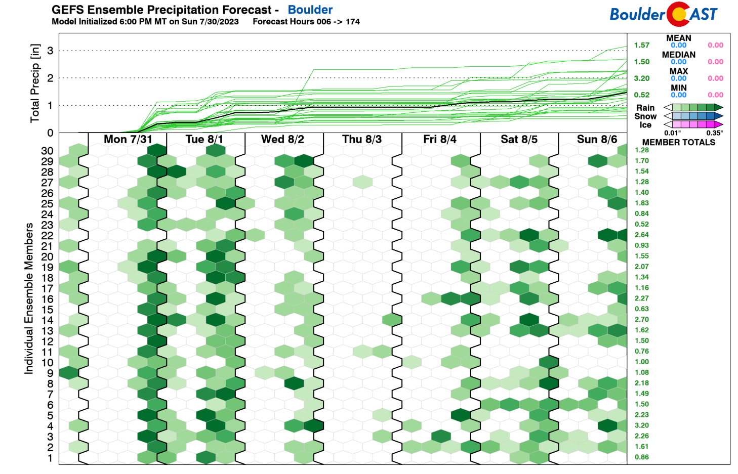
The GEFS precipitation forecast for the week is shown below. As we discussed above, it is no surprise that vast majority of GEFS ensemble members show rain Monday through Wednesday given the above considerations. But for the latter part of the week, you’ll notice that the GEFS is somewhat drier Thursday and Friday, with notably less members showing rainfall. Let’s discuss what this may mean for the tail-end of the week. There does appear to be a resurgence of rainfall chances by the weekend, but that’s a tad more uncertain at this point.
By Thursday, the ridge in the ECMWF/CMC/GFS is forecast to move west towards eastern New Mexico. At the same time, models show the shear axis to our northwest in Idaho and Nevada will lift north a tad from Wednesday. The monsoon flow will still exist over our area, but perhaps begins to lift more toward north-central Colorado. We still are forecasting a somewhat high-chance of storms, but coverage is currently anticipated to be less than the start of the week with highs staying in the 80s.
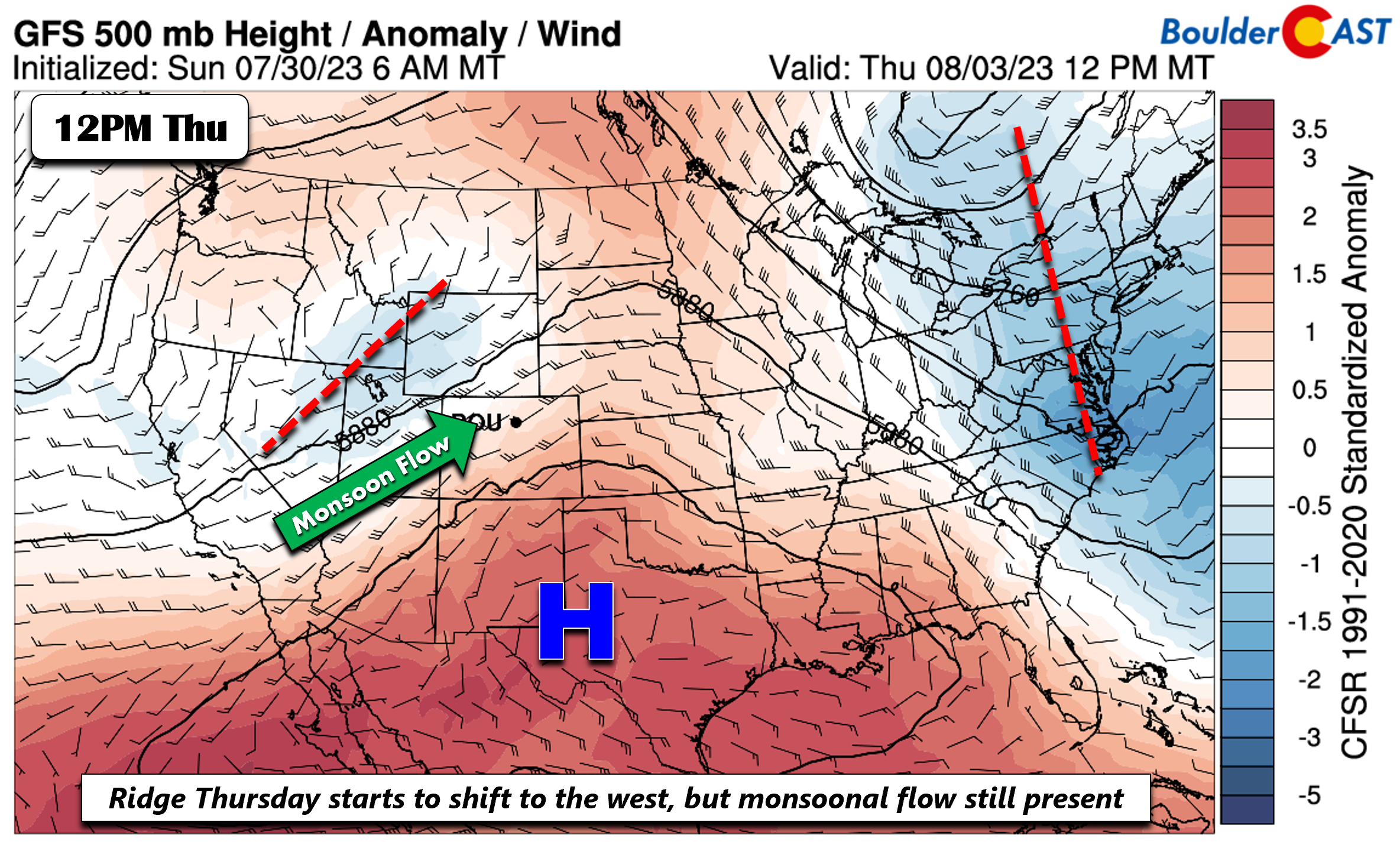
Uncertainty increases come Friday, but the ECMWF and GEFS do show that perhaps the ridge will further shift west into New Mexico/Arizona, while the weak low pressure lifts toward Montana. If this ends up verifying, we could see a less stormy pattern Friday as the deepest moisture shifts north and east of Colorado.
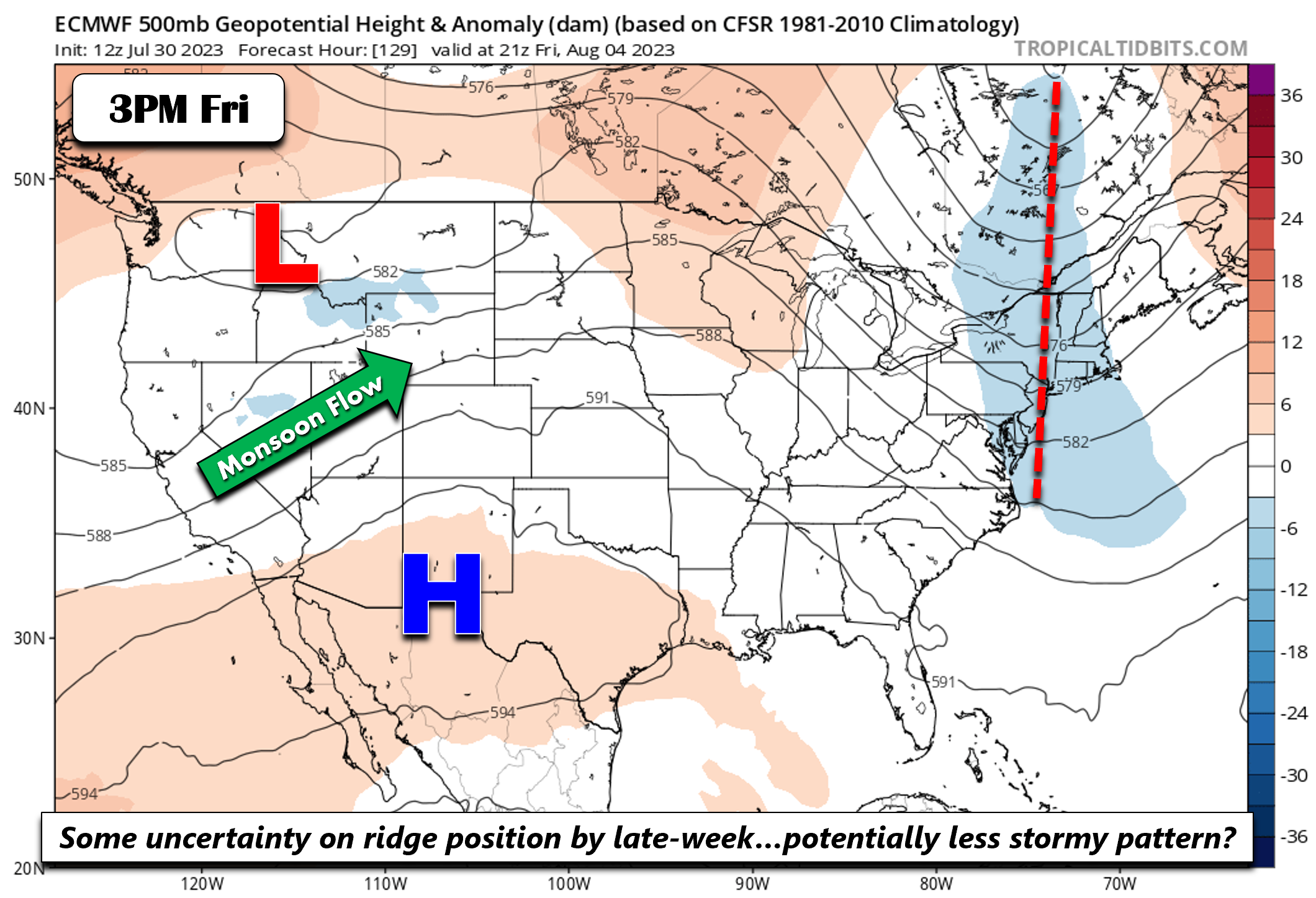
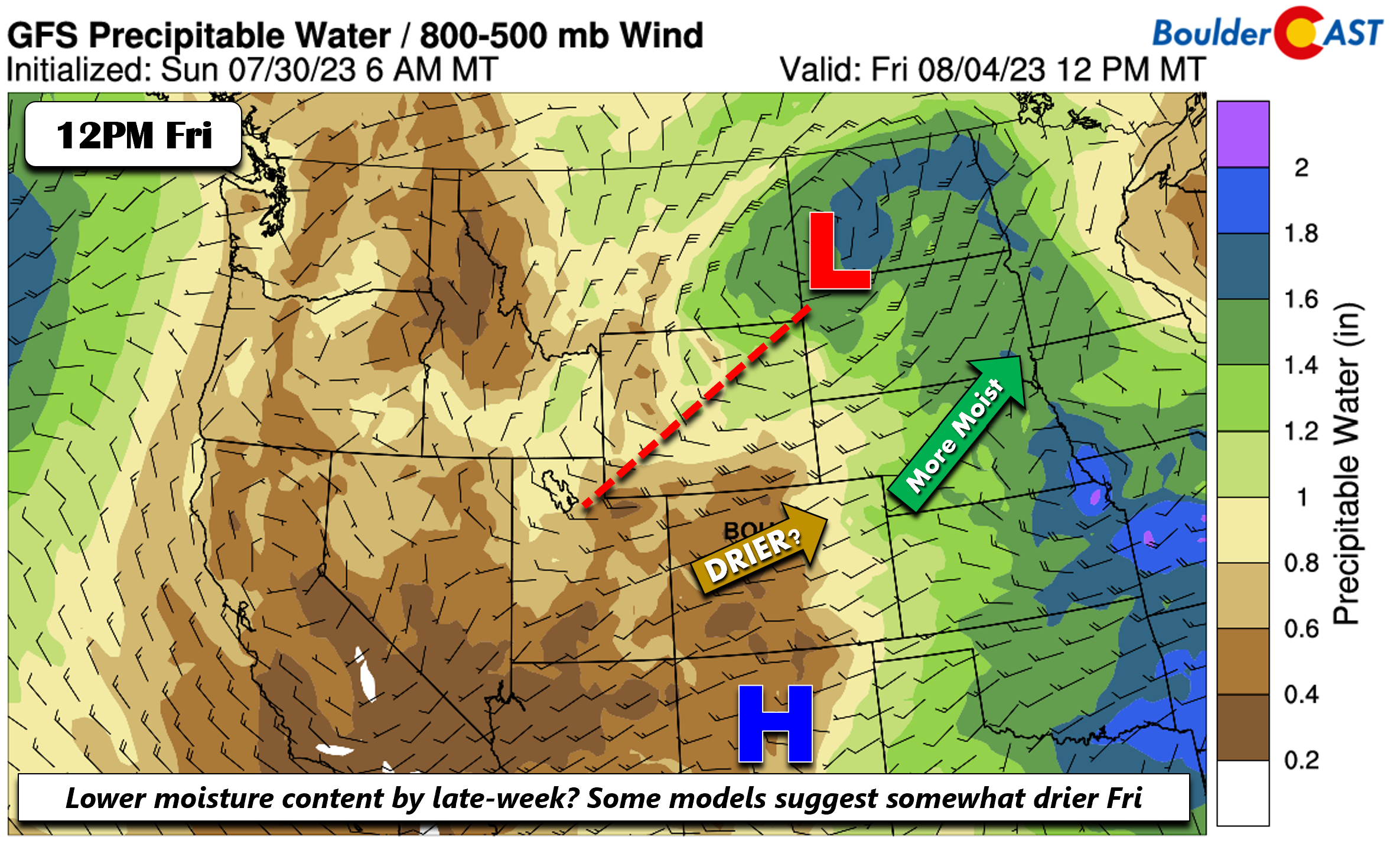
This is probably better noticeable in the GFS precipitable water plot, which shows by midday Friday values below 1 inch and drier air starting to work in from the west with downslope flow. Note however that the trough from earlier in the week will be a key player as to how the late-week period evolves. To that end, we are keeping storm chances on Friday, albeit less than earlier in the week, with highs still in the 80s.
Be sure to stay abreast of the weather this week and have a way to receive warnings if flash flooding occurs. Every day through Wednesday will carry this deadly risk.
Forecast Specifics:
Monday: Partly to mostly cloudy with widespread showers and storms developing late in the day. Storms will be capable of flash flooding and gusty winds. Highs in the lower 90s on the Plains and lower 80s in the Foothills.
Tuesday: Partly to mostly cloudy skies with widespread showers and storms in the afternoon/evening. Flash flooding increasingly is likely again. High temperatures in the middle 80s on the Plains with lower 70s in the Foothills.
Wednesday: Partly sunny becoming cloudy with showers and storms again likely for the afternoon/evening, with a lesser but continued risk of flash flooding. Highs in the middle 80s on the Plains and middle 70s over the Foothills.
Thursday: Partly sunny with scattered late-day and evening storms. Highs in the middle to upper 80s for the Plains and middle 70s in the Foothills.
Friday: Partly sunny with scattered afternoon/evening storms. Temperatures warm back up to around 90 degrees on the Plains and upper 70s in the Foothills.
DISCLAIMER: This weekly outlook forecast is created Monday morning and covers the entire upcoming week. Accuracy will decrease as the week progresses as this post is NOT updated. To receive daily updated forecasts from our team, among many other perks, subscribe to BoulderCAST Premium.
Go Premium, get all the perks.
Daily Forecast Updates
Get our daily forecast discussion every morning delivered to your inbox.
All Our Model Data
Access to all our Colorado-centric high-resolution weather model graphics. Seriously — every one!
Ski & Hiking Forecasts
6-day forecasts for all the Colorado ski resorts, plus more than 120 hiking trails, including every 14er.
Smoke Forecasts
Wildfire smoke concentration predictions up to 72 hours into the future.
Exclusive Content
Weekend outlooks every Thursday, bonus storm updates, historical data and much more!
No Advertisements
Enjoy ad-free viewing on the entire site.
Get BoulderCAST updates delivered to your inbox:
Enjoy our content? Give it a share!


You must be logged in to post a comment.