The week starts out with a southern track snowstorm for the higher terrain, with only a trace to 1/2″ expected in the Denver Metro. Westerly flow ensues for the remainder of the week, with the potential for gusty winds reappearing around midweek. Outside of a brief period of Chinook warming on Wednesday, highs will remain at or slightly below average through the week ahead and into the upcoming weekend.
This week’s highlights include:
- A southern track storm dives well south of Colorado, clips the High Country with fresh snow
- Zonal westerly flow dominates the week, with our next windy day possibly Wednesday
- Temperatures near to slightly below average, with just one warm day mixed in
- Potentially more active come next weekend?
DISCLAIMER: This weekly outlook forecast is created Monday morning and covers the entire upcoming week. Accuracy will decrease as the week progresses as this post is NOT updated. To receive daily updated forecasts from our team, subscribe to BoulderCAST Premium.

A snow storm, primarily for the High Country, starts the week
What a difference 24 hours can make! For our Premium subscribers, our forecast yesterday had called for accumulating snow for the Plains later today. While we will see some snowflakes, most of the accumulating snow will be south and west of the Denver Metro area.
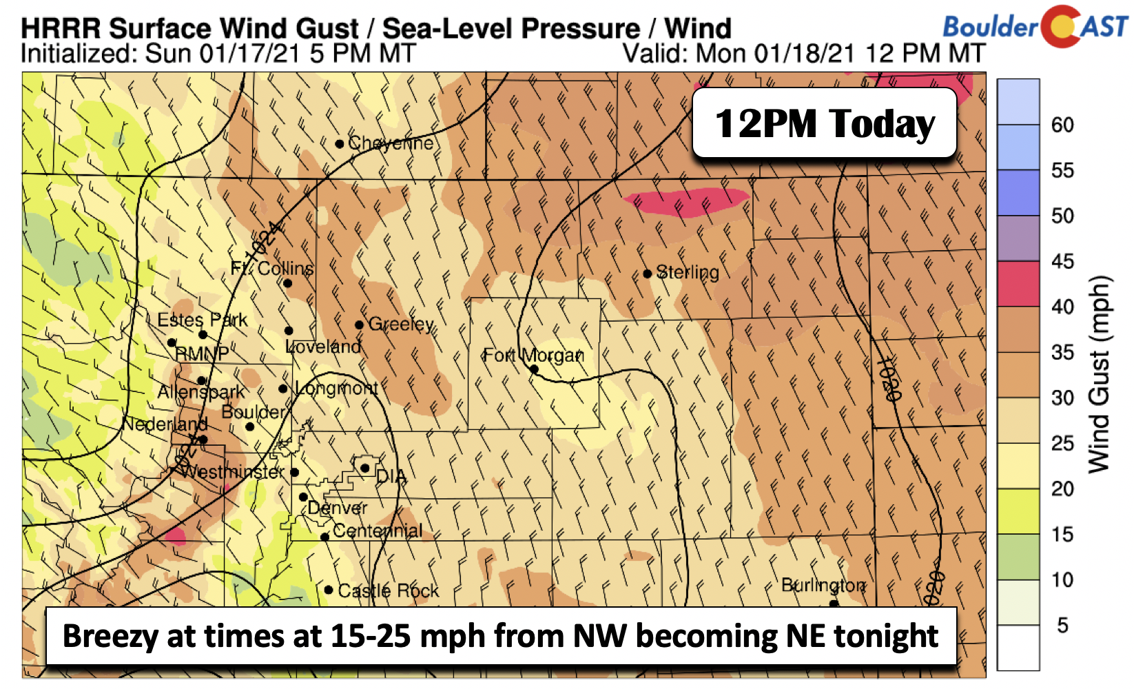
A cold front passed through the Front Range earlier this morning (below), leaving a colder airmass in its wake. Temperatures this afternoon will be cooler as a result in the lower 40’s relative to the upper 40’s on Sunday. In addition, cloud cover will be streaming in from the west and southwest with an approaching trough (more on that later).
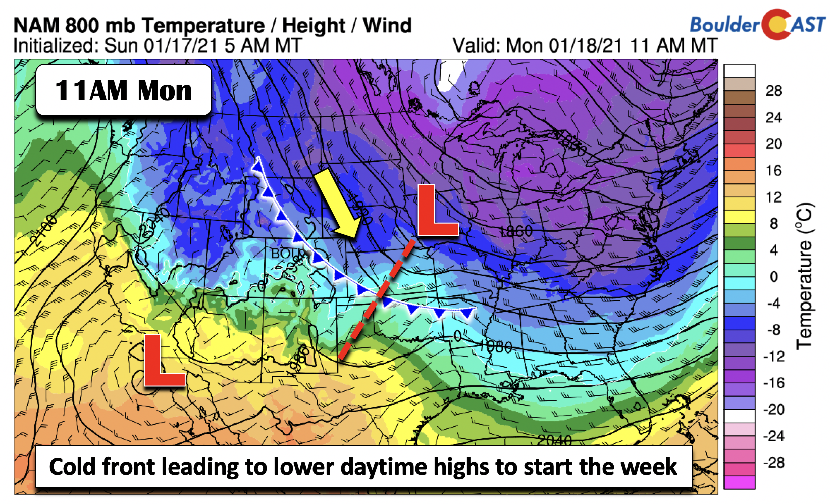
Although the cold front has passed through, winds will shift to be out of the northwest during the day, at times gusting between 15 and 25 mph (below). The flow will transition again to be out of the northeast tonight, with speeds relaxing in tandem with this wind shift.
Now on to the snow storm today, mainly for the Mountains and Foothills. Yesterday, there was good agreement in the forecast guidance of some light snow accumulations on the Plains. As of this writing, the guidance has shifted almost 180 degrees. We had known that the trough was not in the most favorable position, tracking from Idaho this afternoon into southern California by tomorrow morning (below). However, yesterday’s guidance showed upslope extending from the surface to about 10,000 feet up over the Front Range. This has shifted, with primarily northwesterly downslope flow for the Front Range, which will largely keep us dry today and tonight. As for the higher terrain, they will see two waves. The first wave actually started last night with the northwesterly mid-level flow (below left). As the low pressure sags southwestward tonight, the snow will overspread the southwest part of our state.
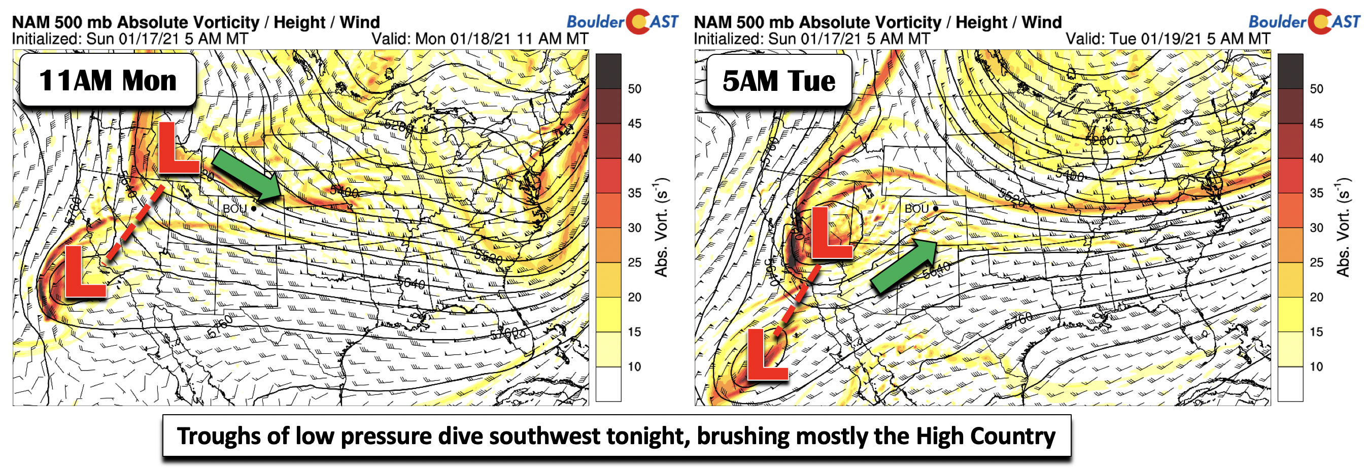
A better depiction of this snow is shown below. The northern part of Colorado has seen the first wave of snow last night until about early this evening thanks to northwest winds creating upslope on the northwest facing slopes. The southwest part of Colorado will see the second wave as the mid-level flow becomes southwest tonight, dumping snow from Telluride to Alamosa, with amounts of 4-10 inches.
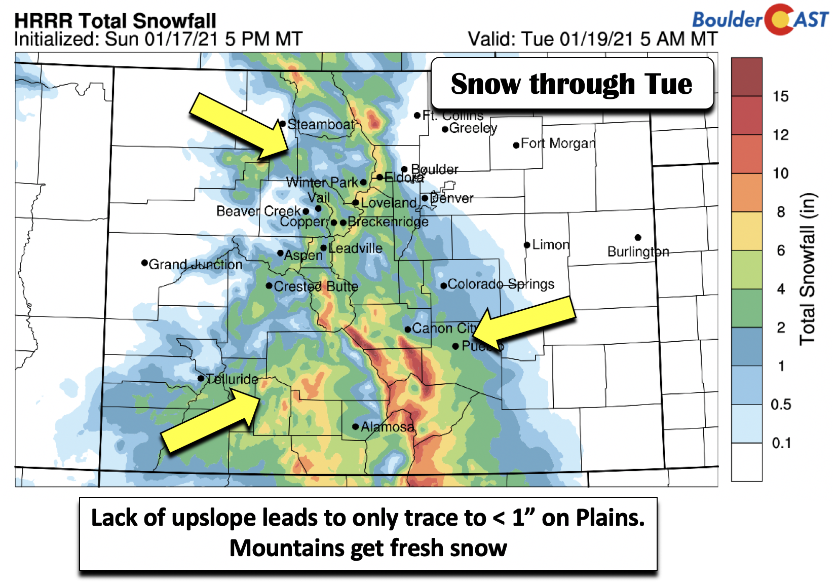
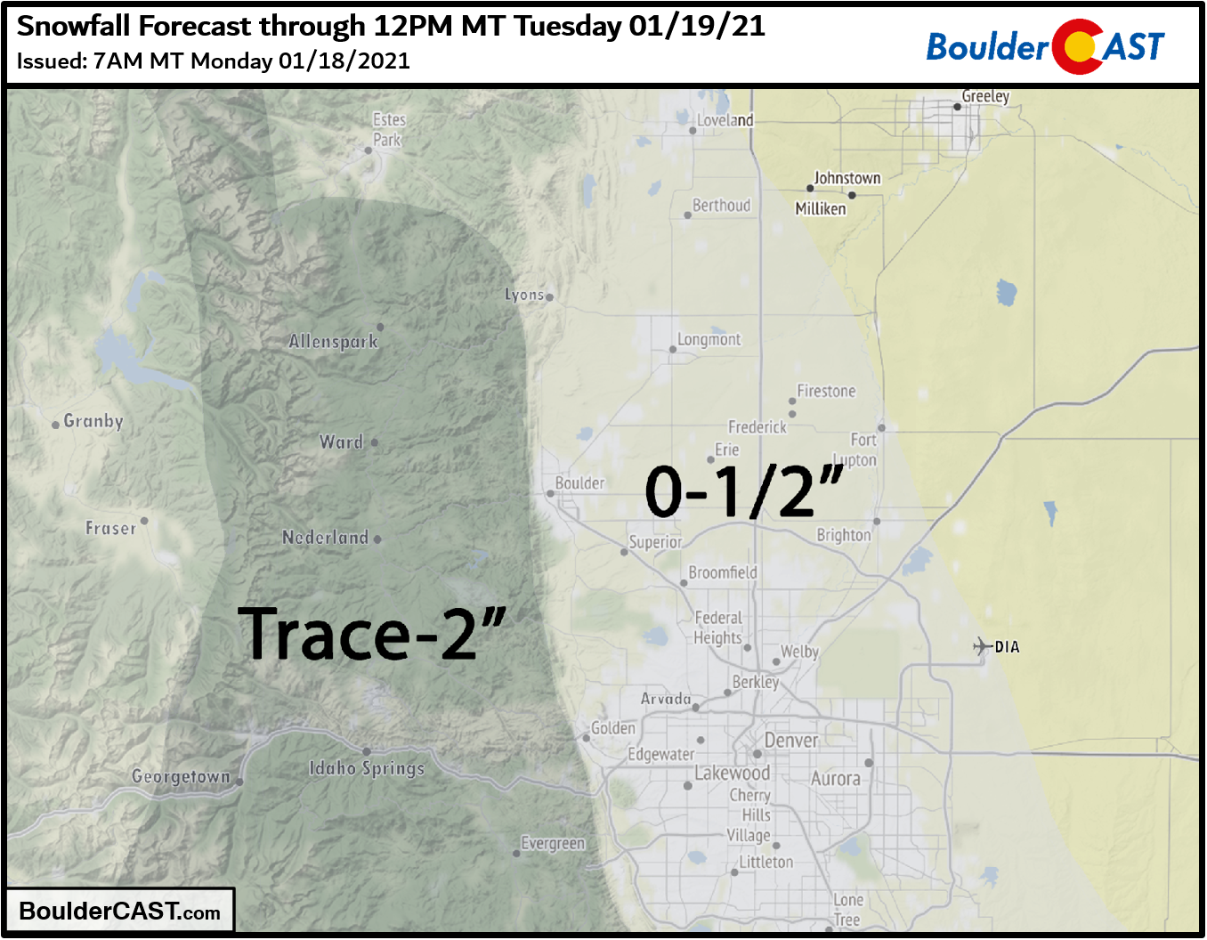
Tonight, light upslope in Denver will produce a brief period of light snow, primarily south of the Metro area. Amounts from Boulder to Denver are expected to be just a few snowflakes up to a dusting. The most likely window for the scattered snow showers will be from 10PM to 6AM overnight Monday night. Deeper upslope will be present near Pueblo and along the Palmer Divide where the lift is most prevalent. Our snowfall forecast map for Monday night’s snow potential is shown below.
On Tuesday, in the wake of the trough, cold air oozes into the Plains, with temperatures on the chilly side in the middle 30’s with overcast skies in the morning gradually clearing through the day.
Brief midweek warmth with Chinook winds possible
Following a cold start to the week with highs near to below normal, there will be a brief warm-up on Wednesday. The low pressure system becomes cut-off from the jet stream (below left), allowing higher heights and downslope warming to take over (below right). Westerly surface winds should push us into the lower 50’s, perhaps middle 50’s if the airmass trends warmer than currently anticipated.
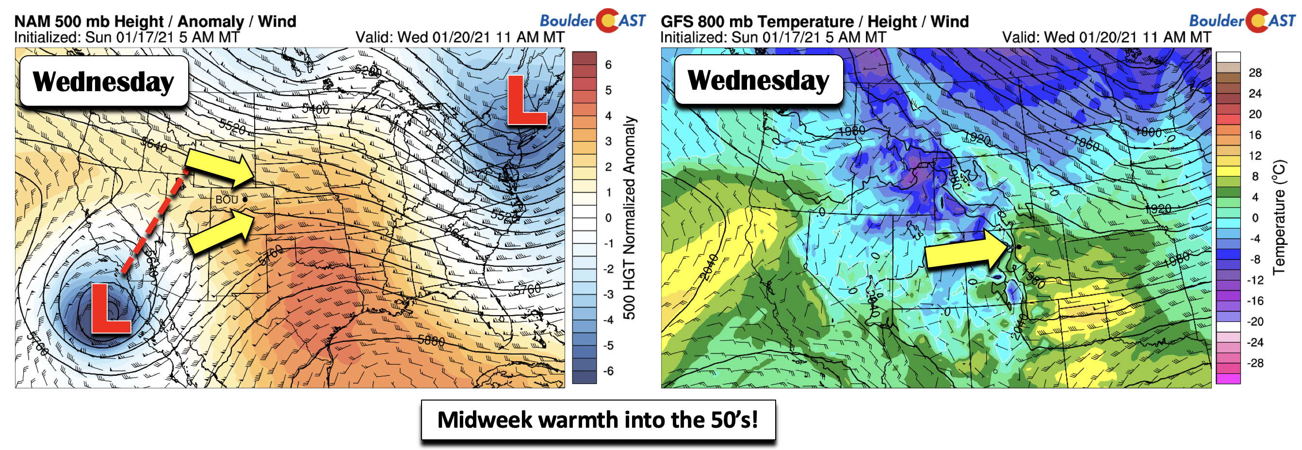
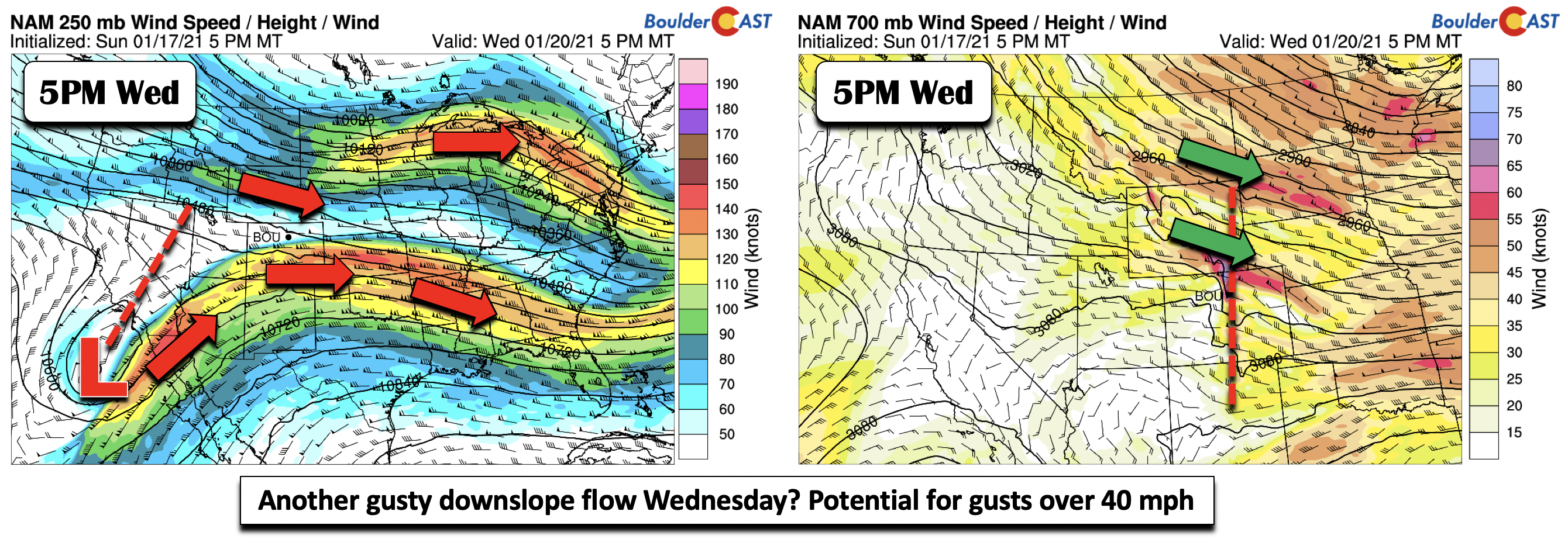
Along with the warmth on Wednesday, we will have to keep an eye out for another downslope wind event Wednesday afternoon/evening. Colorado is poised to be in between the southern and northern jet streams (below left). A confluence of these two jet streams is currently forecast to take hold late Wednesday. Along with a tightening pressure/height gradient, these winds aloft may penetrate to the surface (below right), perhaps exceeding 40 mph. It is too far out to make an estimated magnitude prediction, as a slight deviation in the jet stream will impact the outcome, but suffice to say it will likely be windy for the Foothills and nearby Plains.
Near to slightly below normal to end week
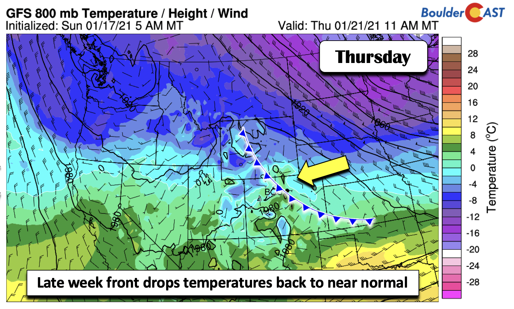
We are expecting a weak cold front to slide through early Thursday morning in response to the northern jet stream sagging southward just a tad to allow the cold air to slide back south after Wednesday’s brief warm-up. The front is barely noticeable in the figure below, but is present with the weak upslope surface winds. This should lower highs Thursday and Friday back into the 40’s.
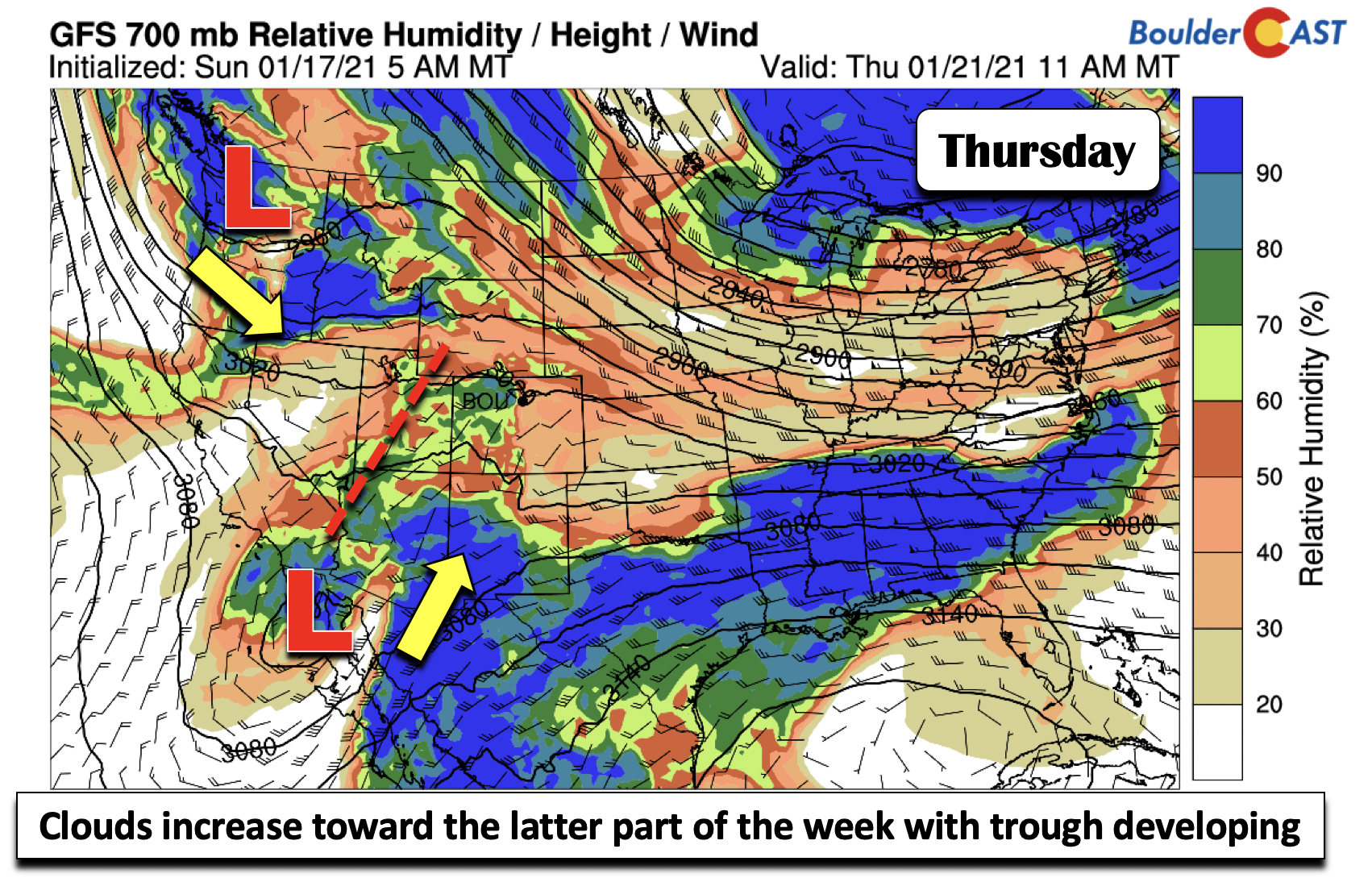
Clouds will be on the increase after sunny days Tuesday and Wednesday, especially late Thursday and Friday and a general area of two low pressure systems converge on the western U.S. (below).
Active pattern for the weekend?
Speaking of those troughs of low pressure, the extended model guidance is hinting at a potential southern track storm system come Saturday/Sunday (below).
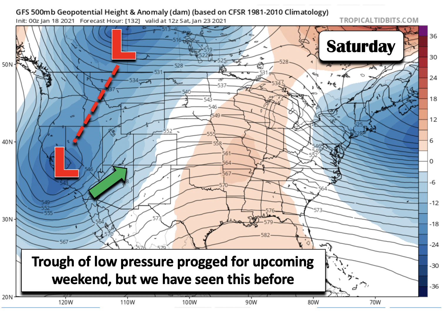
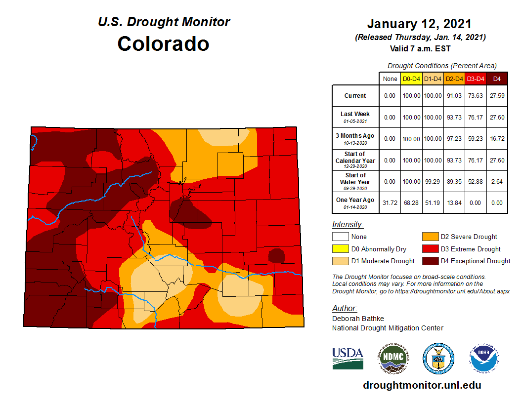
However, we have seen this before with the longer-range models showing an active pattern but then failing to deliver. Nevertheless, the extended outlook still calls for a trend of below normal temperatures. That only happens when the jet stream dives southward, which would increase our chances of seeing a storm or two embedded in that flow. Keep your fingers crossed…we certainly need the moisture with 100% drought coverage across the state and Boulder looking to conclude January with its 7th straight month of below normal precipitation.
Have a great week and stay safe and healthy!
Forecast Specifics:
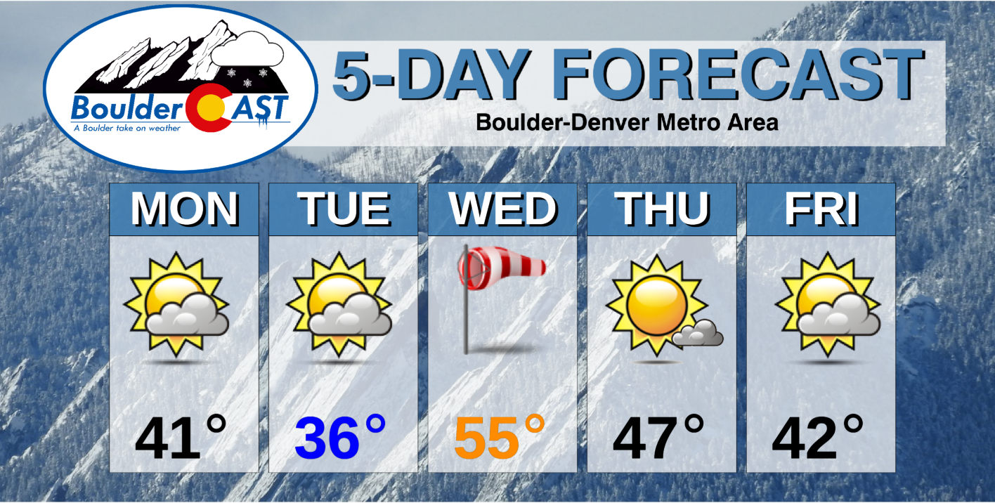
Monday: Partly cloudy and chilly with highs in the lower 40’s on the Plains and lower 30’s in the Foothills. Northwest winds at times gusting to 25 mph. Light snow showers will develop overnight mainly southwest of the Denver Metro area. Snowfall amounts up to 1/2″ on the western Plains and 2″ in the Foothills.
Tuesday: Morning clouds gradually becoming mostly sunny with highs colder in the middle 30’s for the Plains and lower 20’s in the Foothills.
Wednesday: Mostly sunny and warm, with potentially gusty winds late in the day and evening. Highs in the lower 50’s on the Plains and lower 40’s in the Foothills.
Thursday: Sunny skies becoming partly sunny with highs cooler in the middle 40’s on the Plains and lower 30’s for the Foothills.
Friday: A mix of clouds and sun. Chilly with lower 40’s on the Plains and lower 30’s in the Foothills.
Weekend: Increasing clouds with a chance of light snow possible late Saturday and Sunday with temperatures remaining below normal.
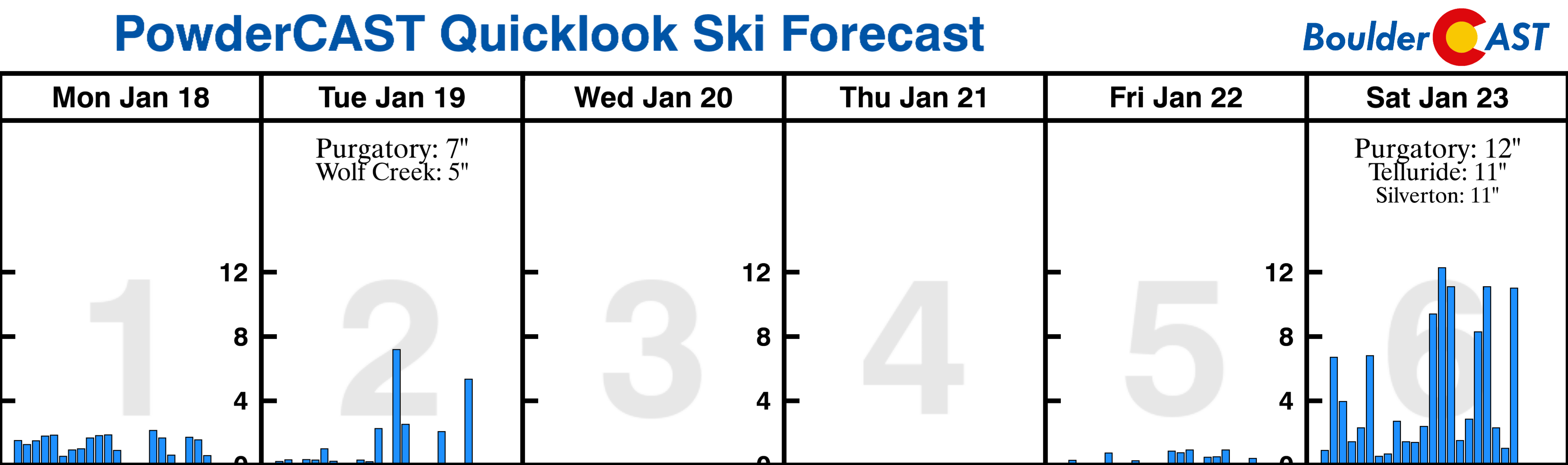
Mountains: Snowy conditions will exist over the higher terrain today, as well as gusty winds. After a dry period Tuesday, strong winds take over midweek with potential avalanches due to fresh snow cover. Another chance of snow is possible over the weekend as a series of troughs track across the state. Check our PowderCAST page for updated forecasts for all the Colorado ski resorts.
Help support our team of Front Range weather bloggers by joining BoulderCAST Premium. We talk Boulder and Denver weather every single day. Sign up now to get access to our daily forecast discussions each morning, complete six-day skiing and hiking forecasts powered by machine learning, first-class access to all our Colorado-centric high-resolution weather graphics, bonus storm updates and much more! Or not, we just appreciate your readership!
.
Spread the word, share the BoulderCAST forecast!
.


You must be logged in to post a comment.