The week ahead will indeed be an active one across the Front Range as an unsettled pattern remains entrenched across the western United States for the foreseeable future. This will spell out periods of gusty downslope winds, persistently cool temperatures and at least one or two chances for snowfall this week in our area, with the best shot coming Wednesday evening and night.
This week’s highlights include:
- An active pattern across the West will keep temperatures generally below normal for the Front Range through the week with frequent disturbances passing through
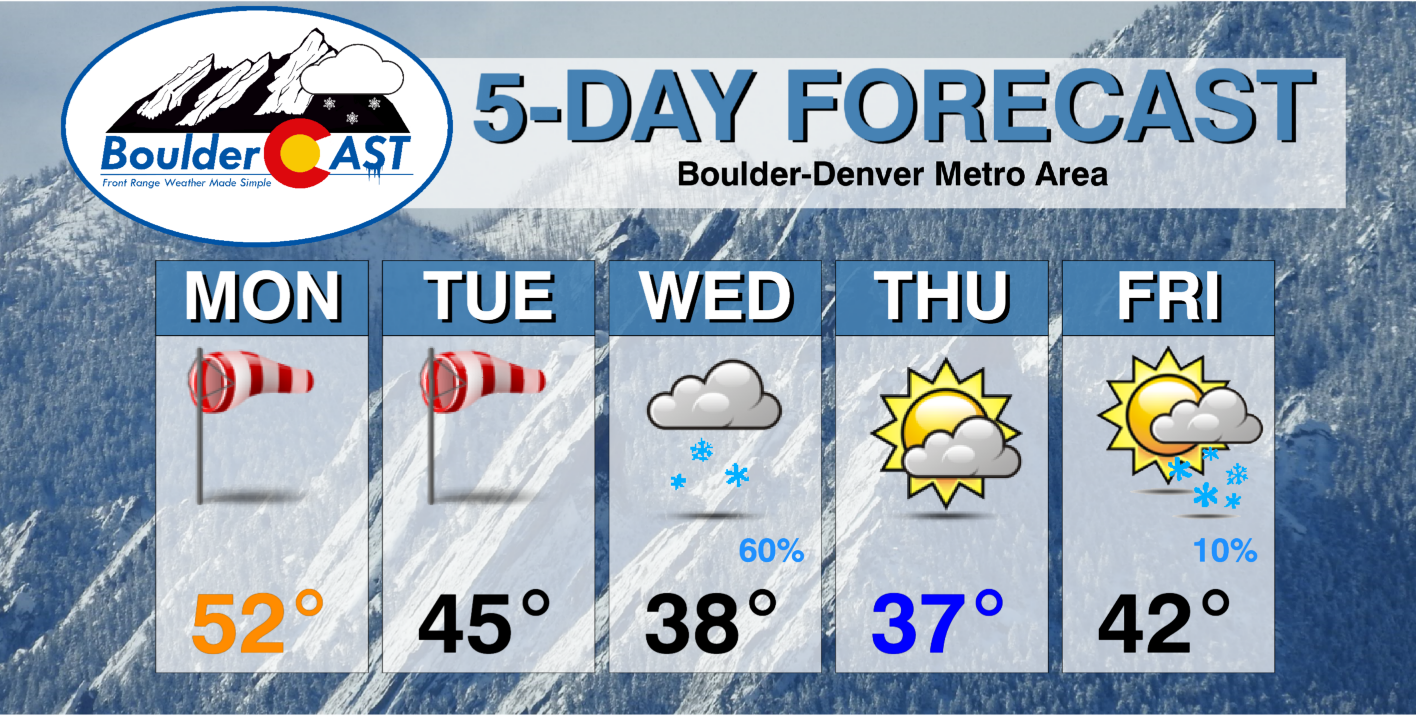
- Monday and Tuesday will be gusty but mostly sunny for the Denver Metro area
- Yet another midweek storm system should bring a period of light snowfall late Wednesday into Wednesday night but with only very minor accumulations
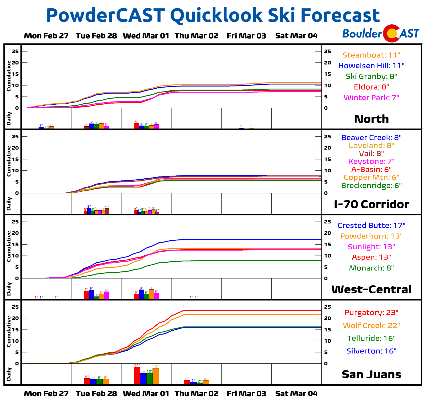
- Moderate to heavy snow will fall in the Mountains through Wednesday — the San Juans will be favored again with 2+ feet of snow expected
- There’s a second chance of snow Friday evening/night, but this one is particularly uncertain right now
DISCLAIMER: This weekly outlook forecast is created Monday morning and covers the entire upcoming week. Accuracy will decrease as the week progresses as this post is NOT updated. To receive daily updated forecasts from our team, among many other perks, subscribe to BoulderCAST Premium.
A gusty start to the week
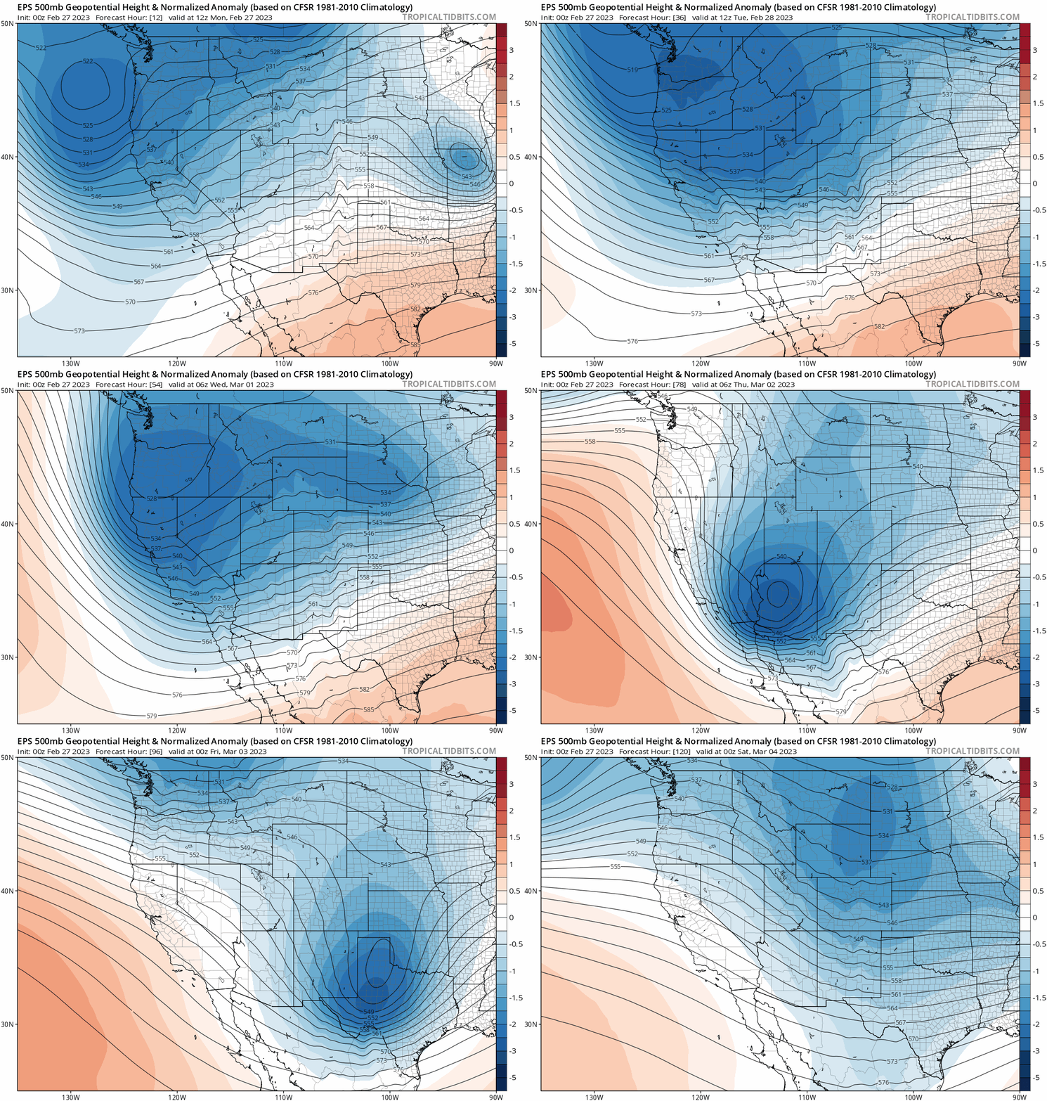
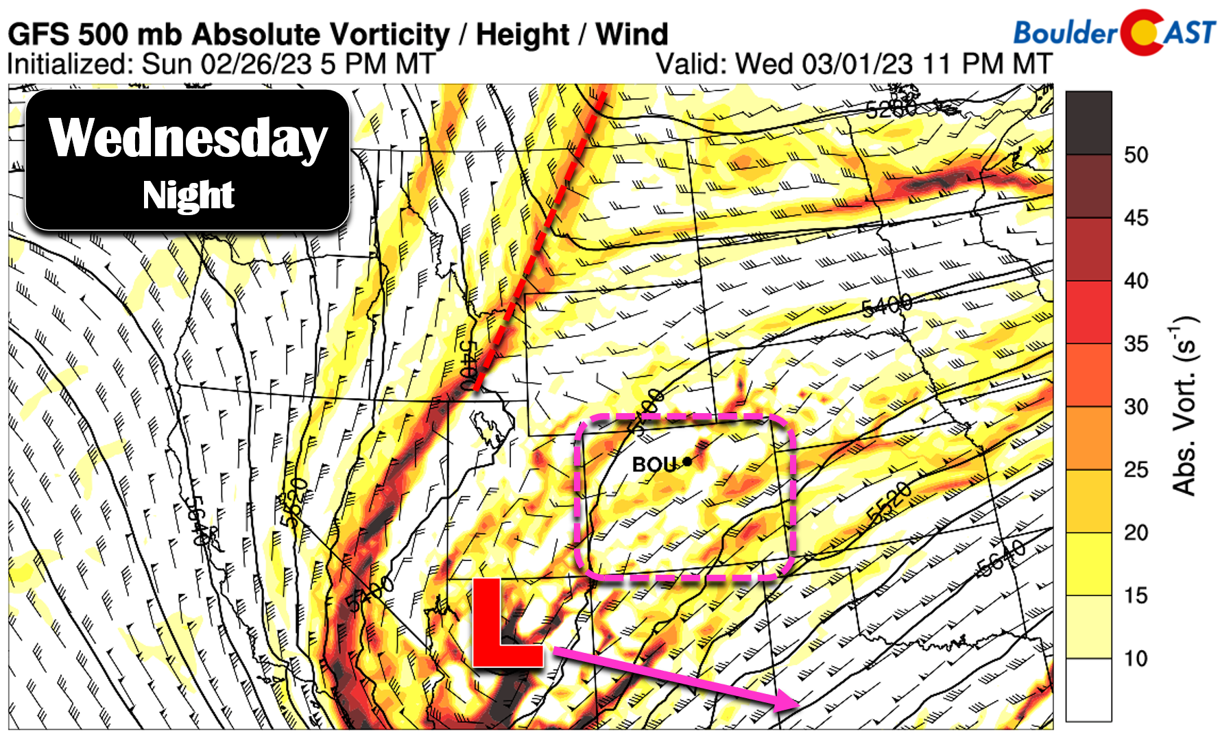
An unsettled, troughy pattern will remain parked across the western United States throughout the week ahead lending to generally below normal temperatures and mildly active weather conditions for our area as we close out the month of February. The biggest concern for the week will be a cut-off low pressure system which dives out of the Pacific Northwest on Wednesday and then sweeps across Arizona and New Mexico on Thursday. This system is slated to track quite far south, but at the moment does look to offer a chance of light snow for the Front Range. Let’s take a better look at the week ahead…
On Monday the main concern will be the strong downslope winds in and near the Foothills during the morning hours. A High Wind Warning was in effect for all of Boulder and Larimer Counties, but the most intense hurricane-force winds of 70+ MPH have largely been confined above 7000 feet elevation. Only a few gusts of 30 to 45 MPH have made it down to the lower elevations overnight. The map below shows observed peak wind gusts.
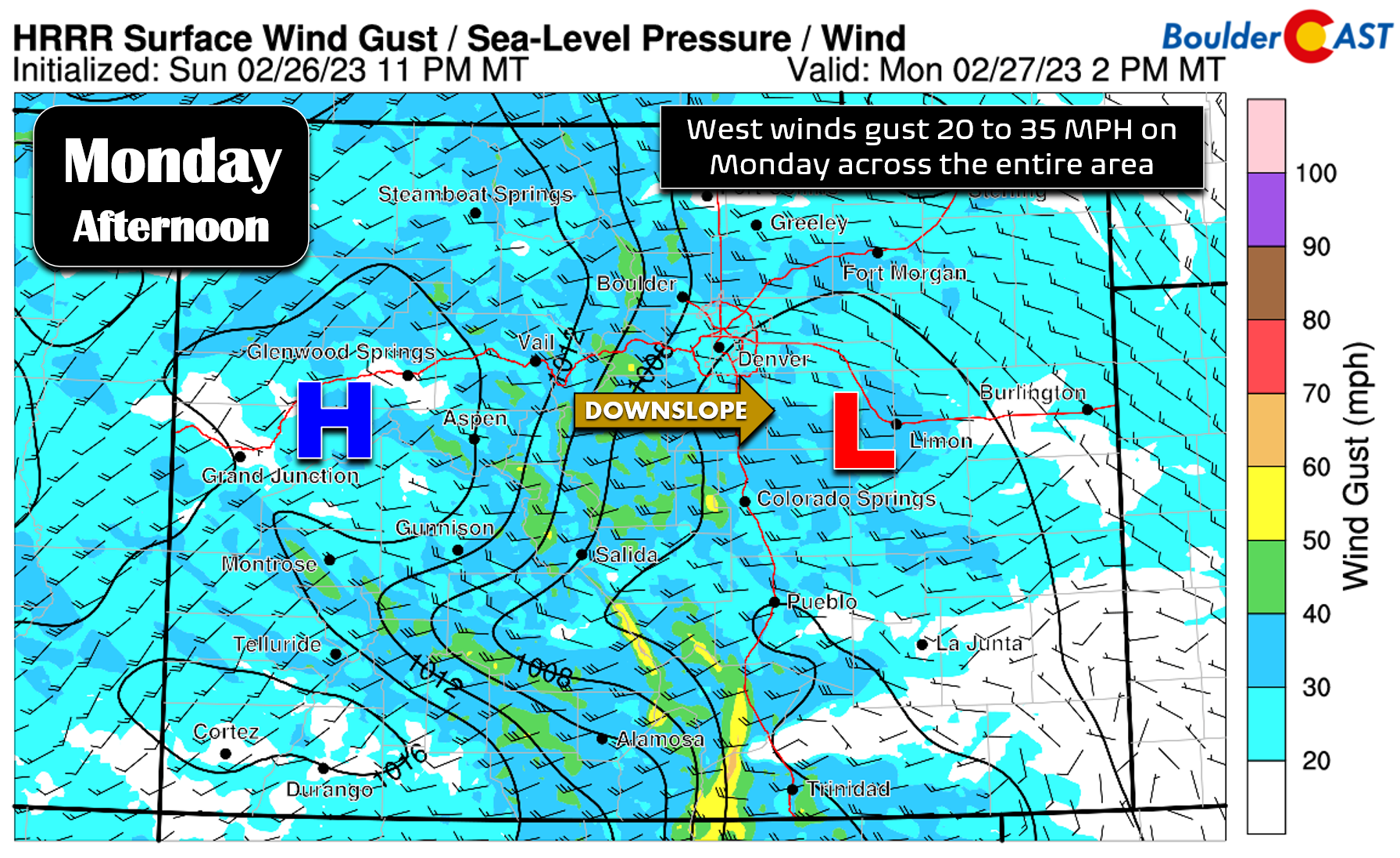
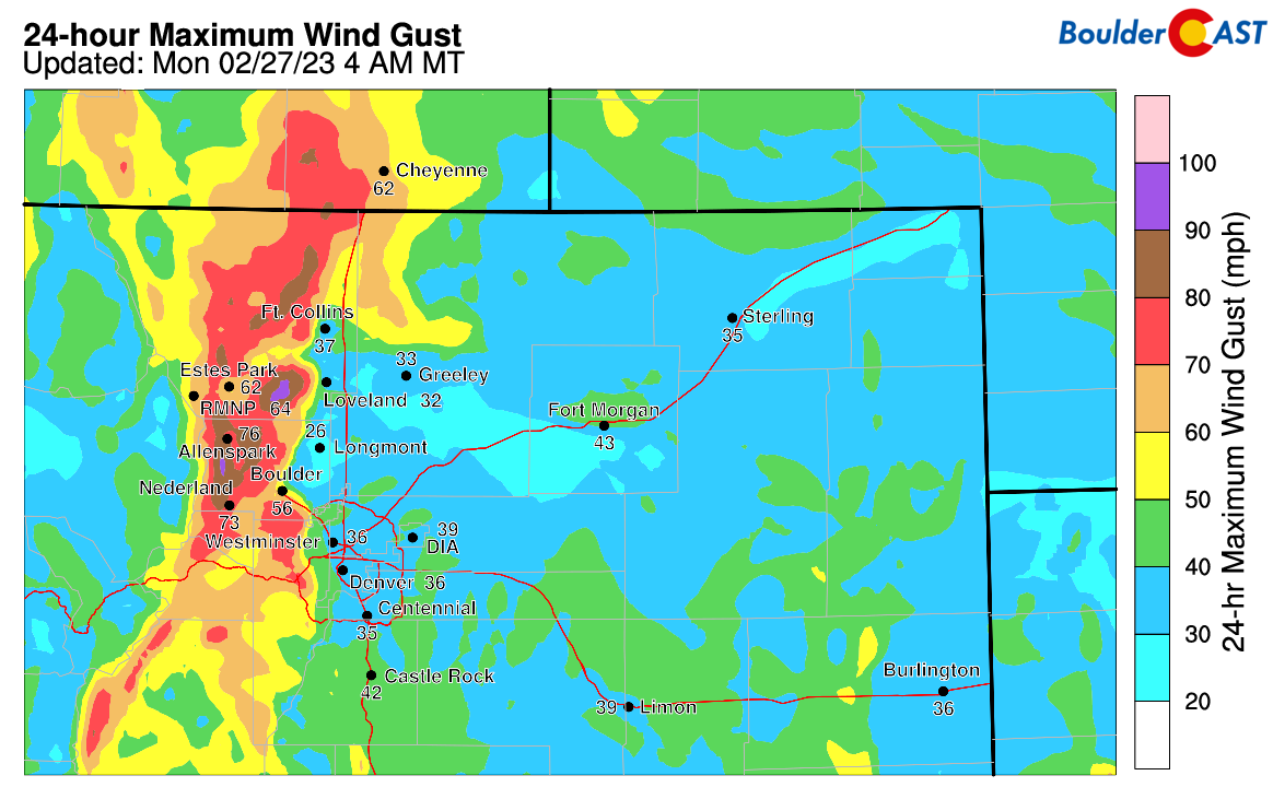 The strong pressure gradient that set up from west (high) to east (low) across the state has already started to weaken — the bulk of the downslope wind event is over and will continue to trend downwards Monday morning. However, through the day Monday and into Tuesday the overhead jet stream will remain draped across Colorado with some mixing of the stronger, jet-infused winds aloft coming down to the surface at times, especially in the daytime periods.
This will lead to continued breezy and/or windy conditions the first few days of the week. Expect daytime gusts of 20 to 35 MPH from the west across the area on Monday.
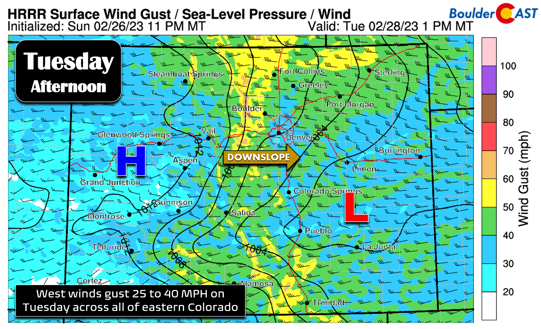
On Tuesday, gusts will increase up to 40 MPH across portions of eastern Colorado.
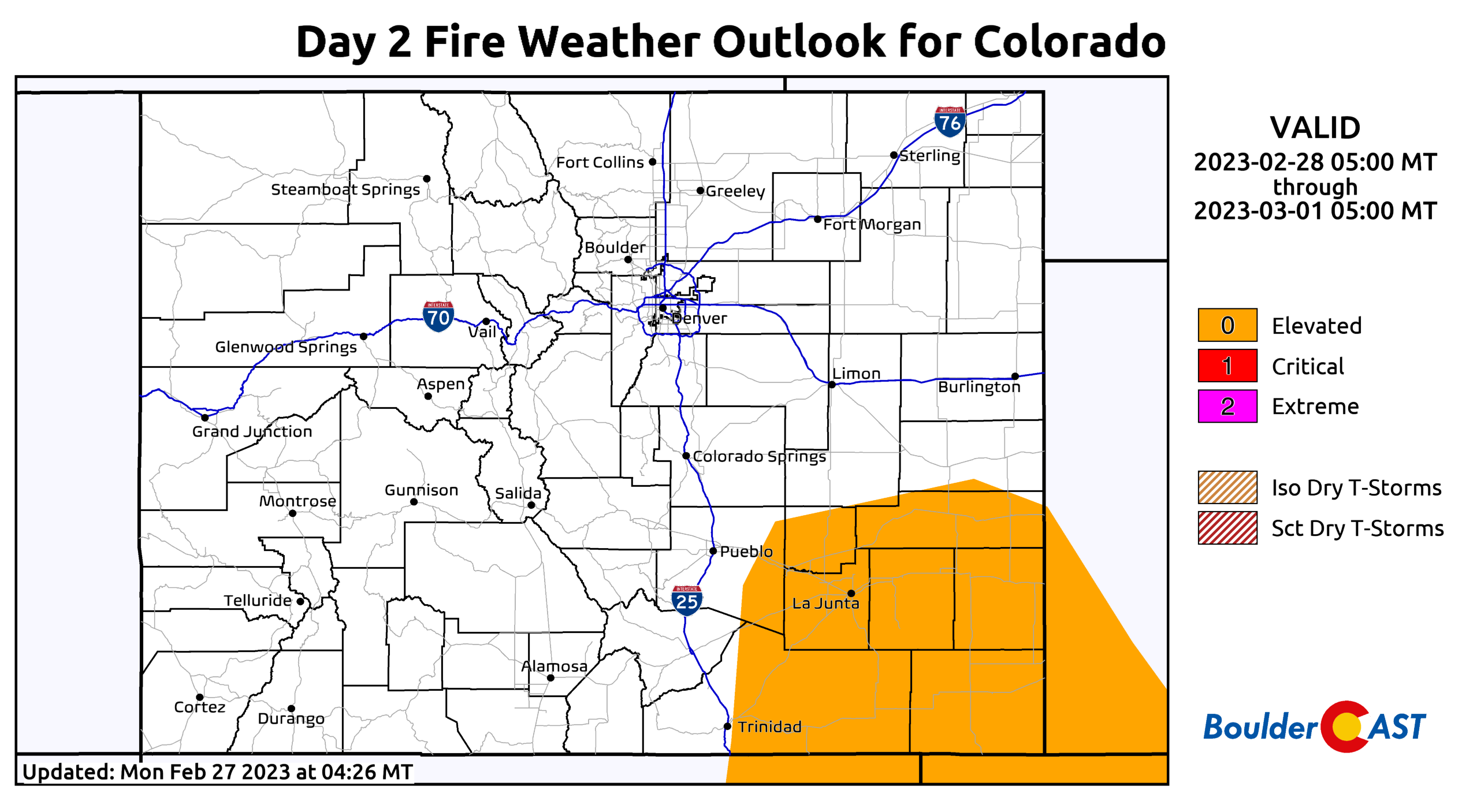
These west winds will create elevated fire concerns across drought-stricken southeast Colorado both days, with Tuesday looking to be the worse of the two.
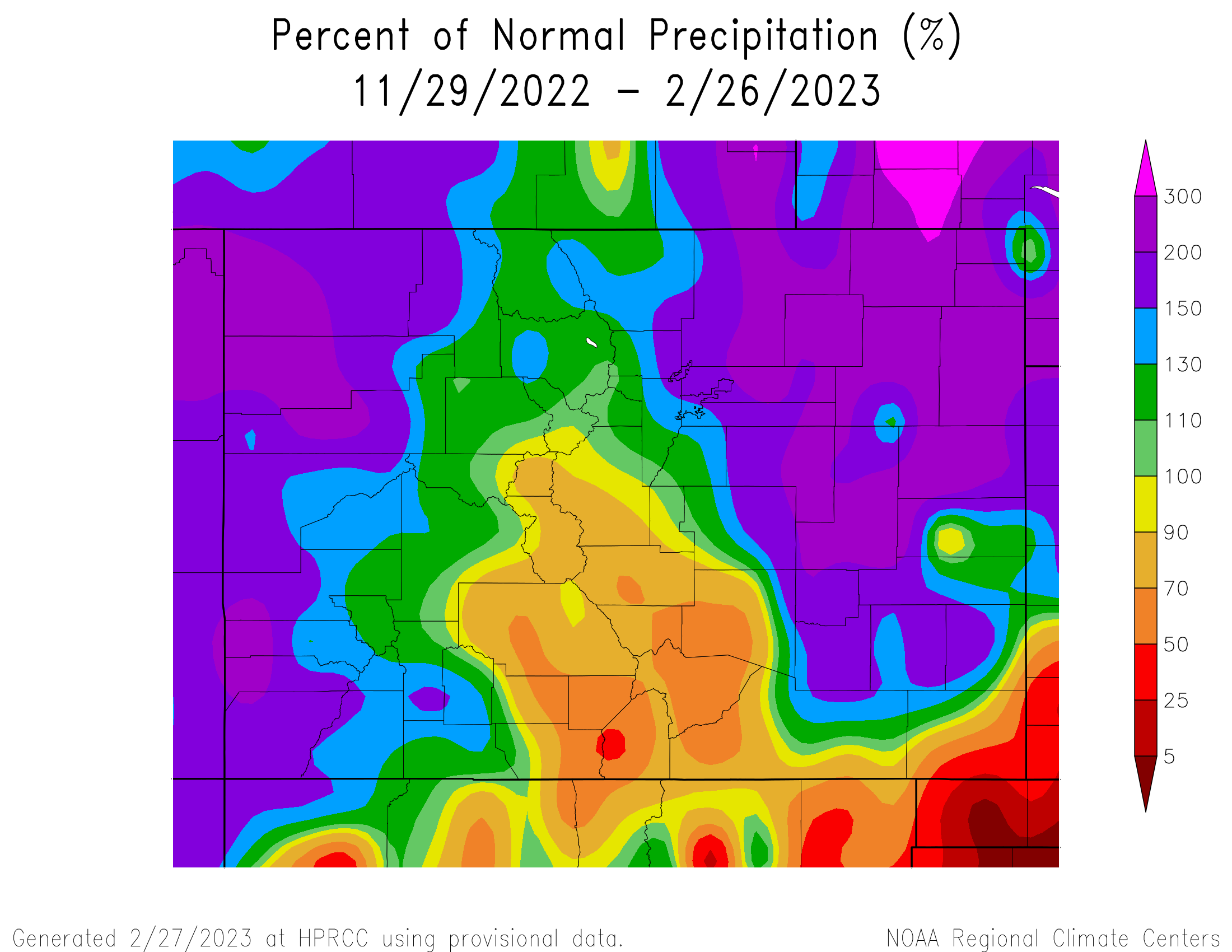
Fortunately there has been so much snow across northeast Colorado the last few months that fire danger will remain fairly low here for now…
High temperatures on Monday will top out in the lower 50s. Tuesday will be cooler following a weak cold front/wind shift blowing through during the day — expect highs only in the lower to middle 40s. A stray snow shower or two could descend off the higher terrain Tuesday afternoon into the western Metro area, but the chance of that is low and no accumulation is expected.
Mid-week snow…again!
You know the drill — the weekends here are beautiful but it snows around Wednesday or Thursday with uncanny regularity! This week will be no exception…
The main storm system we are watching this week is the tightly-wound low pressure dropping south into Arizona by Wednesday night and across New Mexico on Thursday. This deeply southern track will largely take most of the lift/energy and precipitation with it, but there should still be a decent chance of light snow in the Front Range as well — albeit nothing substantial.
Take this with a grain of salt as the storm is still well offshore, but the current timing on the cold front with this system is Wednesday afternoon or early evening. Temperatures quickly fall below freezing with upslope aiding in light snow development Wednesday evening into the night. There’s only a brief period of marginally favorable north-northeasterly upslope and weak large-scale lift passing through during this time. This could support a roughly 12-hour window for light snow to fall late Wednesday afternoon through Wednesday night. Most model guidance paints just an inch or two across the Denver Metro area at best, though there are a few higher outlier ensemble members at the moment. In general, this looks to be a good candidate low pressure to produce some snowflakes for us, but nothing substantial as it mostly zooms past our area to the south. Our current expectations for this event would be a dusting to 2″ of new snow for the Denver Metro area, with perhaps a little more in the higher terrain.
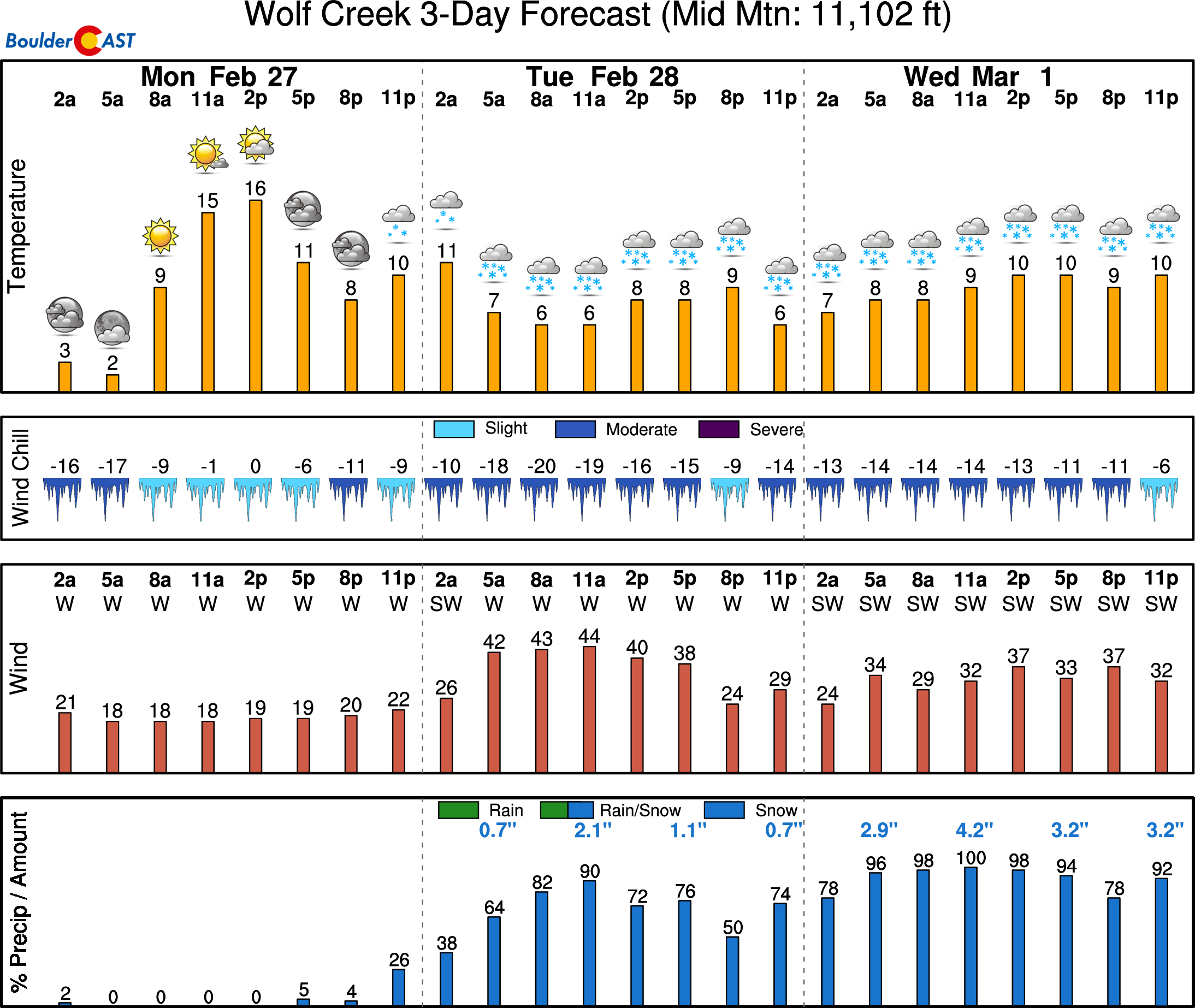
There will be several waves of snow this week in the Mountains, though similar to last week, you really need to trek down to the San Juans to find the top-tier powder — 2 to 3 feet could fall in places like Wolf Creek by the time things wrap up late Wednesday night.
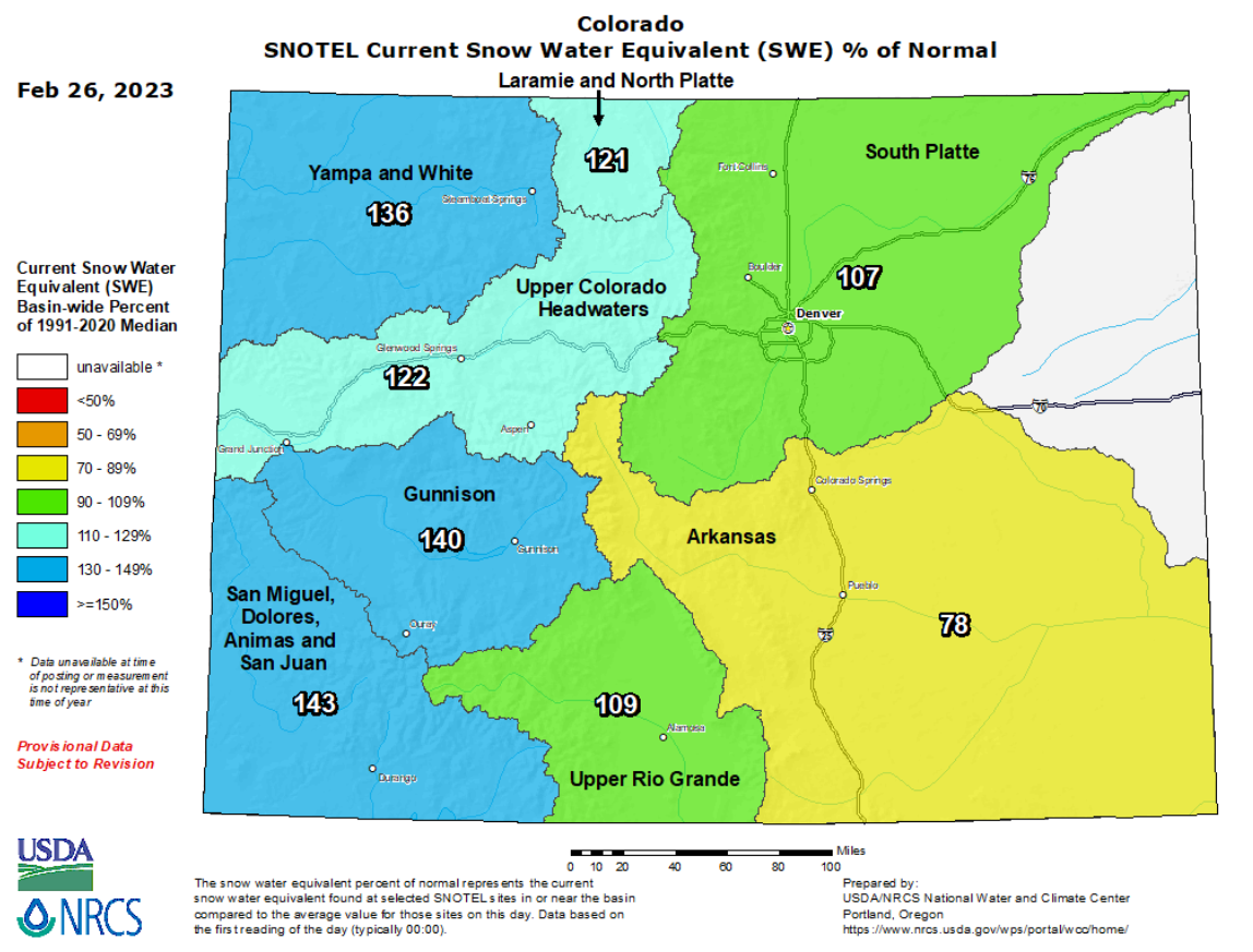
Colorado statewide snowpack is generally looking pretty healthy right now, but more snowfall is (almost) always welcomed news. Even the lagging Arkansas Basin should see some snow this week…
Drying out late week…probably!
Any lingering low clouds or snowflakes across the Front Range should clear out quickly on Thursday morning as drier northwest flow works into the area aloft and spreads out across the Plains as well. Thursday will be partly to mostly sunny but stays cold with highs only in the 30s across the lower elevations and 20s in the Foothills.
Friday will be a little warmer but still below normal in the lower to middle 40s. Our average high temperature in early March should be around 50 degrees. Though highly uncertain, another weak system and associated cold front may brush the area late Friday or Friday night bringing another brief round of snow. This tiny blip in the flow could have some associated jet-forcing to produce locally heavy snow bands. We won’t worry to much about this small-scale system for now as it could easy shift by hundreds of miles or vanish completely from subsequent model runs. For what it’s worth, the European model is more excited by the Friday system for us than the Wednesday one, while the GFS is the polar opposite.
Enjoy the week!
Forecast Specifics:
Monday: Mostly sunny and breezy with west winds gusting 20 to 30 MPH during the day. Highs in the lower 50s across the Plains with upper 30s in the Foothills.
Tuesday: Slightly cooler and borderline windy with west winds gusting 25 to 40 MPH during the day. There could be a few snow showers developing during the afternoon over the Foothills, but no accumulation is expected. Some snowflakes may blow out across the nearby Plains late day. Highs in the low to middle 40s on the Plains with middle 30s in the Foothills.
Wednesday: Lots of clouds and colder with highs only in the upper 30s across the Plains and upper 20s in the Foothills. A cold front moves in late afternoon into the evening with light snow developing on the backside and continuing into the nighttime. A trace to 2″ of accumulation is expected with this event as of writing.
Thursday: Possibly a few lingering morning clouds/flurries giving way to partly sunny skies. Temperatures stay chilly in the middle 30s across the Plains with middle 20s in the Foothills.
Friday: Slightly warmer with partly cloudy skies. There is another chance of accumulating snow developing during the evening or night, but this is currently very uncertain. Highs push into the lower 40s on the Plains with upper 20s in the Foothills.
PowderCAST: Most Pacific southwest flow will be present across Colorado through Wednesday, with the San Juans favored by this flow pattern to see the most snowfall (around 2 to 3 feet in places like Wolf Creek). The northern and central Mountains will see plenty of snow, but not quite that much with generally 5 to 12″ expected Monday afternoon into Wednesday night. Drier air works into the Mountains Thursday through most of Friday.
Help support our team of Front Range weather forecasters by joining BoulderCAST Premium. We talk Boulder and Denver weather every single day. Sign up now to get access to our daily forecast discussion email each morning, complete six-day skiing and hiking forecasts powered by machine learning, first-class access to all our Colorado-centric high-resolution weather graphics, bonus storm updates and much more! Or not, we just appreciate your readership!
Spread the word, share the BoulderCAST forecast!







You must be logged in to post a comment.