The upcoming week will feature a drastic change in our weather as a late-season Arctic airmass surges in on Monday and remains locked across the Front Range through at least Friday. Alongside the bitter cold temperatures will be a handful of light snow chances from President’s Day Monday through Wednesday night that will bring a wide range in potential snowfall totals. We’re expecting the highest amounts in and near the Foothills, including Boulder. Read on for the full details on what is surely to be a frigid and snowy week ahead.
This week’s highlights include:
- One last mild morning on Monday before the Arctic front plows through early Monday afternoon
- First wave of snow Monday afternoon into Tuesday morning with up to 4″ of snow in Boulder and up to 2″ in Denver
- Record cold overnight lows and daytime highs possible throughout the week with the Arctic airmass entrenched
- Second and third chances of snow Tuesday night and Wednesday night, but with more uncertainty on amounts
- Watch for heavy snow through the week in the Mountains, particularly in the San Juans which could see upwards of 3 or 4 feet
- While still unseasonably cold, we may get into the lower 20s on Friday with perhaps a fourth chance of snow as well
DISCLAIMER: This weekly outlook forecast is created Monday morning and covers the entire upcoming week. Accuracy will decrease as the week progresses as this post is NOT updated. To receive daily updated forecasts from our team, among many other perks, subscribe to BoulderCAST Premium.

Say goodbye to the mild weather with Arctic air/snow arriving Monday afternoon
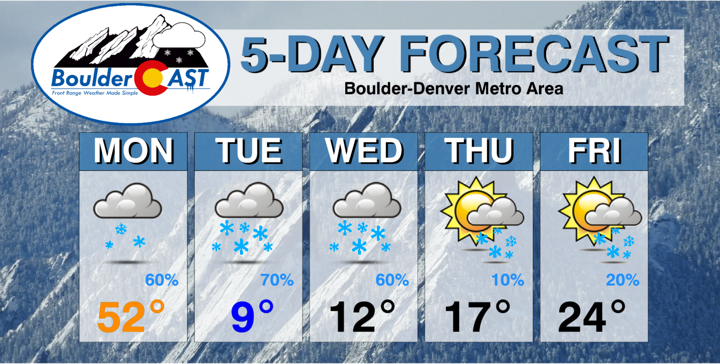
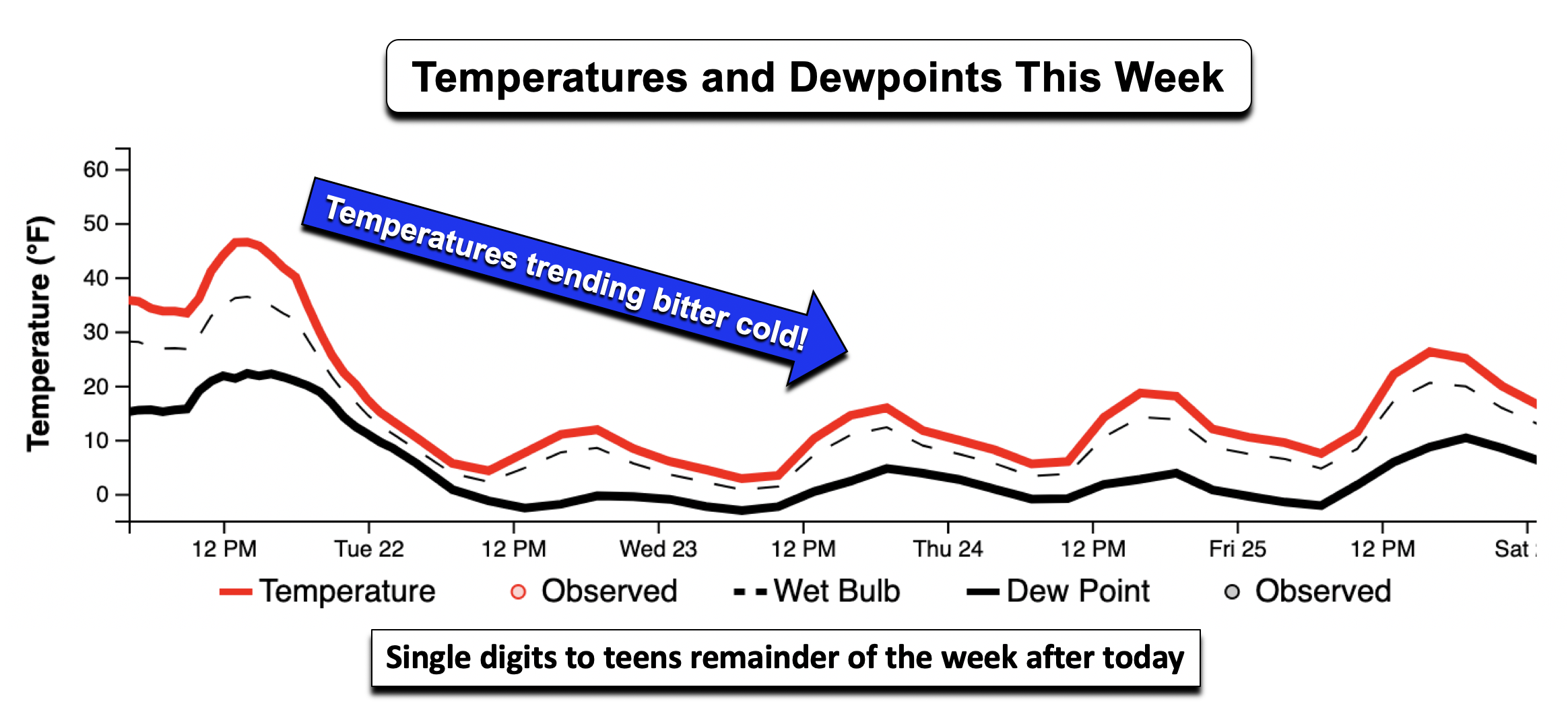
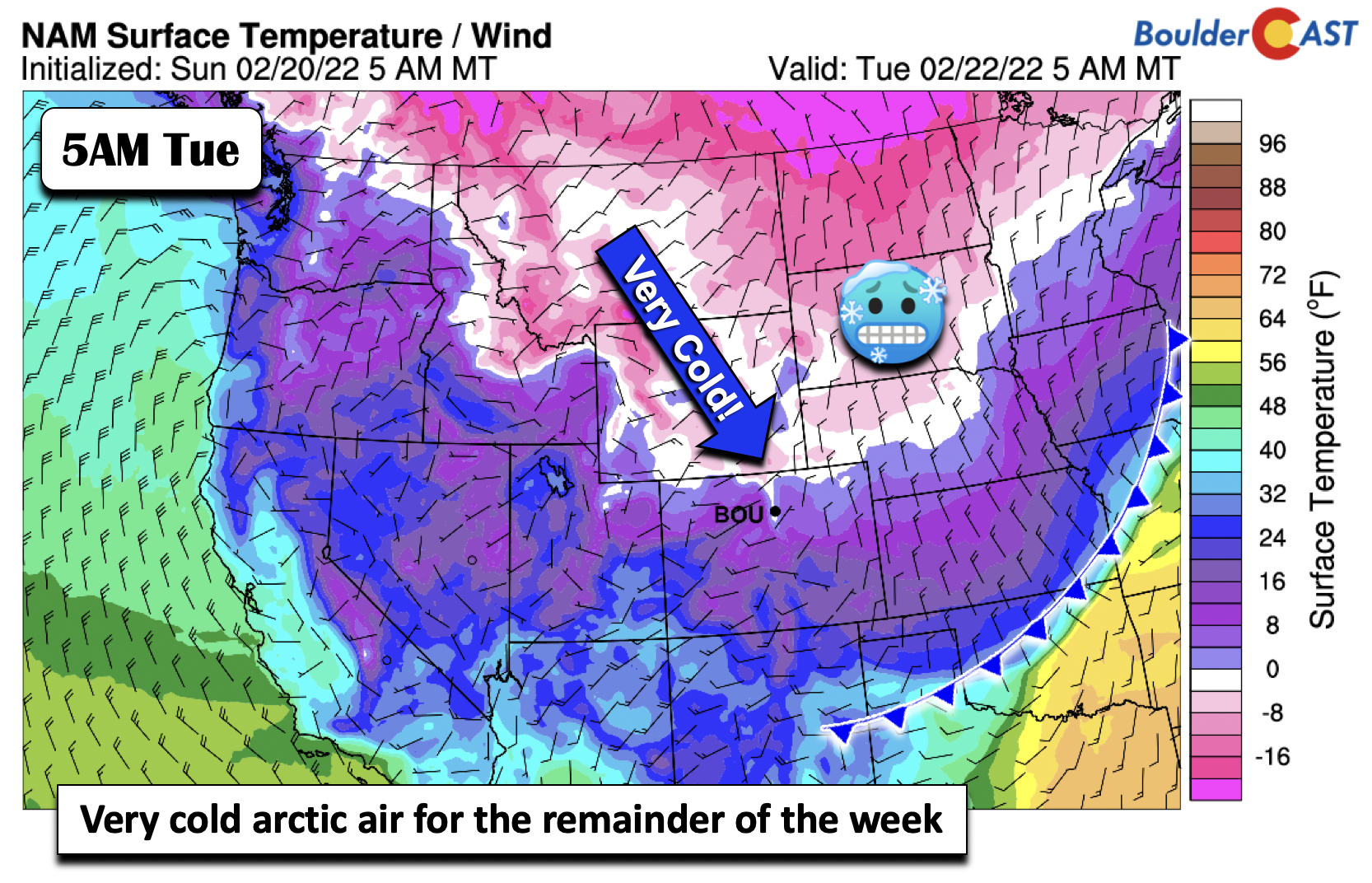
You were warned! We’ve been discussing this very pattern change since last Thursday with our weekend outlook. A strong Arctic cold front will plow through the Front Range later today ushering in a deep freeze that will last through at least Friday (below). After highs slightly above normal on Monday around 50 degrees, temperatures will plummet into the single digits by early Tuesday, with highs only in the single digits to teens the through Thursday — and perhaps then lower 20s by week’s end.
If you happen to be off today for Washington’s Birthday, get outside to take in the last fetch of mild temperatures before they drop off a cliff later today. With the Arctic front north of us around midday, highs should reach the low to middle 50s across the Denver Metro — don’t be surprised if a few upper 50s or a lone 60-degree reading are found in southern sections.
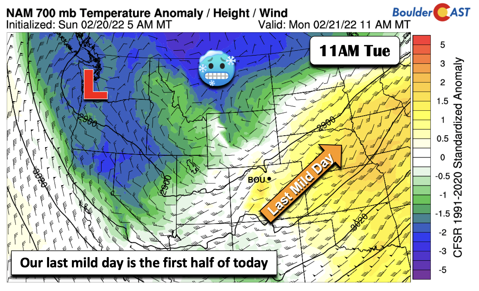
The Arctic front is poised to move through the Front Range during the afternoon hours. The NAM-NEST (below) and GFS are fastest with the front, bringing it through between roughly 1-4 PM. The NAM/HRRR are slower, bringing in through between 2-4 PM. Experience tells us that these fronts move through faster than anticipated so expect a cold start to the evening commute, along with a brisk/smelly northeast wind. Temperatures will plummet into the teens by evening and eventually single digits by early Tuesday — a 50-degree temperature change from Monday!
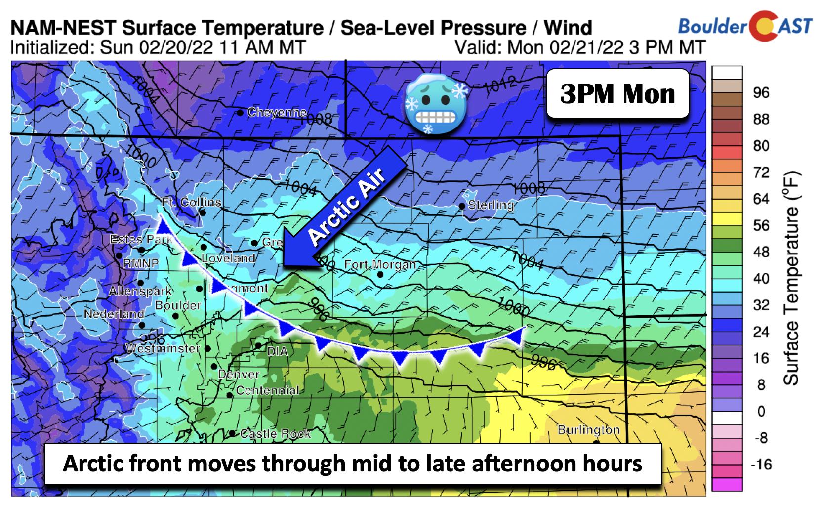
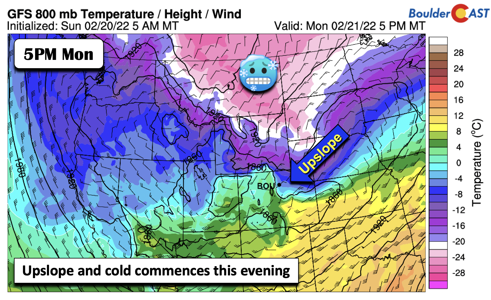
Upslope and cold will commence this evening with the passage of the Arctic front, shown below. Yes, the map does indicate well below zero readings in Montana! The upslope will usher in a period of favorable conditions for snow to develop along the Front Range Monday evening into early Tuesday.
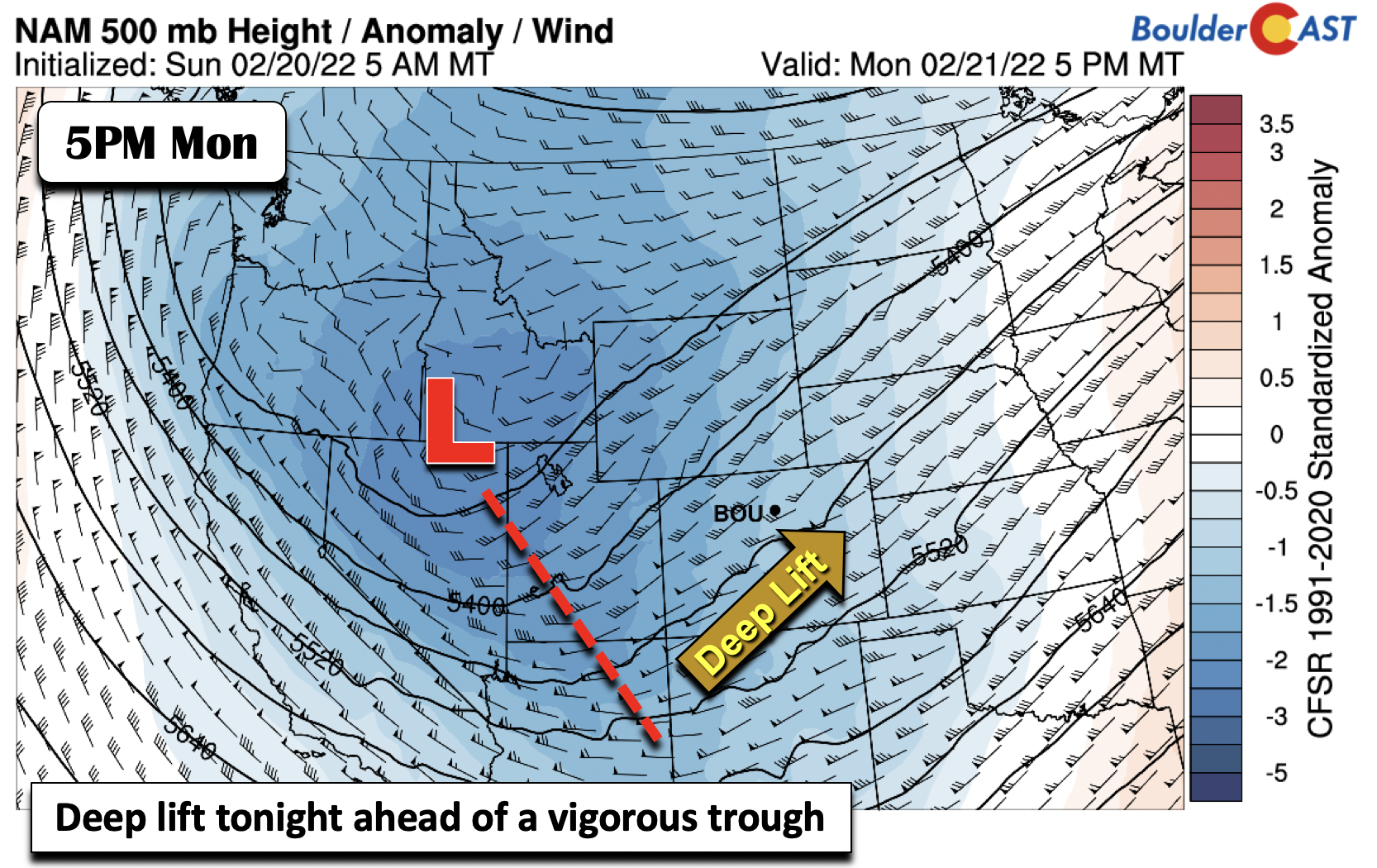
This system on Monday is considered wave #1 for the snow chances this week. At mid-levels, a vigorous mid-level trough is centered over northern Nevada. It becomes negatively-tilted tonight, with deep lift rotating east of the trough into Colorado. Thus, there is also strong lift to combine with the upslope Monday night.
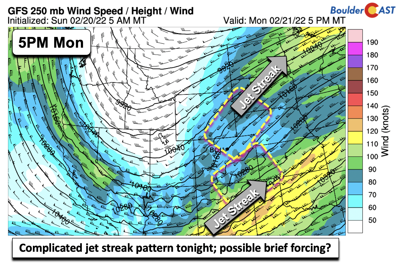
Further aloft in the upper-levels, while the pattern is complex and less clear, there will be two jet streaks, one from northeast Colorado into North Dakota, and a second from New Mexico into Kansas. Neither of these jet streaks are in the ideal position for us, but it is possible some brief jet coupling may take place this evening for isolated snow bands to develop.
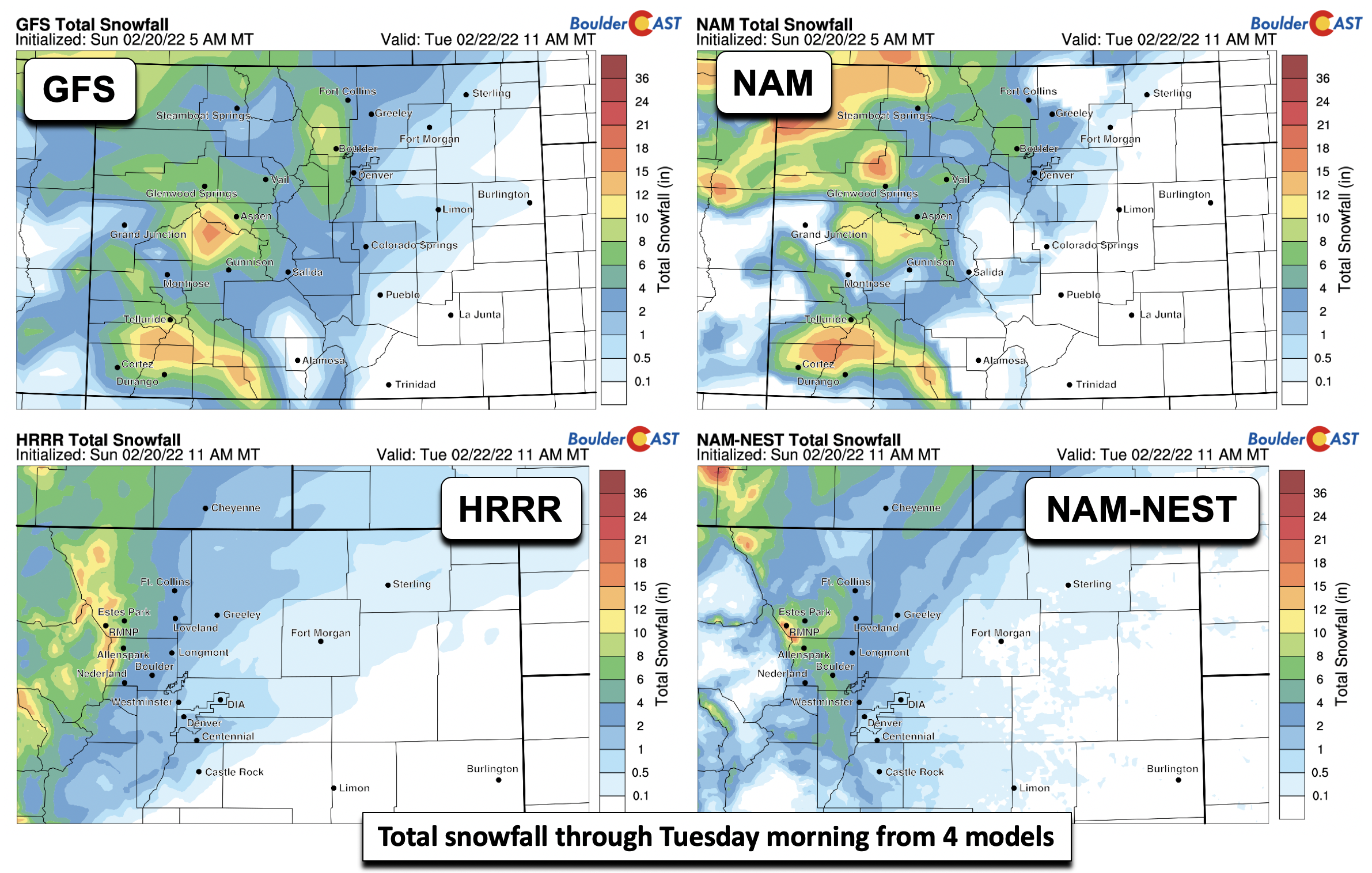
Below shows the accumulated snowfall through Tuesday morning from the GFS, NAM, HRRR, and NAM-NEST. There is fairly good agreement that the highest totals with the first wave will take place over Boulder and near the Foothills, consistent with this event being largely driven by low-level upslope. The NAM and NAM-NEST show some evidence of jet-forced snow bands along northern sections of Denver. All in all, it looks like roughly 0-2″ in Denver and 2-5″ in Boulder, with isolated higher amounts possible in any snow bands. A limiting factor tonight will be southwesterly winds at 5000 feet off the surface, which may limit deep upslope potential.
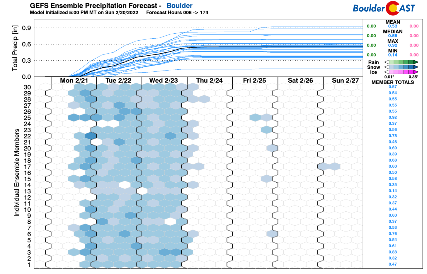
The GEFS precipitation totals for Boulder are shown below, indicating roughly 0.2″ of liquid equivalent from Wave #1. Higher than 10-to-1 snow ratios would put totals close to the amounts discussed above. Lower amounts are found for Denver with the GEFS (not shown).
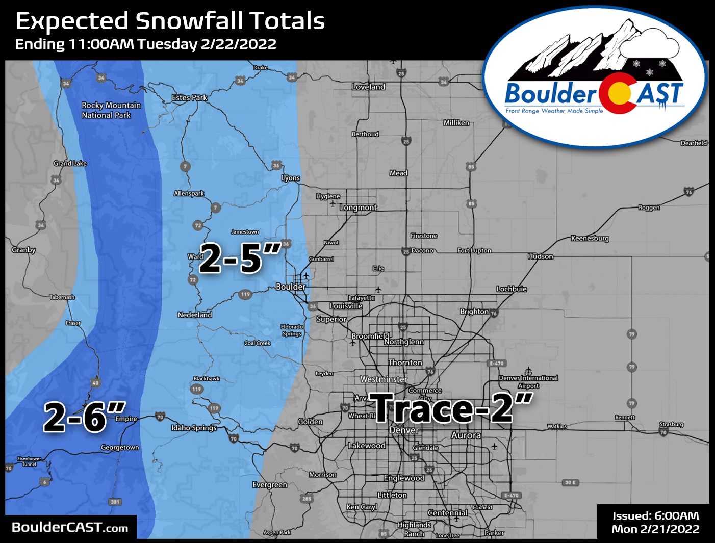
Our snowfall forecast map for Wave #1 is shown below. This covers all snow falling from Monday afternoon until about midday Tuesday. We will issue later snowfall maps throughout the week for the follow-up snow chances. We’re generally expecting 2-4″ for Boulder and the Foothills with this first round of snow, with lesser amounts elsewhere below 2″.
Waves #2 and #3 of snow Tuesday and Wednesday, with Arctic cold lingering
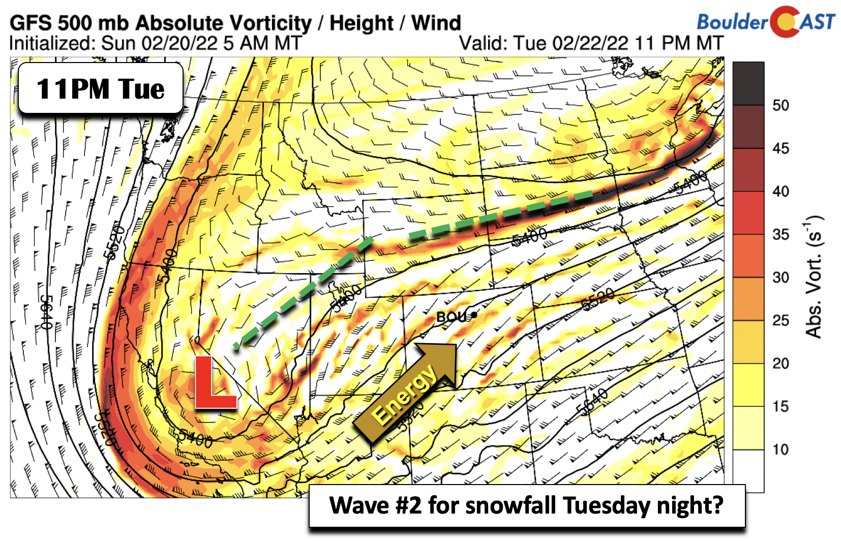
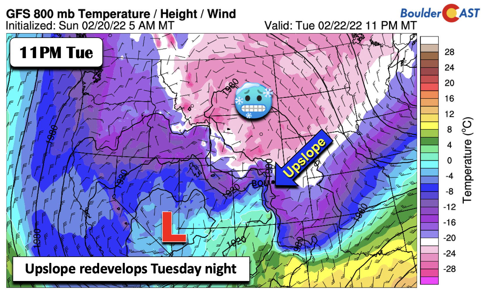
Monday into Tuesday will not be our only chance of snow this week. The vigorous trough to our northwest Monday will remain to our west, located over central California by Tuesday evening. Light snow will linger into Tuesday morning, but should start to taper off by the afternoon as upslope weakens and upper-level forcing shifts northeast into Nebraska. The mid-level system Tuesday night will send a second batch of energy into the state from the southwest Tuesday evening into Wednesday morning. A third wave will also commence Wednesday night. As we’ll discuss soon, there is more uncertainty in these two waves compared to the first, mainly due to their fine-scale nature and that they are farther out in the forecast.
The second wave will continue to feature low-level surface upslope across the Plains and Foothills alike, with the Arctic air well-entrenched across the area. Highs Tuesday will only top out in the single digits to lower teens at best! This is extremely cold for this late in the season. Yes it is still technically winter, but the absolute coldest days of winter are already behind us. There’s only been a few occasions in Boulder’s history where single digit high temperatures have occurred after mid-February! Thus, we’ll probably see a few record broken this week — if not overnight lows due to the cloud cover and snow, likely a few coldest high temperatures will be bested.
Upslope will redevelop in the evening on Tuesday, weakening again by Wednesday morning. Snowfall amounts vary more for this second wave, but we could see another 1-4″ across the area, with the highest amounts again in Boulder.
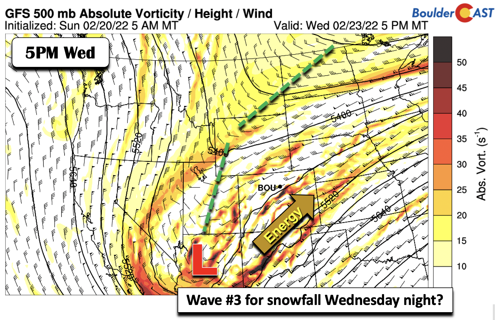
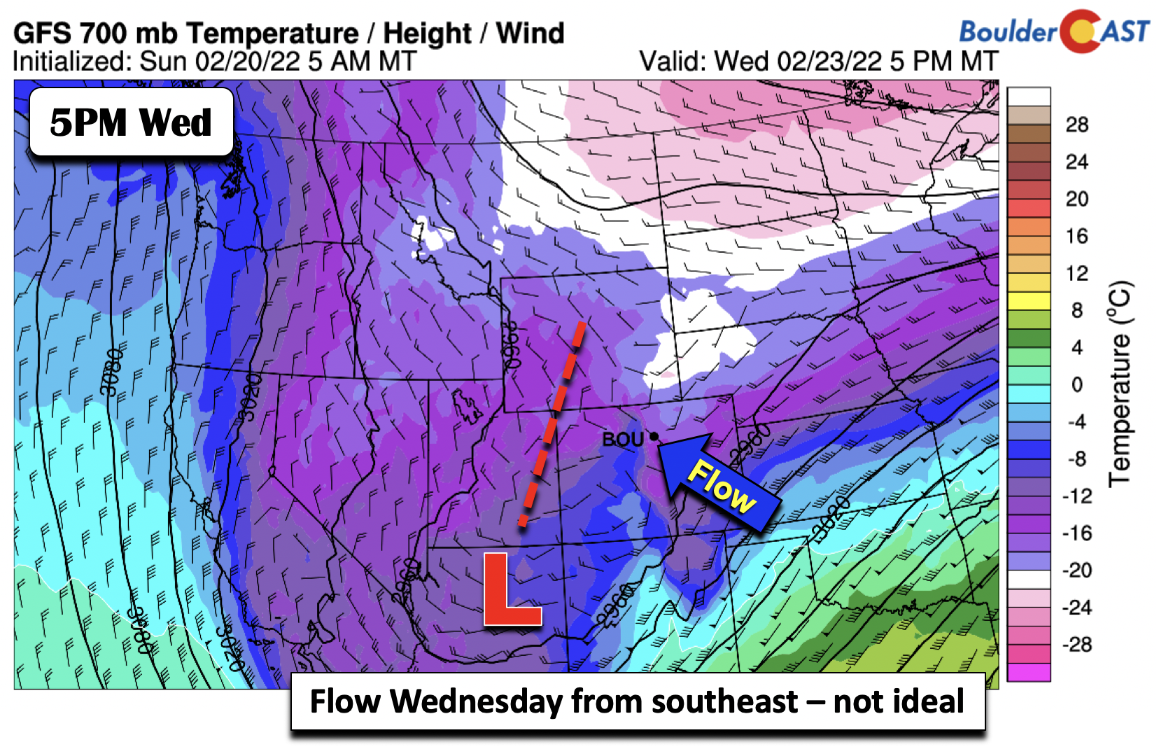
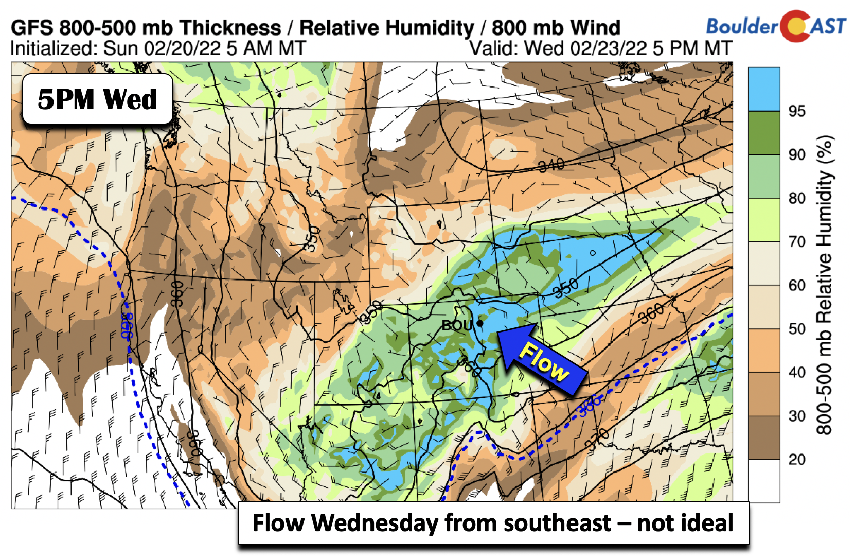
On Wednesday, the mid-level trough in the southwest will finally make its trek eastward, taking a southwest to northeast track into the Four Corners, eventually exiting to our east by Thursday morning. There remains uncertainty as to how the ejection of the trough will evolve. The latest solutions are somewhat muted on the trough becoming positively tilted, keeping most of the energy to our south.
At the same time, the flow 5000 feet off the surface is more out of the southeast as opposed to northeast. This is not the ideal scenario for snow for Boulder/Denver, but could help things along near Fort Collins. Cold air is definitely supportive though for more snow!
At the surface, the southeasterly flow is also evident, further decreasing our confidence in amounts with this third wave. Early predictions are anywhere from 1-3″ across the area. This will hopefully get fine-tuned as we get closer. Keep in mind — a different track of the mid-level system could drastically alter our snow predictions for this wave of snow that is currently about three days out! Regardless, teens will be the norm for highs Wednesday, well below average (we should be in the upper 40s).
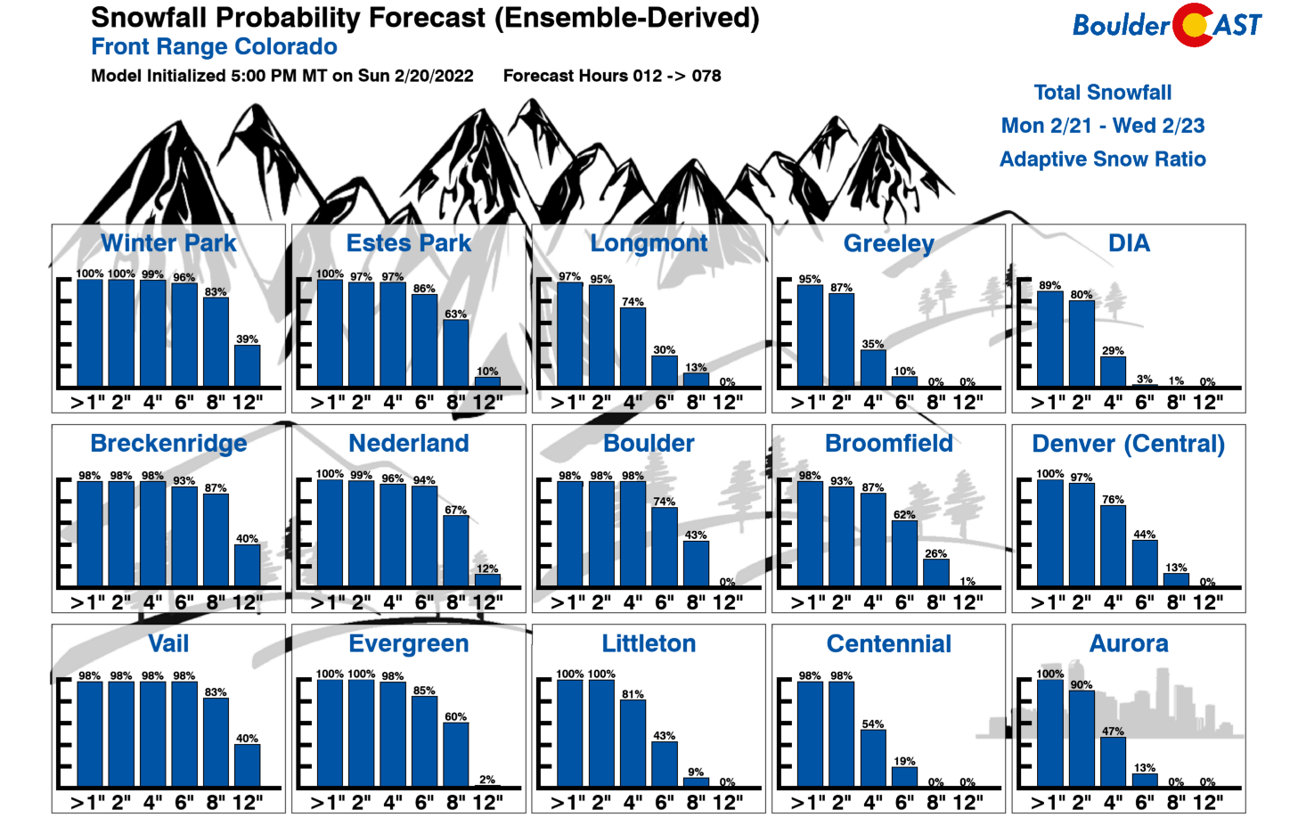
Based on all we talked about for the second and third waves of snow, below shows the cumulative snowfall probabilities for the area through the week. There is a good chance of at least 4 to 8″ in Boulder through Wednesday, with lesser amounts in Denver (roughly around 3-5″ total). Keep in mind these amounts are through Wednesday and considered a total snowfall for the week.
Slight moderation of temperatures late-week, but still cold
The mid-level trough is expected to finally exit the area Thursday morning or early afternoon, allowing the cold air to slowly move out from west to east. Highs Thursday should moderate but only to the upper teens to lower 20s. On Friday, highs in the 20s should return, but this is still some 25+ degrees below average for late February! The GFS/ECMWF are showing a secondary trough tracking through the area Friday afternoon and evening, which could bring another glancing blow of light snow to the area. The upslope is weak at best so we are not too excited for this one, consistent with low probabilities from the ensemble suites. Better chances would exist in the Mountains. It is something we will keep an eye on however.

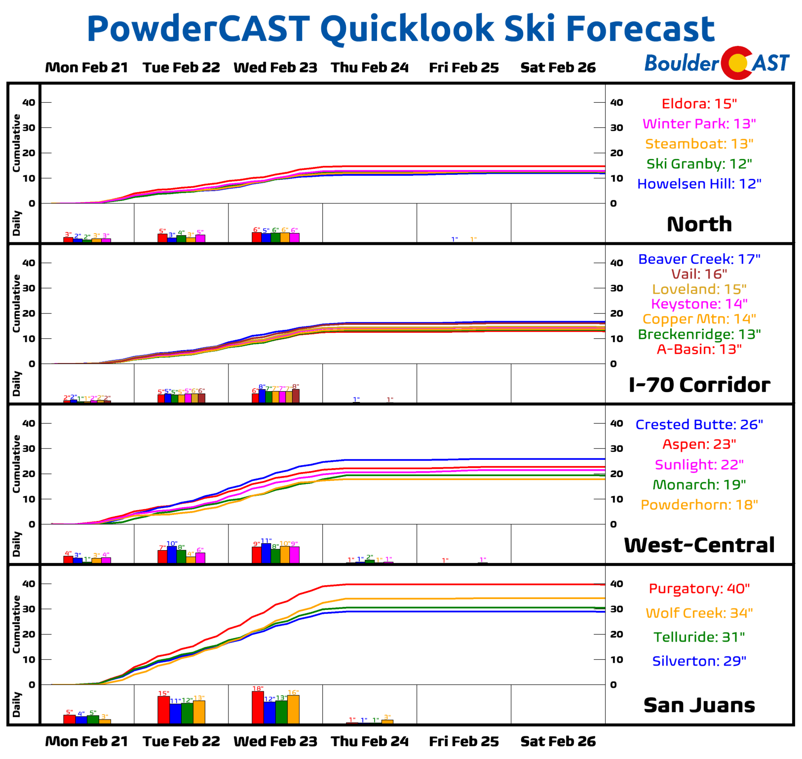
Finally we wanted to touch on the widespread snow returning to the Mountains this week. Usually areas west of the Continental Divide don’t do too well from Arctic outbreaks as the moisture is typically lacking and the forcing just doesn’t reach that far west. However, this Arctic outbreak is unique in that it will be accompanied by a slow-moving trough well to the west. Thus, we’re looking for a very snowy week in the High Country with the San Juans favored to see the most. Snow totals by Thursday morning will range from 1 to 4 FEET of snow across the state of Colorado — surely enough to satisfy the skiers!
Stay up to date with Colorado weather and get notified of our latest forecasts and storm updates:
Forecast Specifics:
Monday: Mild with highs in the low to middle 50s, then turning bitter cold with teen by this evening falling into the single digits by early Tuesday. Light snow possibly developing by afternoon and continuing off and on into Tuesday morning. Highs in the Foothills in the middle 40s.
Tuesday: Extremely cold temperatures with highs the single digits to lower teens over the region. Light snow tapering off by midday, then redeveloping in the evening hours.
Wednesday: Mostly cloudy with another period of snow possible in the evening and overnight. Highs in the low to middle teens in the Denver Metro and single digits in the Foothills.
Thursday: A chance of morning snow showers, then turning partly sunny. Highs in the mid to upper teens on the Plains and single digits in the Foothills.
Friday: Increasing clouds with a slight chance of snow. Highs in the low to middle 20s on the Plains and upper teens in the Foothills.
Mountains: Several rounds of snow will occur through Wednesday in the High Country, with several feet of snow possible in southwestern parts of the state. Drier weather takes over Thursday through Saturday, although a chance of light snow exists Friday over the central and northern part of the state.
Help support our team of Front Range weather bloggers by joining BoulderCAST Premium. We talk Boulder and Denver weather every single day. Sign up now to get access to our daily forecast discussions each morning, complete six-day skiing and hiking forecasts powered by machine learning, first-class access to all our Colorado-centric high-resolution weather graphics, bonus storm updates and much more! Or not, we just appreciate your readership!
Spread the word, share the BoulderCAST forecast!


You must be logged in to post a comment.