It has been fairly dry most of the summer with the monsoon moisture plume largely staying to our west. Over the last eight weeks, Denver has officially reported less than a half inch of rainfall which is far below normal. Not surprisingly, drought has now returned to portions of northeast Colorado. The week ahead will offer little reprieve from this dry pattern as temperatures remain above normal in the 90’s with just one day of decent rain chances to look forward to. Wildfire smoke will be fairly bearable, however, as a northward storm track and resulting atmospheric flow will keep the worst of it away from the Front Range.
This week’s highlights include:
- Drought has returned to northeast Colorado thanks to a dismal showing of the monsoon this summer in our area
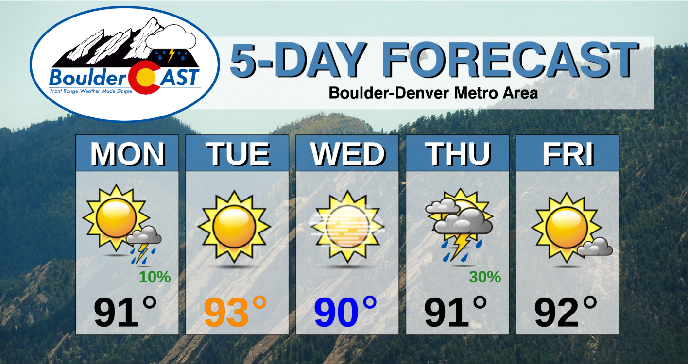
- Hot and generally dry conditions will persist through the week as the storm track stays just to our north
- Highs mainly in the lower 90’s each day this week
- The plume of thickest wildfire smoke will stay to our north as well, though some uncertainty in its location develops Thursday and Friday
- Thursday will offer the best chance of thunderstorms as a weak system clips across northern Colorado
DISCLAIMER: This weekly outlook forecast is created Monday morning and covers the entire upcoming week. Accuracy will decrease as the week progresses as this post is NOT updated. To receive daily updated forecasts from our team, subscribe to BoulderCAST Premium.
Drought has returned to northeast Colorado
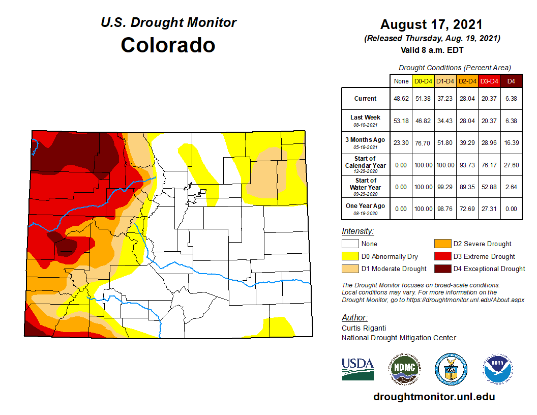
After an extremely snowy and wet spring across the Front Range, it seems unlikely that we would be talking about drought again so soon, but that is unfortunately the case. The last two weeks have seen a return of Moderate Drought classification for portions of northeast Colorado, but this situation has been months in the making. At the moment, 51% of our beautiful state is experiencing drought or abnormally dry conditions according to the United States Drought Monitor.
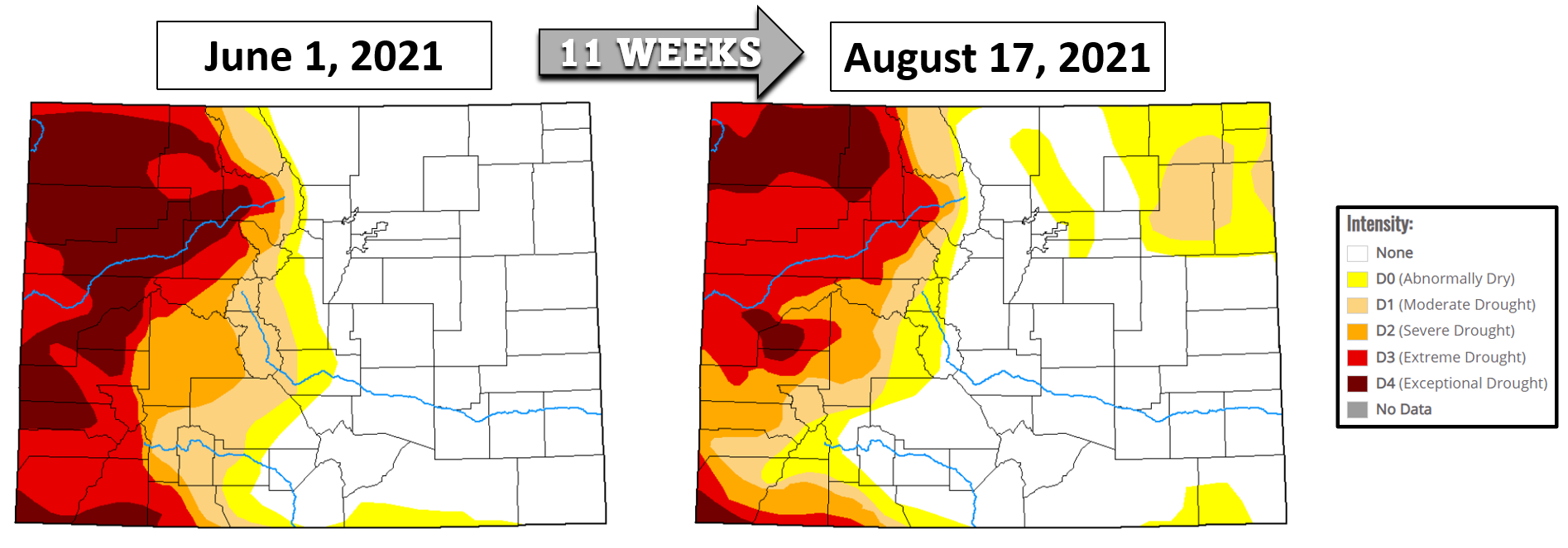
Ironically we have seen the extreme drought across the Western Slope improve somewhat through the summer, while we’ve stayed plenty dry east of the Continental Divide. Notice below how the drought map has evolved since June 1st.
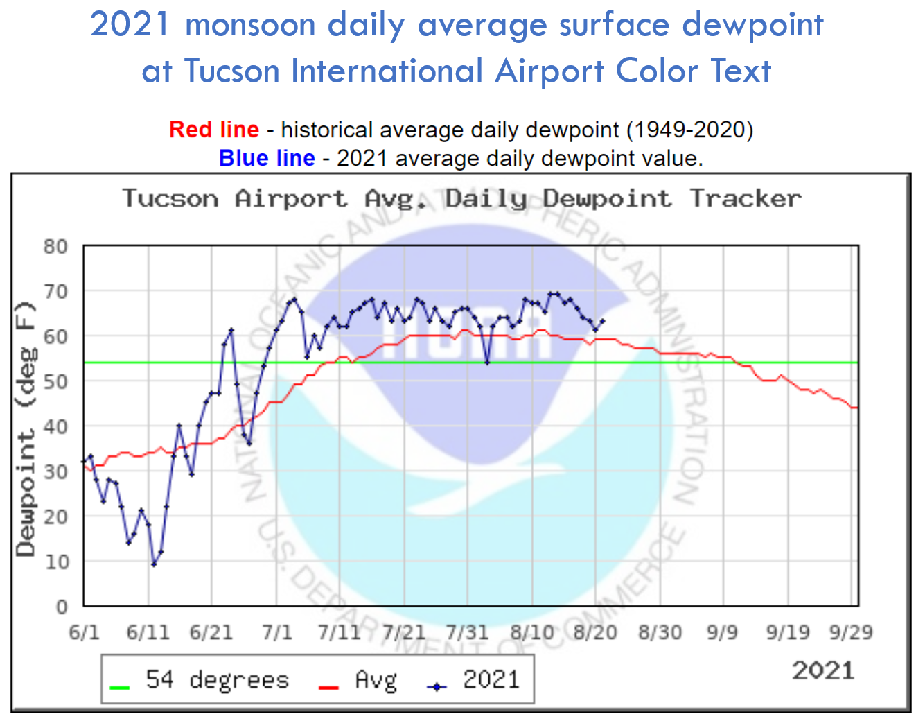
How could we return to drought? Well, obviously something has been up with the monsoon this summer. One way that we can monitor the status of the North American Monsoon is to look at surface dew points in southern Arizona. Cities like Tucson, AZ are much closer to the source of the moisture than we are here in Denver. The moisture more-or-less has to pass through Tucson as it moves northward into the United States. Thus, this makes moisture in that area a good proxy for the overall health of the monsoon. A look at daily average dew points in Tucson this summer shows that the flow of deep moisture into the Desert Southwest hasn’t been an issue — not at all. Above normal moisture has been present in Tucson almost every single day since late June.
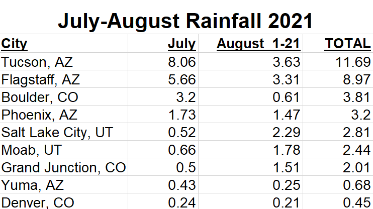
In fact, Tucson has seen one of its wettest monsoon summers on record with nearly 12″ of rain falling since July 1st. This is equivalent to the city’s average yearly rainfall total!
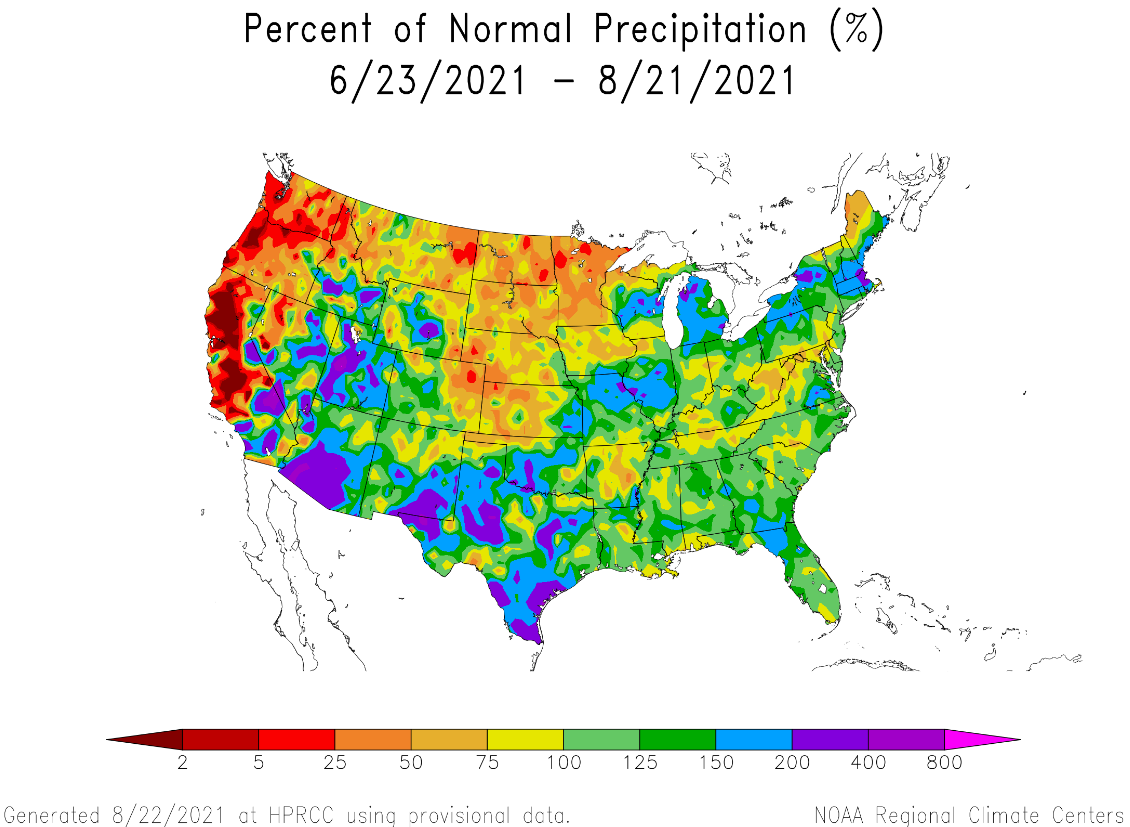
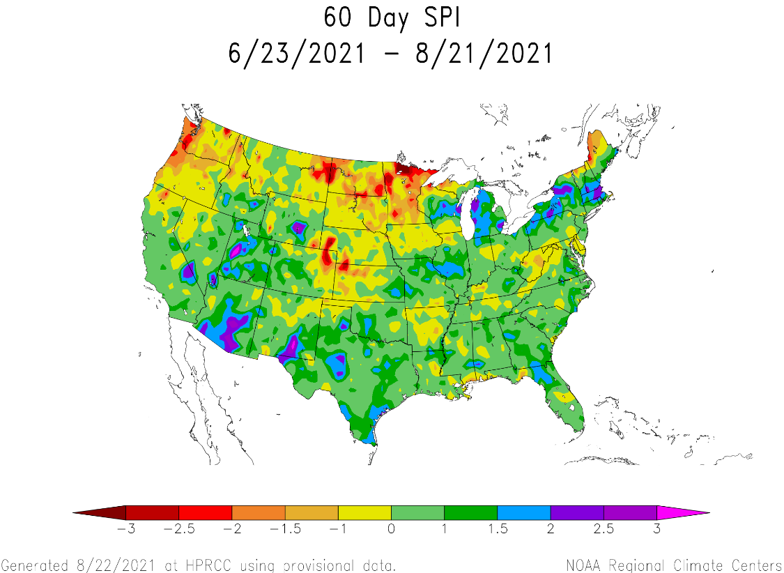
Tucson is a pivot-point for the monsoon moisture plume itself. Think of Tucson as the “faucet”, with a “hose” of moisture wandering northward. Sometimes the hose if over Nevada, other times it meanders over Utah or Colorado. This summer, that figurative hose has largely avoided EASTERN Colorado, with very few exceptions. Since July 1st, just 0.45″ of rain has fallen in Denver — one of the city’s most dismal monsoon showings in the last half century. Over the last 60 days, almost everywhere east of the Continental Divide in Colorado has seen below normal precipitation (Boulder is one of the few exceptions). This summertime deficit is most drastic across the northeast corner of our state.
The map below shows the Standardized Precipitation Index (SPI) for the last 60 days. SPI is used to compare precipitation as it relates to “average” over regions with vastly different climates. Most of the Four Corners area did quite well this summer — eastern Colorado (and perhaps northeastern New Mexico) was the lone exception.
Will this week offer any reprieve from the dry conditions for the Denver area? In short: no, but let’s take a look.
The week ahead stays seasonally warm & mostly dry
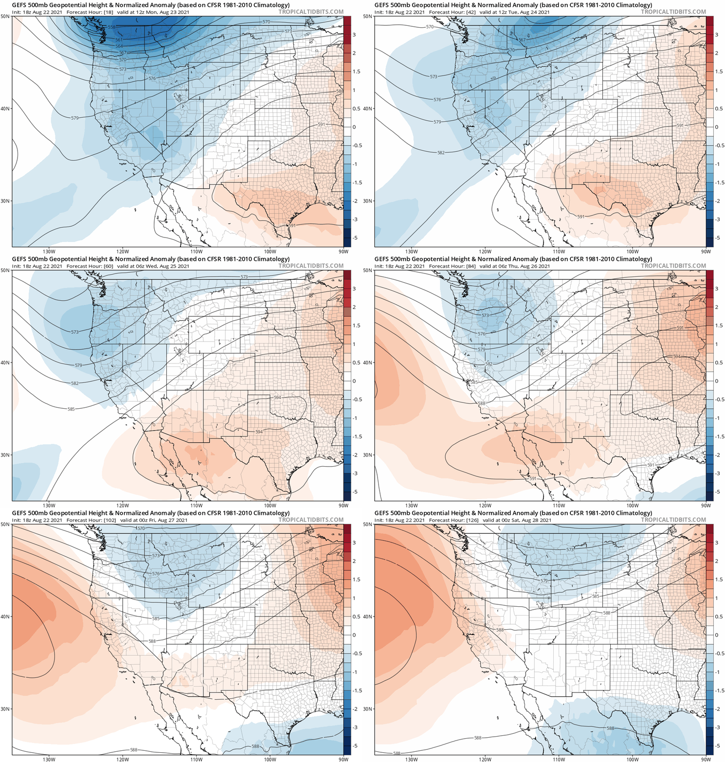
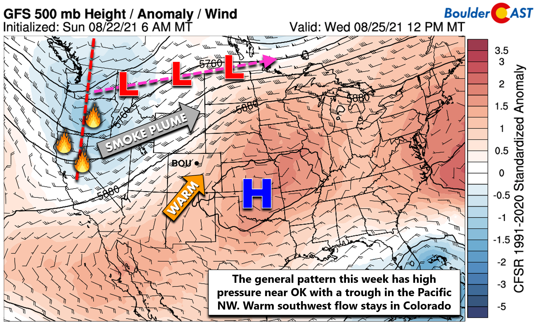
The large-scale pattern this week will remain largely unchanged from Monday all the way into the upcoming weekend….and a hot one it will be. The GFS ensemble 500mb height anomaly forecast animation for the week is shown below. The stagnant pattern has a weak trough persisting across the Pacific Northwest while a ridge of high pressure remains centered near Oklahoma.
Under this setup, the storm track will largely stay across the far northern Rockies and near the Canadian border. Warm and mainly dry southwesterly flow will be the story for us here in Colorado.
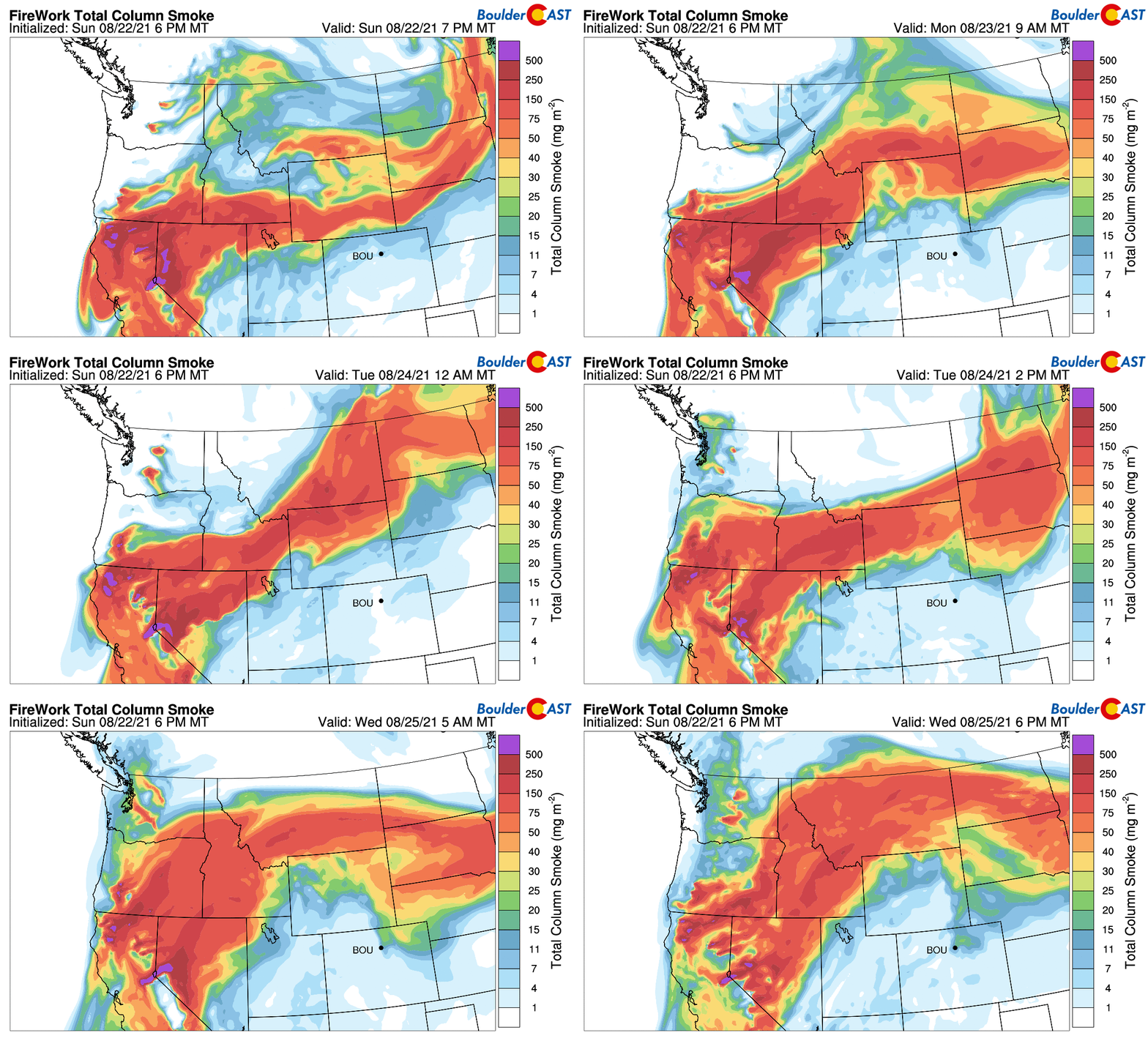
There is some good news for this pattern. Smoke from the many large wildfires burning in California and in the Pacific Northwest will generally stay north of our area through the week. The latest smoke forecast through Wednesday evening shows the narrow plume stretching from California northeastward into Montana and Wyoming. There is light smoke indicated across the Denver Metro area on Monday morning and again on Wednesday, but the thickest smoke should elude us during this period.
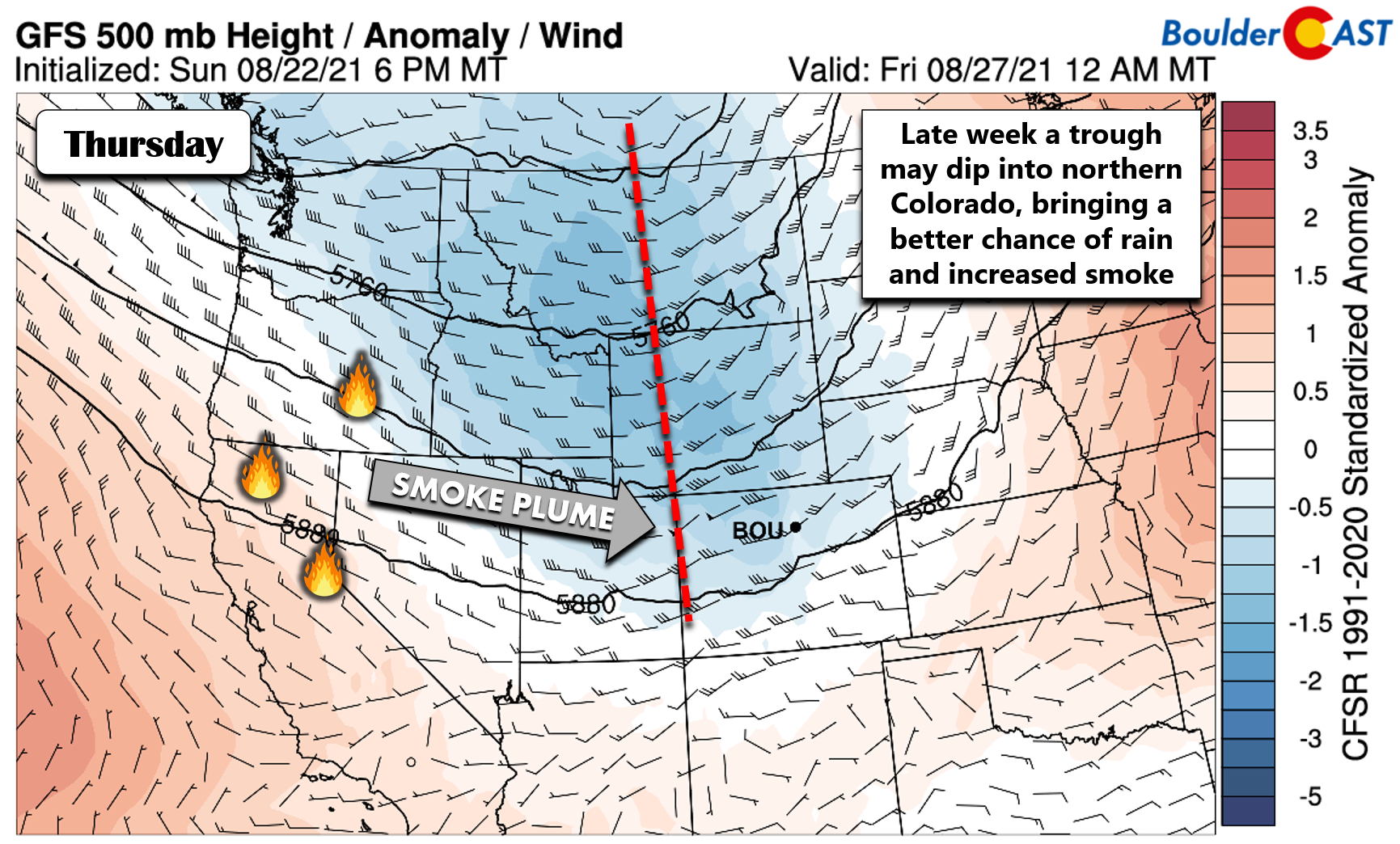
This could change later in the week as models show a weak trough potentially digging far enough southward to include northern Colorado. The GFS is currently the most aggressive with this trough (see below), while the Euro model and ensembles keep the track a tad further north. A slightly more southern track would favor a decent chance of thunderstorms for our area on Thursday and bring the smoke plume southward as well. Regardless of the track, Thursday will be the day to watch for rain this week, though it doesn’t look overwhelmingly wet right now with just widely scattered afternoon and evening storms expected.
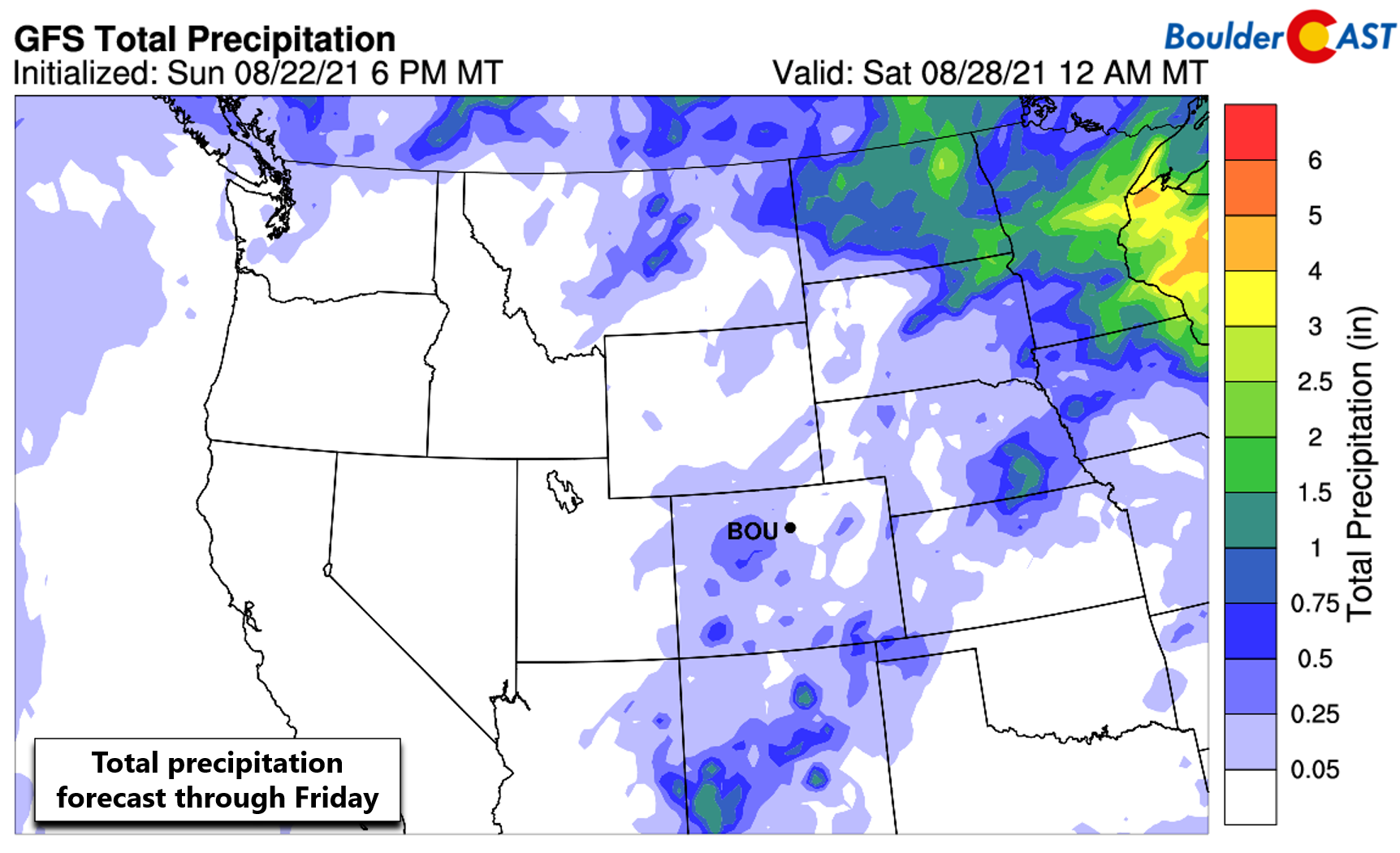
Forecast precipitation totals through the week across the West are far from impressive as moisture remains extremely limited overall (see below). Areas currently aflame in California and the Pacific Northwest will see essentially no relief this week. The wettest location will be New Mexico which will entertain a smattering of monsoon thunderstorms on occasion. Colorado will be fairly dry, though as mentioned already, we do need to keep an eye on Thursday.
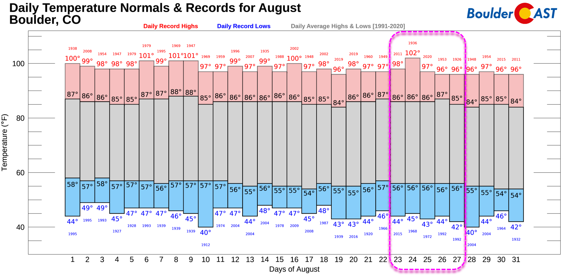
As far as temperatures, it will be seasonally warm to borderline hot for late August across northeast Colorado. For the most part, the lower elevations of the Denver Metro area will rise into the lower 90’s Monday and Tuesday. A weak cold front will reach the area early Wednesday morning, making that day slightly cooler. However, by the late-day period, it looks like we should see temperatures reach back close to 90 degrees. Some cold front, eh? Thursday and Friday will return easily to the lower 90’s. Climatology has our average highs this time of year in the middle 80’s (and trending downwards!), with record highs sitting anywhere from the middle 90’s to low 100’s. Yes, it’s going to be a persistently hot week, but we’re not anticipating any new record highs to be set.
The tornado-warned mothership cloud over Broomfield #COwx pic.twitter.com/JaXXK6cym8
— BoulderCAST Weather (@BoulderCAST) August 19, 2021
Stay up to date with Colorado weather and get notified of our latest forecasts and storm updates:
We respect your privacy. You can unsubscribe at any time.
Forecast Specifics:
Monday: Morning sun and haze with increasing clouds and isolated late-day thunderstorms. Highs in the lower 90’s on the Plains with upper 70’s in the Foothills.
Tuesday: Sunny and hot with temperatures in the low to middle 90’s on the Plains and near 80 degrees in the Foothills.
Wednesday: Mostly sunny with light smoke following the passage of a pre-dawn cold front. Temperatures a tad cooler in the upper 80’s to near 90 degrees on the Plains with upper 70’s in the Foothills.
Thursday: Partly to mostly cloudy with scattered afternoon and evening thunderstorms. Highs reach the lower 90’s across the Plains with upper 70’s in the Foothills.
Friday: Mostly sunny and probably dry with temperatures in the lower to middle 90’s on the Plains with upper 70’s in the Foothills.
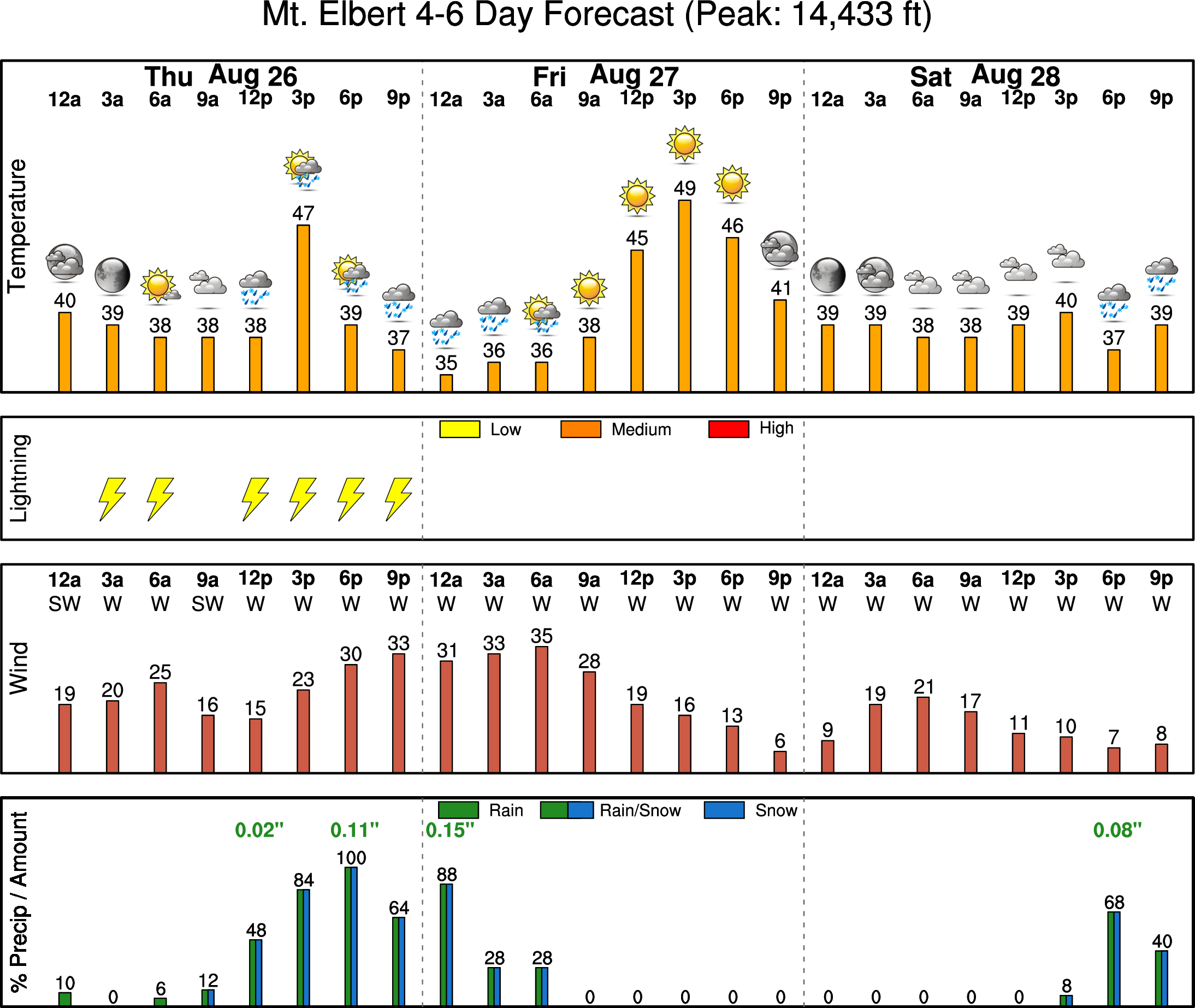
Mountains: The best chance of rain in the Mountains this week will also be on Thursday as a weak storm system passes through. Expect scattered to widespread thunderstorms statewide on Thursday. Otherwise, most days will either be completely dry or offer isolated storms alongside above average temperatures. Check our SummitCAST page for up-to-date forecasts for more than 120 mountain destinations across Colorado, including all the 14ers.
Help support our team of Front Range weather bloggers by joining BoulderCAST Premium. We talk Boulder and Denver weather every single day. Sign up now to get access to our daily forecast discussions each morning, complete six-day skiing and hiking forecasts powered by machine learning, first-class access to all our Colorado-centric high-resolution weather graphics, bonus storm updates and much more! Or not, we just appreciate your readership!
.
Spread the word, share the BoulderCAST forecast!
.





You must be logged in to post a comment.