We kick off the week with a deluge of monsoon moisture setting the stage for potential heavy rain and flash flooding on Monday. The rest of week turns drier but at least remains on the cooler side. For once, there isn’t a single 90-degree day in our extended forecast! Let’s take a look at the weather week ahead.
This week’s highlights include:
- All the ingredients are coming together for widespread monsoon rainfall Monday afternoon into Monday night — though we have some concerns
- Watch out for flash flooding in the higher elevations, though locally heavy rain is also possible in the Denver area
- Tuesday’s high temperatures stay in the 70s — something that has only happened twice this summer!
- Staying cool the rest of the week with minimal chances for additional rainfall
DISCLAIMER: This weekly outlook forecast is created Monday morning and covers the entire upcoming week. Accuracy will decrease as the week progresses as this post is NOT updated. To receive daily updated forecasts from our team, among many other perks, subscribe to BoulderCAST Premium.
Heavy rain possible Monday
Following the passage of a cold front Sunday night, Monday will only be the second day so far in August where the temperatures fail to reach the 90-degree mark in Denver — this is a trend that will continue throughout much of what will ultimately be a cooler week ahead.
We begin on Monday with what will certainly be our best chance of rain for the week as all the ingredients for widespread rainfall, some of that being very heavy, appear to be coming together…
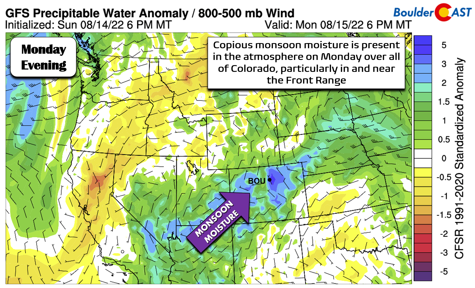
- A pipeline of monsoon moisture is flowing directly into Colorado, with the region from Fort Collins to Colorado Springs seeing the greatest moisture anomalies. This amount of moisture will support very heavy rainfall rates in areas that see storms develop.
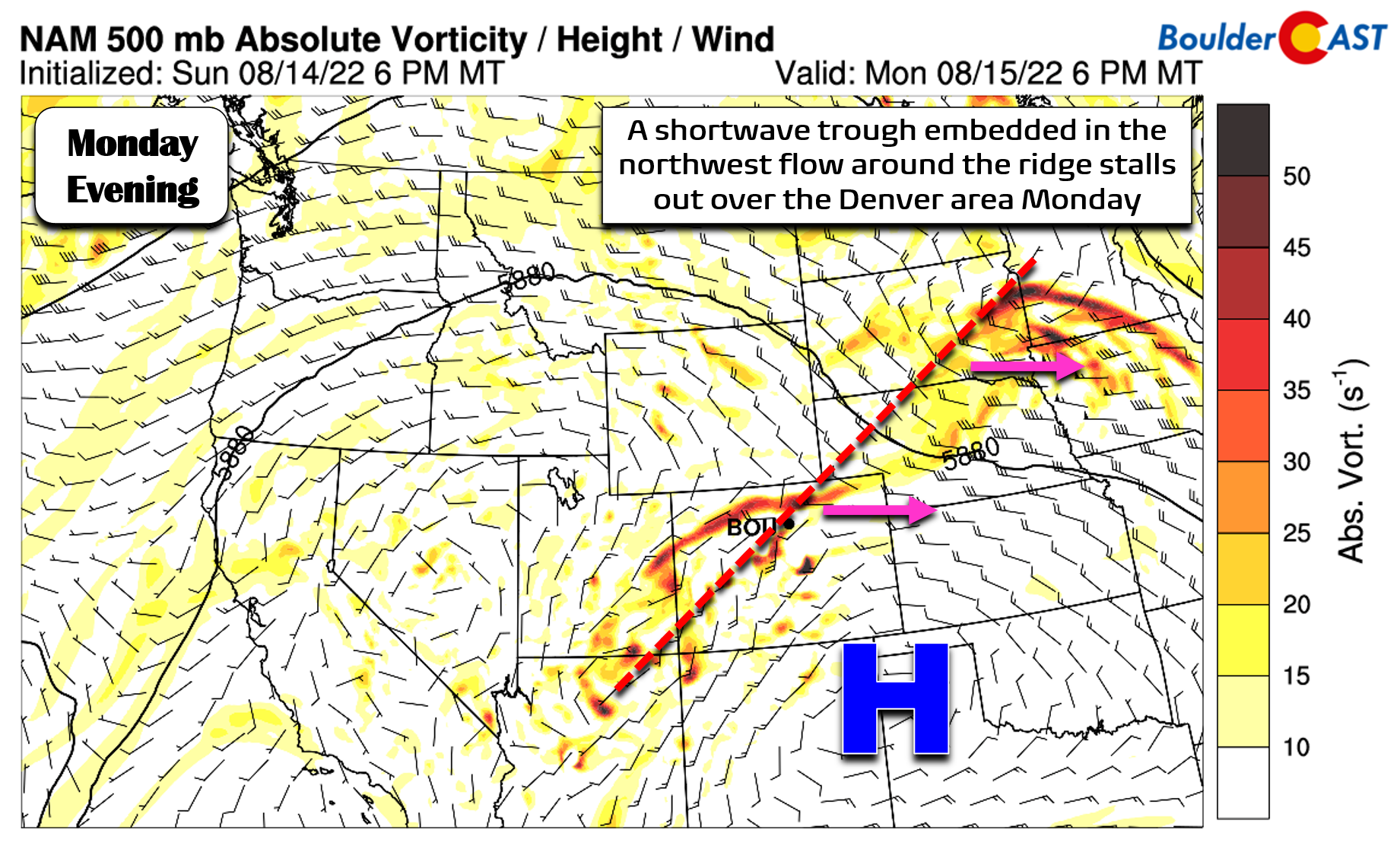
- In the mid-level, high pressure remains situated over the Texas Panhandle with southwest flow (and all that moisture) heading directly into Colorado! A shortwave piece of energy will traverse along the northern fringe of the ridge on Monday. This will supply additional lift to our area during the late-afternoon Monday into the overnight.
- Low-level north-northeasterly winds behind the cold front will help to moisten the low-levels and provided upslope-forcing during the day Monday and Monday night.
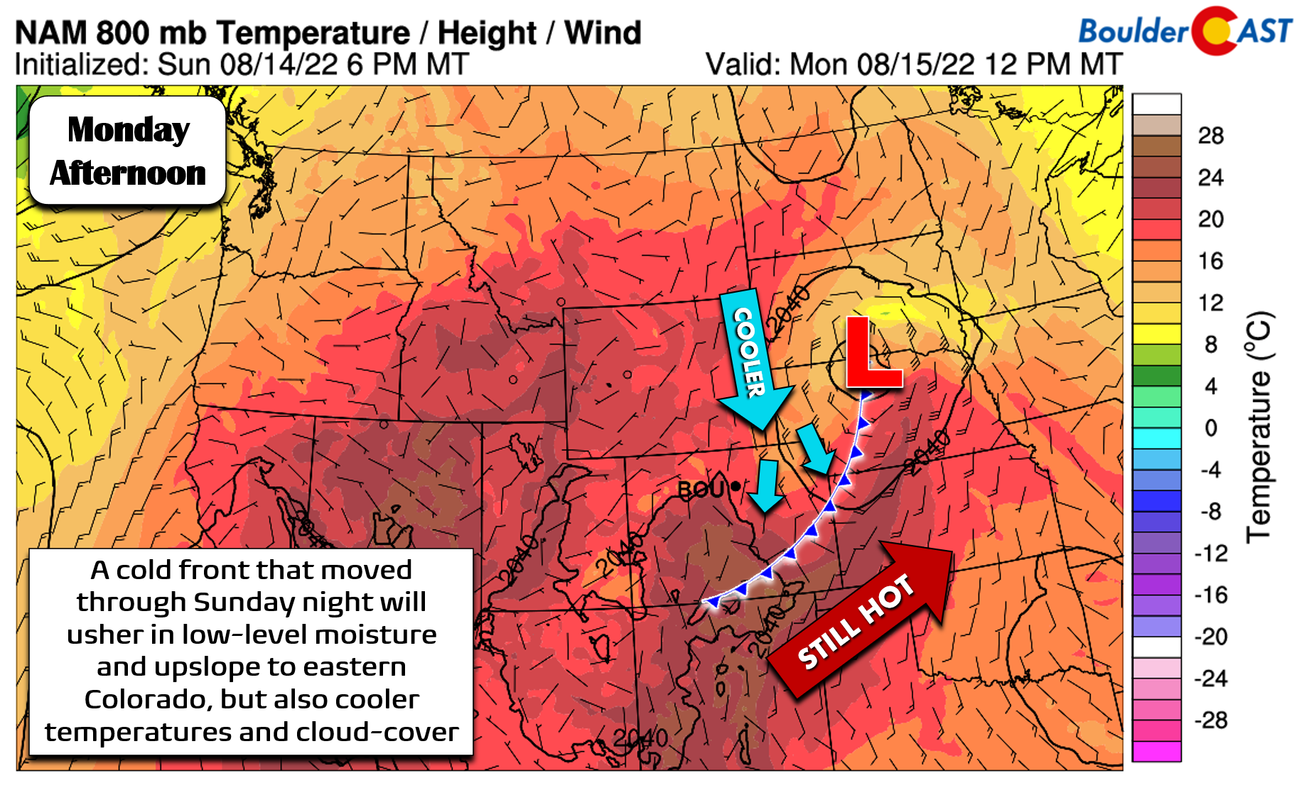
As always, these type of forecasts can still be finicky, despite how much rainfall the models want to dump on the Front Range. While cold fronts often do lead to an uptick in rainfall potential for us, they also come with their downsides — mainly the supply of cooler air at the surface which reduces instability, but also the upslope which often produces low clouds over our area. Too much cloud cover further reduces the instability by taking solar heating out of the equation. We’ve already seen this happen several times this summer, and today will align in a similar fashion unfortunately. Yes, things once again look excellent on paper for a soaking afternoon and evening across the Front Range, but we’re concerned due to the cooler temperatures and cloud cover present as of Monday morning. If action is to pick-up later today, we’re going to need at least a little sunshine at some point!
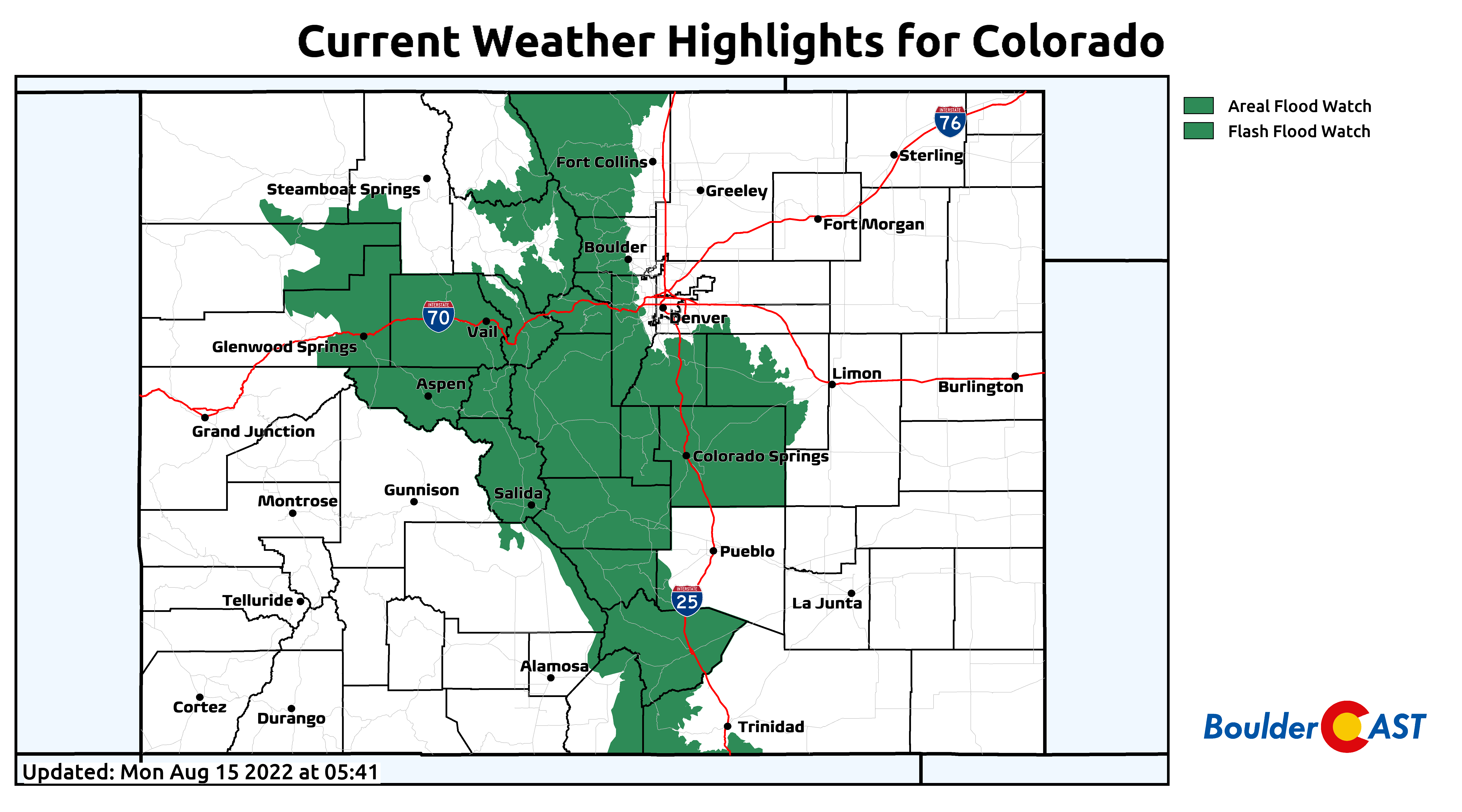
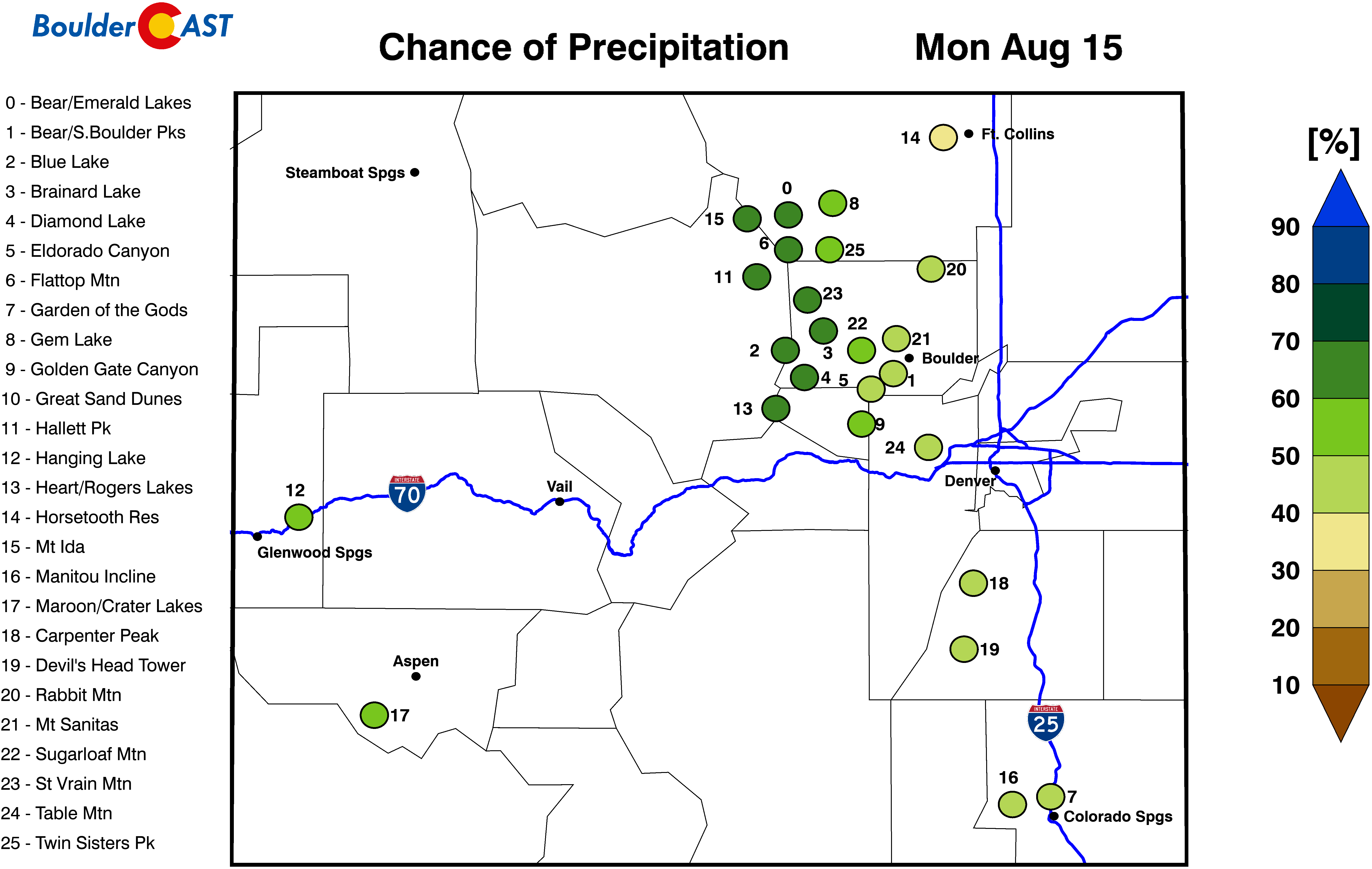
The areas with the greatest chance of seeing widespread storms Monday will be across the Foothills and Palmer Divide. Things also look fairly wet south of Interstate 70. The northern Front Range is where we are most worried about a drier outcome, but even still, these areas should see some rain as well. Overall, expect a wet day, but don’t be too upset if things get spoiled in your location. Flash Flood Watches are posted for mainly the higher terrain with the burn scars at the forefront of the worry again.
The high-resolution HRRR model shows slow-moving thunderstorms (with heavy rain) moving into the Denver Metro area quickly by mid-afternoon.
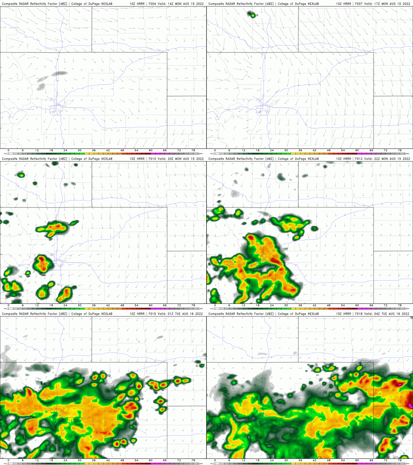
HRRR model-simulated radar animation for Monday showing the potential for widespread showers/storms across much of northeast Colorado
Depending on how persistent the clouds are early on, temperatures may not get out of the 70s before the rain arrives. Areas that see the most sunshine may reach the middle 80s. Either way, this will be the coolest day we’ve seen in more than a week. The best chance of rain comes between 2:00 PM Monday through 2:00 AM Tuesday! Be weather aware and please don’t drive into flooded roadways!
Staying cool the rest of the week
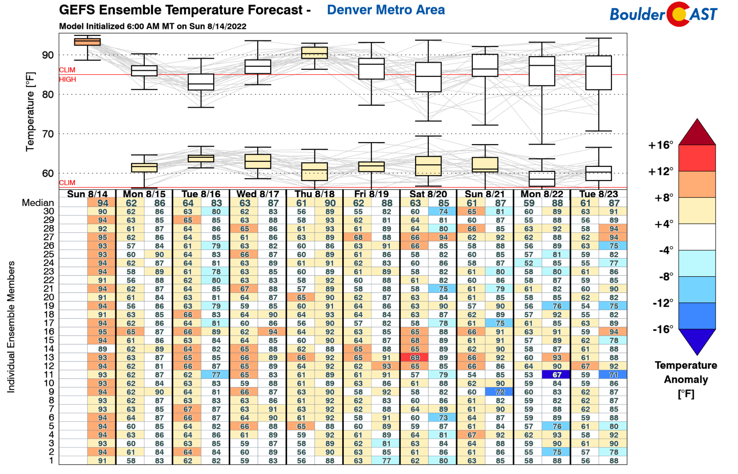
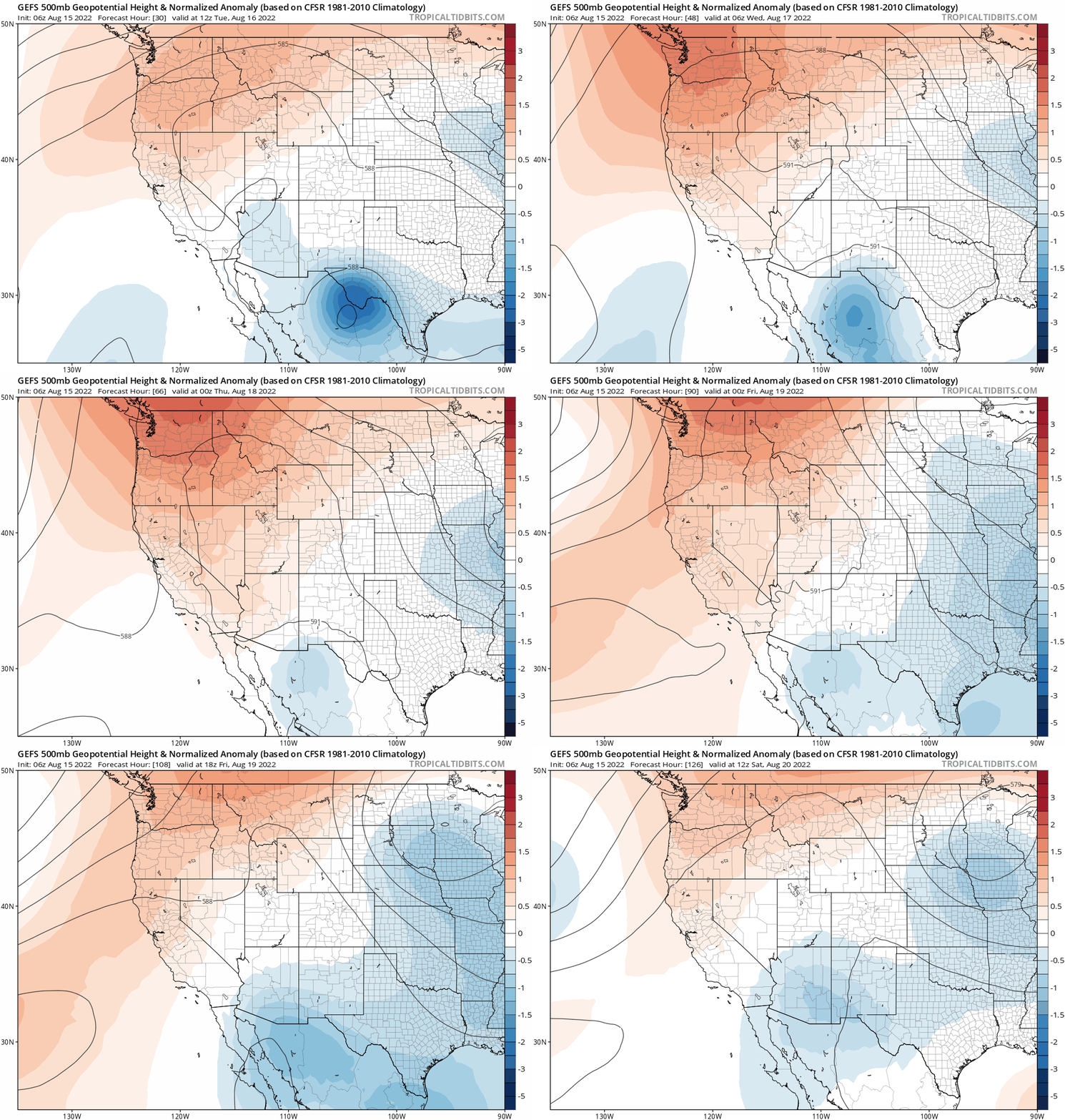
The remainder of the week will stay cool, but things will be also be drier. There really isn’t going to be a dominant weather feature for the next several days with a mix of weak high and low pressures through Saturday. However, the general pattern indicates a persistent trough over the East and for a weak ridge to develop over the northern Rockies. This setup will lead to cooler northwest flow staying the course over Colorado during the week with temperatures remaining near or slightly below normal as a result. Monsoon moisture will get redirected to the south and west, setting up mainly in the Deserts and the Great Basin. On the contrary, moisture will be fairly limited for eastern Colorado Tuesday afternoon and beyond.
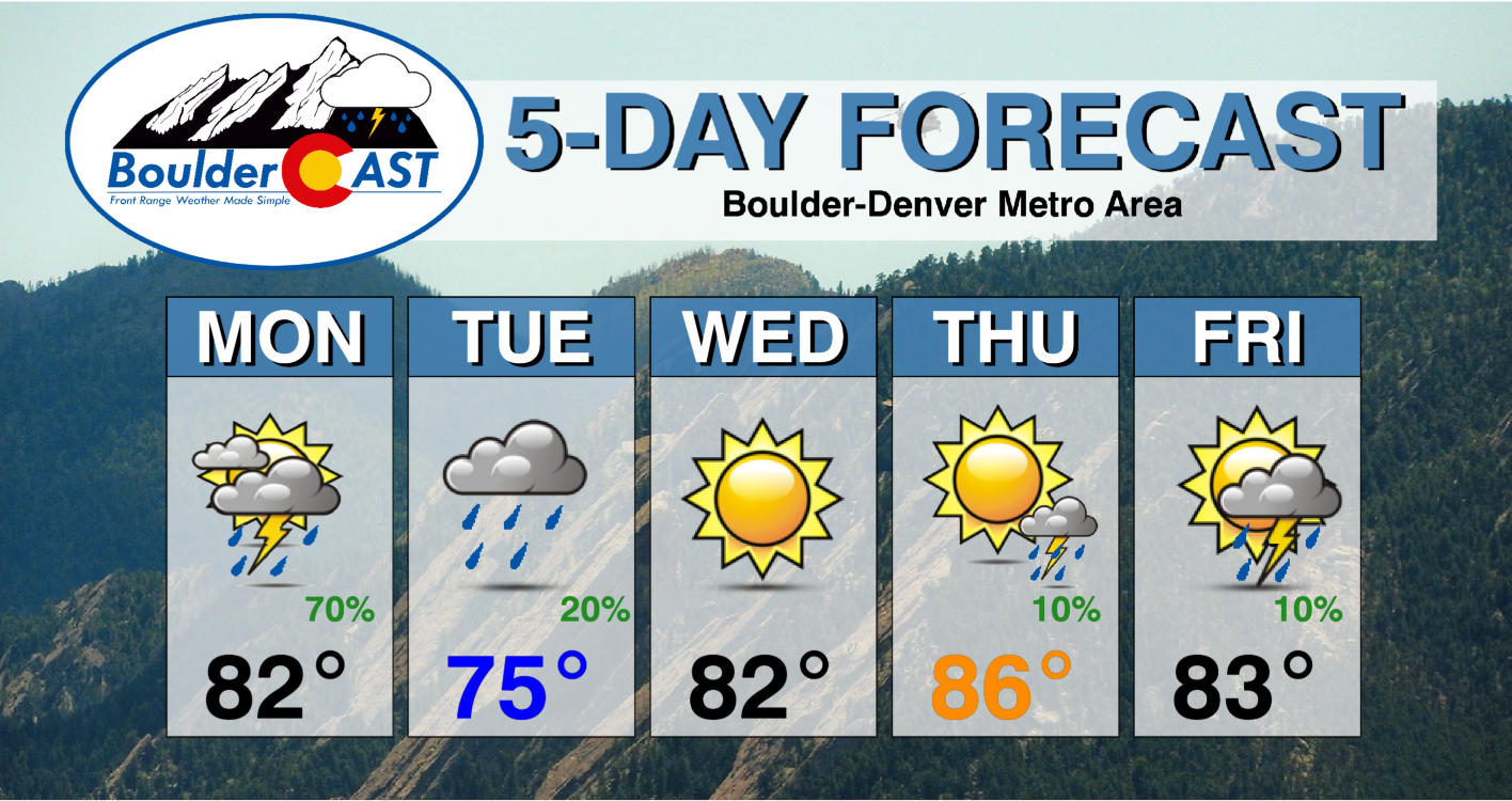
Since June 8th, Boulder has only had two days with high temperatures below the 80-degree mark. Tuesday of this week should be the third! With widespread clouds and some light showers around through the day, high temperatures on Tuesday will land only in the middle 70s. Go ahead and turn off those air conditioners and open the windows! Wednesday will be sunny and dry with temperatures warmer in the lower 80s. Thursday and Friday see the slight chance of rain return, mainly across the higher elevations. Temperatures stick in the 80s through the end of the week.
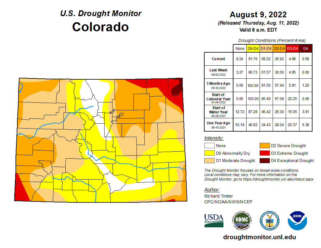
We got some good news last week — the entirely of the Front Range Foothills and Mountains saw their drought classifications removed. However, drought intensified over the northeast corner of the state and stays persistent over the Denver area as well. Hopefully most of us can cash in on some beneficial rains on Monday as the remainder of the week will be rather dry…
Stay up to date with Colorado weather and get notified of our latest forecasts and storm updates:
Forecast Specifics:
Monday: Partly to mostly cloudy with widespread showers and storms developing in the afternoon and continuing into the overnight. Localized heavy rain and flash flooding is possible, mainly south of Interstate 70. Highs in the lower 80s on the Plains with upper 60s in the Foothills.
Tuesday: Mostly cloudy with scattered rain showers possible throughout the day, mainly south and southwest of Denver. Cool with highs only in the middle to upper 70s on the Plains and in the middle 60s in the Foothills.
Wednesday: Sunny and warmer with highs in the lower 80s for the Plains and near 70 in the Foothills.
Thursday: Partly to mostly sunny and seasonal with temperatures reaching the middle to upper 80s on the Plains and into the lower 70s in the Foothills. Isolated thunderstorms possible, mainly across the higher terrain.
Friday: Partly cloudy with isolated to isolated late-day thunderstorms, mainly across the higher terrain. Highs in the low to middle 80s on the Plains with lower 70s in the Foothills.
High Country: Widespread showers and thunderstorms are expected across much of the state’s Mountains on Monday with flash flooding possible. Be very careful in the Mountains on Monday as lightning will be widespread! Tuesday will see showers and some storms continue, especially south of I-70. Wednesday through Friday will have widely scattered storms in most areas with more sunshine and slightly warmer temperatures.
Help support our team of Front Range weather bloggers by joining BoulderCAST Premium. We talk Boulder and Denver weather every single day. Sign up now to get access to our daily forecast discussions each morning, complete six-day skiing and hiking forecasts powered by machine learning, first-class access to all our Colorado-centric high-resolution weather graphics, bonus storm updates and much more! Or not, we just appreciate your readership!
Spread the word, share the BoulderCAST forecast!





You must be logged in to post a comment.