The week starts off rather warm under increasingly strong southwest flow aloft. This will culminate in elevated fire danger on Tuesday with dry and gusty winds in place. The mid to late week period will turn unsettled and much colder with a series of low pressure systems and cold fronts lining up that will bring at least two chances for Front Range rain and snow during the period. Read on for more details.
This week’s highlights include:
- Temperatures comfortably in the 70s to start our week
- Fire danger will be elevated Tuesday under warm, dry, and breezy conditions
- A cold front drops temperatures into the 60s to 50s Wednesday along with a chance of rain changing to snow Wednesday night
- We turn even cooler Thursday & Friday and must watch for a secondary system that could bring another chance of snow late in the week
DISCLAIMER: This weekly outlook forecast is created Monday morning and covers the entire upcoming week. Accuracy will decrease as the week progresses as this post is NOT updated. To receive daily updated forecasts from our team, among many other perks, subscribe to BoulderCAST Premium.
Daily Forecast Updates
Get our daily forecast discussion every morning delivered to your inbox.
All Our Model Data
Access to all our Colorado-centric high-resolution weather model graphics. Seriously — every one!
Ski & Hiking Forecasts
6-day forecasts for all the Colorado ski resorts, plus more than 120 hiking trails, including every 14er.
Smoke Forecasts
Wildfire smoke concentration predictions up to 72 hours into the future.
Exclusive Content
Weekend outlooks every Thursday, bonus storm updates, historical data and much more!
No Advertisements
Enjoy ad-free viewing on the entire site.
Warm & breezy to start the week
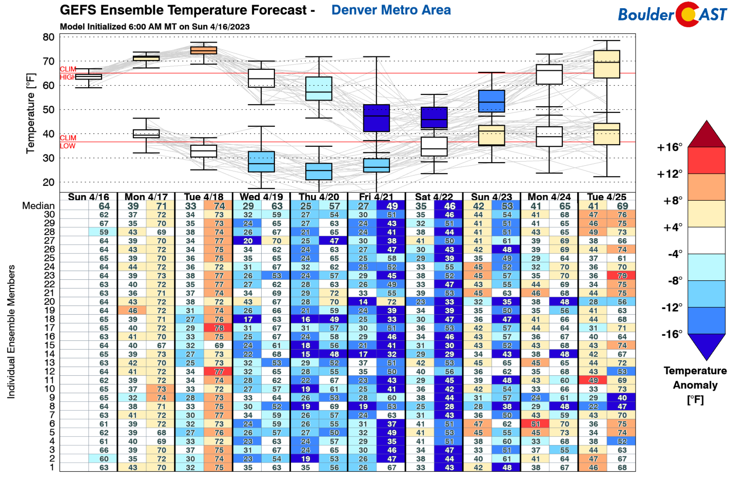
It will be an active week ahead, albeit not much so at the beginning. The main action takes place between Wednesday and Friday. The GEFS temperature pattern for the week shows the above normal temperatures in store with 70s to potentially some low er 80s in spots Monday to Tuesday. The bottom drops out Wednesday and beyond behind a series of cold fronts and approaching low pressure systems. We may struggle even to get out of the 40s or 30s come Friday.
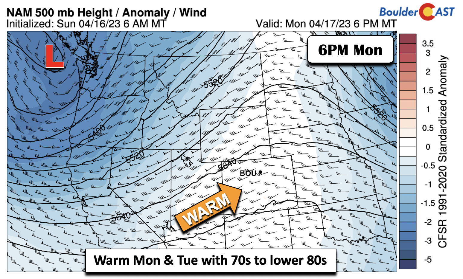
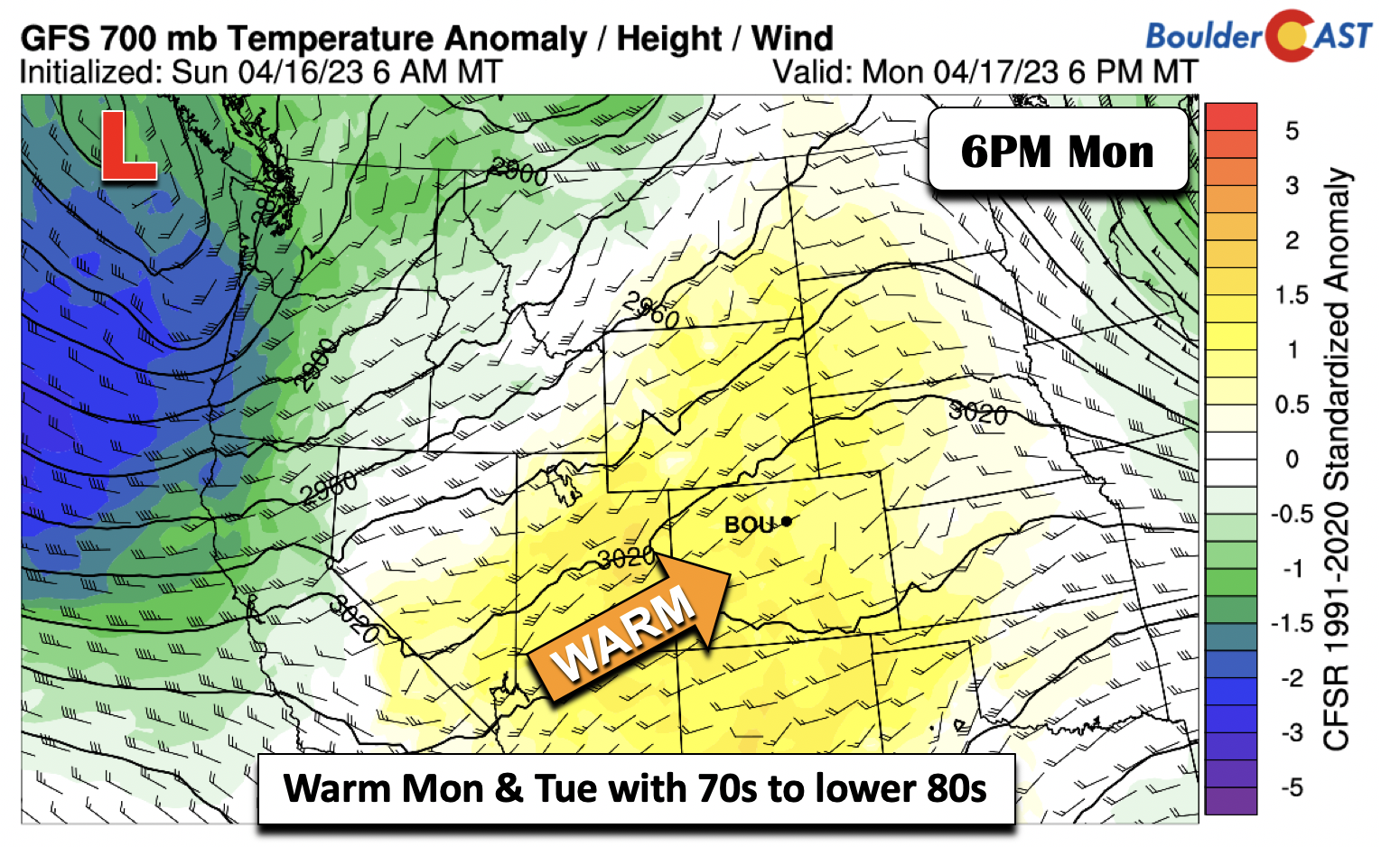
To start the week on Monday, a deep trough will be moving onshore across the Pacific Northwest while ridging will be in place across our area. Broad southwest flow will keep the warm weather in place across Colorado with low to middle 70s Monday afternoon for the Denver Metro area.
The warmth will intensify slightly into Tuesday allowing us to reach the middle 70s, with some upper 70s across the southern Metro area.
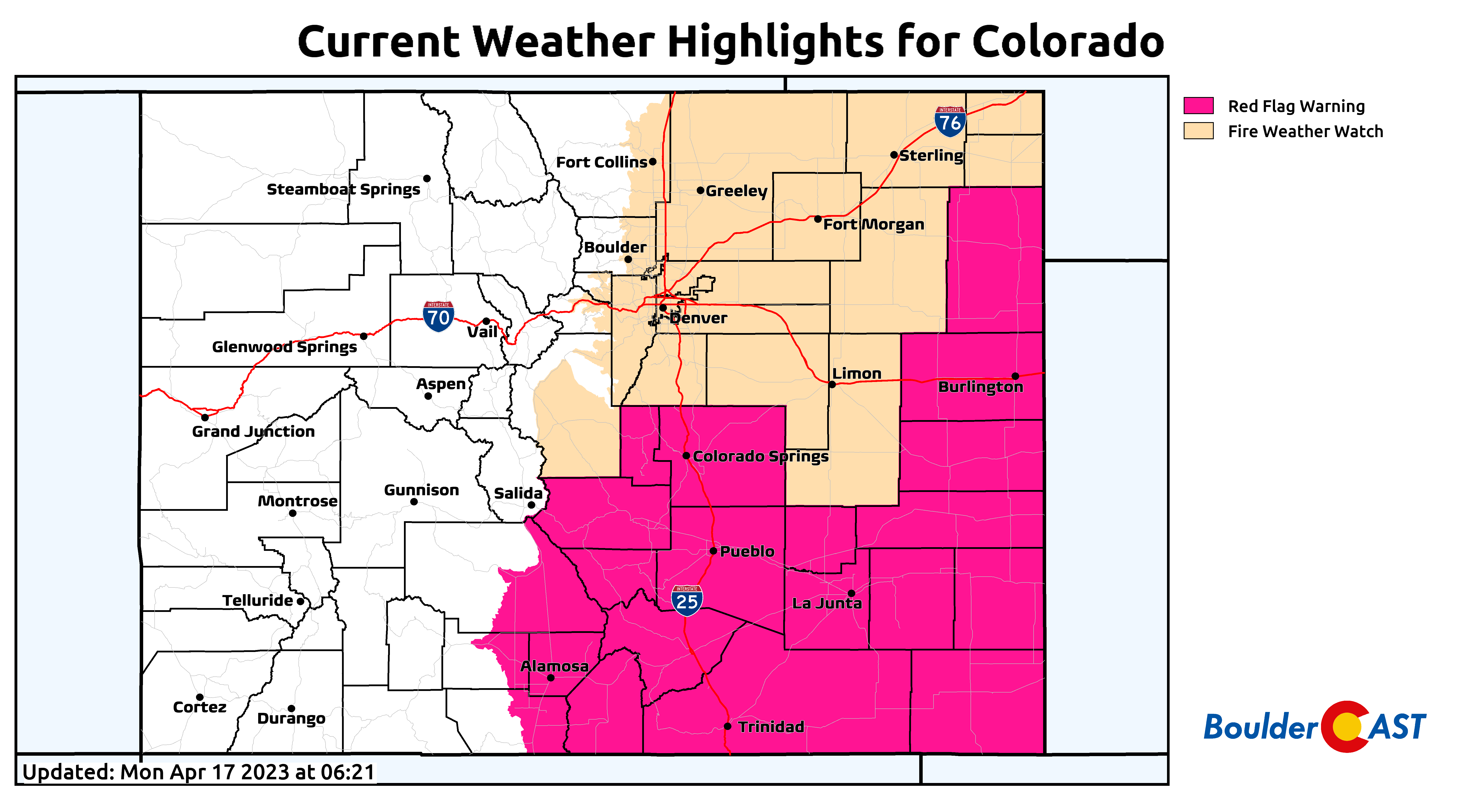
Along with the warm weather Tuesday, strong southwest surface winds at times gusting 30+ MPH gusts will combine with low relative humidity levels for elevated fire danger concerns once again. 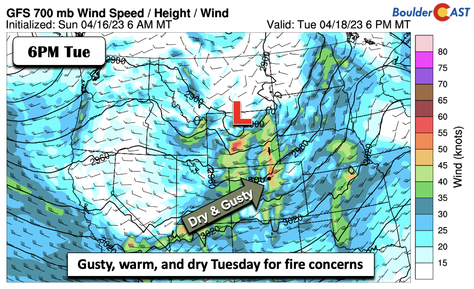
As of writing early Monday, a Fire Weather Watch is already in place for Tuesday which will likely be upgraded to a Red Flag Warning soon. Outdoor burning, flames and sparks are strongly discouraged Tuesday.
Overall, it will be a pleasant start to the week with little to complain about.
Turning colder with two chances of rain and snow Wed-Fri
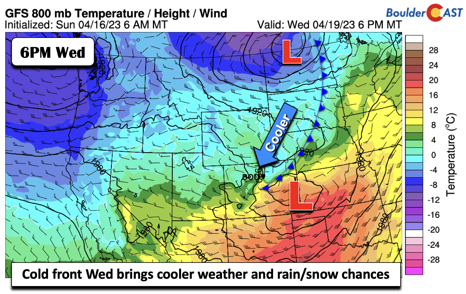
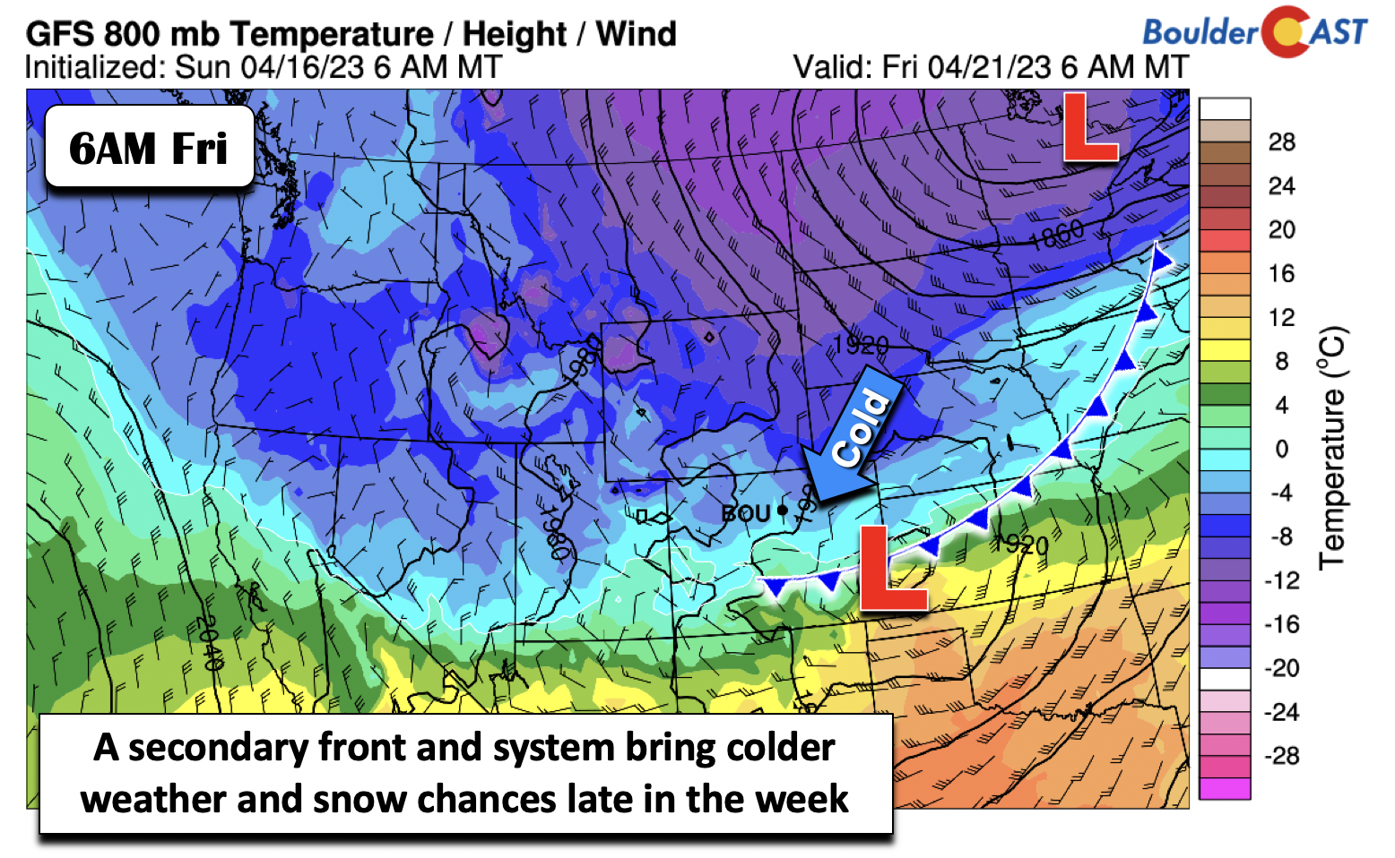
A notable cooldown is evident in most model guidance following a cold front which will drop through from Wyoming early Wednesday, though it may retreat back northward as a warm front before settling back south Wednesday night. This will lower our highs by midweek to the low 60s to perhaps some upper 50s.
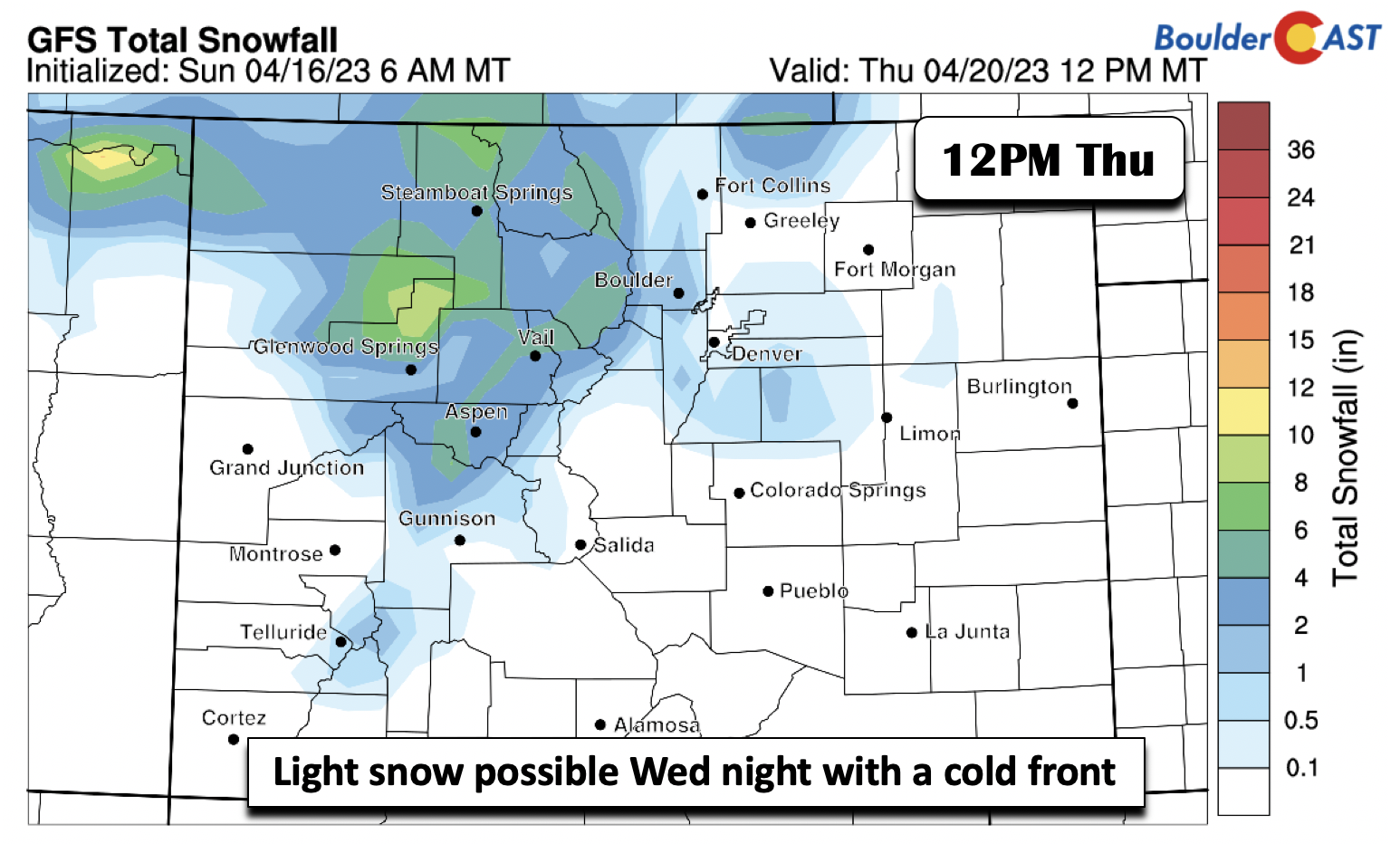
Along with the cooler air Wednesday, models are suggesting just enough cold air for a brief changeover from rain to snow Wednesday night to early Thursday. Most guidance only shows a trace to less than an inch across the Front Range. Given the warm temperatures to start the week, we are not too concerned, though the overall track will need to be watched. As it stands now, it is not all that favorable for significant precipitation in the Front Range.
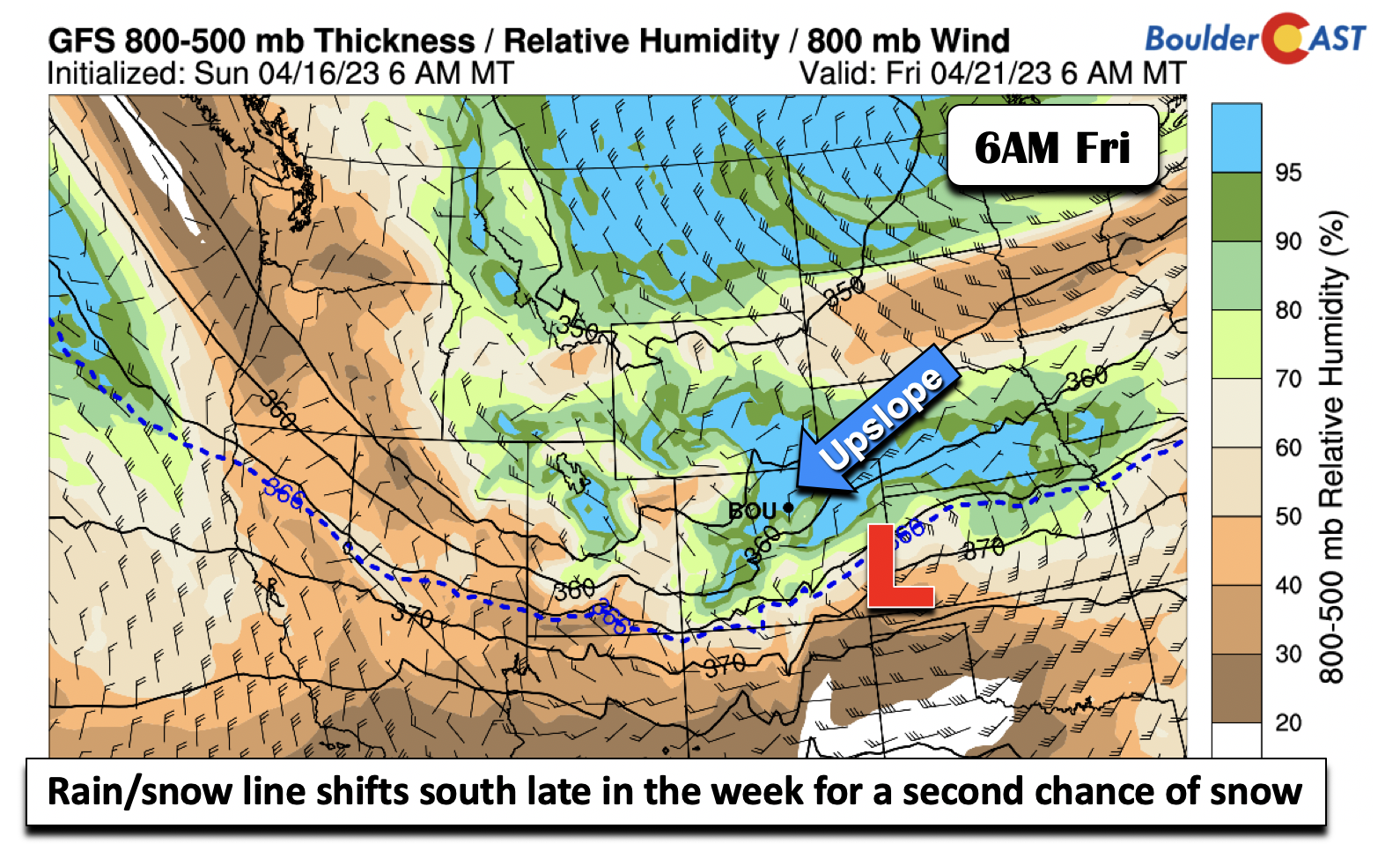
Models and their ensembles are hinting at a more potent cold front coming through late in the week, sometime Thursday to early Friday. The GFS also shows an area of low pressure riding along the front for a period of upslope snow to close out our week. Yikes !
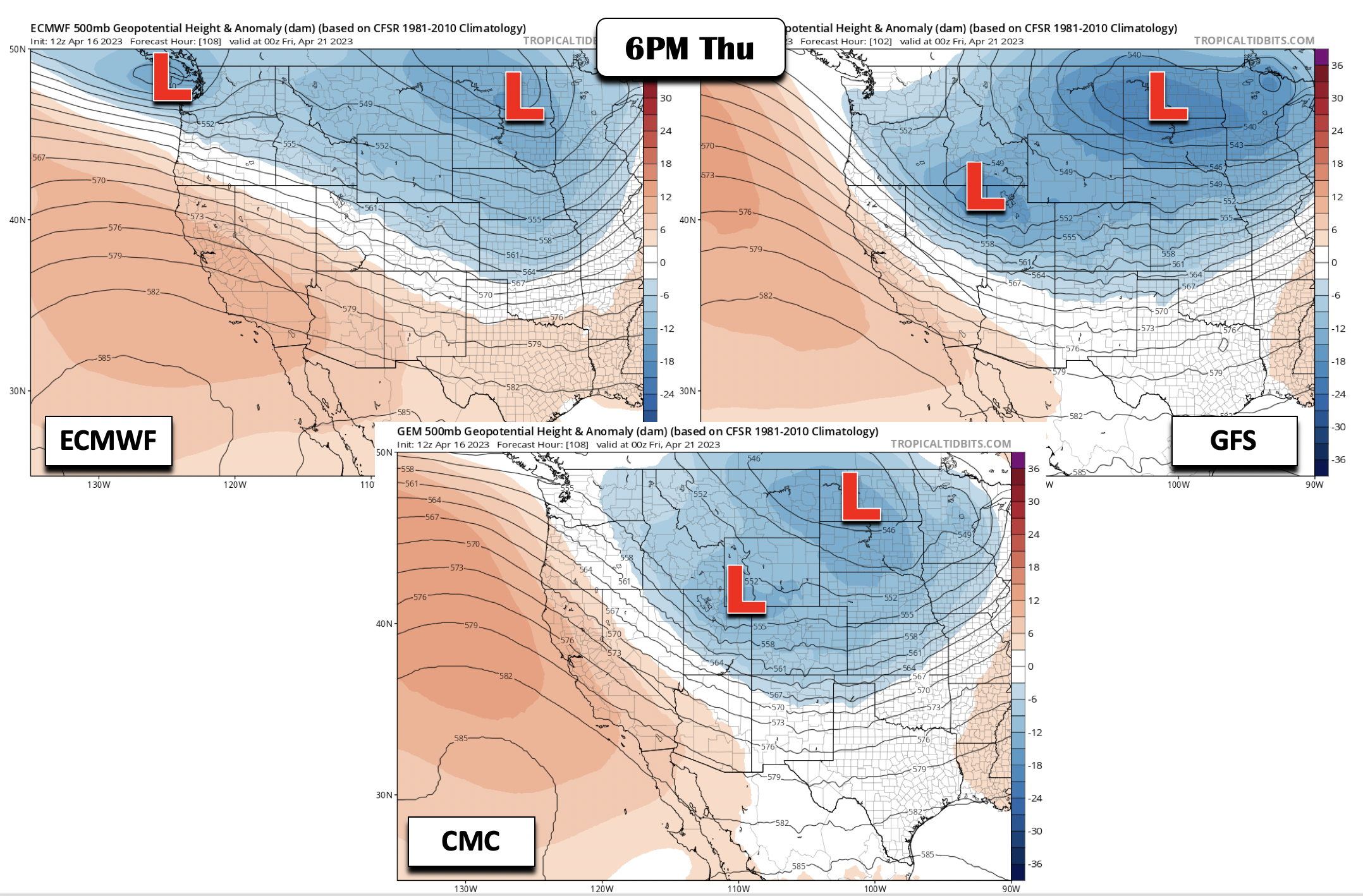
However, if we take a look at the model guidance between the ECMWF, CMC, and GFS for Thursday night, there is very little agreement in regards to the overall trough pattern and timing. The ECMWF shows a west-northwest flow aloft, which would be a drier/cold pattern, while the GFS is the wettest, showing a secondary low forming near Utah and bringing energy into the state Friday. The CMC is somewhat in between the other two mentioned models but also does show a secondary low seen in the GFS. This will be something to watch late-week given its track, but it’s too uncertain to make any snow predictions this far out.
Regardless of which solution pans out, it looks like it will be cold enough for snow, with the rain/snow line well south of the Front Range (dashed blue line in graphic below). It will just be a matter of seeing if the models can produce upslope with the cold air, which is always tough this time of year.
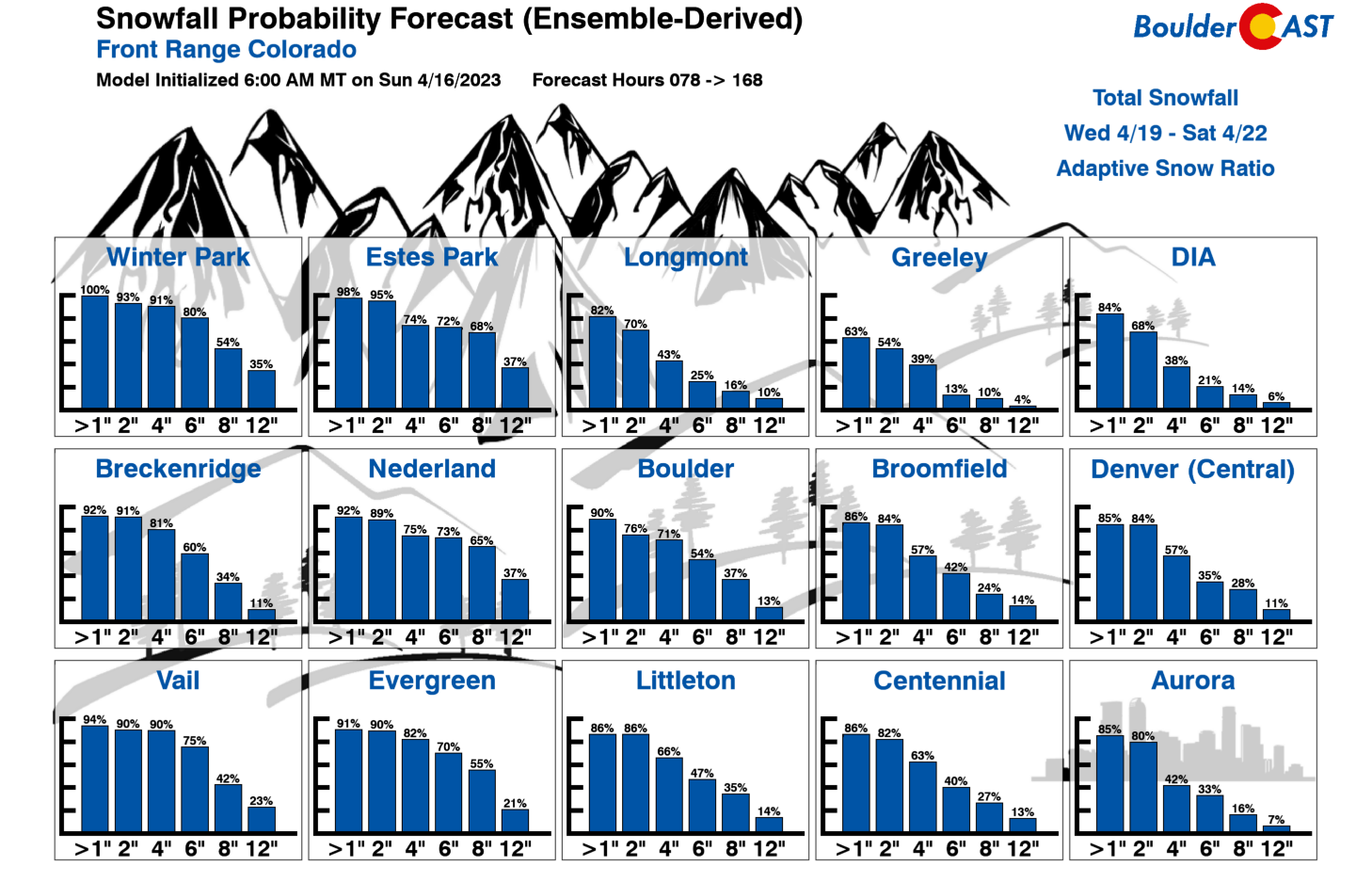
The GFS ensembles align well with their parent GFS model, showing high probabilities for 4+ inches of snow in Boulder/Denver for the late-week period. Stay tuned! The ECMWF could also verify, leaving us with only a trace of snow and a drier but cool conclusion.
Forecast Specifics:
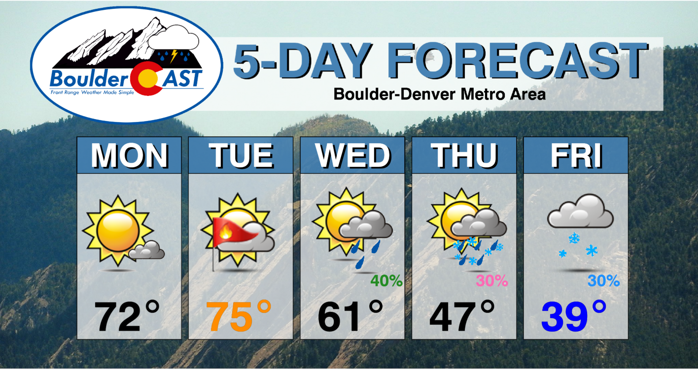
Monday: Warm and sunny with low to middle 70s for the Plains and lower 60s in the Foothills.
Tuesday: Elevated fire danger concerns with warm and dry conditions accompanied by gusty winds between 30-40 mPH. Highs in the middle to upper 70s on the Plains and middle 60s in the Foothills.
Wednesday: Cooler behind a cold front. Increasing clouds with a chance of rain changing to snow Wednesday night. Highs in the upper 50s to low 60s.
Thursday: Increased uncertainty but cooler weather in the lower 50s on the Plains and lower 40s in the Foothills. A chance of rain/snow Thursday night.
Friday: A chance of rain or snow under mostly cloudy skies. Highs quite chilly in the upper 30s to lower 40s on the Plains and lower 30s in the Foothills.
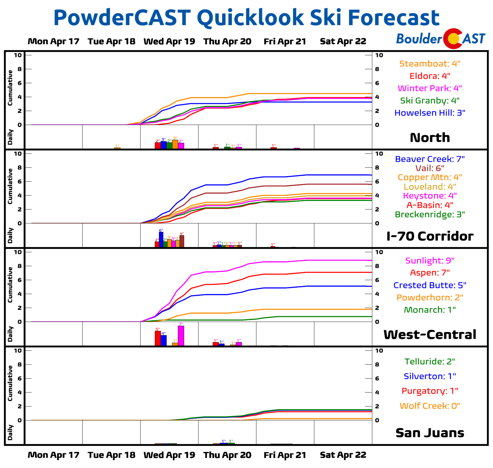
PowderCAST: A few periods of snow are possible this week. The first arrives Tuesday afternoon over the north-central and northwest mountains and continues through Wednesday with 3-6″ possible in most ranges. A secondary chance comes Thursday into Friday, albeit with more uncertainty. Several inches of snow may be possible again late-week but the exact location and amounts are too uncertain at the moment.
DISCLAIMER: This weekly outlook forecast is created Monday morning and covers the entire upcoming week. Accuracy will decrease as the week progresses as this post is NOT updated. To receive daily updated forecasts from our team, among many other perks, subscribe to BoulderCAST Premium.
Daily Forecast Updates
Get our daily forecast discussion every morning delivered to your inbox.
All Our Model Data
Access to all our Colorado-centric high-resolution weather model graphics. Seriously — every one!
Ski & Hiking Forecasts
6-day forecasts for all the Colorado ski resorts, plus more than 120 hiking trails, including every 14er.
Smoke Forecasts
Wildfire smoke concentration predictions up to 72 hours into the future.
Exclusive Content
Weekend outlooks every Thursday, bonus storm updates, historical data and much more!
No Advertisements
Enjoy ad-free viewing on the entire site.
Spread the word, share the BoulderCAST forecast!





You must be logged in to post a comment.