Are you hoping for a White Christmas in 2019? Don’t hold your breath. We discuss the weather pattern that is quickly erasing any chance for a White Christmas in Denver and Boulder this year.
White Christmas Defined
There are two acceptable meteorological definitions for the occurrence of a “White Christmas.”
- 1″ of snow present on the ground at any point during Christmas Day (this is the “official” definition as denoted by the NCDC).
- At least 0.1″ of snow must fall and accumulate on Christmas Day.
Surely we all prefer the second option, with actual snow flying as you open your gifts and stuff your face with holiday food! Old, disgusting brown snow on the ground doesn’t really tend to spread the holiday cheer, now does it?
In a past podcast, we discussed Boulder’s “White Christmas” climatology. When just considering the last 19 years, Boulder has a 32% chance of recording snowfall on Christmas day, but a 57% chance of having some snow on the ground. The longer term averages for Denver (14% snowfall and 38% snow on ground) suggest we have been relatively more fortunate since the turn of the century!
The climatology map below paints the Front Range at above 40% chances, with near 100% odds in the western Mountains.
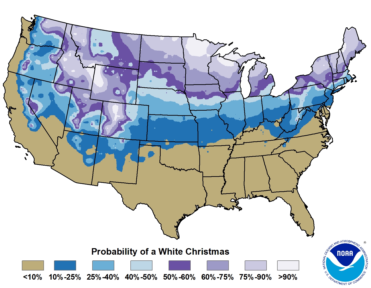
Percentage chance of having snowfall on the ground on Christmas (Credit: NOAA). This is a climatology, not the forecast or specific odds for 2017.
2019 White Christmas forecast
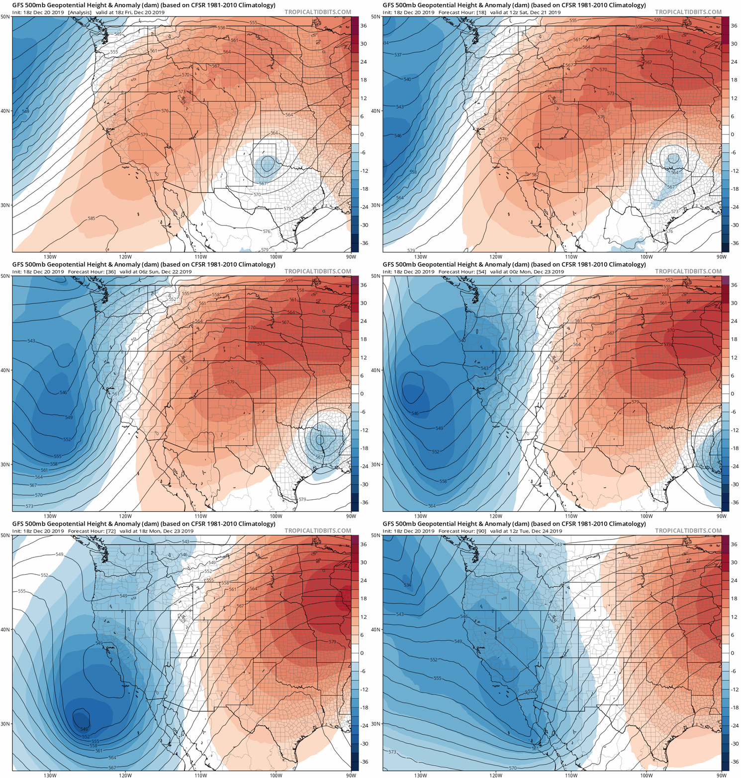
For anyone that loves snow, the weather forecast for the next several days will cut deep. The blood-red shading in the 500mb height anomaly animation below is associated with the developing ridge of high pressure over Colorado and is predicted to last until Christmas Eve.
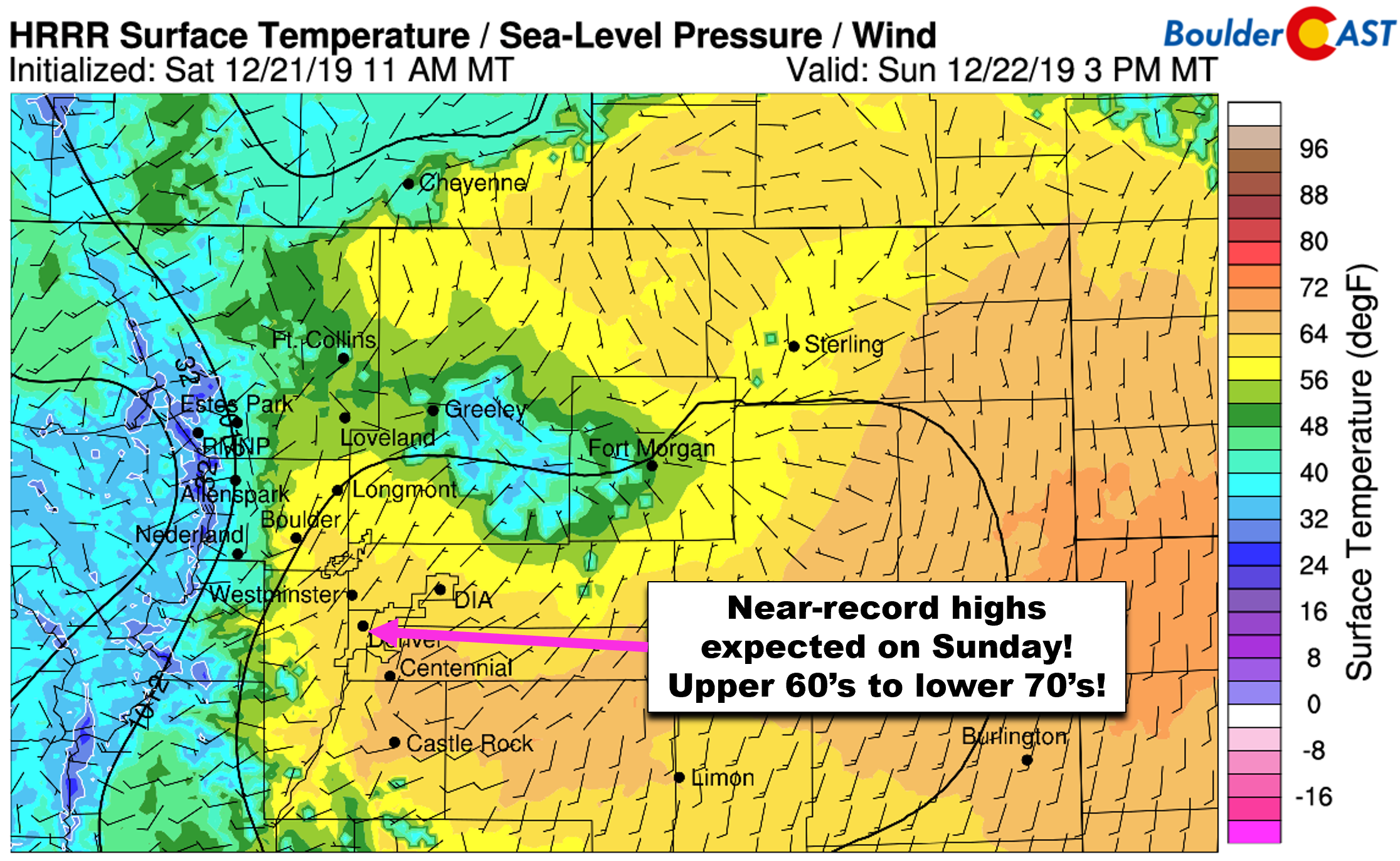
This will facilitate unseasonably warm conditions across the area through the 24th. We’ve already seen highs today (Saturday) in the middle 60’s in portions of the Denver Metro area. Some spots may even crack 70°F on Sunday…very near to record values for the date. Thick upper-level clouds will be on the increase, however, which may prevent anyone from hitting the elusive 7-0.
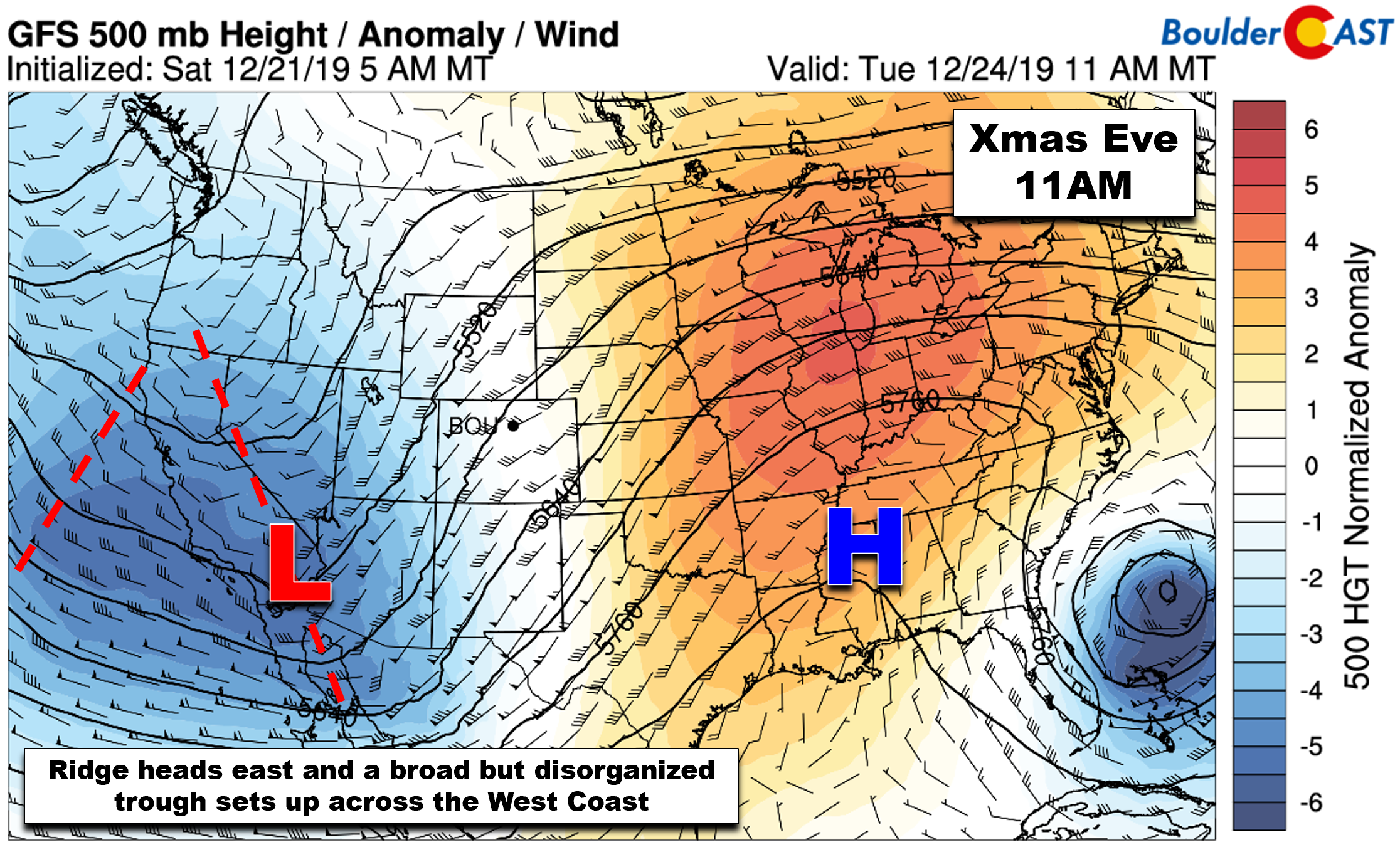
The “December heatwave” will stick with us through Monday and Tuesday, though temperatures will be trending cooler each day. By Christmas Eve, the core of the ridge will head east with a broad and disorganized trough just beginning to take shape across the western United States (see below). This pattern will leave Colorado in the area between the trough and the ridge with southwesterly flow dominating.
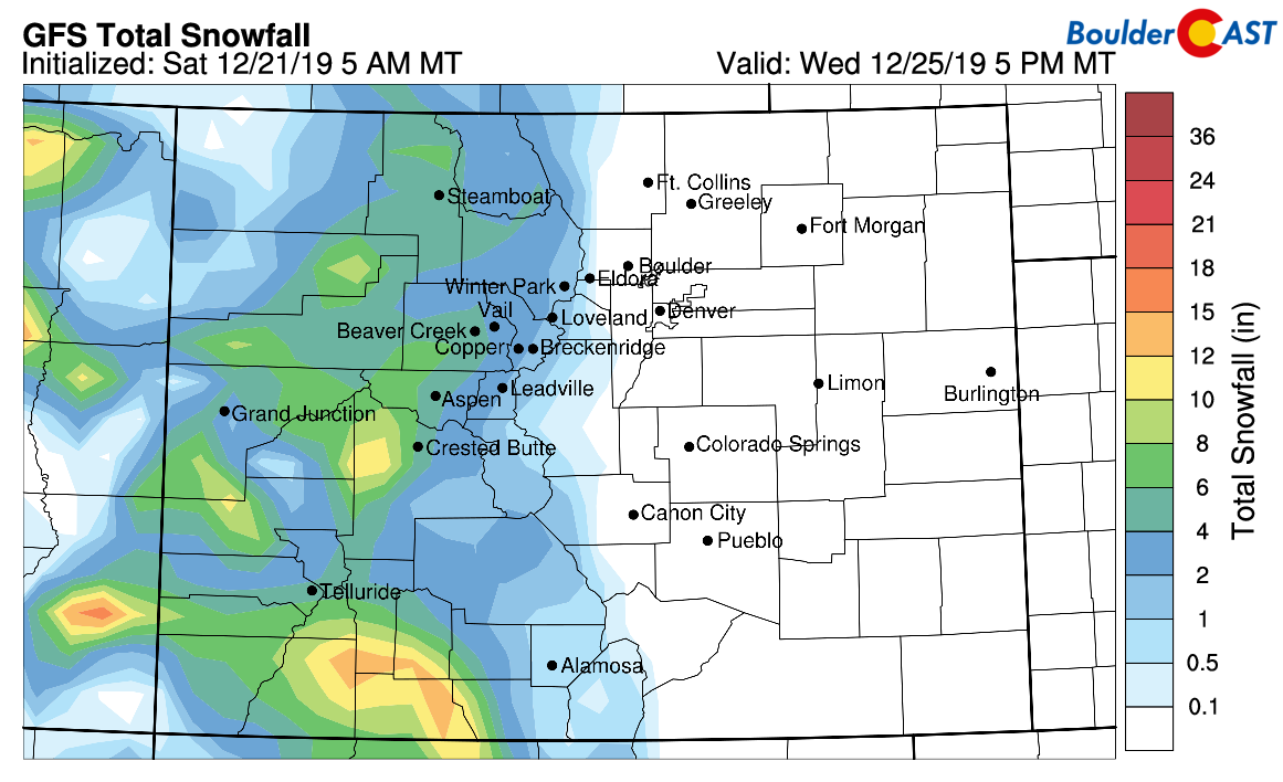
With such disorganization expected with this West Coast trough, the forecast by the middle of next week is a little bit wishy-washy. Models are trying to develop several weak pulses of energy that swing around the base of the trough and skirt eastward into Colorado and Wyoming beginning on Wednesday. At this time, none of them appear strong enough to do anything more than provide light snow to the Mountains. They won’t really get much kicking east of the Divide. Thus, as much as it pains us, we’re not expecting any precipitation, rain or snow, in the Boulder/Denver area through Christmas. With no snow left on the ground, it appears very likely that neither of the previously discussed “White Christmas” conditions will be met this year.
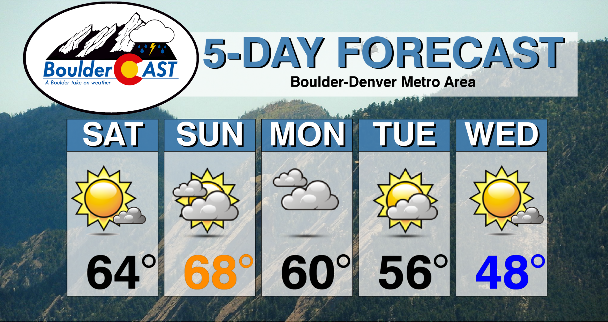
Here’s our five day forecast. No precipitation with temperatures above normal each and every day. Just what you want as we roll into the Holidays….NOT!
We’ll continue to monitor the approaching trough with hopes that Mother Nature can pull a snowy rabbit out of the hat for us. As of now, though, we’re not expecting any Yuletide magic tricks…
Subscribe to receive email notifications for BoulderCAST updates:
We respect your privacy. You can unsubscribe at any time.
From all of the BoulderCAST Team,
we wish you Happy Holidays!
.
Share this forecast:
.




You must be logged in to post a comment.