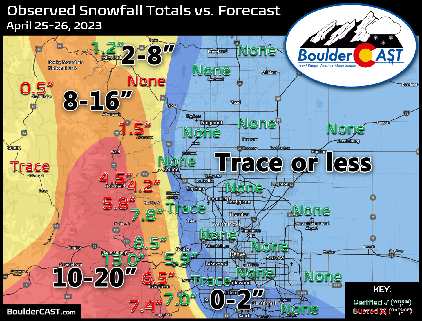
Shown below is our snowfall forecast map issued Tuesday morning with actual storm totals overlaid. Green values indicate that our forecast verified to within one inch of the observed snowfall total. Red numbers did not. We had fairly good verification across most of the immediate Boulder-Denver area which received basically no snow because it was too warm. That was the easy part of the forecast. Boulder and Denver both received no snowflakes at all.
As you may have noticed, forecast verification in the Foothills was generally terrible for a number of reasons. We’ll blame a slight southward drift in storm track & the Denver Cyclone interrupting the promised upslope snow machine Tuesday evening for huge bust in the northern Foothills. During what should have been the height of the storm, this area completely shut off w/ NNW flow!
Huge dry slot over #Boulder and the Foothills right now as a persistent Denver Cyclone setup near DIA to the east has been spoiling the party. It seems to be collapsing which should lead to a better surge of moisture/upslope westward, but this definitely cut into QPF output #COwx pic.twitter.com/Pv24EHduN4
— BoulderCAST Weather (@BoulderCAST) April 26, 2023
What should have been 1-2″ per hour heavy snow from 4-10PM actually was almost completely dry. Lost a bulk of the moisture during this time, but also the dynamic cooling that would have accompanied the heavy snow. This led to warmer temps, more rain, and lower snow ratios. Boo!
😀 Officially 0.94" of rain in #Boulder, no snow as temperatures never got below 39°F. Biggest precipitation event since December 28-29, 2022.
🫤 Only 0.31" of rain officially in Denver. Also no snow. Biggest event since January 17-18, 2023 #COwx
— BoulderCAST Weather (@BoulderCAST) April 26, 2023
Ironically it was the sunshine resulting warmer temperatures Tuesday afternoon that saved the entire event, allowing for the explosion of storms early on which were much stronger and more widespread than forecast. This included the first confirmed tornado of 2023 in Colorado just east of DIA Tuesday afternoon.
First Colorado tornado of the year, a landspout near Keenesburg.
North view of it from @DENAirport from @Pchazz12:#9wx #COwx pic.twitter.com/X2nwXG1O2d
— Chris Bianchi (@BianchiWeather) April 25, 2023
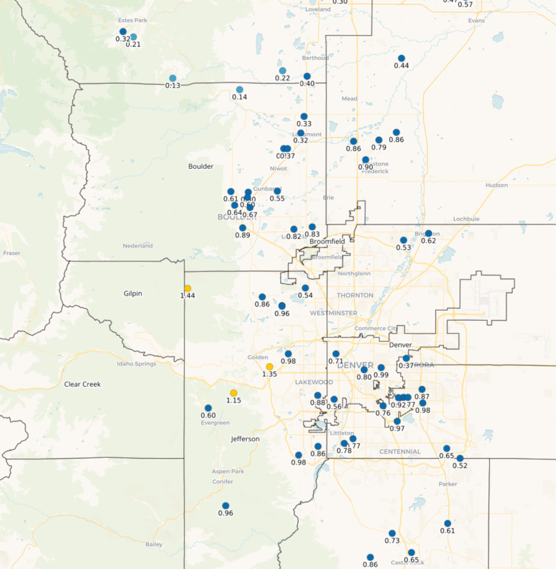
Moisture totals came in on point, despite unfolding unconventionally, with generally 0.5 to 1.5″ of rain and melted snow across the region. This will go a long way to helping the drought across the area — not full eradication but definitely improvement. Keep a close eye out as the hillsides will be turning a nice shade of emerald very soon!


You must be logged in to post a comment.