This week’s slow-moving spring storm drenched the Boulder-Denver area with widespread soaking rain, while elevations above 7,500 feet were blanketed in dense, heavy snow. As the storm begins to wind down, we take a look at how it unfolded and review the final rain and snow totals.
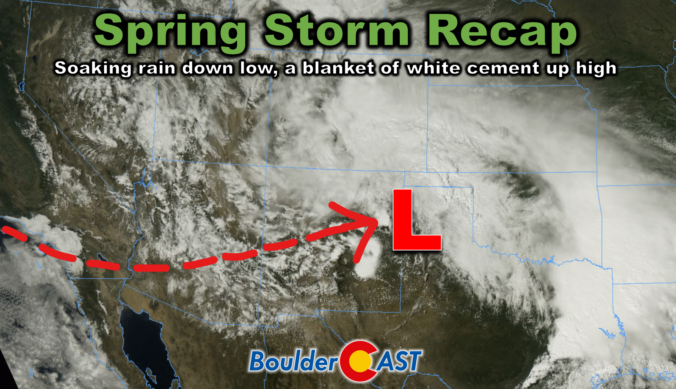
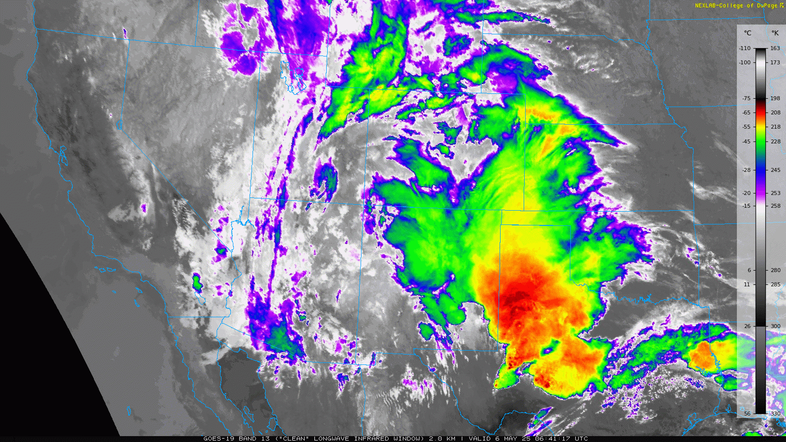
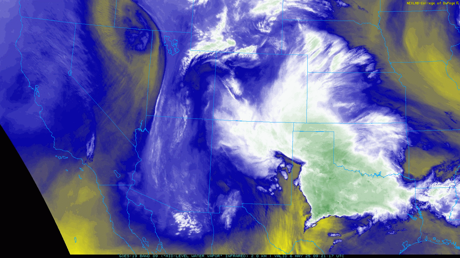
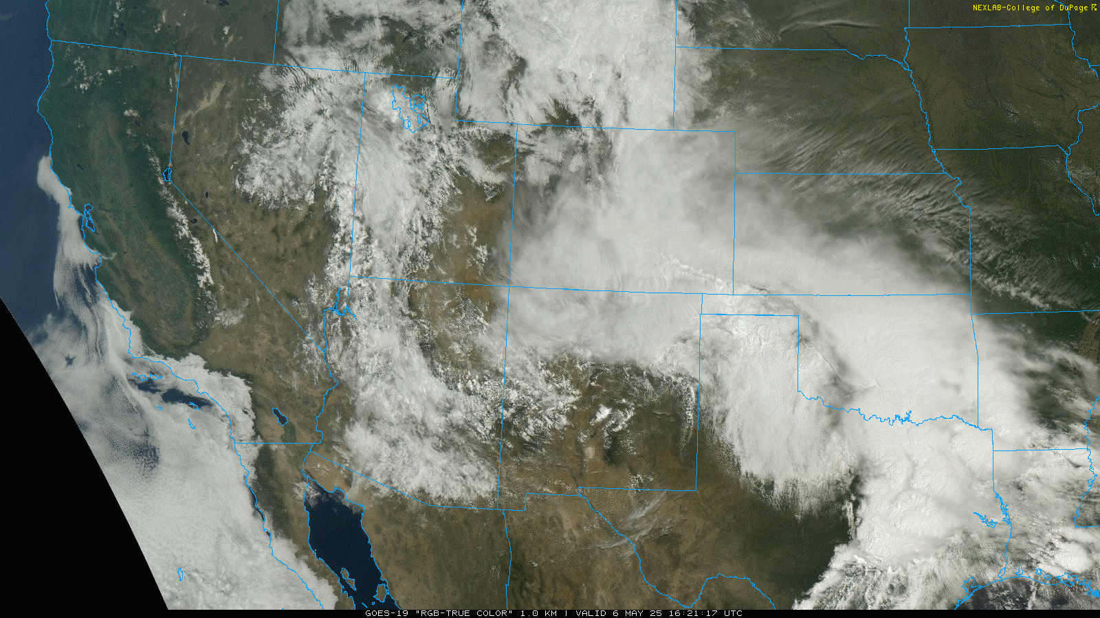
This classic southern-track storm moved into an ideal position on Tuesday, passing over northern New Mexico. A deep stream of Gulf of Mexico moisture surged northward before wrapping west into the Front Range, fueling prolonged, efficient upslope conditions across the region. The GOES-East satellite captured stunning infrared, water vapor, and visible imagery of the storm’s progression:
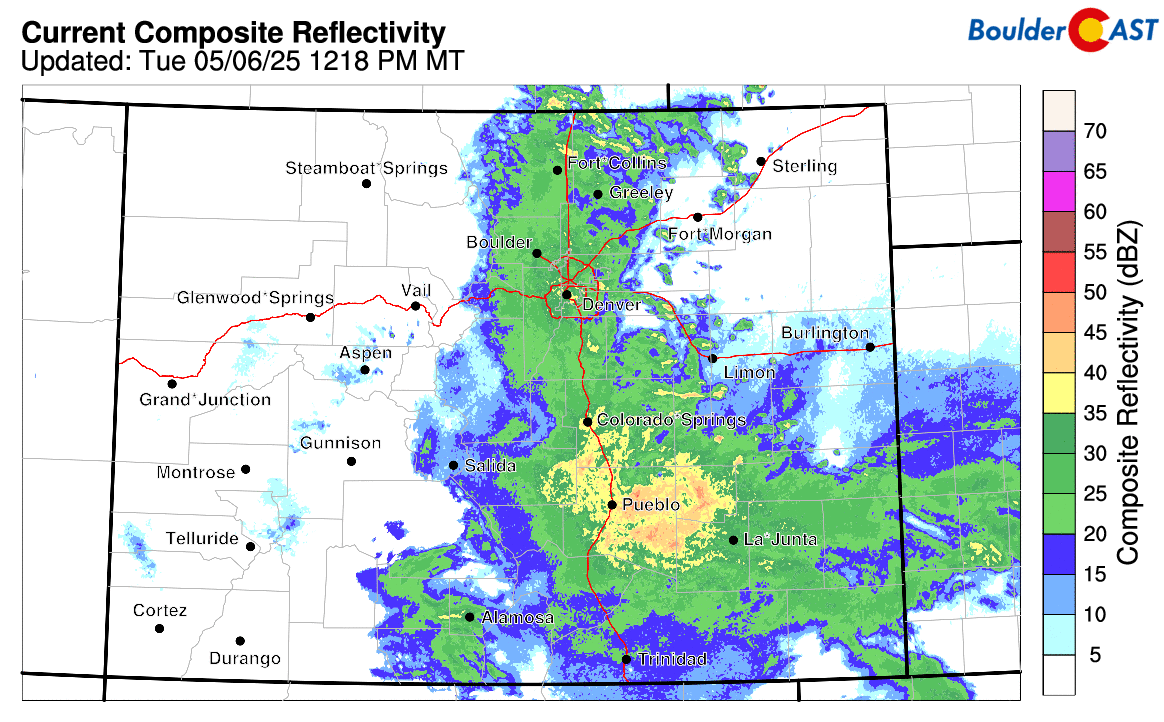
Radar across eastern Colorado impressed throughout the day Tuesday, highlighting the storm’s robust upslope dynamics and abundant spring moisture.
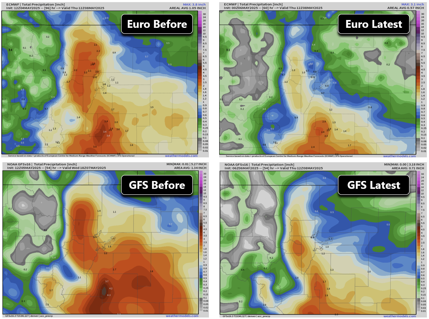
Forecasting this storm presented unique challenges—not only due to the sharp, uncertain rain-snow transition, but also because models significantly cut projected precipitation totals ahead of time. While we hesitated to fully trust this last-minute shift, we ultimately adjusted our forecast downward. In hindsight, the storm performed remarkably well, closely aligning with our original predictions.
Our snowfall forecast map issued Tuesday morning is shown below with storm totals overlaid. Green values indicate our forecast verified, Yellow values mean the observed total was just outside our forecast, while Red was a busted forecast (more than 1″ off). The southern Foothills saw particularly impressive snowfall, with totals exceeding a foot along the upper I-70 corridor as heavy snow persisted through Tuesday and into the night.
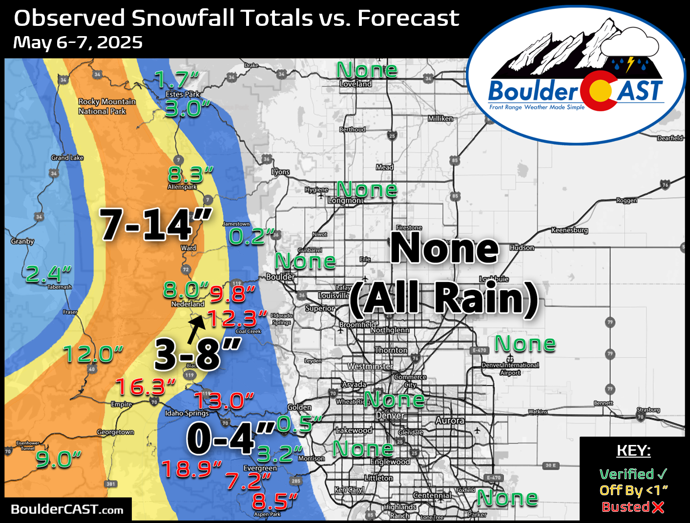
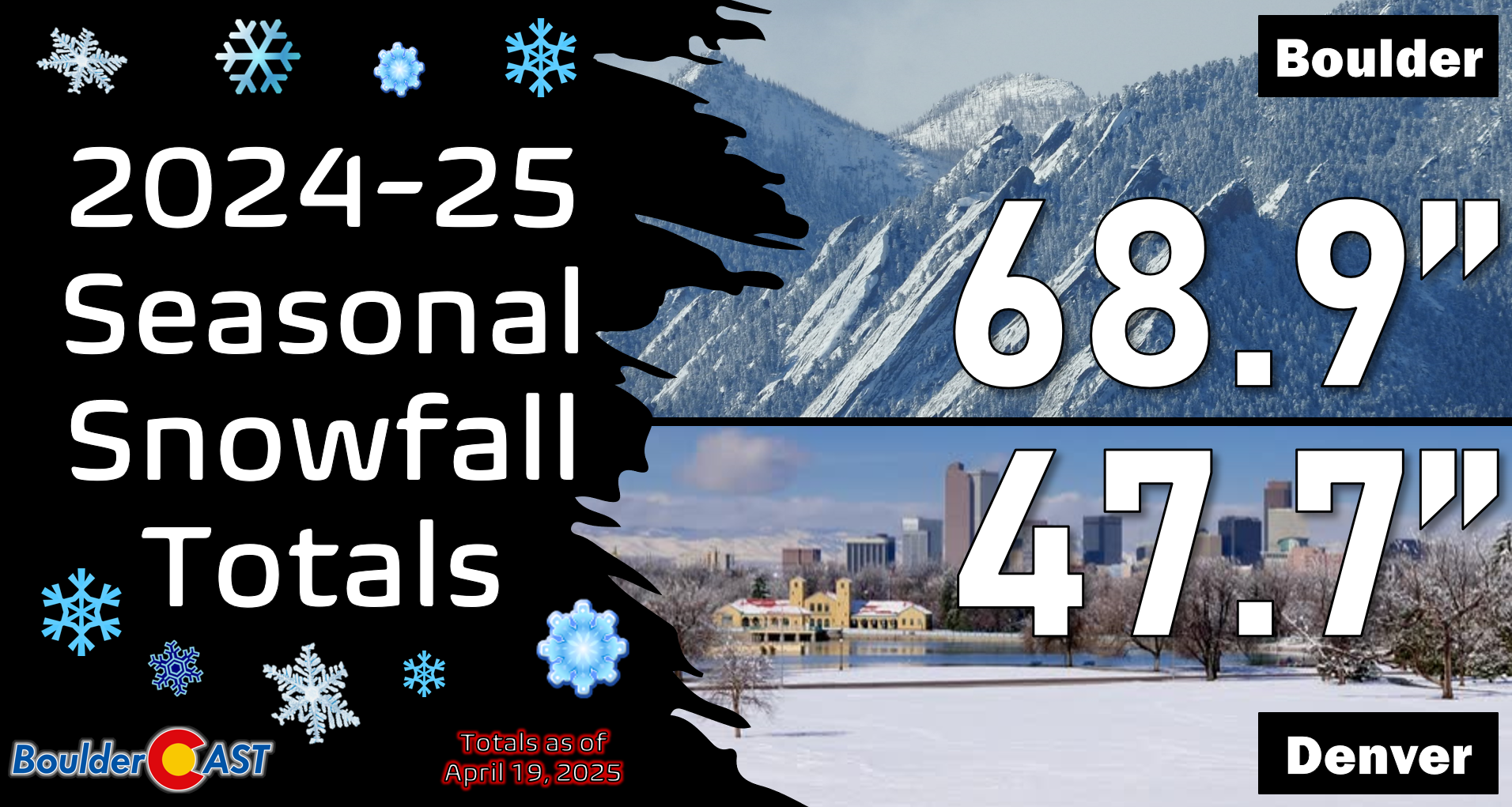
Officially, Boulder and Denver saw only rain from this soaking storm—no recorded snowfall. Seasonal totals for the two cities remain at 69 inches and 48 inches, respectively. You can find a recap of all the winter storms so far in the 2024-2025 snow season HERE.
The 48-hour precipitation totals, which include rain and melted snow, reveal a substantial moisture boost for the region. Nearly everyone received at least 0.75 inches of precipitation, with localized amounts exceeding 2 inches in the Foothills. This deluge of moisture will significantly reduce fire concerns for the remainder of the month.
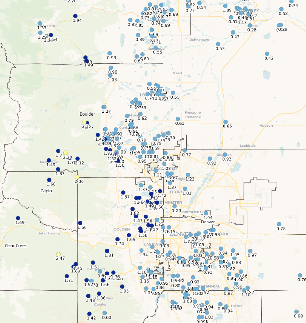
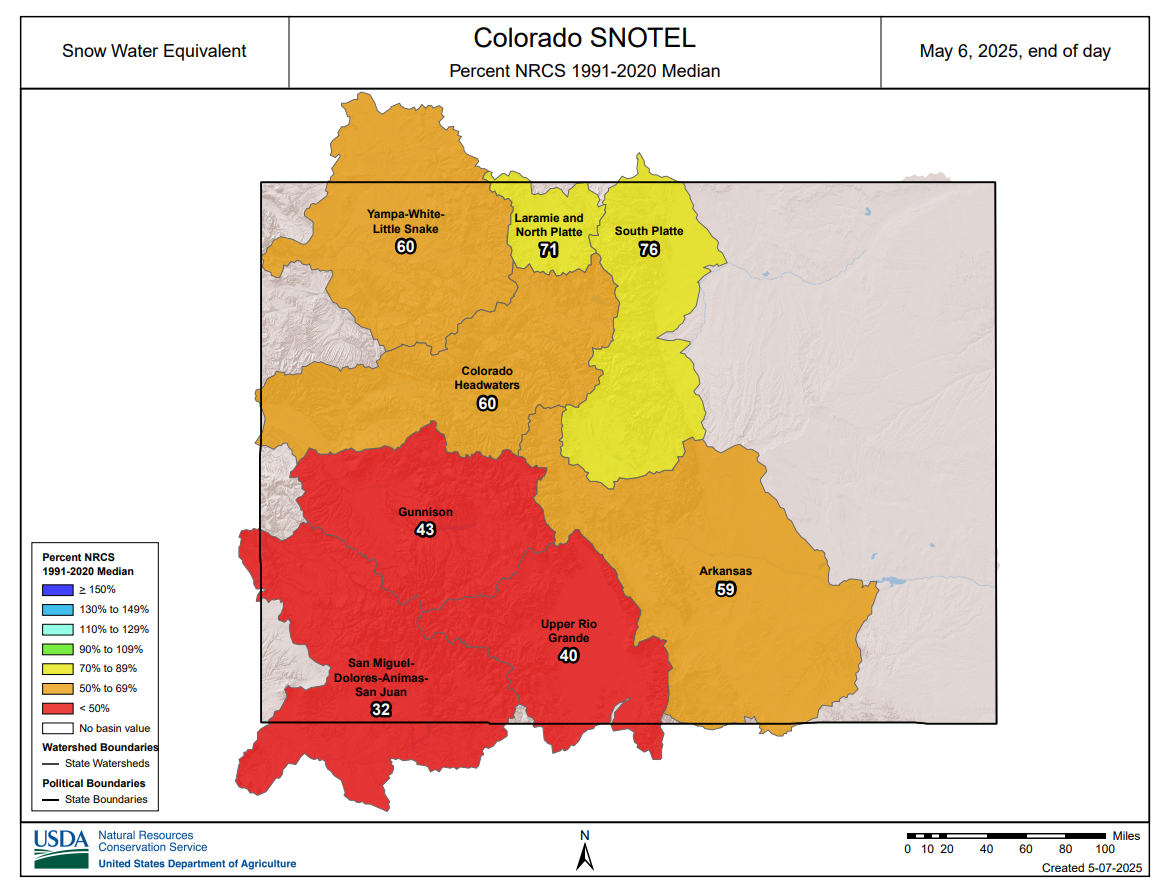
Meanwhile, the fresh layer of wet mountain snow should help replenish Colorado’s struggling snowpack, particularly in the South Platte and Arkansas basins, which saw the greatest impact from this storm’s upslope flow.
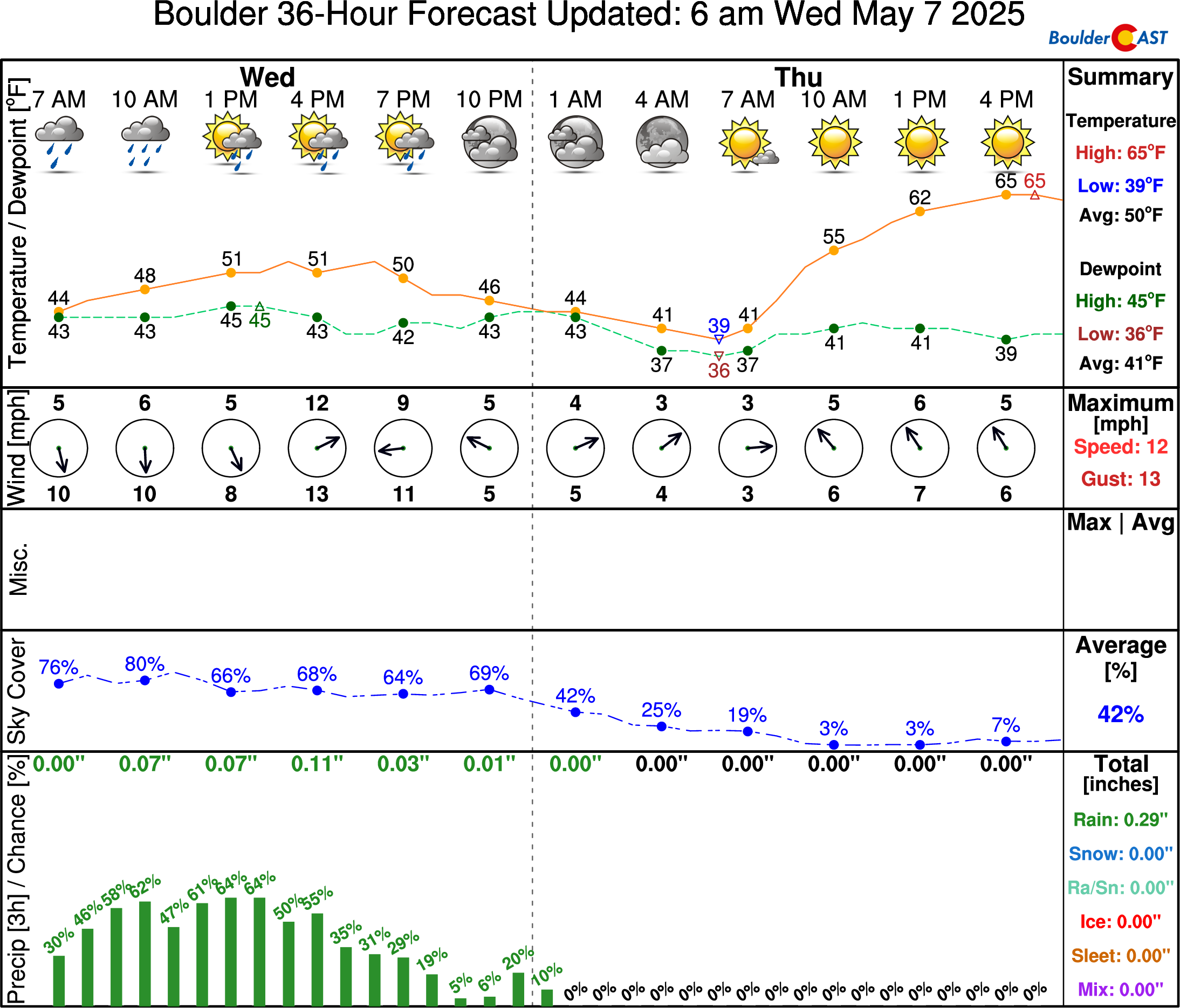
Chilly rain and thunder showers will linger through the day Wednesday, with another 0.25 to 0.5″ of rainfall possible through the day. We have good news though — drier, sunnier, and warmer weather is right around the corner!


You must be logged in to post a comment.