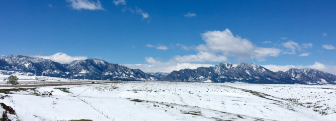
From 70’s to falling snow in only eight hours! That’s the weather that unfolded Monday afternoon into the overnight hours across the Front Range, with most of us waking up to a layer of wet snow Tuesday morning. Let’s take a look how we got here, review the storm totals, and take a peek ahead to the beautiful weather in the extended forecast.
A
strong cold front blew through Monday evening dropping temperatures from the 70’s into the 20’s in the matter of hours. Later in the overnight, widespread snow developed across the Denver Metro area. An intense band of lift and resulting deep clouds and snow can be seen in the GOES-East infrared satellite animation below from Tuesday morning. Notice the continuous band slowly sagging southward across the entire state of Colorado. This band produced pockets of moderate to heavy wet snow early Tuesday morning.
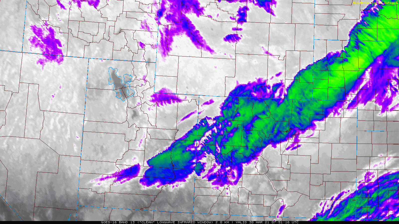
GOES-East infrared satellite animation from Tuesday morning (3/30/21)
Shown below is our snowfall forecast map issued Monday morning with actual storm totals overlaid in boxes. Green boxes indicate that our forecast verified to within one inch of the observed snowfall. Red did not. As expected, the heaviest of the snow was generally along and south of Interstate 70 with totals of 1-4″ widespread through much of Denver. Officially Boulder reported 0.6″ of snow and Denver reported 1.1″. This now makes 2021 the second snowiest March on record for Denver. The highest totals with this system of 3 to 5″ were observed in southern and southwestern portions of the Metro area.
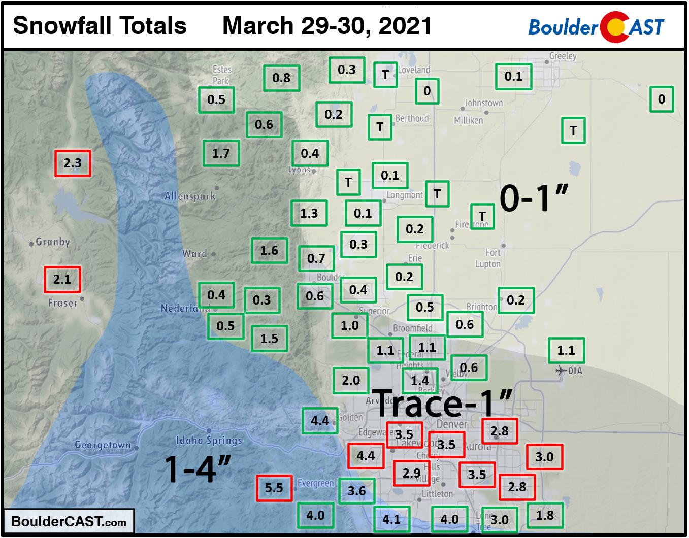
Our forecast didn’t verify that well at all for much of central and southern Denver. Model uncertainty was elevated leading up to this event with broad disagreement between the global and high-resolution models struggling to resolve the banded feature. Most notably, there were two lingering questions in our minds…
- Would downslope above the surface reduce the band’s potential impact in Denver/Boulder?
- How quickly would the band be moving through our area?
The forecast for less than 1″ was the most likely outcome in our opinion, but we did express our concerns on Twitter for low-end odds of booming snow amounts which ultimately did verify.
The snow potential late Monday night into Tuesday morning is still quite nebulous, with poor overall model agreement. Most likely scenario has 0-1" for the Denver area, but low-end odds for higher amounts. Best chance of accumulating snow tonight will be along/south of I-70 #COwx pic.twitter.com/BSJeg6YGCc
— BoulderCAST Weather (@BoulderCAST) March 29, 2021
Continue to 2020-2021 Winter Snow Summary
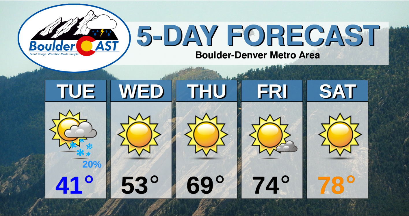
Any lingering snow will taper off from north to south across the Metro area through the morning Tuesday. The sun will be in and out the rest of the day with highs around 40 degrees.
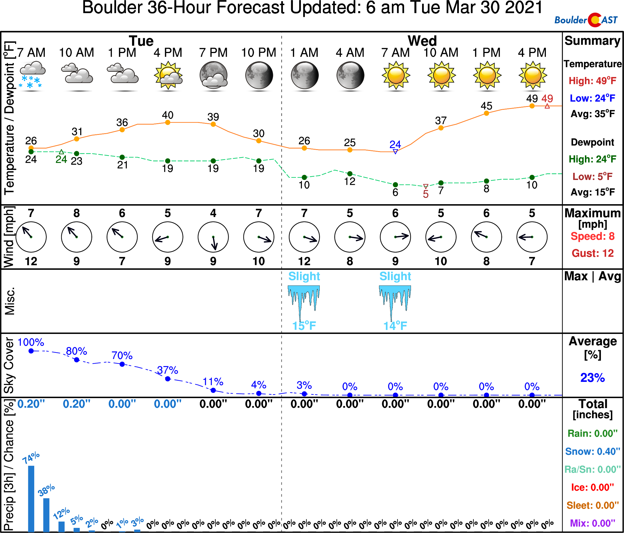
We’ll then warm back closer to normal for Wednesday (near 50). The rest of the week will be sunny with temperatures soaring into the 70’s and even near 80 degrees for the upcoming weekend. Our next chance of precipitation won’t be until sometime next week, and even then, chances are not looking great. We could conceivably be dry for the next 10 to 14 days under a developing and persistent ridge setup. This isn’t the type of pattern we want to see during our “wet” season, so hopefully it breaks down sooner rather than later. Enjoy the week ahead…it will be perfect for outdoor activities and yard work!
Share this forecast:


You must be logged in to post a comment.