
Temperatures are climbing to near-record levels into the low 80’s this afternoon. Would you believe that by this time tomorrow we’ll be 40 to 50 degrees colder with snowflakes flying? That is the situation at hand as a quick-moving storm system is set to clip eastern Colorado. Read on for details.
Tumbling temps…
Mid-level downslope and gusty but warm southerly winds at the surface are pushing temperatures east of the Continental Divide towards historic values this afternoon. The temperature to beat for the date is 80 degrees in Boulder and Denver. There is a good shot at both of these today!
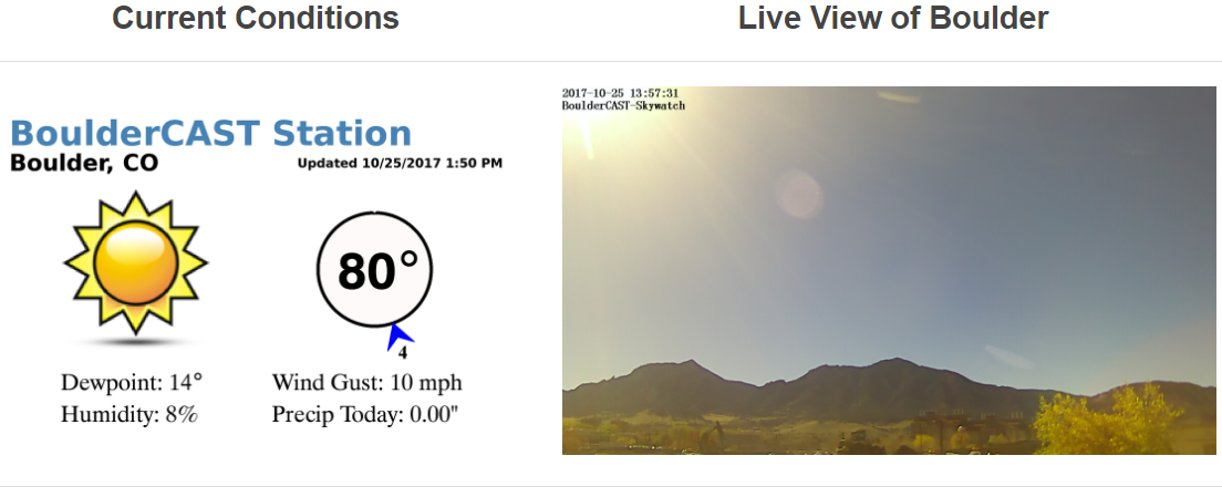
BoulderCAST Station current conditions at 2:00PM Wednesday
The annotated near-surface temperature map below shows the phenomenal warmth in the lee of the Rockies, pushing northward through Colorado and into eastern Wyoming. The cold front this afternoon is still located well north in Montana.

NAM 800mb temperature and wind forecast for Thursday at noon
However, this front will quickly slide south and be through Denver by mid-morning Thursday. Much colder air will be filtering in along with upslope, clouds, and precipitation by the lunch-hour. Our maximum temperature on Thursday will likely be in the 50’s and occur during the morning hours just before the frontal passage.
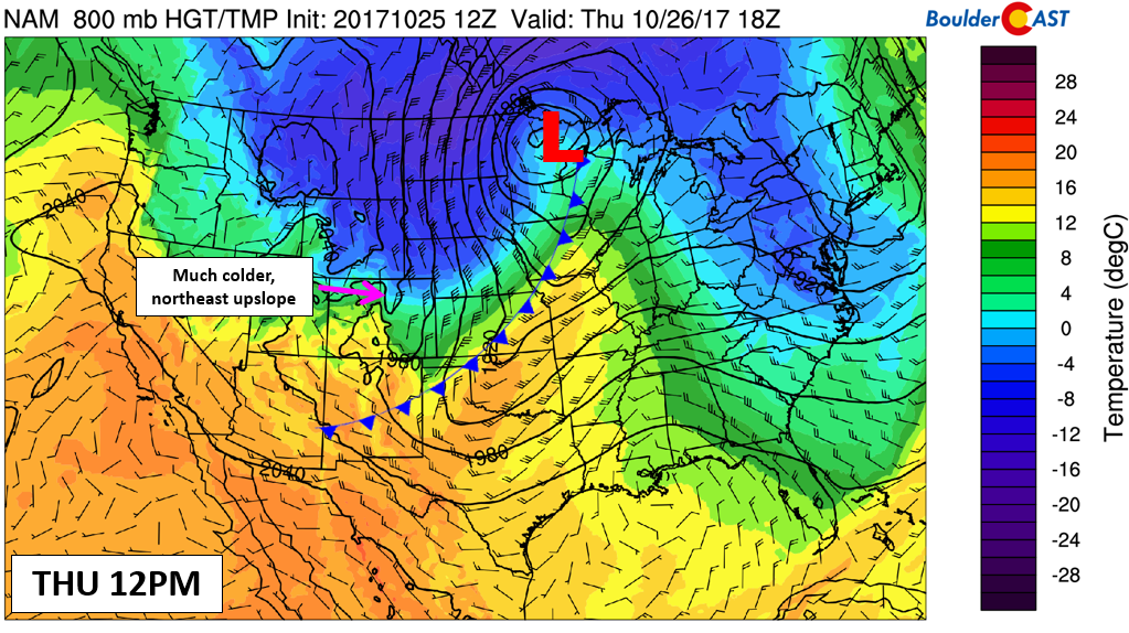
NAM 800mb temperature and wind forecast for Thursday at noon
Behind the front, temperatures will fall through the 40’s and into the 30’s by late afternoon across the Metro area.
Snowfall potential…
The general consensus from the weather models has been consistent the last two or three days with this system. We have reiterated this with our Premium subscribers the last few mornings. The storm will be quick-moving and only offer about 6 to 9 hours of precipitation potential for the region, beginning around noon on Thursday. In the Foothills above 6,500 feet, the forecast is pretty easy….1 to 4″ of snow by midnight Thursday night.
The challenging part of the forecast will be the temperature profile over Denver and Boulder during the short-lived precipitation event. The storm is moving so rapidly that there may not be enough time for the lower atmosphere to cool to support snowfall. Precipitation will likely begin as rain across the Plains, then mix with snow during the afternoon in most locations. The graphic below of NAM model-derived snow-level shows elevations dropping from around 7,000 feet at noon on Thursday to near 5,000 feet by 6:00 PM.
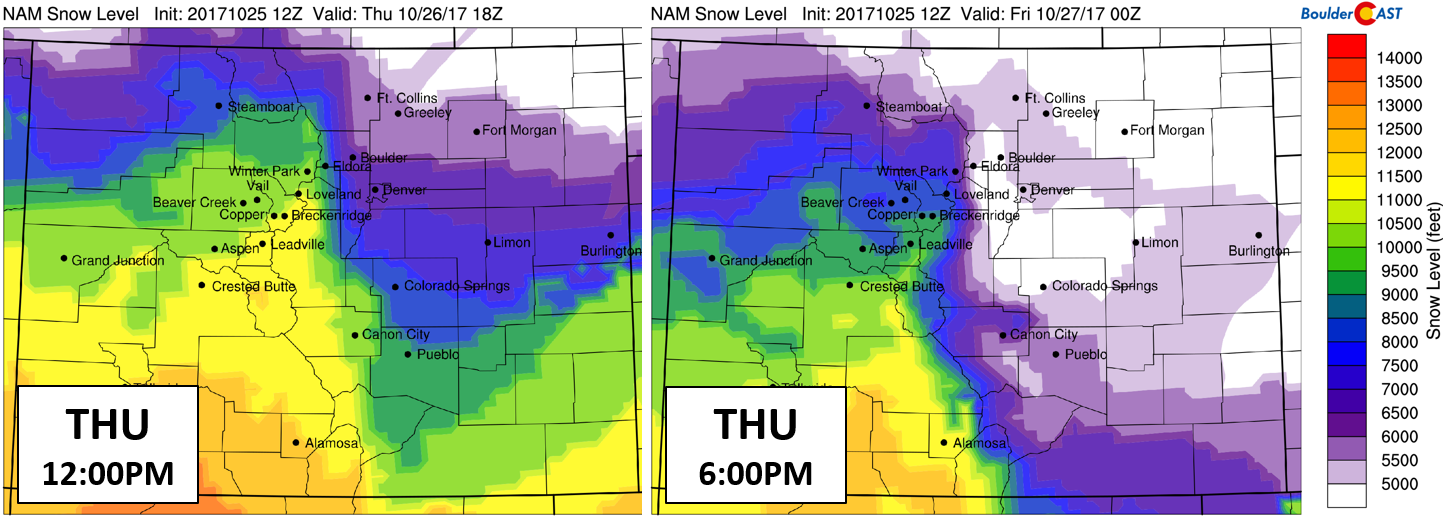
NAM model-derived snow level forecast for Thursday at 12PM (left) and 6PM (right)
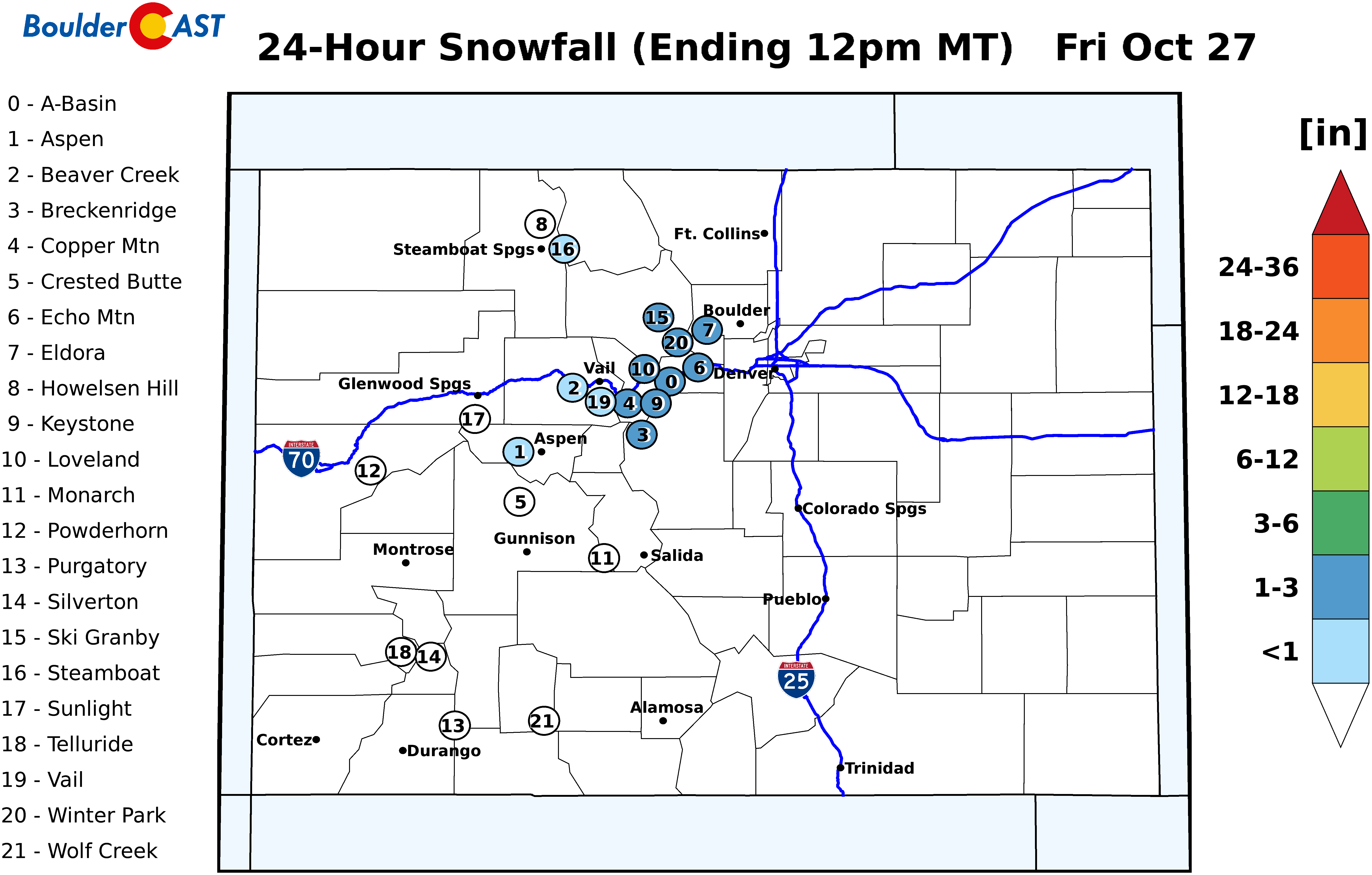
Because of this timing, we believe most snow that falls across the Plains will be light, mixed with rain, and not accumulate much, especially considering the elevated ground temperatures from today’s record warmth. We’re expecting just a trace of snow for most of the Metro area (no accumulation), but some locations, especially closer to the base of the Foothills (Boulder, Golden, Lakewood) could see up to 1/2″ or so.
Our official snowfall forecast map for the region is below:

The ski resorts won’t benefit much from this storm. It’s too quick moving and keeps almost all of the action east of the Divide.
After the storm, calm and cool weather will take us right through the upcoming weekend, with 40’s on Friday, 50’s on Saturday and 60’s on Sunday. Our attention then turns to another potential snow event on Halloween. This one is still quite a ways out, so we’ll only tease it for now…
Have a good rest of the week!
Share this forecast:
.


You must be logged in to post a comment.