Yet another spring storm is eyeing northeast Colorado, poised to bring an extended period of rain and snow to the region Thursday afternoon into Saturday. The Foothills are set for another dumping of powder, but questions remain as to how much snow the Plains will be able to squeeze out.
We first alerted you to the potential of a wet and snowy end to the week on Monday. The models were in a disagreement back then, and it was still four days out, so we painted the picture with a broad brush. Models have since zeroed in on a (mostly) common solution, one which will bring significant snow to the Foothills, and another sizable chunk of precipitation to the Plains. The big question mark is how much will be rain and how much will be snow…
The set-up
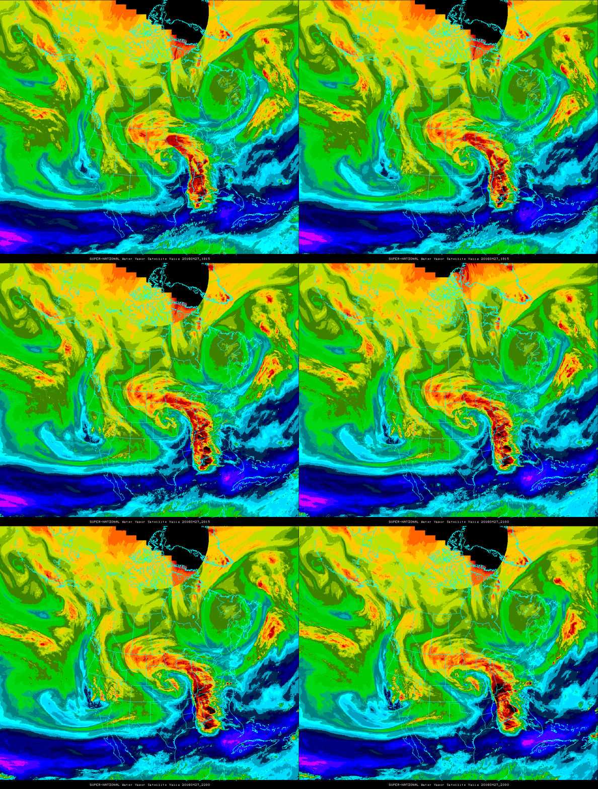
The southern storm track has guided the system ashore this evening in California. Notice the spin over Northern California above in the water vapor satellite loop.
The system will move into the vicinity of the Four Corners by Thursday night (shown below), then across southern Colorado Friday during the day, then into northwest Kansas by Friday night. Does this approach seem familiar? It should. The storm that accumulated 18″ in Boulder ten days ago began on a similar path.
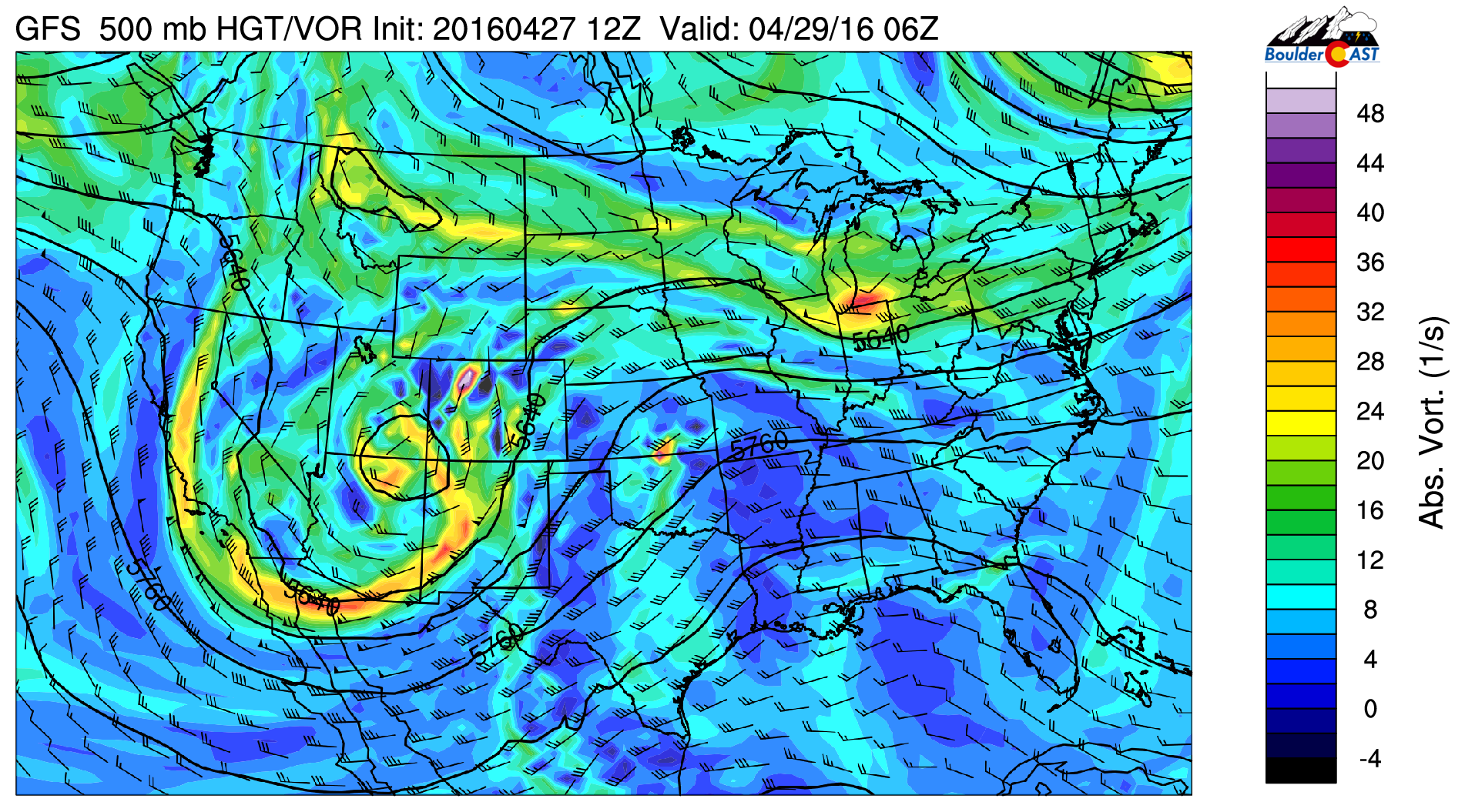
GFS 500 mb vorticity map for Thursday night showing the location of the low over the Four Corners region
The storm will take it’s time moving across our state, which will lead to a prolonged period of upslope and precipitation. The Foothills are definitely in store for significant snow, but as is usually the case with these springtime storms, snow accumulation on the Plains is a big wildcard right now.
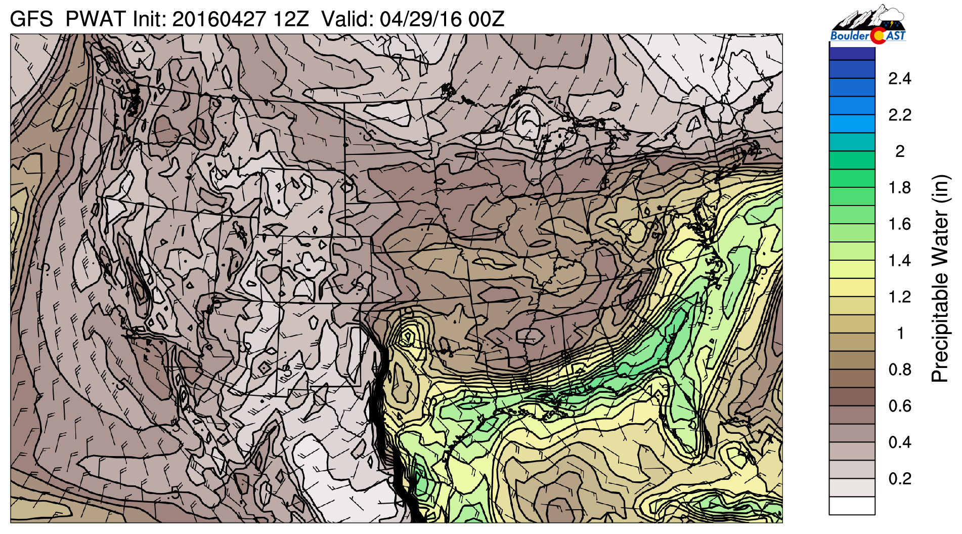
With the persistent trough in place for many days now, background moisture levels are already relatively high across the Front Range. As the system approaches, low-level southeasterly flow will feed even more Gulf of Mexico moisture into the region by Thursday afternoon. This is shown nicely in the precipitable water map below.
Moisture levels spike Friday during the height of the storm, but are not “off the charts”, so to speak, at any point.
Some uncertainties remain…
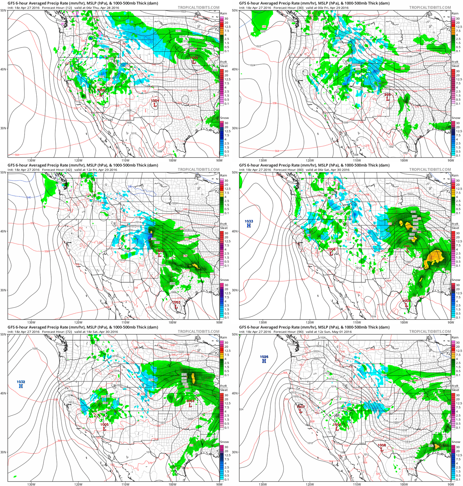
The track of the system is relatively consistent between the models at this point. It’s the intensity and overall outcome that is a little more ambiguous. The GFS model produces copious amounts of precipitation, generally 1.5 – 3.0″ of liquid across the region (and has been for days). It is by far the wettest model right now. The NAM, Canadian and Euro generate about half that amount. Still a large dumping, but not as extraordinary as the storm ten days ago.
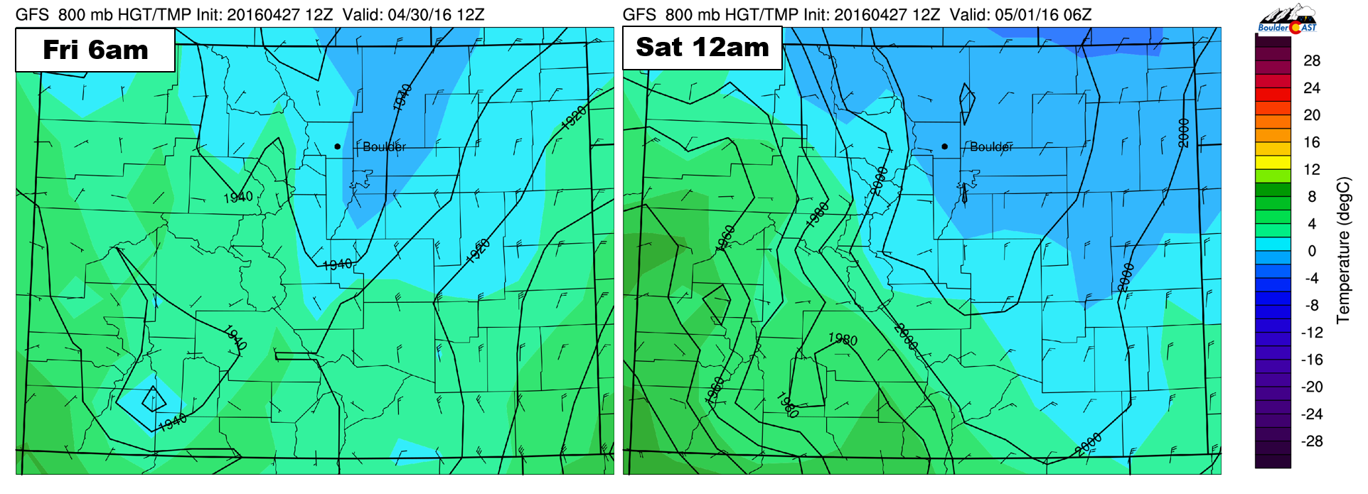
There are also differences in strength and duration of the upslope, which plays into when the heaviest precipitation might fall and when it would begin to taper off. This timing is especially important for the lower elevation dwellers hoping for snow. The atmospheric temperature profile is marginal for snow down low. The best chances for that rain changing over to the white stuff would be late Thursday night and then again Friday evening/night.
Below shows the 800 mb temperature forecasts for Friday morning (left) and Friday night (right). We generally like to see below freezing temperatures for accumulating snow on the Plains. Friday morning is marginal; Friday night is more probable for snow (if precipitation can persist until then).
The NAM, for instance, has a wave of precip Thursday night, some drying on Friday, then has wrap-around precipitation pushing back into the area Friday night (which would have higher odds of being heavy snow for the Plains). The GFS has heavy precipitation across the region from late Thursday evening all the way into Friday evening, then tapering off. Two vastly different solutions. The NAM, despite lower precipitation totals, produces more snow, while the GFS largely slams the region with rain Thursday night and during the day Friday.
It goes without saying that exactly how things evolve will play into snow totals for everyone.
Preliminary snow amounts by Saturday morning:
As the trough approaches Thursday morning, snow will begin in the Foothills. With a fair amount of cold air in place, snow levels will begin fairly low, around 7,000 feet. Precipitation will spread onto the Plains by late morning in the form of a rain/snow, with snow levels dropping. We’ll likely see at least patches of snow on the Plains Thursday night, probably changing back to rain Friday during the day, with some snow returning again Friday night.
Highs Thursday will be near 40 degrees, with upper 30’s during the day Friday, and overnight temperatures in the low to mid 30’s. Rain/snow will decrease in coverage and intensity Friday night. We won’t escape the dreary, unsettled weather until the middle of next week, though, if we’re lucky!
Foothills: With adequate cold air in place and the near guarantee of ~1 .0-1.5+” of precipitation, snow totals will easily reach 10-20″ above 7,000 feet. In the lower Foothills (6 to 7,000 feet), 5-12″ is more probable, mostly due to melting early on and lower snow to liquid ratios.
Plains: A lot of questions remain, which will hopefully get ironed out tomorrow. For now, we’ll simply say that the Plains likely won’t exceed 6″, but should see something. The best chance of accumulating snow will be in the areas closer to the Foothills (western and southern Denver suburbs, including Boulder) during the overnight hours. Some locations, especially north and east of Denver, may not see any snow stick at all.
In the unlikely event that the other models sway towards the wetter GFS solution tomorrow, totals would jump significantly. Regardless of what eventually transpires, snow on the Plains won’t be overly impactful this late in the season. It will have a difficult time sticking to roads (except across the higher elevations at night). With totals less than 6″, power outages and downed trees are of minimal concern.
We’ll look to the models for better answers Thursday morning and post our final snow map during the afternoon. It’s going to be a busy next few days. Stay tuned!



You must be logged in to post a comment.