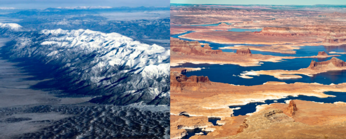
Winter may be on the calendar, but it certainly hasn’t been in the air this year. As the West stumbles through one of its warmest, most lopsided cold seasons on record, the signs of a deeper shift are becoming impossible to ignore. From record‑breaking heat along the Front Range to a snowpack crisis unfolding across the entire West, this “winter” has rewritten the rules — and the ripple effects are only beginning to surface. We break down what happened this year, why it matters, and what this complete failure of a winter means for the months ahead.

Page 3 of 556


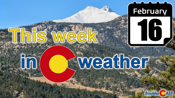
As we roll into the new week, Colorado is staring down a remarkably busy stretch of weather — the kind that keeps both meteorologists and emergency managers on their toes. From dangerous fire conditions on the Plains to a multi‑day snow dump in the Mountains, the state is set to experience just about every flavor of February weather. A powerful longwave trough will anchor itself over the West through the week, sending repeated waves of wind, moisture, and cold our way. The result will be critical fire danger, high winds, heavy snow, and a late‑week cooldown. Let’s take a closer look at what’s coming and why this week could be one of the more impactful ones Colorado has seen so far this “winter” season.


Live View of Boulder

Current Conditions

Live Radar

Recent Premium Posts

Storm Update – Fri 03/06/25 8:00 AM | Wet snow totals nudged a tad across the board, but impacts remain relatively unchanged
❄️ Sloppy Snowstorm Looking Good: Stronger, slower system is now expected to deliver …
BoulderCAST Daily – Wed 03/04/26 | A pair of gorgeous days preceding a cold & snowy Friday
🌧️ Yesterday’s storm shifted south, dropping 0.4–1.0″ of rain in the Springs/Pueblo while …
BoulderCAST Daily – Tue 03/03/26 | Storm #1 spreads rain in today, while Storm #2 remains on-track to produce snow later this week
🌧️ First shortwave of the week arrives today with rain for the lower …
3-Day Forecast

Trending Content

© 2026 Front Range Weather, LLC