Happy Friday! It sure is gorgeous out there today. Change is coming however as the weather pattern is set to shift just in time for Halloween and the end of the month. We discuss the latest forecast surrounding the much cooler and gloomier weather about to settle into northeast Colorado…and yes, it will offer another chance for Front Range cities to pick up their first snow of the season!
At a Glance:
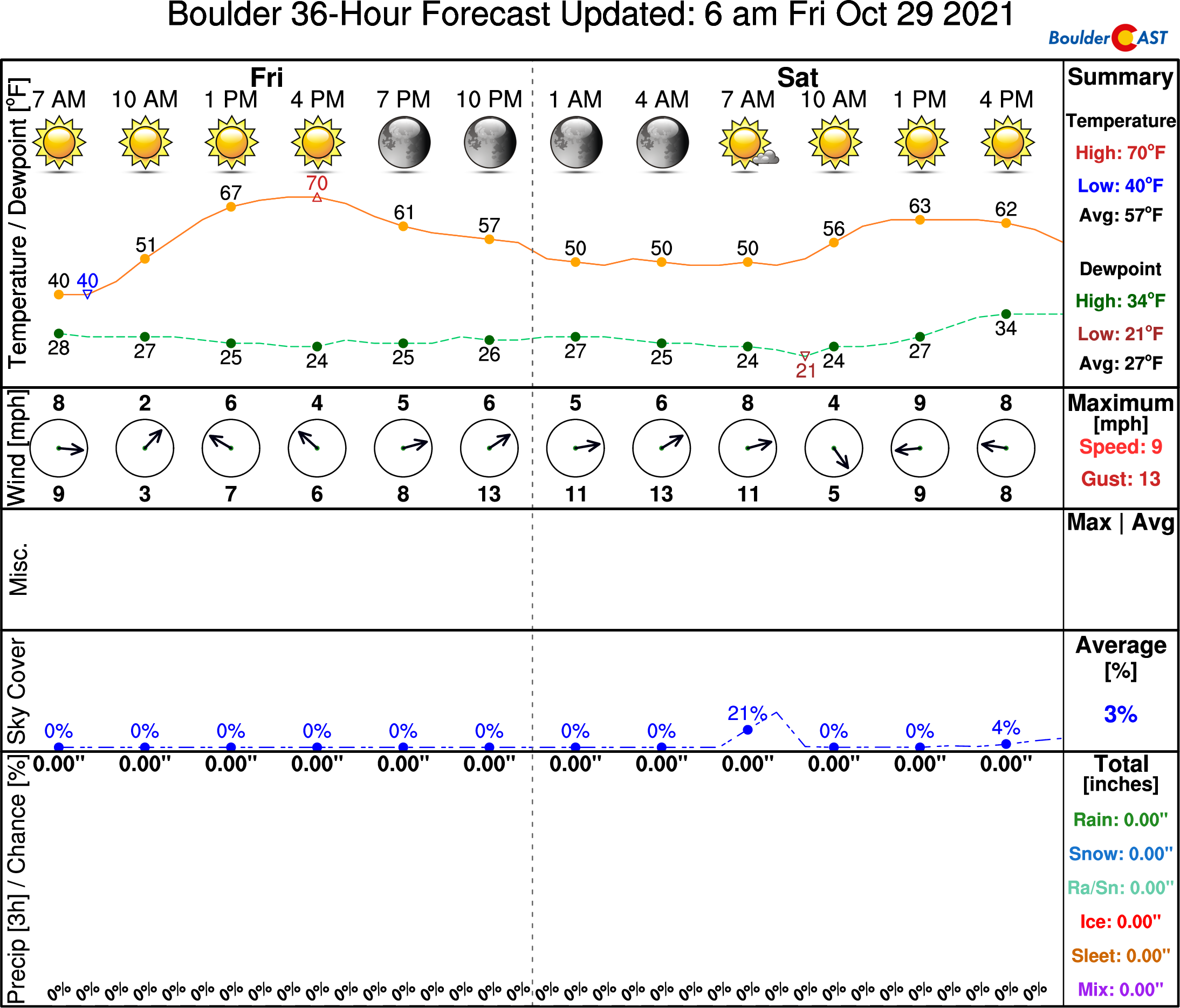
- High pressure keeps relative warmth and sunshine in place through Saturday
- Boulder and Denver’s first snow is already running two weeks later than normal
- A series of cold fronts will bring much colder temperatures, clouds, and spotty precipitation to the Front Range Sunday and beyond
- Rain, drizzle, freezing drizzle and snow are all possible in the evolving forecast
- Specifics are not known yet, but the unsettled pattern will stick around into the middle of next week
We discuss Boulder and Denver weather every single day on BoulderCAST Premium. Sign up today to get access to our daily forecast discussions every morning, complete six-day skiing and hiking forecasts powered by machine learning, access to all our Front Range specific weather models, additional storm updates and much more!
W
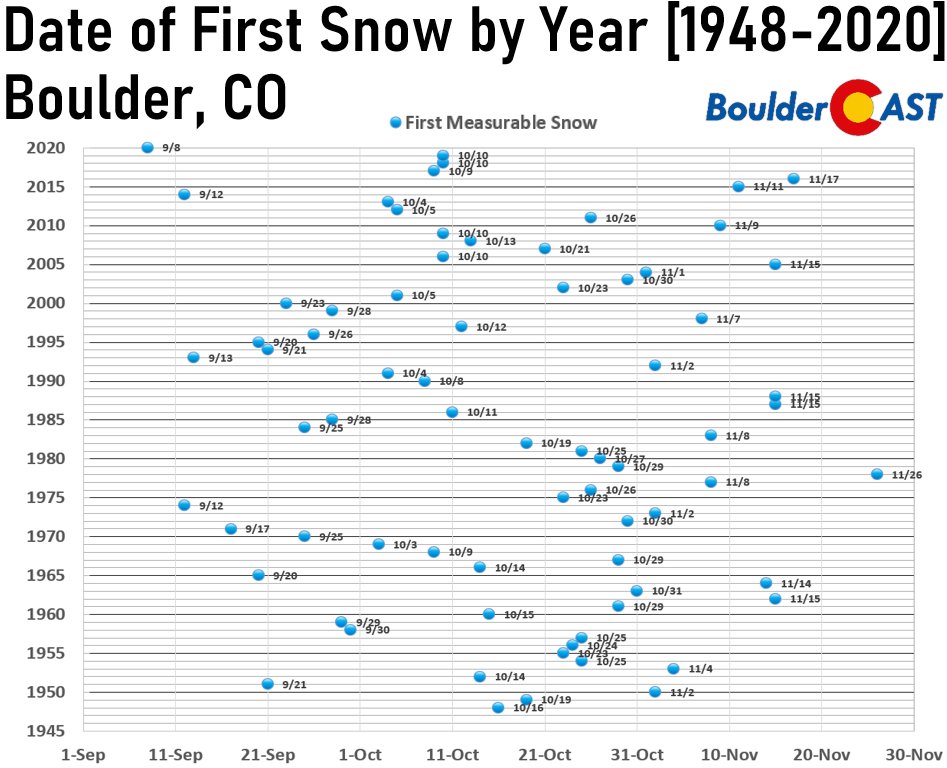
hile many Boulderites picked up a dusting of frozen precipitation (mainly graupel) a few weeks back, both Denver and Boulder are still officially awaiting that elusive first snowfall of the 2021-22 season! The median date of the inaugural snow in the city of Boulder is October 17th, so things are already running about two weeks late right now. We haven’t had a snowfall this delayed since 2016 as the last four years have delivered the snowy goods sooner than normal. The earliest snowfall on record for the city was last year on September 8th, while the latest in years past has been November 26 of 1978.
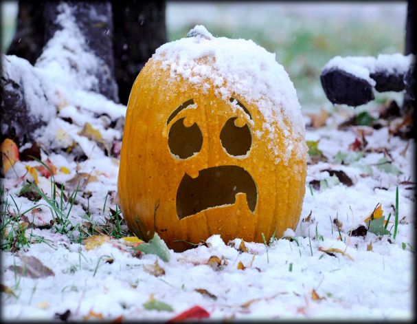
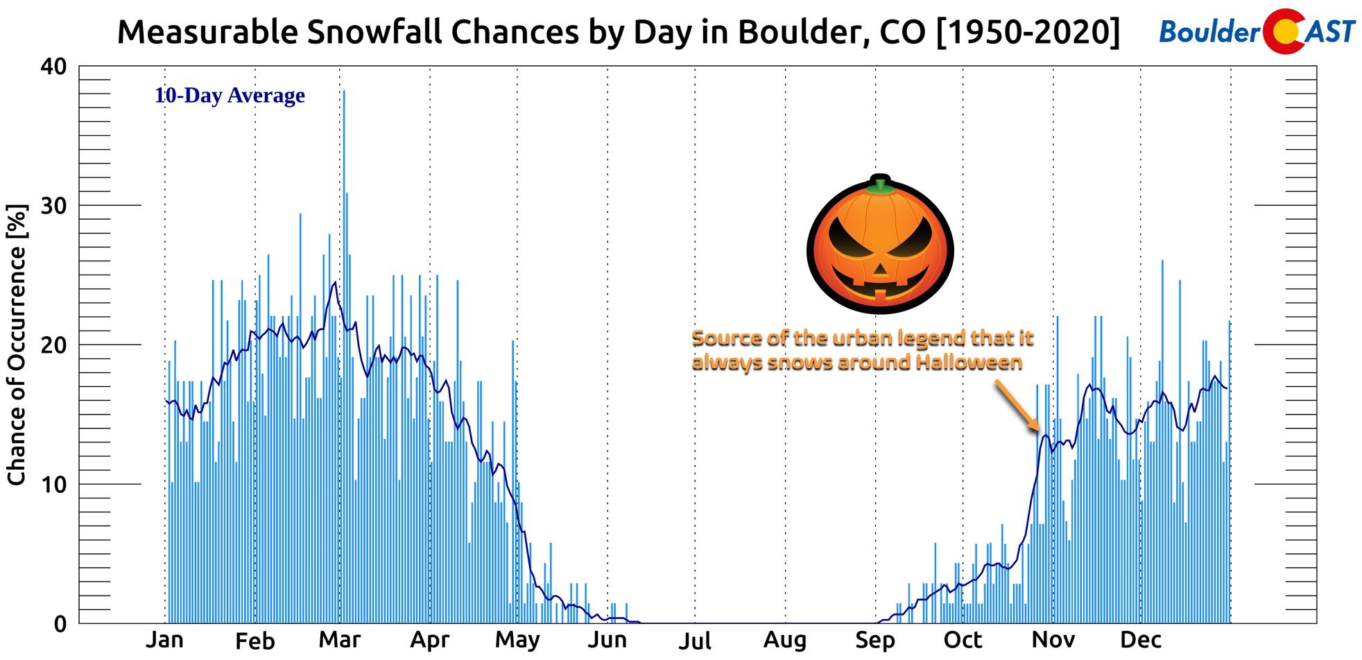
You’ve probably heard the “urban legend” that it ALWAYS snows around Halloween in Boulder and Denver? While critically far from the truth, there is a notable uptick for accumulating snow chances in the days leading up to Halloween, at least compared to the sporadic nature of snow events in the six weeks prior. We’re definitely overdue for snow at this point, and the upcoming week could finally deliver!
A prominent ridge of high pressure is in place across the Rockies bringing sunny and warm weather to the Front Range for this Friday and that will stick around for a portion of Saturday as well. However, a strong storm system is about to drop out of Canada into the northern tier of the country. Models continue to advertise that we will evade the brunt of this wintry system as a major cut-off low is forecast to develop in eastern Canada by Sunday night.
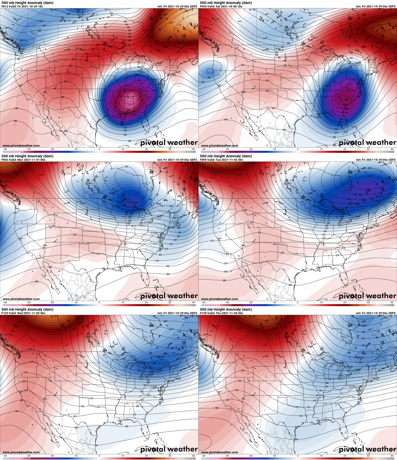
GFS ensemble mean 500mb height anomaly forecast animation spanning Friday through Wednesday Nov 3rd.
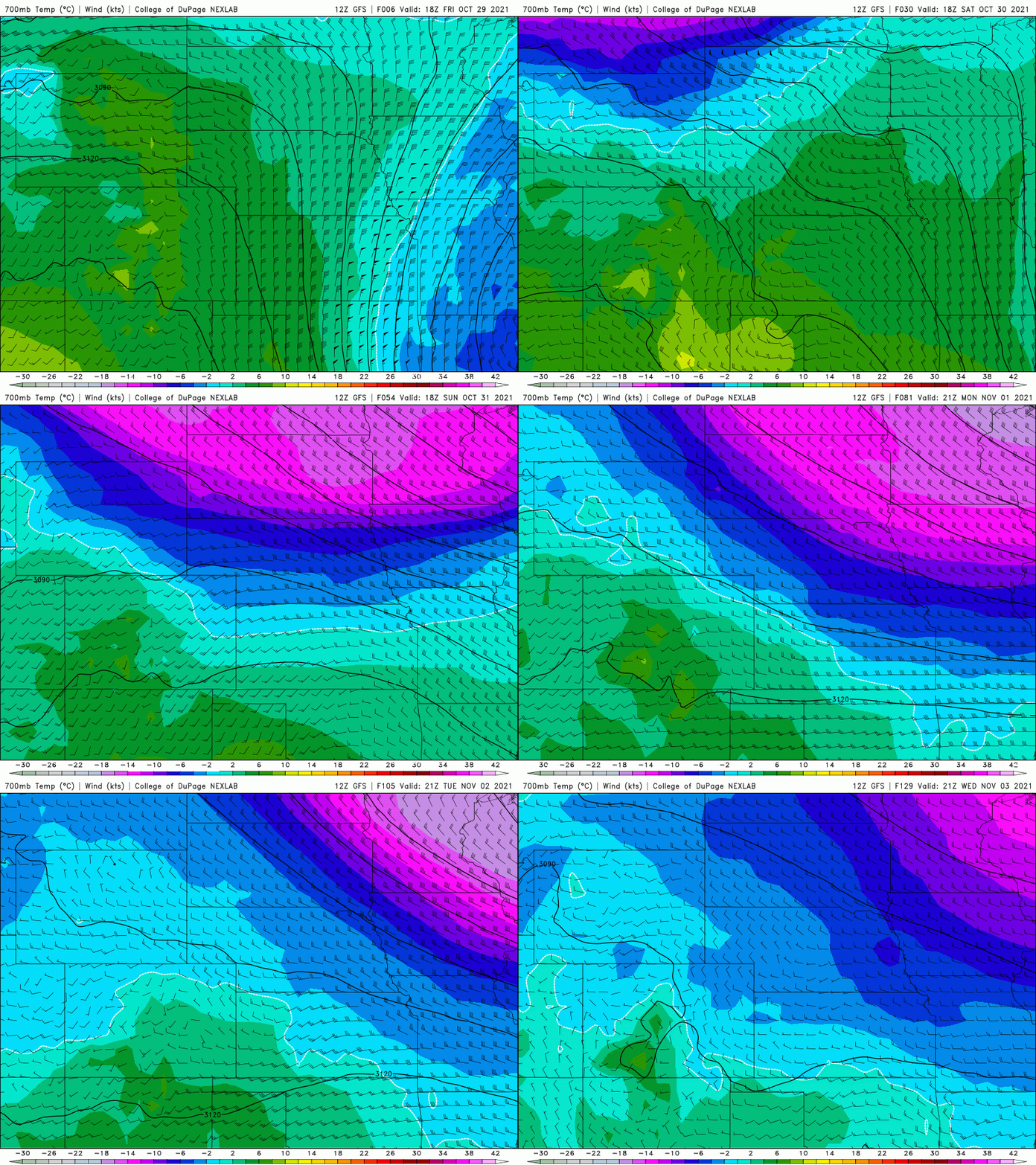
Most of the energy with this passing wave will remain north of our area, but the influence of the massive low in Canada will still bring a trailing cold front our way. This chilly airmass will need to be closely monitored in the coming days as it drops into northeast Colorado from Wyoming and holds on for a few days. This airmass isn’t technically Arctic in origin, but it will be a big change for us and the shallow nature of the cold wedge will make for a tricky forecast nonetheless.
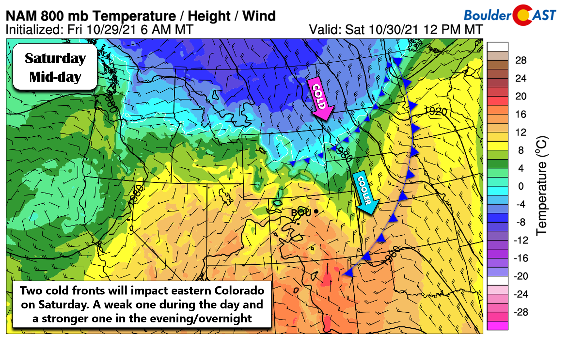
The initial wave of cooler air will arrive during the daytime Saturday with highs falling back into the 60’s. Still not bad for late October but do be aware of the changes knocking on the door! A stronger cold front will work in Saturday evening and night with shallow and chilly upslope developing across northeast Colorado.
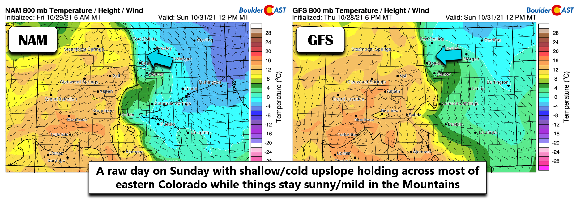
The upslope flow will remain locked across the area during the day Sunday and likely through Monday as well. Here’s a near-surface wind and temperature forecast from two models for mid-day Sunday. Yikes. While there is some slight differences, it’s clear that the cold airmass will be locked in with upslope banked up against the Foothills. This will spell out a gloomy day with overcast skies, low clouds, and possibly light drizzle for the Denver Metro area. Highs in the upper 30’s to middle 40’s will be the story.
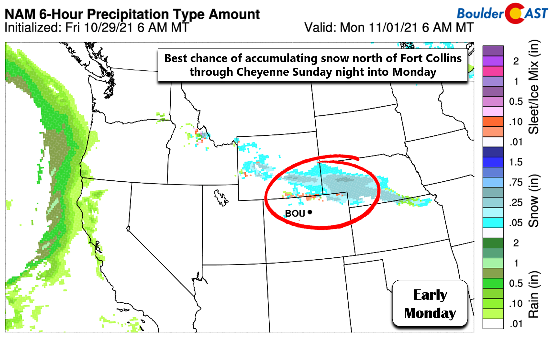
The coldest air and best upslope are currently slated to stay along the Wyoming border region. Those areas could see some accumulating snow. Based on the latest model forecasts, the predominant precipitation type from Boulder southward would be drizzle or freezing drizzle…
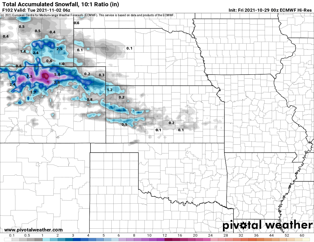
However, there are some models indicating snowfall for portions of the northern Front Range as well. For example, the Euro model actually produces a gnarly band of snow from Boulder to Fort Collins Sunday evening into Monday evening. This is an outlier though.
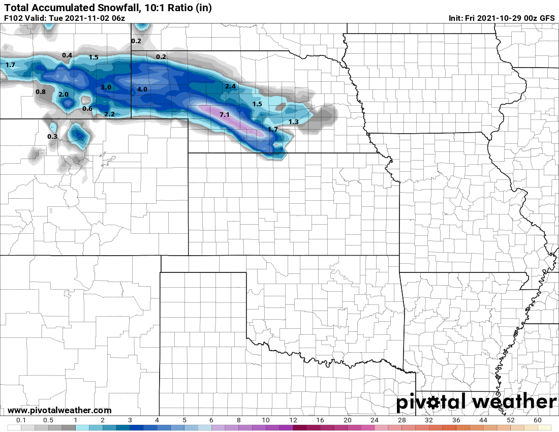
The GFS, and most model guidance, has no flakes for those same areas.
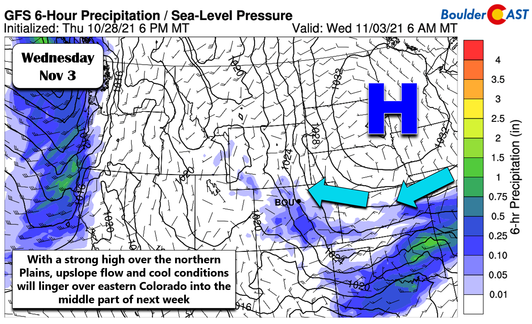
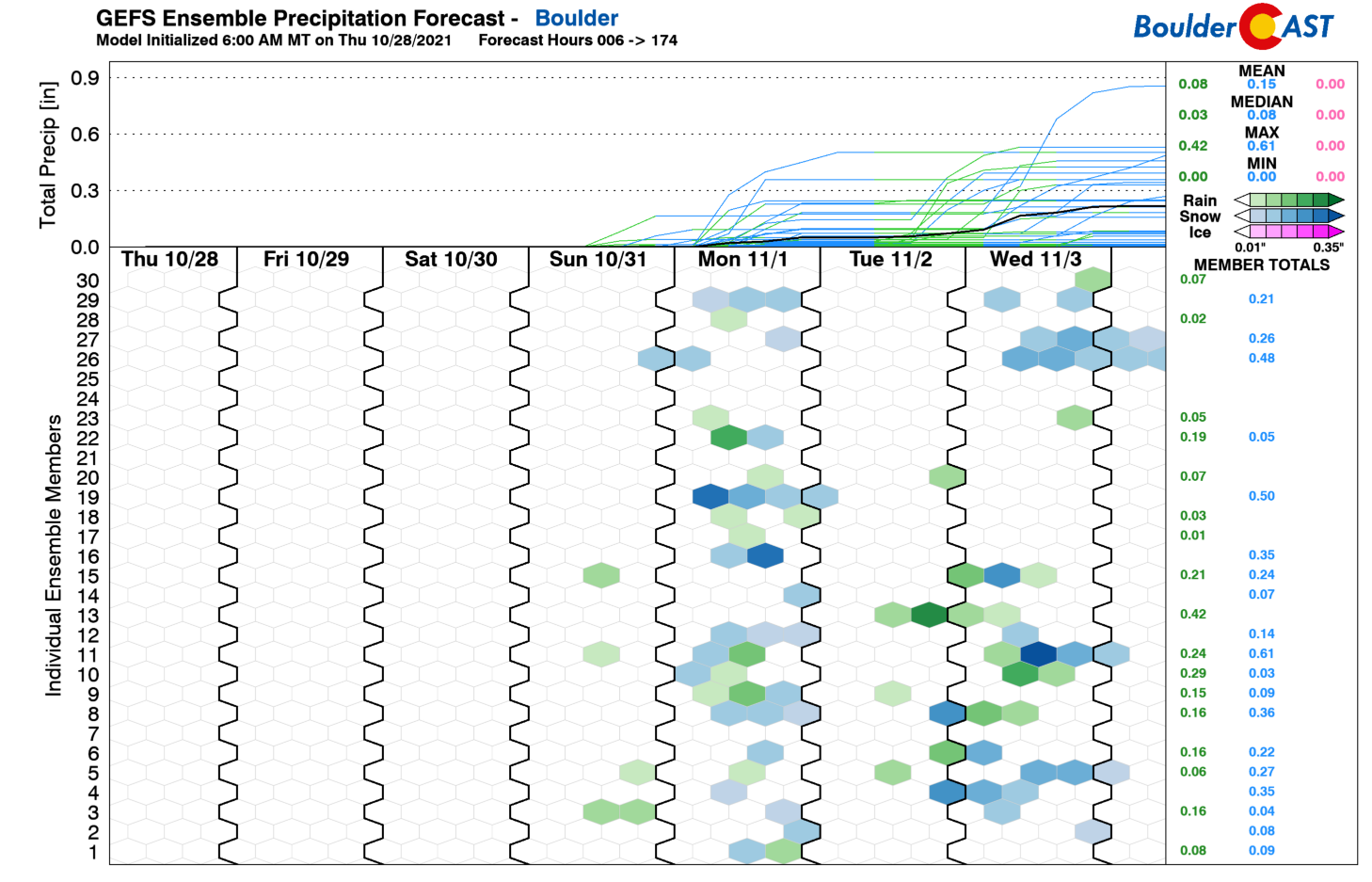
We can’t stress enough that the forecast Monday and beyond is uncertain at this time. It’s clear that a large dome of high pressure will be positioned over the north-central part of the country — there is excellent model agreement for this general pattern. Clockwise flow around this high will keep cool easterly upslope locked in over northeast Colorado into the middle part of next week. The forecast will ultimately depend on what type of small upper-level features will be moving across Colorado during this time. It seems likely that there will be at least one disturbance capable of producing a burst of rain/snow for our area during this period. The timing and any potential snow amounts next week are still lost in the fray for now.
One thing is for sure, cool and unsettled weather takes hold late Saturday and sticks around into next week with another chance for Boulder and Denver to pick up their first snow of the season. Any snow amounts should be on the light side however.
Enjoy Friday and Saturday’s sunshine and relative warmth…those conditions have a rapidly approaching expiration date.
Help support our team of Front Range weather bloggers by joining BoulderCAST Premium. We talk Boulder and Denver weather every single day. Sign up now to get access to our daily forecast discussions each morning, complete six-day skiing and hiking forecasts powered by machine learning, first-class access to all our Colorado-centric high-resolution weather graphics, bonus storm updates and much more! Or not, we just appreciate your readership!
.
Enjoy our content? Give it a share!
.




You must be logged in to post a comment.