
This Live Blog has concluded.
Thanks for jumping in! The Live Blog will remain active into Thursday morning. Due to server constraints, you must manually refresh the page to get updates to this page. Newer posts will be at the top. Feel free to post in comments down at the bottom of the page.
———————————–
12:30 PM
Storm totals are 13″ in Boulder and 4″ in Denver.
That’s a wrap. Check out our recap post later today.
———————————–
8:30 AM
It’s quite chilly out there! The temperature at BoulderCAST Station has been bouncing between 3 and 4 degrees since midnight:
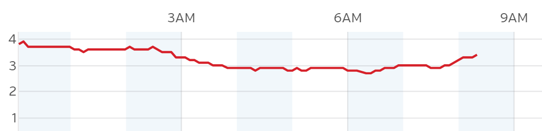
Time series of temperature at BoulderCAST Station on the morning of January 5, 2016.
There won’t be much of a warm up today as clouds and snow will prevent this Arctic airmass from warming. Look for highs in the 4 to 7 degree range across the Plains, and -4 to 0 degrees in the Foothills.
———————————–
8:00 AM
Current view from the snowy BoulderCAST Livecam…
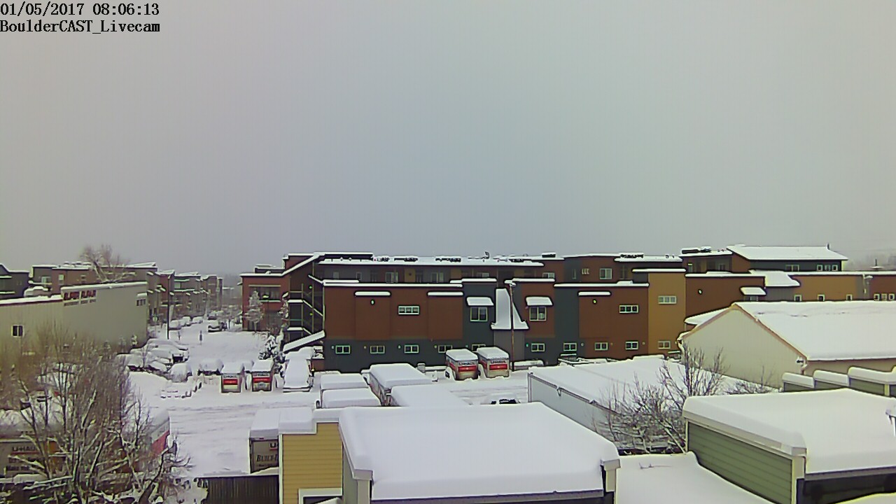
More regional webcams can be found HERE.
———————————–
7:30 AM
Quick update on the storm totals so far. Many of you may have thought the storm to be a bust with the delayed start (in spots). However, overnight snow was fairly widespread and intense.
Looking around the region, current totals in Boulder range from 9 to 13″, to 14 to 24″ in the Foothills of Boulder County, with 4 to 8″ in Denver. So most areas will have landed within our forecast ranges, albeit probably towards the low-end, especially considering the potential for another inch or two still to fall. We’ll know more once more reports start coming in.
Look for our storm recap post later today…
———————————–
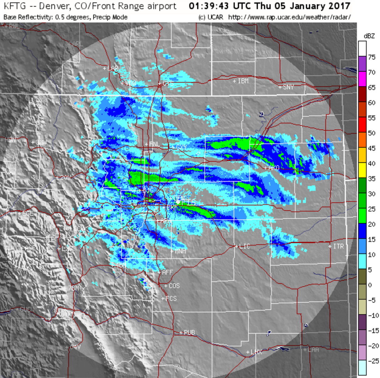
7:15 AM
Good morning! Light snow continues to fall in the region, with some heavier snow towards the Springs. The current radar image is shown below:
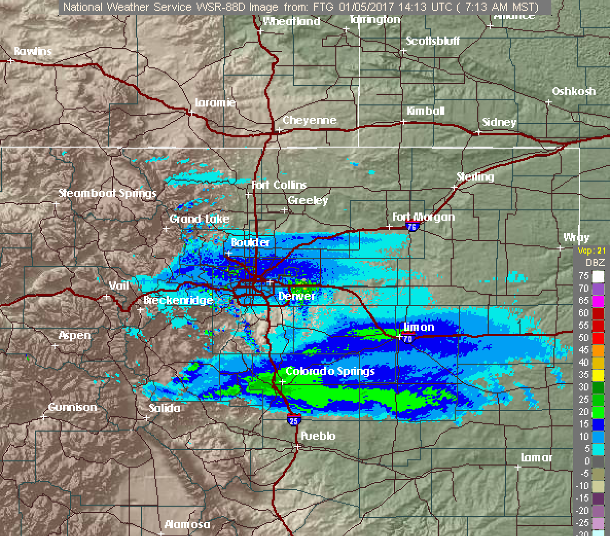
Snow will continue to decrease in coverage and intensity this morning. Though, some indication says very light snow will continue in and near the Foothills through much of the day. 1 to 2″ of additional accumulation through the day may be possible (especially southwest Denver suburbs).
———————————–
12:45 AM
One final update for the night. Heavy snow is falling in Boulder now at at rate near 1″ per hour most likely. Who knows how long it will last. We’re starting to see the shield of precipitation move southward. The northern edge is right along the Wyoming border currently.
Tomorrow will see snow taper off mid to late morning in most spots, then overcast skies the rest of the day. Highs will be in the single digits in most places. Sunshine returns Friday with slightly (emphasis on slightly) warmer temperatures. Just something to look forward to if you hate snow. Enjoy!
———————————–
11:45 PM
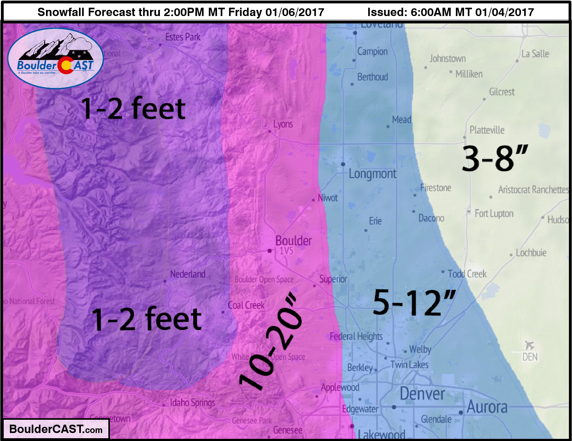
5 to 7″ has fallen in Boulder so far. However, areas near and south on Interstate 70 have hardly seen any snow yet! The system will sag southward through the night. It looks to be heaviest between midnight and 4AM for the Boulder area. Still expecting treacherous travel everywhere by tomorrow morning.
We haven’t really seen the big fluffy flakes out there yet. Snow to liquid ratios are probably closer to 15:1, which may cut into totals for the region. However, there is still many hours of snow ahead of us. Boulder shouldn’t have trouble getting to 10″ (at least).
Here is our forecast map as a reminder 🙂
———————————–
9:15 PM
Currently in a bit of a lull as the storm regenerates snowfall over the region. Everything on radar is north of Denver right now. High-resolution models show snow filling back in soon and continuing into the early morning hours.
HRRR model snowfall intensity forecast from 8pm through noon tomorrow.
———————————–
9:00 PM
~5″ on the ground so far in North Boulder. The NWS reported 5.0″ as well at 8:15pm in South Boulder.
———————————–
6:45 PM
Those heavy snow bands we mentioned in our forecast can be seen in the current radar image below…notice the patchy areas of green. These bands will have snowfall rates ~1″ per hour, but are spotty and moving quick at this point. Should see them continue through much of the night.
———————————–
6:30 PM
Snow has intensified right on schedule which made for a tricky rush hour. However, based on the number of cars on the road, it seems most folks bolted early ahead of the storm.
Snowfall totals thus far are 1-2″ in north Denver and 2-5″ in Boulder. The Foothills are probably already in the 5 to 10″ range.
Forecast right on track.
.
.
.


You must be logged in to post a comment.