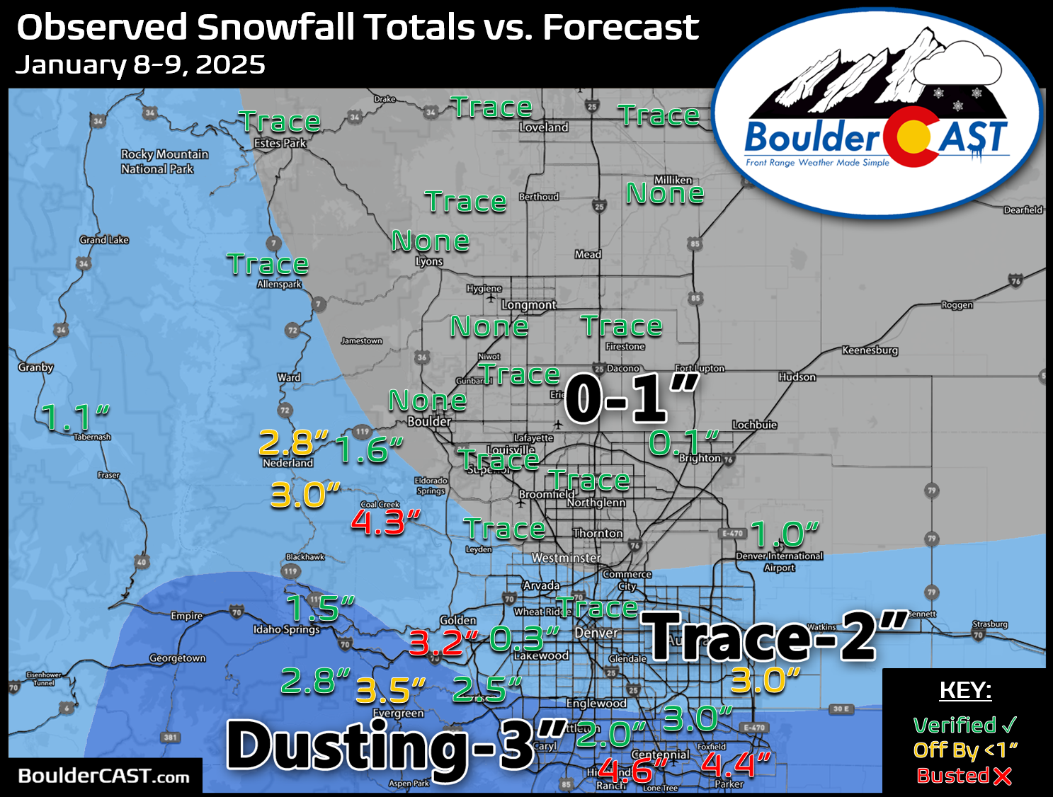
For the third time in six days, a weak storm system brought light snow to the Denver Metro area. We briefly review both the snow totals from this single storm and seasonally.
O
ur snowfall forecast map issued Wednesday afternoon is shown below with storm totals overlaid. Green values indicate our forecast verified, Yellow values mean the observed total was just outside our forecast, while Red was a busted forecast (more than 1″ off). As expected almost all of the snow was south of Interstate 70 this time around, with the exception being the Foothills where it crept a little further north into parts of southwestern Boulder County with 1 to 3 inches there. Areas south of Interstate 70 saw anywhere from a dusting to 5 inches of new snow on Thursday creating a treacherous morning commute!
Officially, Boulder received NO new snow from the mid-week storm, while Denver (DIA) recorded 1.0″. Seasonally, Denver is still holding onto a rare lead over Boulder, including this storm being the fifth time Denver recorded more snow than Boulder. This is exceptionally rare for this many events to unfold like this!
| Seasonal Snow Totals (Updated January 10 2025) |
|---|
| Boulder | Denver |
|---|---|
| 24.3" | 29.5" |
You can find a recap of all the winter storms so far in the 2024-2025 snow season HERE.
By the way, another round of snow may fall on Saturday with our next quick-hitting weak storm system in the northwest flow, but it shouldn’t amount to much across the lower elevations, though we are tracking some chance for brief convective snow showers with some uncertainty..


You must be logged in to post a comment.