
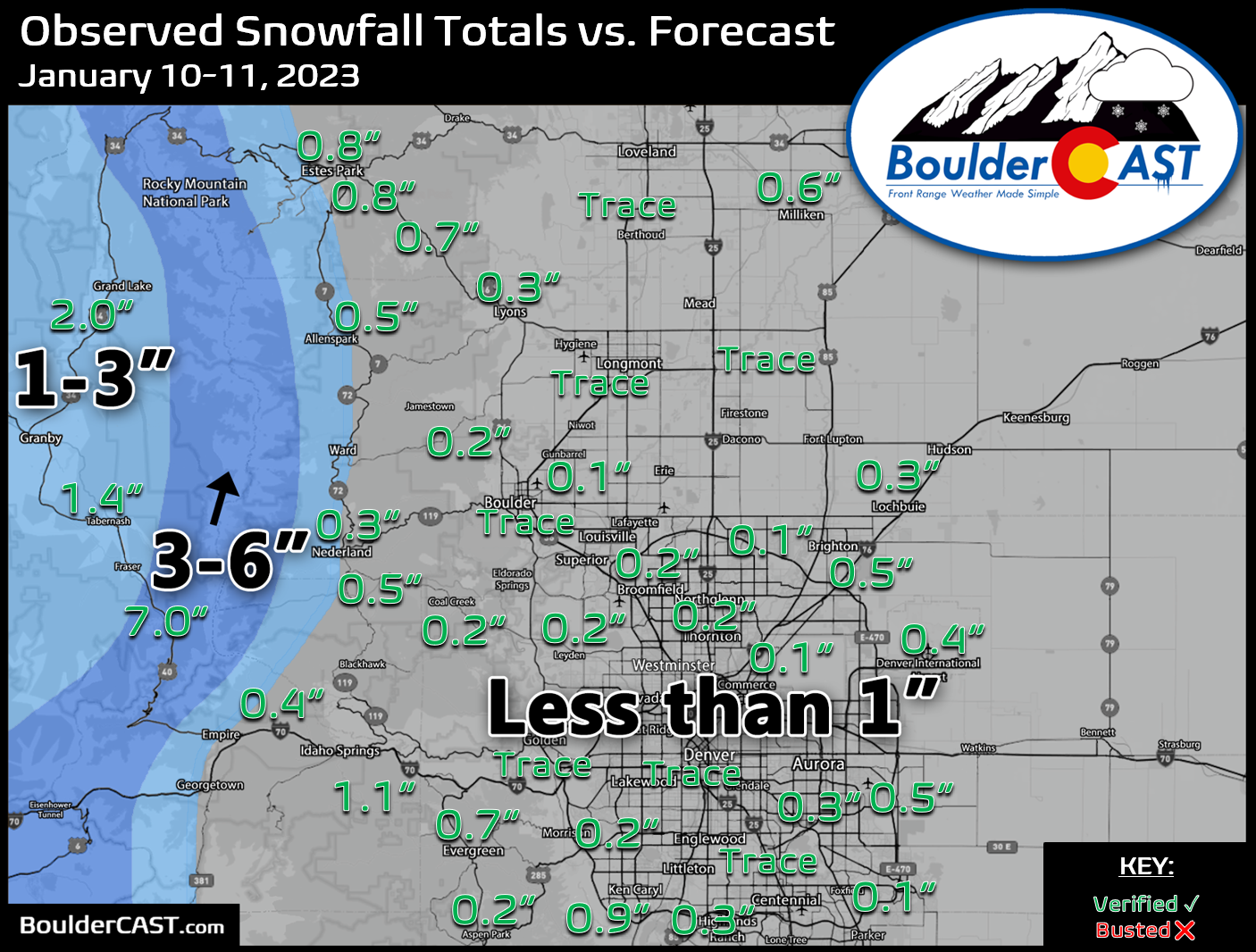
Shown below is our snowfall forecast map issued Tuesday morning with actual storm totals overlaid. Green values indicate that our forecast verified to within one inch of the observed snowfall total. Red numbers did not. This meager storm produced a trace to than 1″ of snow over most of the area Wednesday morning, with the highest totals west of the Divide. Denver officially reported 0.4″ of snow at DIA, while Boulder recorded just a trace.


You must be logged in to post a comment.