Well, most of us are waking up and having to shovel snow for the third Saturday in a row! This tiny recap post covers our latest winter storm, including a map of the verified snowfall totals and where we stand season-to-date against climatology.
While this weekend’s storm was far from the easiest forecast we’ve done, it was comparatively easier than the prior two weekend dumpings. A quick-hitting system from western Canada dropped south and across the Front Range Friday night. After some patchy freezing drizzle Friday afternoon, snow arrived quickly by early evening. With the ice layer underneath, travel by car or foot became extremely slick over much of the Denver Metro area.
6:30PM: Roads are becoming slick and snow-covered very quickly — even major roads. There may also be a glaze of ice under the snow following some drizzle earlier. Don't travel unless you like a thrill! #COWx pic.twitter.com/i2VW1z5hWo
— BoulderCAST Weather 🏔️❄️ (@BoulderCAST) February 17, 2024
There were a few pockets of moderate to heavy snowfall Friday evening (see video below), but for the most part those bands didn’t linger anywhere too long so fluffy snow totals remained on the lighter side.
Boulder at 6:50PM: 18°F, heavy snow falling, and the 2" mark is gone! 📏☃️ #COWx #Boulder pic.twitter.com/9gPLQxuBeF
— BoulderCAST Weather 🏔️❄️ (@BoulderCAST) February 17, 2024
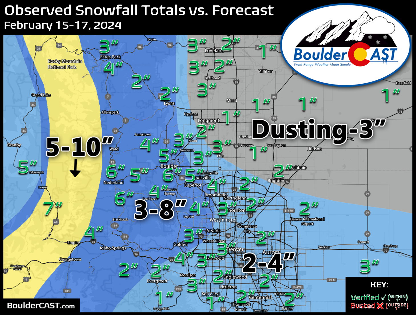
Shown below is our snowfall forecast map issued Thursday morning with actual storm totals overlaid. Green values indicate that our forecast verified to within one inch of the observed snowfall total. Red numbers did not (there are no red in this case). In general, a broad brush of 1 to 6 inches of snow fell across the entire Front Range. The lowest were in the northeastern Metro towards Greeley and Firestone where only one inch of snow was recorded. The highest totals, up to 6 inches, fell in and near the Foothills in Boulder County. Officially, Boulder received 6.4″ of new snow from this weekend’s storm, while Denver (DIA) recorded 1.8″.
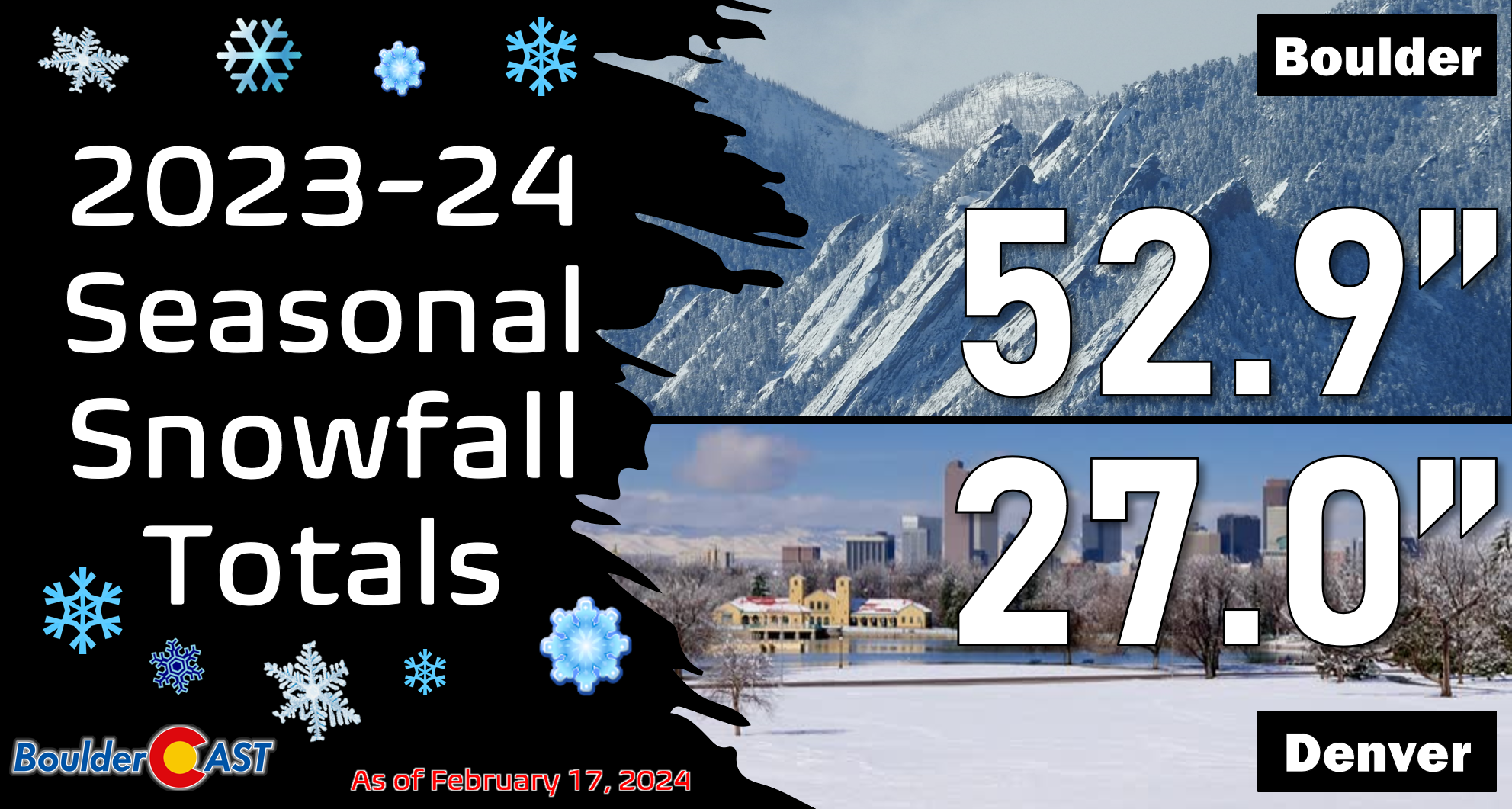
Updated seasonal snowfall totals for Boulder and Denver are shown below.
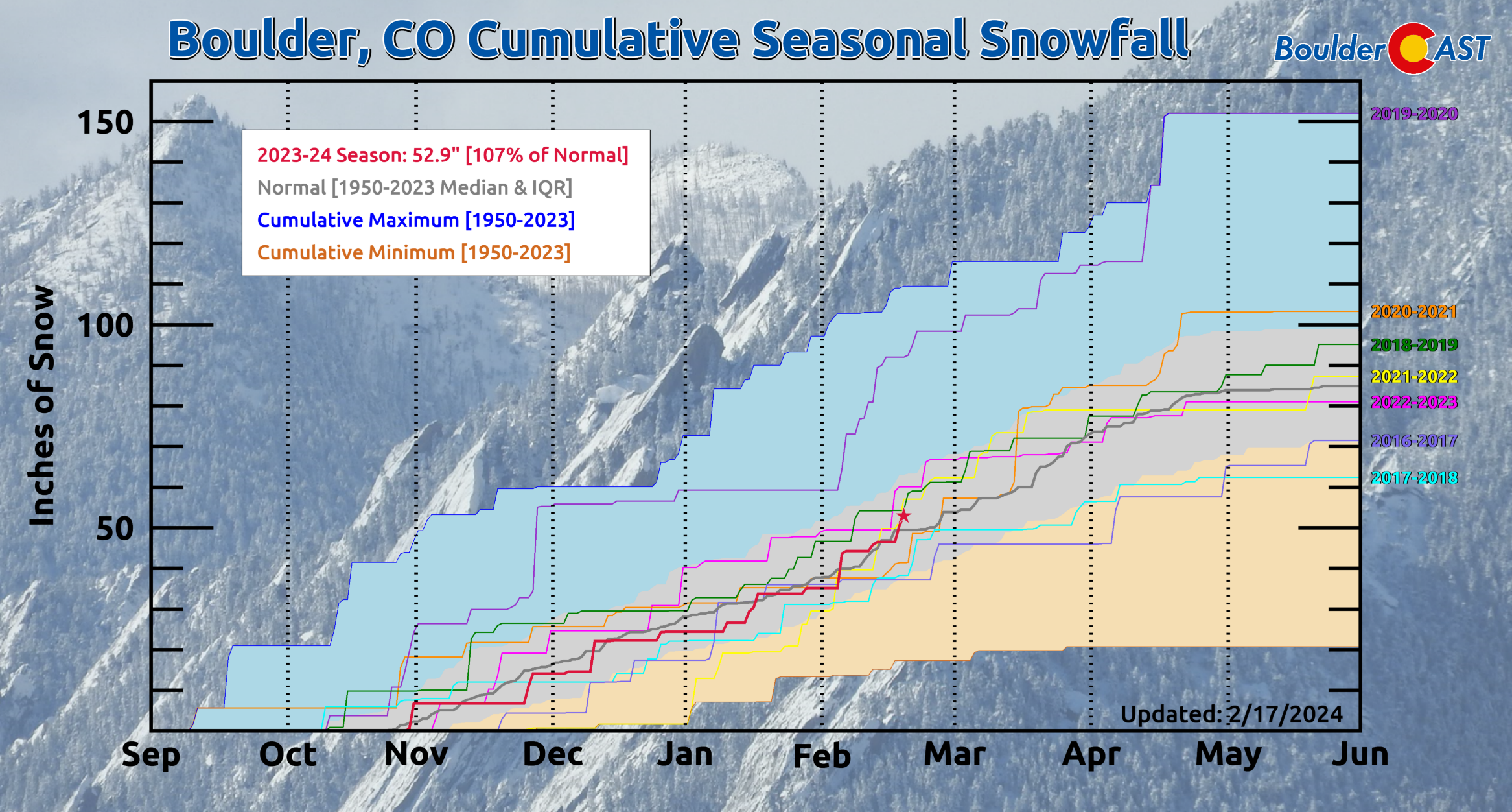
Boulder’s 53″ of snowfall is about 7% above normal season-to-date. This has truly been one of the most “normal” snowfall seasons for Boulder as we’ve been tracking closely with climatology (+/- 5″) since our first snowfall back in late October!


You must be logged in to post a comment.