Here’s a quick and colorful rundown of our weather during January 2021 and how it relates to climatology.
Help support our team of Front Range weather bloggers by joining BoulderCAST Premium. We talk Boulder and Denver weather every single day. Sign up now to get access to our daily forecast discussions each morning, complete six-day skiing and hiking forecasts powered by machine learning, first-class access to all our Colorado-centric high-resolution weather graphics, bonus storm updates and much more! Or not, we just appreciate your readership!
Top Weather Highlights of January 2021:
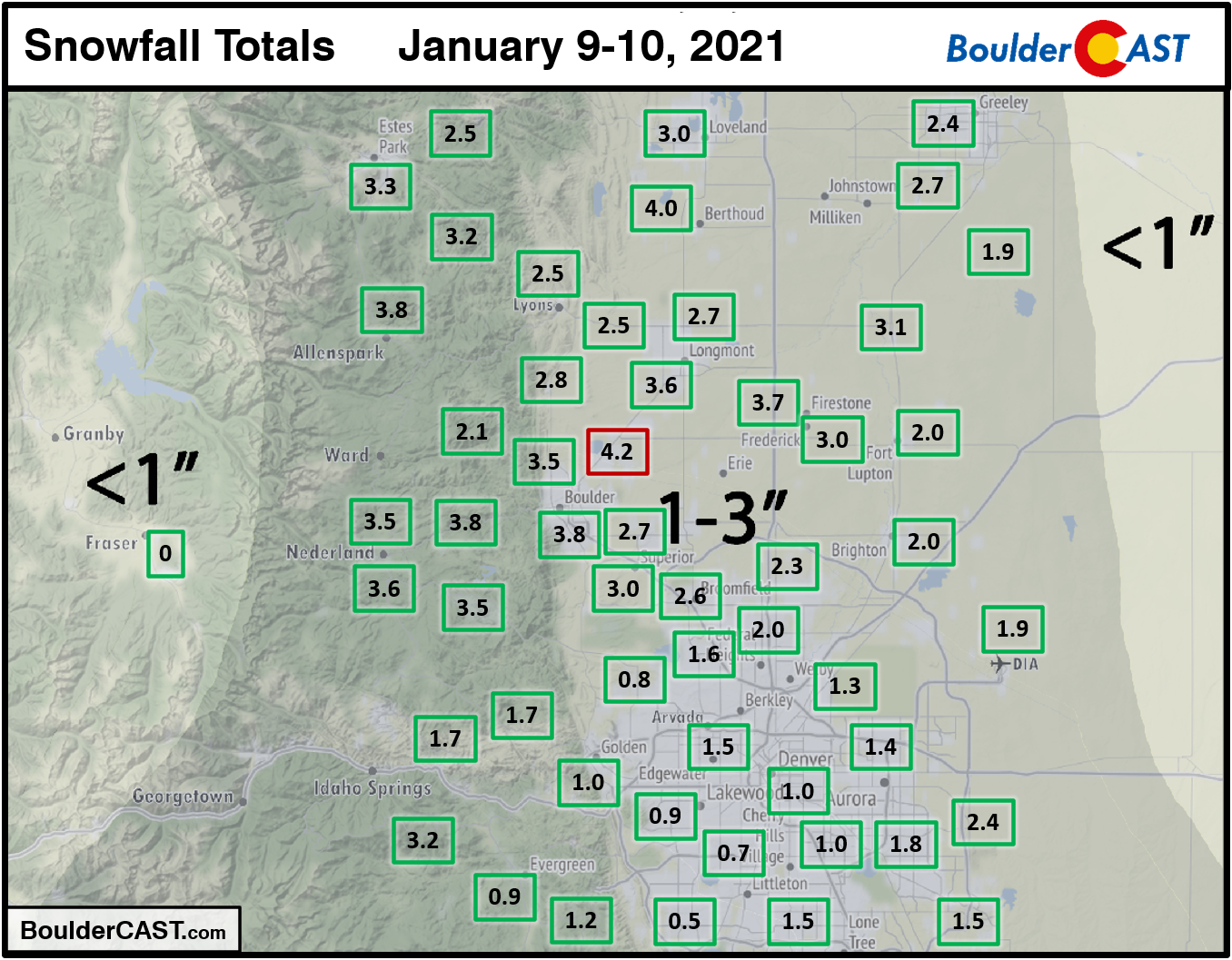
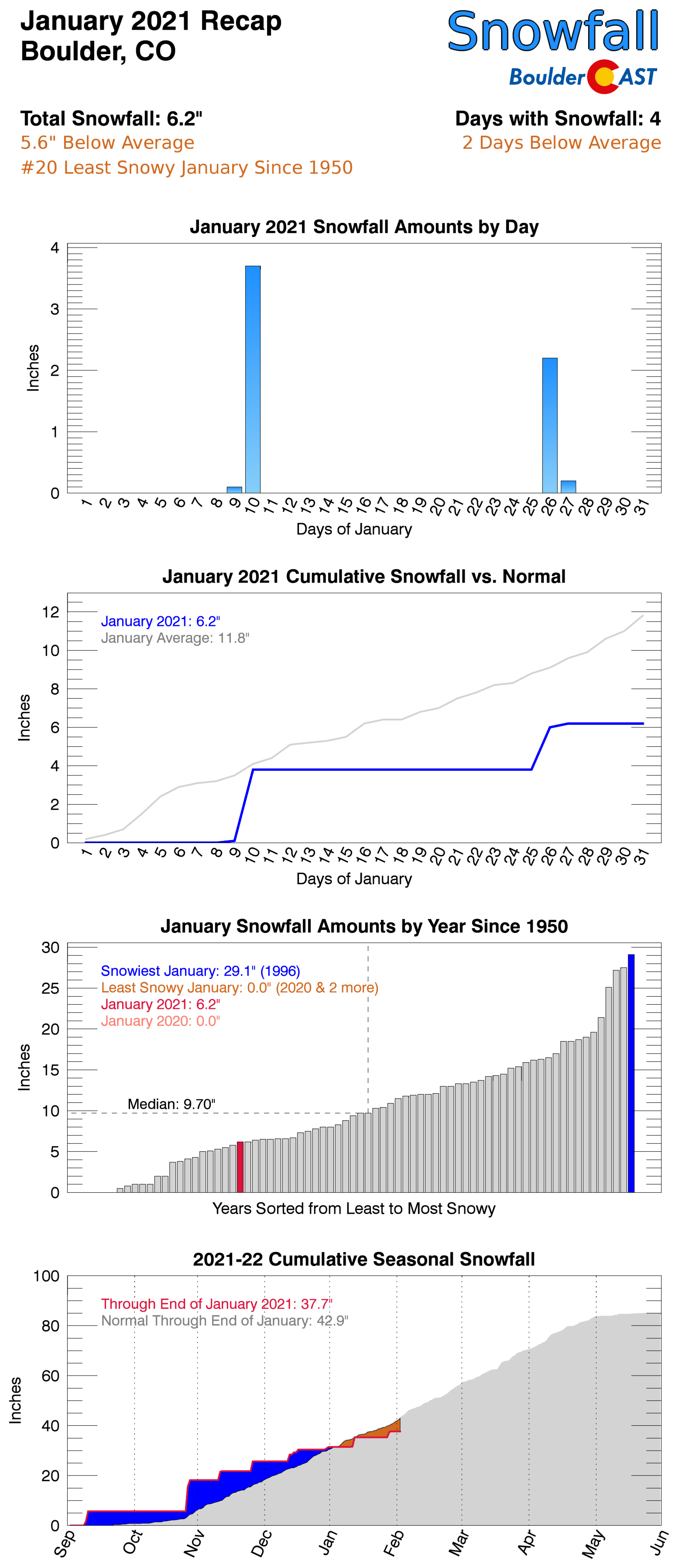
IS TWO INCHES TECHNICALLY A SNOWSTORM? Another month, another dismal performance in the snowfall department. Though there were three or four standalone snow events during the month of January, all of them produced less than 4″ for the entire area, and in some cases, nothing at all. Boulder reported just 6.2″ of snow which roughly half of normal, despite reporting snow on 8 different days. The “biggest” and most widespread snow event occurred on January 9th into the 10th.
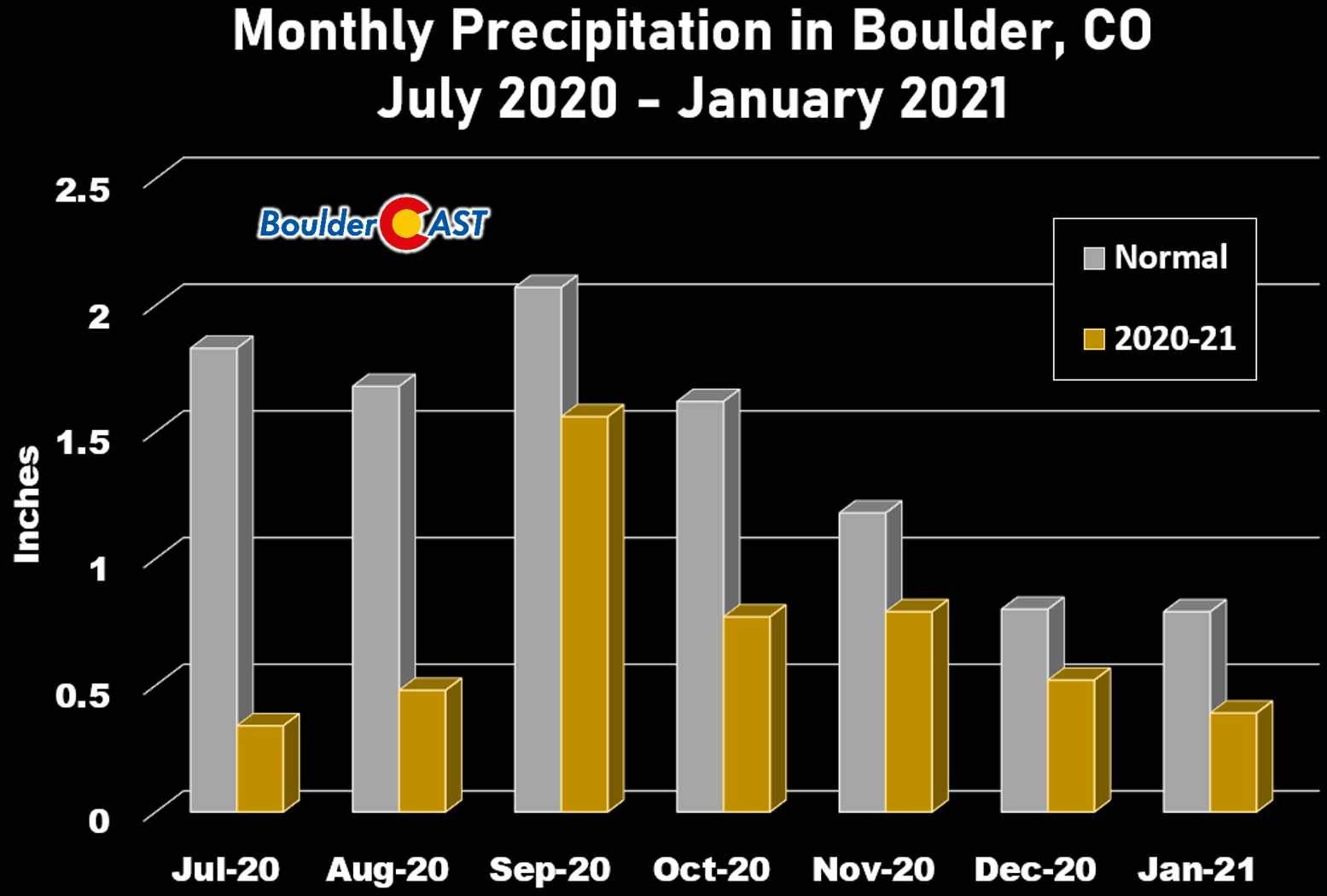
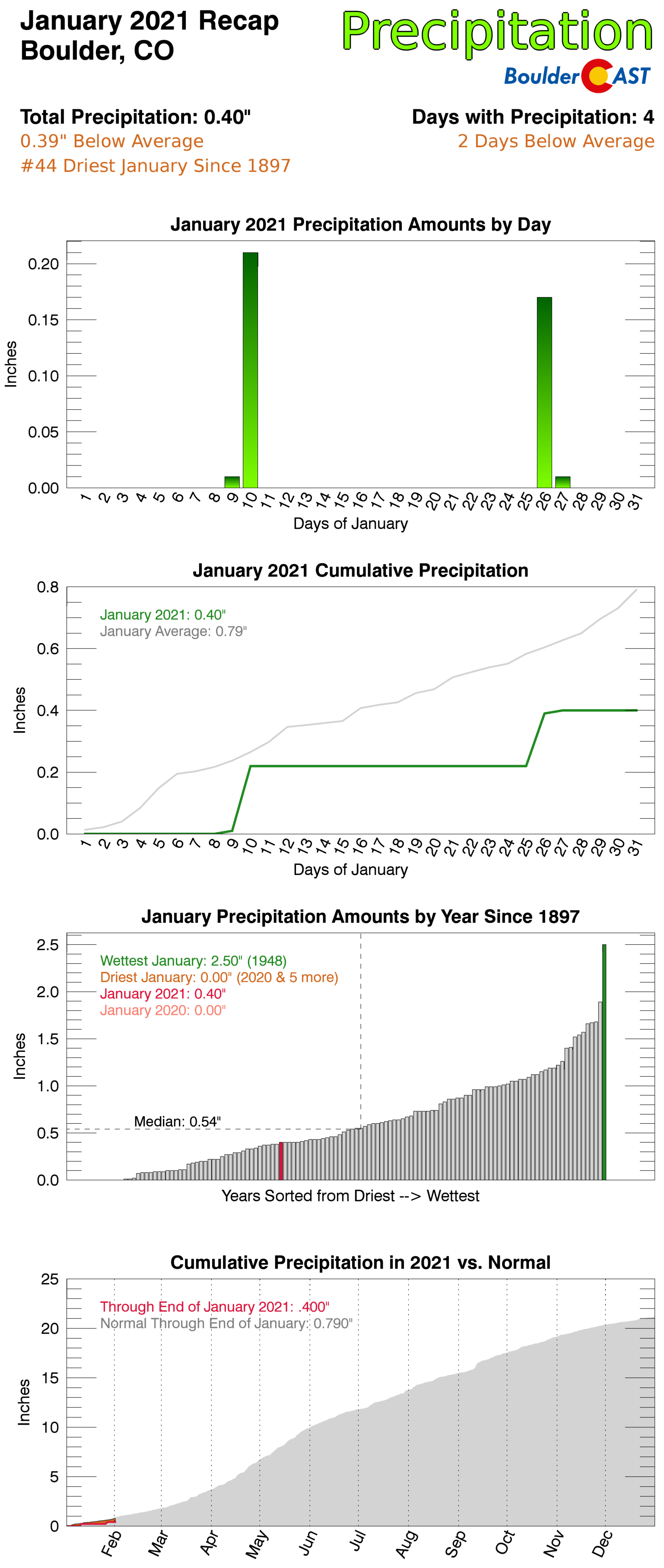
SEVEN IN A ROW: The 0.40″ of precipitation that fell in January was Boulder’s seventh in a row with below normal (average) precipitation. The last month with above normal precipitation was June of 2020. A stretch of months with below normal precipitation this long is borderline unprecedented in the historical record.
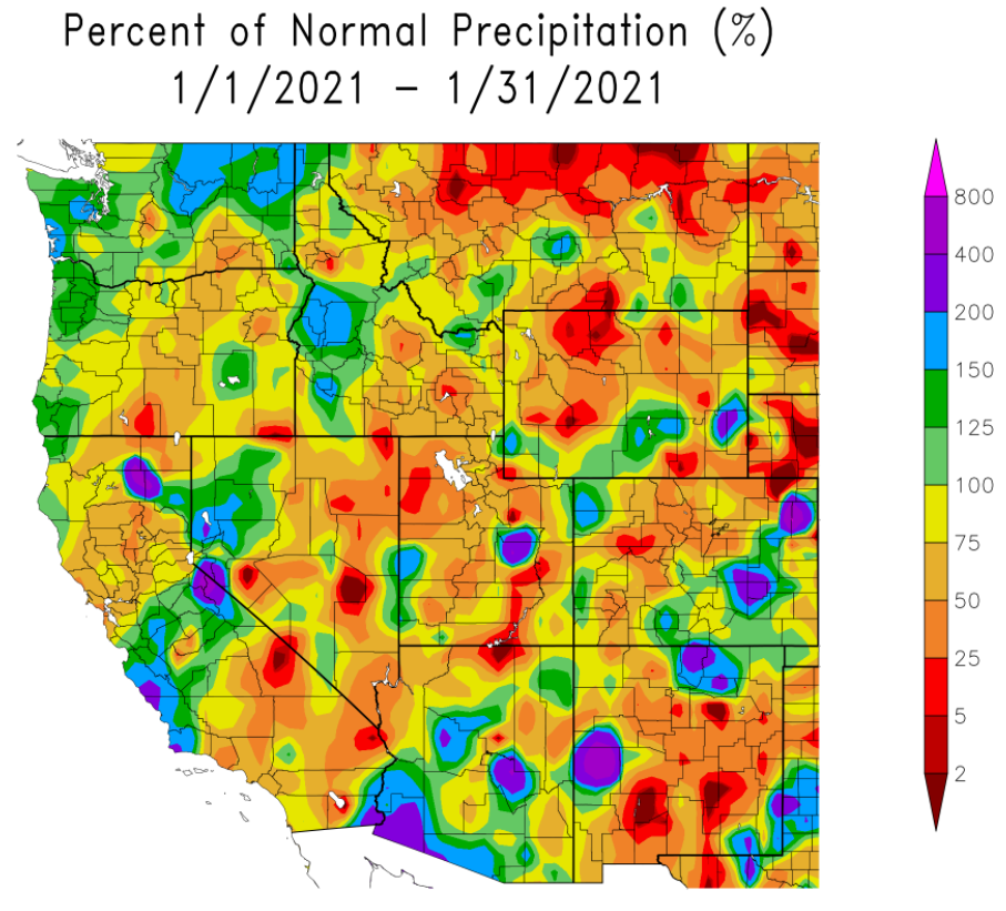
Most of the West and much of Colorado was also drier than normal during the month, particularly across the Mountains where snowpack has tumbled in the New Year.
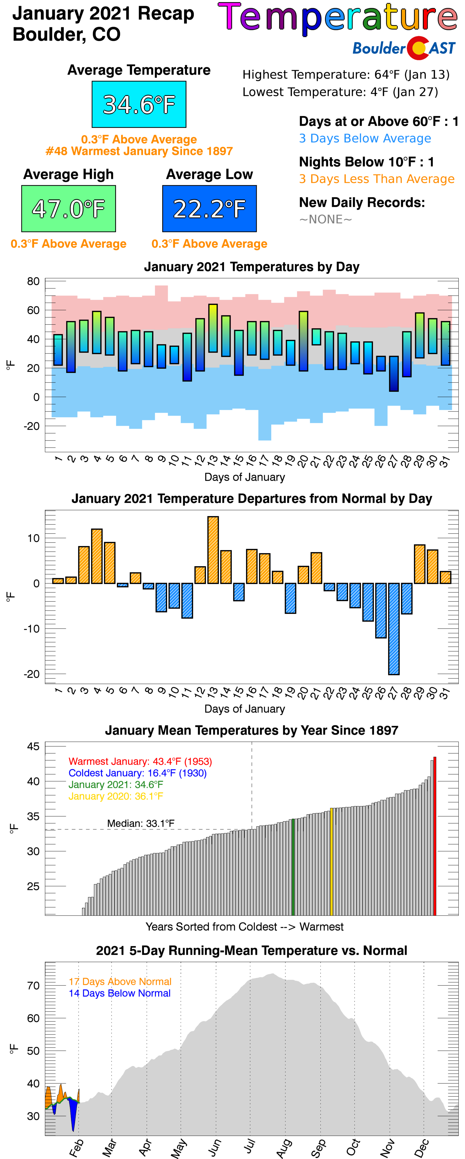
January 2021 Recap Graphics:
Spread the word, share Colorado weather:
We discuss Boulder and Denver weather every single day on BoulderCAST Premium. Sign up today to get access to our daily forecast discussions every morning, complete six-day skiing and hiking forecasts powered by machine learning, access to all our Front Range specific weather models, additional storm updates and much more!




You must be logged in to post a comment.