We take a quick peek at snowfall totals as of Friday morning, check the latest from the models, and let you know how much snow is still to come.
Right on schedule, moderate to heavy bands of snow developed northeast of Denver Thursday just after rush hour and slowly sagged southwest into the Metro area through the evening hours. Here are some of the snow totals so far:
The southern Metro area got hit harder last night than the northern tier. 5-7″ were reported in areas such as downtown Denver, Lakewood, Aurora, Parker, Centennial, and Englewood. Further north, the Boulder area only received 1-4″. The region originally expected to get hammered with this snow (Fort Collins to Greeley) saw almost no accumulation!
Models agreement was VERY poor for this event, even as it was already happening! The NAM and GFS were too far north with the heavier snow, while the high-resolution HRRR model had almost nothing happening last night when Denver was getting dumped on. Now you see the reason for our broad brush forecast of 2-6″ with locally up to 12″. There was too much uncertainty for anything more precise!
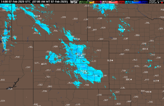
The overhead jet stream is very much still active across the area. A look at the current radar shows a blob of jet-forced snowfall lined up from the Wyoming border all the way to the Oklahoma Panhandle this morning.
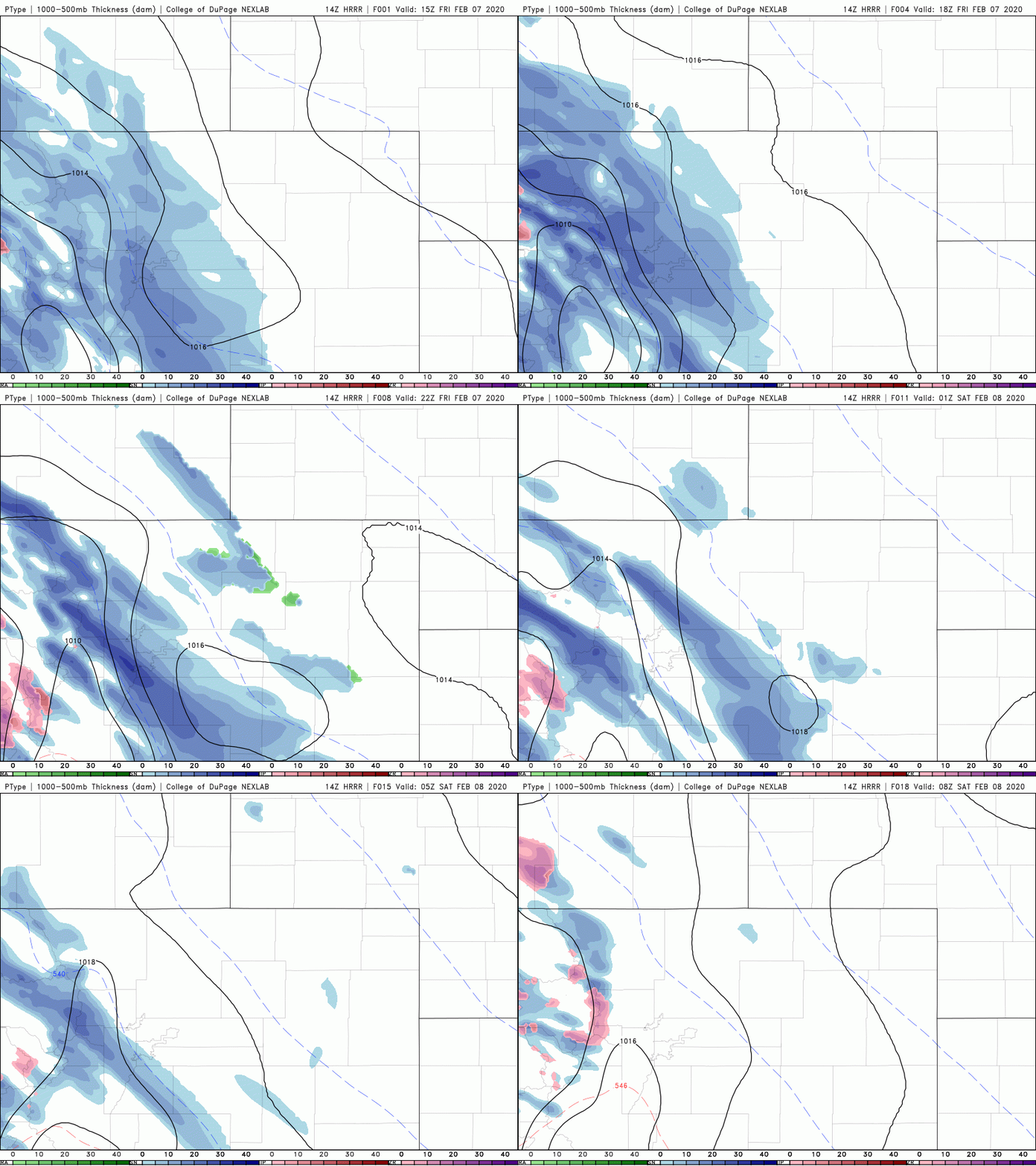
The HRRR seems to have a better grasp on things today, showing persistent jet banding across the Front Range through the entire day into this evening (simulated radar animation shown below).
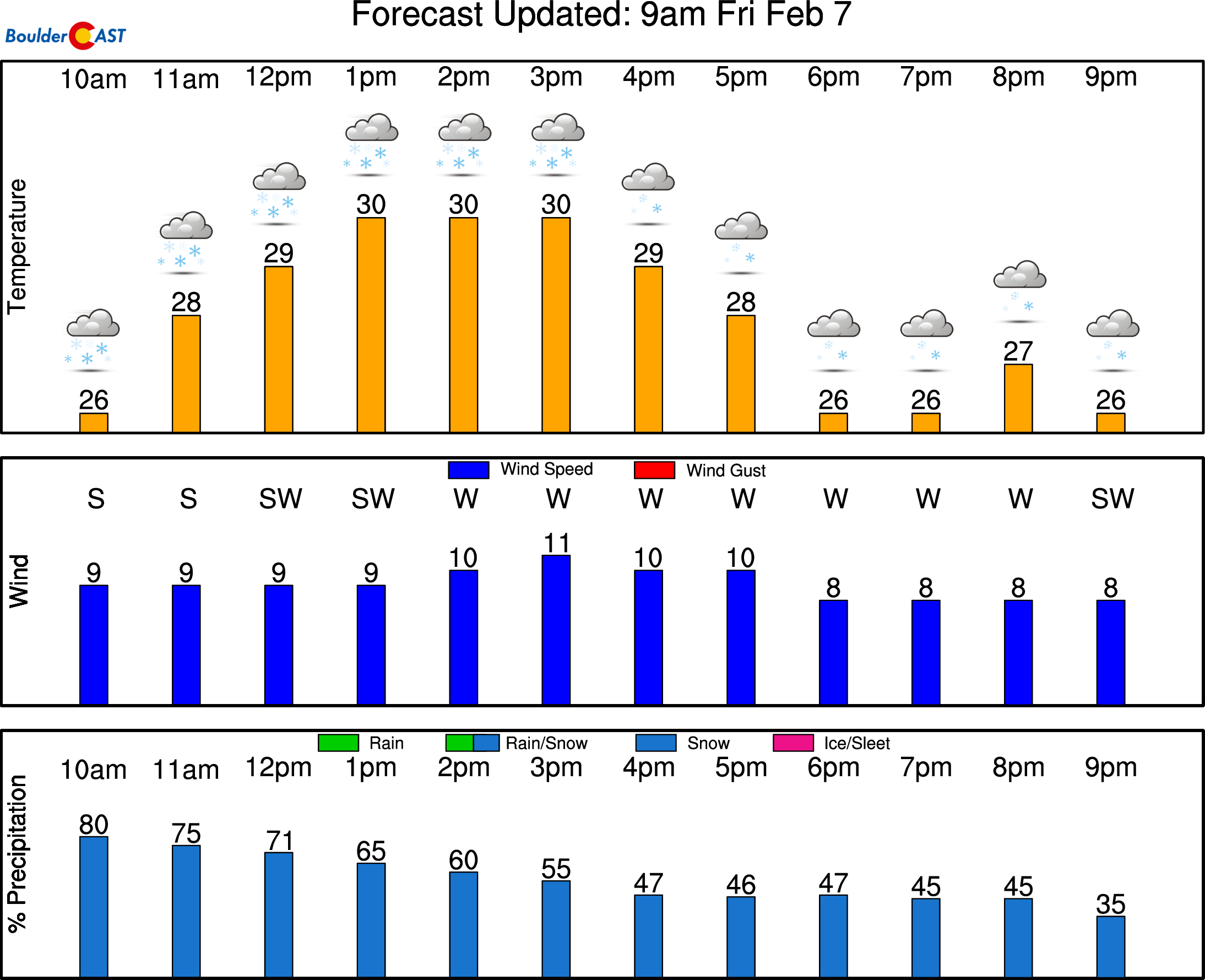
The very last band is predicted to dissipate around midnight tonight. With this setup, we expect another 1-4″ of accumulation across the area by the time things are all said and done, highest south of Interstate 70. Light snow will persist in most areas all day, maybe non-stop, but it’s the intermingled bands of moderate snow that will cause travel impacts from time to time. Look for highs to struggle to reach freezing. Most areas will probably top out in the upper 20’s to lower 30’s.
If anyone has a chance to reach the elusive “foot” storm total, it would be far south Denver (Aurora/Parker/Littleton) and into the Foothills of Jefferson County. Good luck and drive safe!
P.S. Don’t even try to go to the Mountains. 1 to 3 feet of snow has fallen and 50+ MPH winds are causing blizzard conditions, impassible roads, and many road closures.
—
We discuss Boulder and Denver weather every single day on BoulderCAST Premium. Sign up today to get access to our daily forecast discussions every morning, complete six-day skiing and hiking forecasts powered by machine learning, access to all our Front Range specific weather models, additional storm updates and much more!
Subscribe to receive email notifications for BoulderCAST updates:
We respect your privacy. You can unsubscribe at any time.
.
Spread the word, share the BoulderCAST snow forecast!


You must be logged in to post a comment.