Read our brief recap of Thursday’s rain, snow and lightning. We also discuss our thoughts on a potential wintry event Sunday into Monday.
Spring is near!
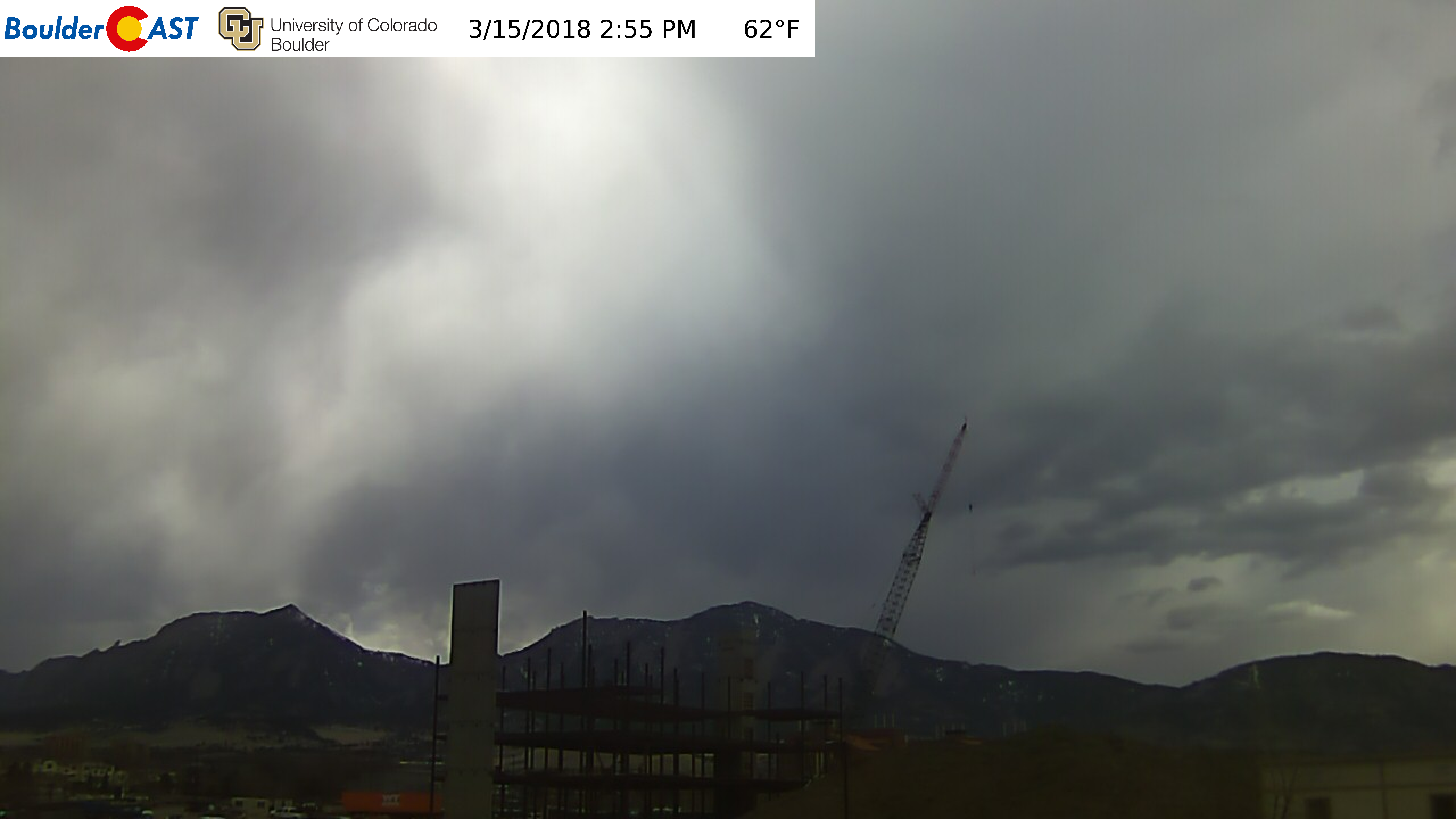
It was great see the skies once again filled with cumulonimbus, mammatus, and flashes of lightning yesterday. Nothing signifies the arrival of the spring season more, which by the way, is just a few days away now. The skies over Boulder turned ominous Thursday afternoon and evening.
Watch the TIME-LAPSE VIDEO.
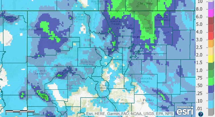
The map below shows all of the lightning that occurred in Colorado yesterday. A smattering of strikes happened over the higher elevations (thundersnow!), with the largest concentration of bolts northeast of the Denver Metro area.
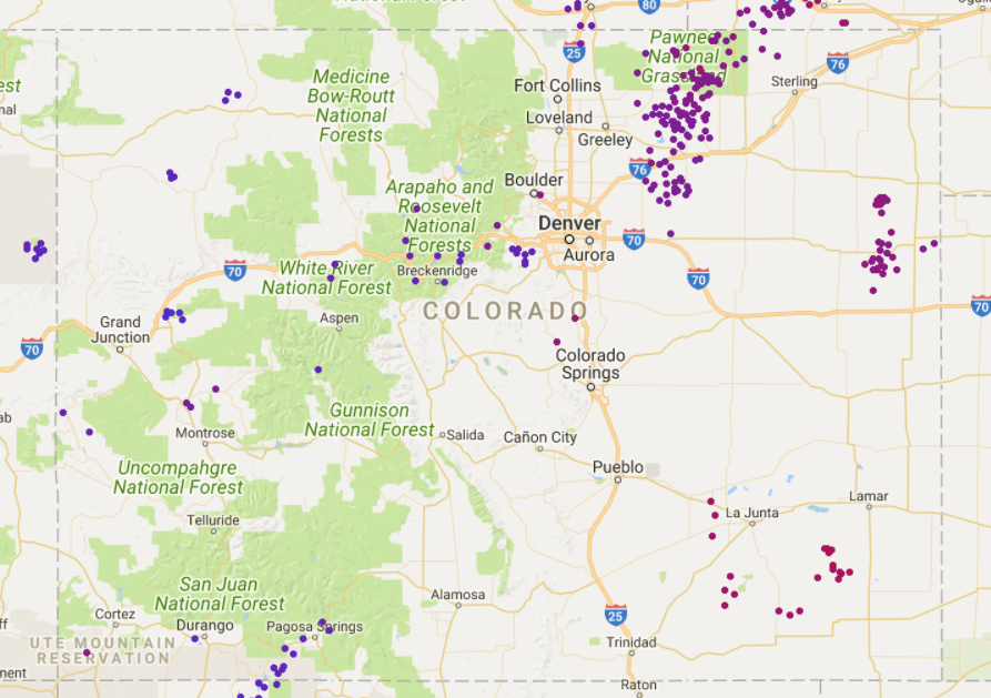
Map of lightning strikes that occurred on Thursday March 15, 2018 across Colorado.
A closer look shows the only flash explicitly within the Metro area occurred in southeast Boulder. We also got reports from readers of pea-sized hail near Gunbarrel!
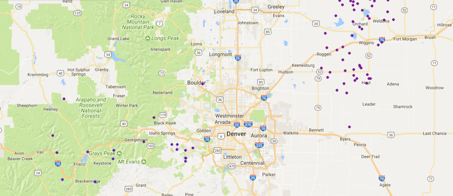
Map of lightning strikes that occurred on Thursday March 15, 2018 across the Front Range.
The storm also brought much needed moisture to the state, three weeks to the day in Boulder since our last measurable precipitation (longer in Denver). Rain amounts across the Metro area were generally 0.1 to 0.5″. We reported 0.21″ at BoulderCAST Station. Some areas from Greeley to Cheyenne saw more than 1″ of precipitation, including several inches of sloppy snow.
Precipitation totals for the state from the March 15, 2018 storm.
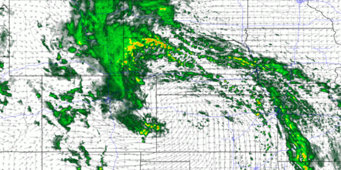
The observed storm totals matched up surprisingly well with the NAM’s prediction.
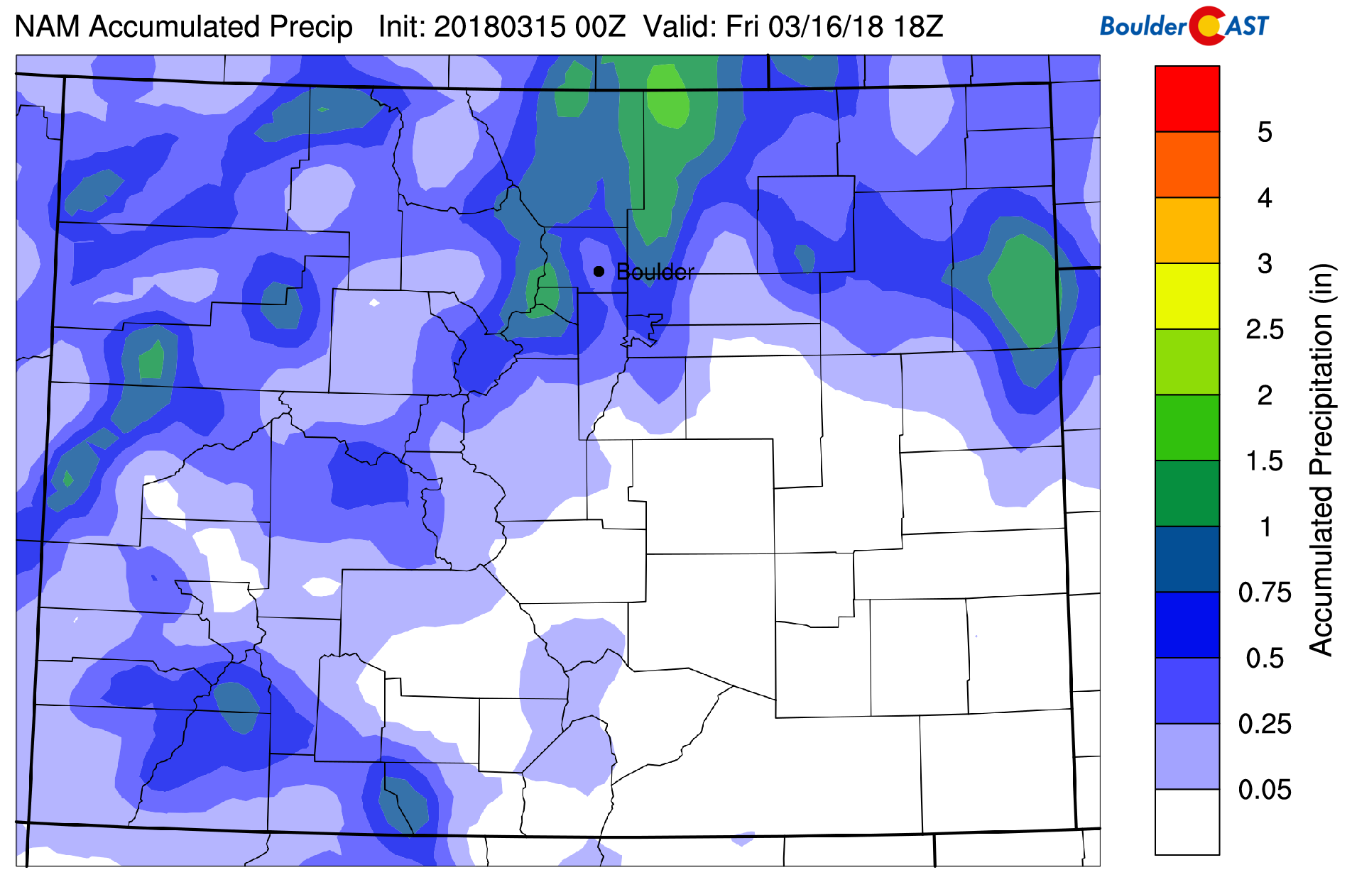
NAM total precipitation for the event. The heavier precipitation will be north of Boulder and Denver.
Our forecast all along included mention that the lower elevations would see almost all rain. We personally did not notice any snowflakes mixing in, but wouldn’t doubt that a few fell in some of the heavier rain cells after sunset Thursday evening near Boulder or Broomfield. At the peak of the heaviest rain, temperatures at BoulderCAST Station bottomed out at 37 degrees…just a shade too warm to turn the rain over to snow. An all-rain event for the lower elevations in March is not a frequent occurrence for our region, but can happen under the right circumstances.
The Foothills west of town above 8,000 feet elevation saw minor snow accumulations, generally less than 2″. Winter Park was the big winner for powder….10″ worth (with another 1-2″ expected through the day Friday)! Most ski resorts reported 3 to 7″.
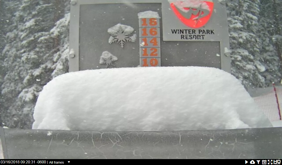
Winter Park snow cam Friday morning. 10 inches!
Tracking snow late in the weekend
Our snowiest month of the year looks to get back on track towards the tail-end of the weekend. We’re monitoring another storm system set to impact much of Colorado Sunday into Monday. We’re still cautious given the poor performance of the models of late in handling the trough across the West. However, confidence is growing for a precipitation event Sunday afternoon into the night-time hours. There is general agreement in the models for a small but tightly-wound upper-low to move along the Colorado-New Mexico border on Sunday. This is a much more favorable track to bring precipitation to the Front Range than the last storm.
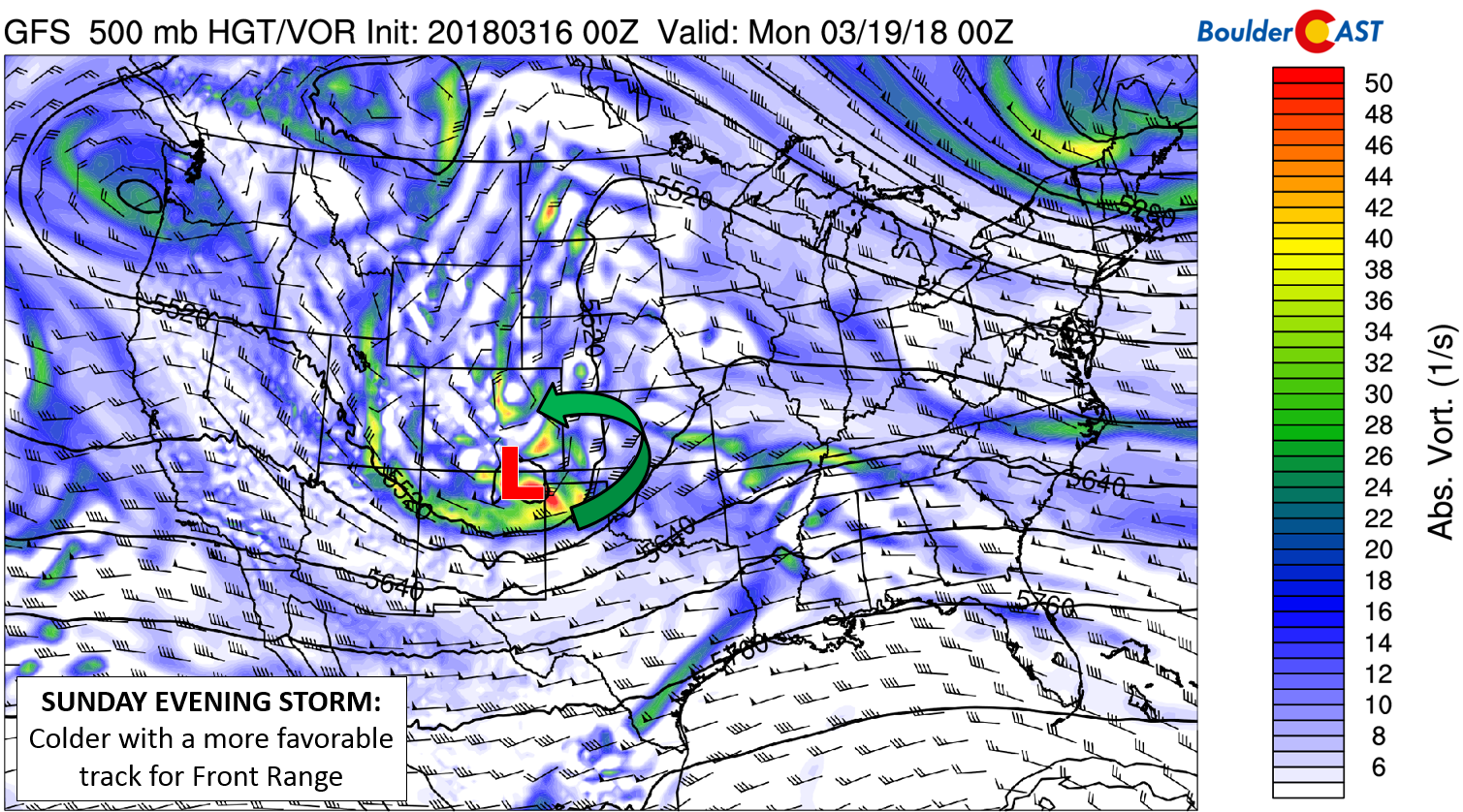
GFS 500 mb vorticity map for Sunday evening. A closed-low is expected to move across northern New Mexico.
The two key things we are watching right now:
- Is the track too far south? For larger weather systems, a track across the Colorado-New Mexico border is near-perfect for Front Range snow in March. However, Sunday’s storm is lacking in scale. This could lead to the path actually being too far south. This may limit the depth and strength of the upslope in our region…which does appear to be the way the models are trending right now. The GFS is currently the furthest north model and produces the biggest impact for the Denver Metro (see plumes below). The Euro and NAM are slightly further south with everything.
- Will it be cold enough for accumulating snow? The answer is yes for the Mountains and Foothills. For the Plains, we’d say probably. We’re likely looking at temperatures in the 40’s to low 50’s Sunday with rain showers changing over to snow Sunday afternoon into the evening. When this change-over happens will also play a large part in potential snow amounts.
There is a lot of wiggle room for things to change between now and Sunday. It’s going to be a tight forecast for our region. We may be on the outside (north-side) looking in again. We’ll pass along updates as needed over the weekend. That’s all for now…
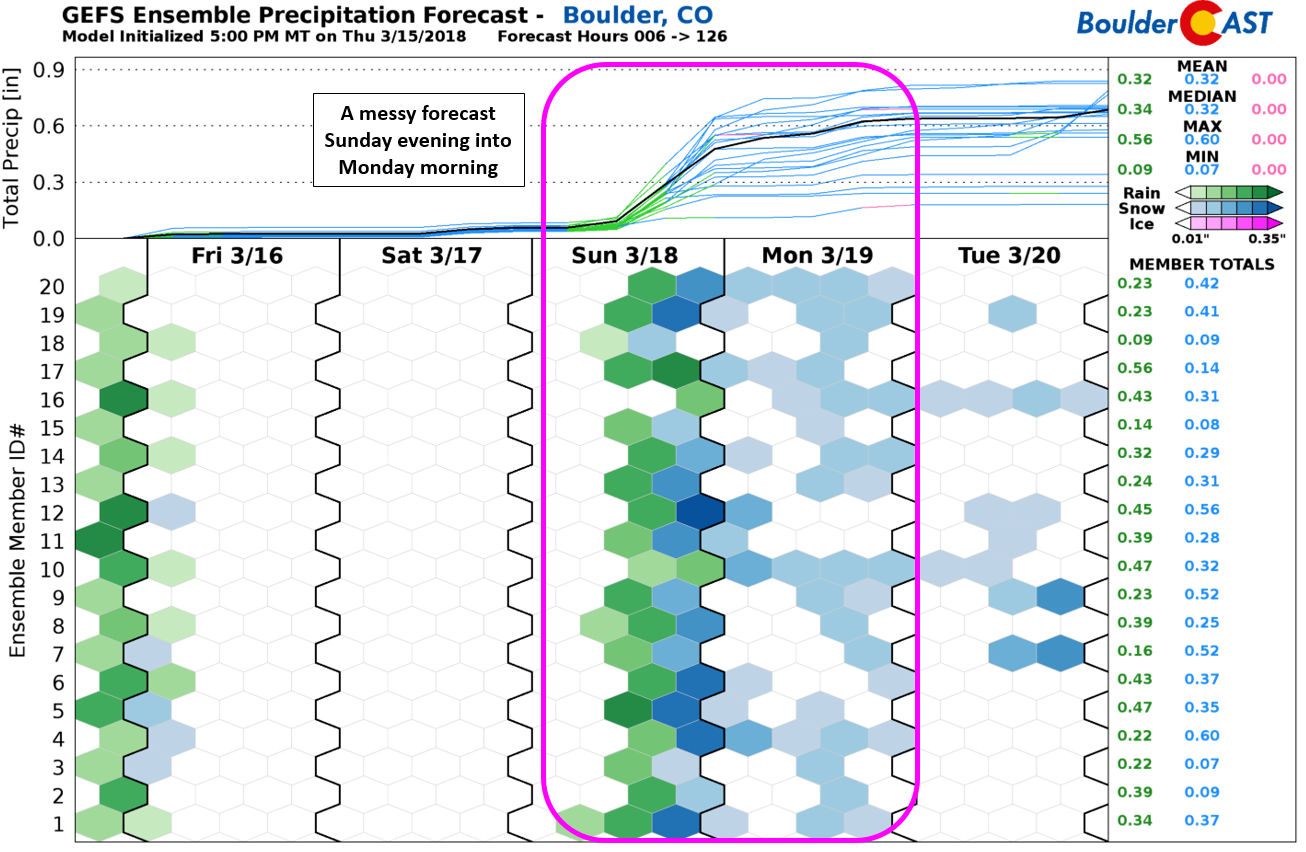
GFS ensemble forecast for precipitation. Rain changing to snow is likely for Sunday evening.


You must be logged in to post a comment.