Thursday marks the final chapter of our late-summer heatwave, with record-challenging highs expected across the Front Range — but big changes are on the horizon. A cold front arrives tonight, ushering in cooler temps, a return of thunderstorms, and a wetter, more active pattern that could stick around well into next week. From sizzling heat to damaging hail, monsoonal moisture, and a long stretch of below-normal highs, today’s forecast update has a little bit of everything.
At a Glance:
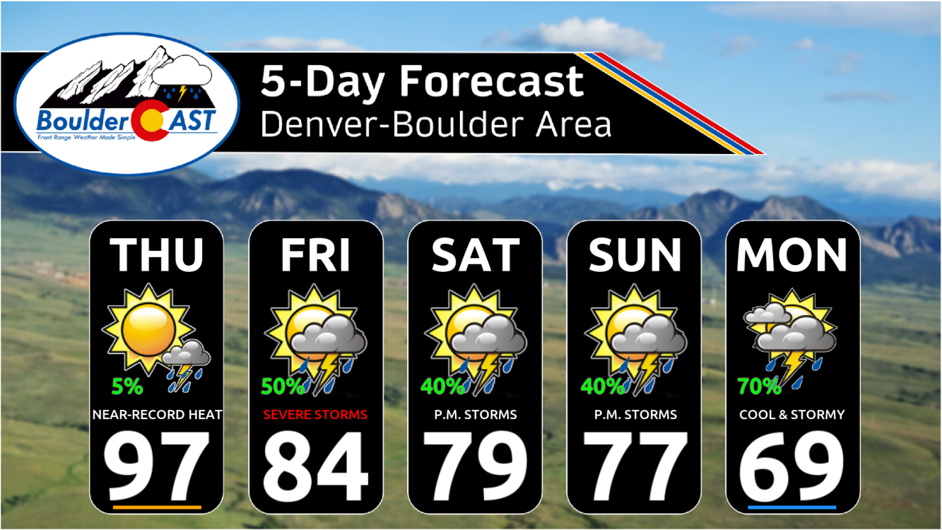
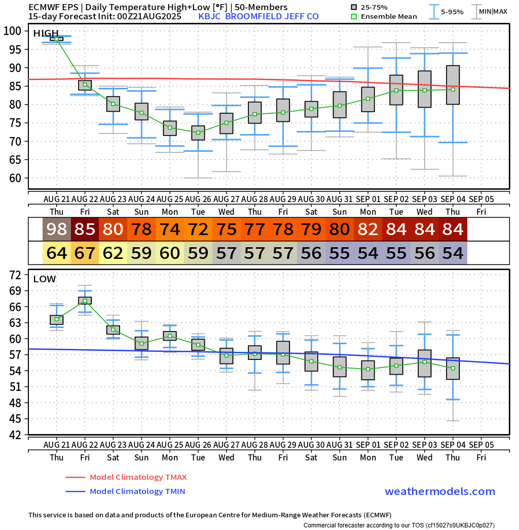
- Final Day of Intense Heat: Highs in the mid to upper 90s today, with Boulder and Denver flirting with record temperatures from 2023. A few spots may hit 100°F.
- Cold Front Tonight: Models vary on timing and strength, but expect a noticeable cooldown Friday — about 15° lower, with highs in the low to mid 80s.
- Storms Return Friday: Scattered afternoon and evening thunderstorms (30–40% chance), with potential for hail up to 1.5″ and a Marginal Risk for severe weather.
- Wet Weekend Ahead: Monsoonal moisture and upslope flow will fuel daily storm chances through midweek. Rainfall totals could average around 1 inch.
- Cooler Than Normal Through Next Week: Highs drop into the 70s starting Saturday, with Monday–Tuesday possibly stuck in the 60s. Seasonal warmth may not return until after Labor Day

Go Premium, get all the perks.
Daily Forecast Updates
Get our daily forecast discussion every morning delivered to your inbox.
All Our Model Data
Access to all our Colorado-centric high-resolution weather model graphics. Seriously — every one!
Ski & Hiking Forecasts
6-day forecasts for all the Colorado ski resorts, plus more than 120 hiking trails, including every 14er.
Smoke Forecasts
Wildfire smoke concentration predictions up to 72 hours into the future.
Exclusive Content
Weekend outlooks every Thursday, bonus storm updates, historical data and much more!
No Advertisements
Enjoy ad-free viewing on the entire site.
Big changes ahead
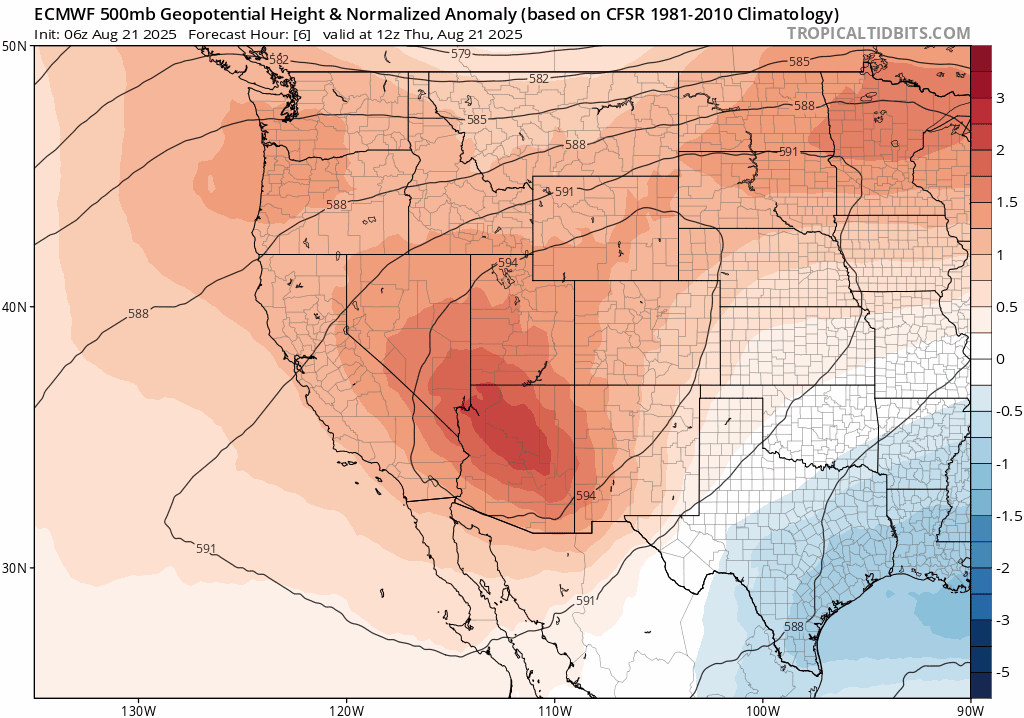
We’ve got one more scorcher to power through today before a cold front rolls in tonight and flips the script on our weather pattern — not just for Friday, but well into next week. Expect highs in the mid to upper 90s across the lower elevations today, with a few unlucky spots like Greeley or Longmont possibly hitting the century mark.
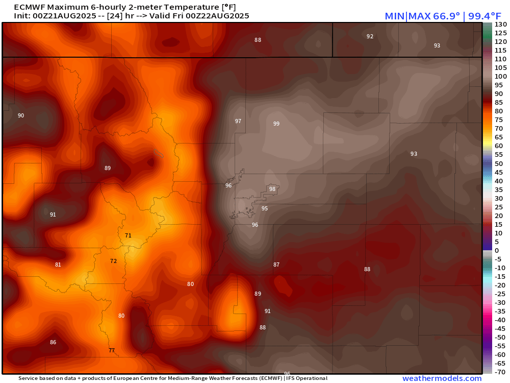
Euro forecast high temps for Thursday — it’ll be hot!
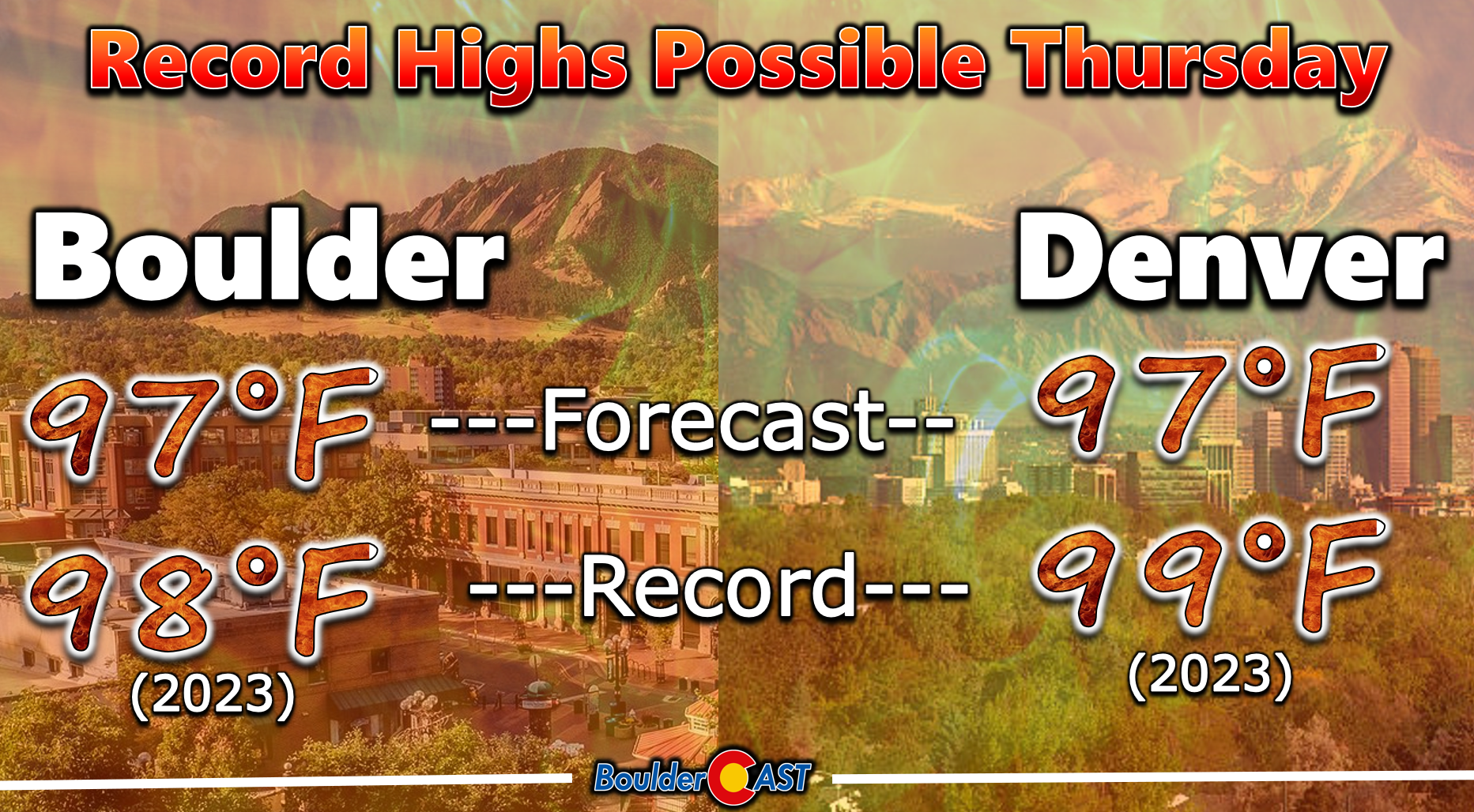
Boulder’s forecast high is right around 97°F, just shy of the August 21st record of 98°F set in 2023. Denver’s sitting in similar territory — aiming for 99°F, which also happens to be the record from that same hot summer day two years ago.
Sunshine will dominate most of the day, but by early evening, clouds will start spilling off the higher terrain. There’s a slim chance (less than 10%) of a rogue storm or two coming off the terrain with the clouds Thursday evening, mainly north of Boulder toward Fort Collins.
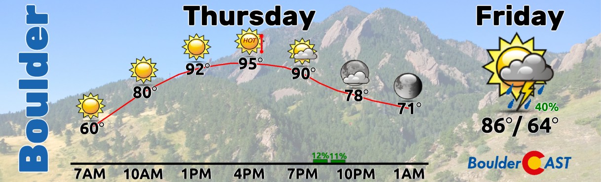
Model guidance is still a bit scattered on tonight’s cold front. The NAM wants to bring it in early and strong around sunset, while most other models keep things more subdued and push it through overnight. We’re leaning toward the latter scenario. Either way, Friday will feel noticeably cooler — about 15 degrees down from today, with highs in the low to mid 80s.
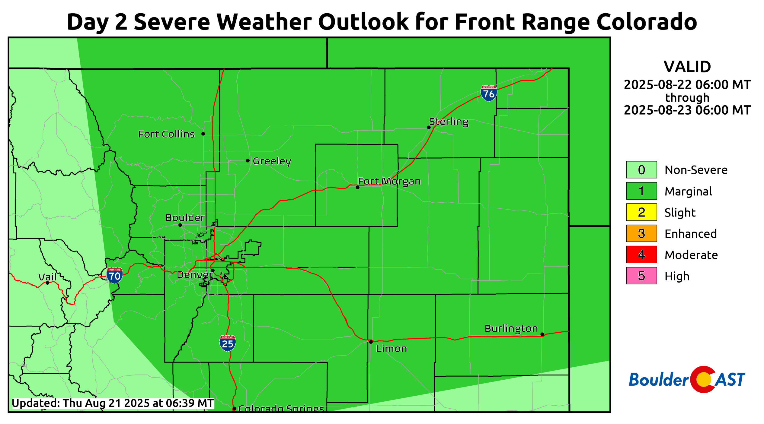
Behind the front, upslope flow and increased moisture will help spark scattered thunderstorms Friday afternoon and evening (40-50% coverage). The HRRR suggests some of these could pack a punch. With decent bulk shear and low-level easterly flow, a few storms may go severe — hail up to 1.5″ in diameter is the main concern.
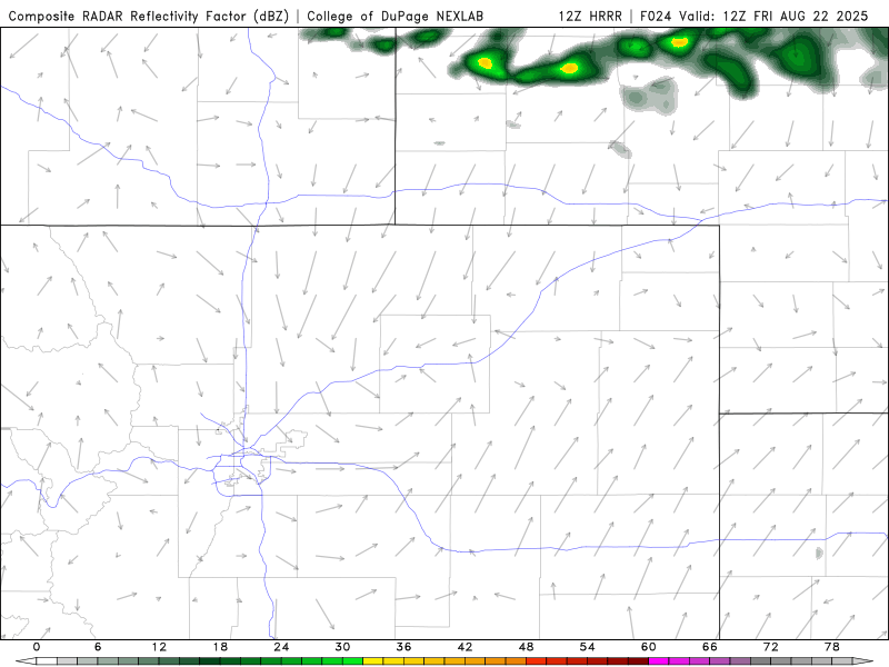
HRRR model-simulated radar for Friday
The Storm Prediction Center has northeast Colorado under a Marginal Risk for severe weather on Friday. Keep an eye to the sky!
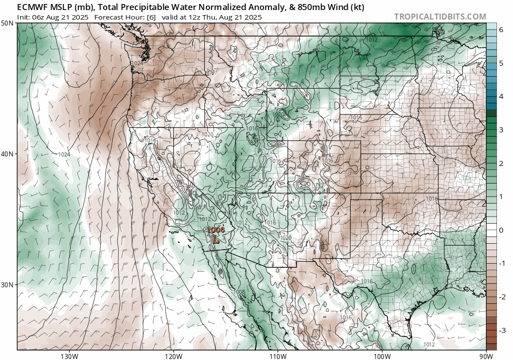
As we head into the weekend, the dominant ridge that’s been baking us all week gets flattened and shoved southwest by a passing Canadian trough. That will leave us in a stagnant northwest flow pattern that will starkly contrast the dry heat of late.
At the same time, moisture will continue to pool across Colorado. Initially, it’s post-frontal upslope doing the work, but by Sunday or Monday, monsoonal flow from the south and southwest will kick in, reinforcing the wet setup. Precipitable water values will stay above normal through at least midweek, supporting daily chances for scattered to numerous storms statewide. That’s excellent news for the parched Front Range and especially the drought-stricken Western Slope.
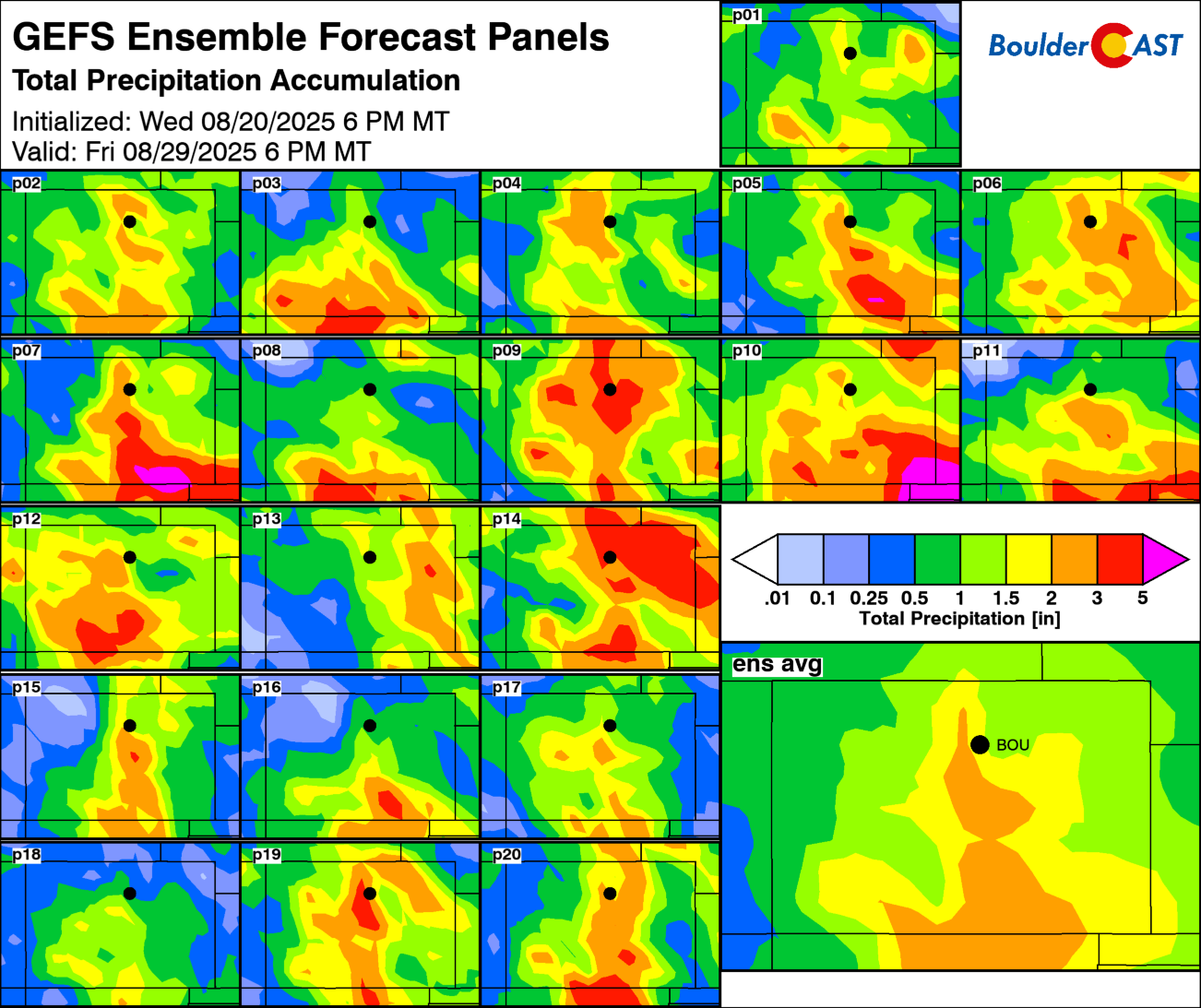
Ensemble guidance suggests around 1 inch of rainfall for most of our area through early next week, though totals will vary from one neighborhood to the next, as they usually do. Most, but not all of the rain, will come in the late-day periods.
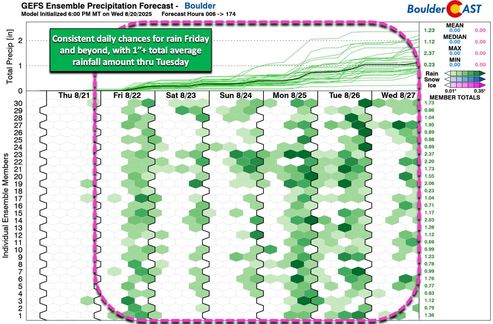
There has been an observable trend in the modeling which could favor central and southern Colorado for the best dump of rain over the next seven days. Colorado Springs to Pueblo (1.5-2.5″) may end up doing better than Boulder and Denver (0.75-2″), but it certainly won’t be “dry” here, regardless of the ultimate outcome.
Temperatures will trend cooler overall, too, with persistent upslope flow keeping highs in the 70s starting Saturday. Monday and Tuesday look particularly chilly, wet, and cloudy — some spots may not even get out of the 60s early next week. No major cold fronts are showing up in the extended outlook, but a steady feed of cooler air from the east will keep us below normal.
Unseasonably cool temperatures and wet weather are favored to stick around through most of next week, possibly not returning to seasonal normals until after Labor Day.
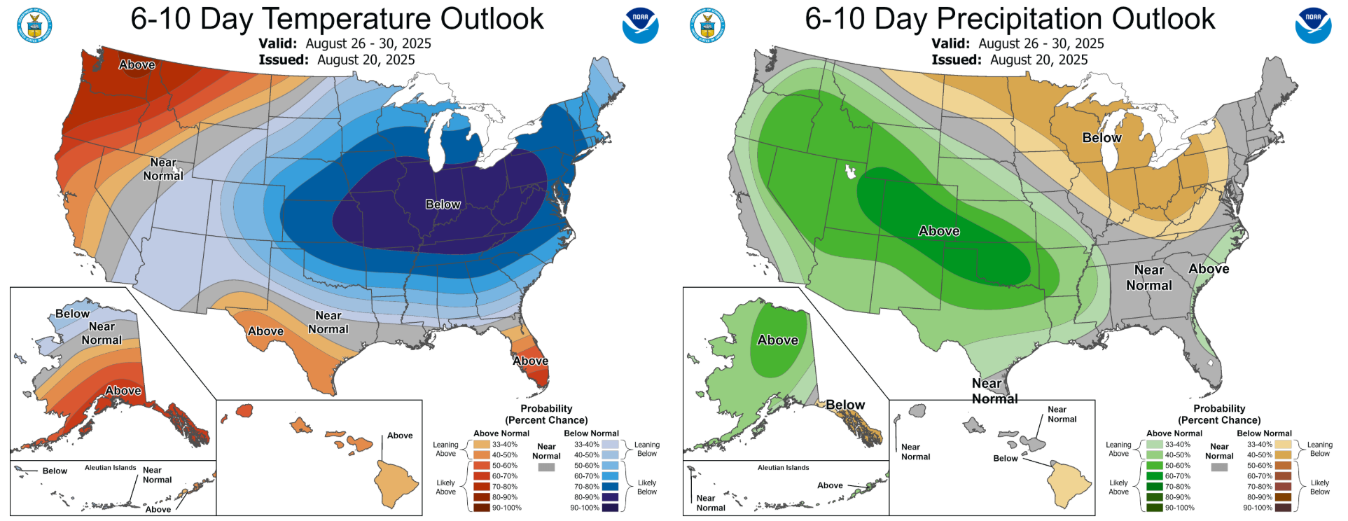
This time of year, we should be in the middle 80s. We wont be getting back to that level of warmth for quite some time. We’ve been hearing community cries for this type of pattern shift for many weeks now — it’s finally here. Enjoy!
Spread the word — share Colorado weather:
Go Premium, get all the perks.
Daily Forecast Updates
Get our daily forecast discussion every morning delivered to your inbox.
All Our Model Data
Access to all our Colorado-centric high-resolution weather model graphics. Seriously — every one!
Ski & Hiking Forecasts
6-day forecasts for all the Colorado ski resorts, plus more than 120 hiking trails, including every 14er.
Smoke Forecasts
Wildfire smoke concentration predictions up to 72 hours into the future.
Exclusive Content
Weekend outlooks every Thursday, bonus storm updates, historical data and much more!
No Advertisements
Enjoy ad-free viewing on the entire site.


You must be logged in to post a comment.