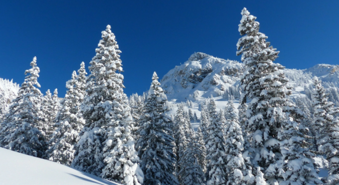
Skiers rejoice! A persistent influx of sub-tropical moisture associated with a developing atmospheric river event will bring a prolonged period of light to moderate snow to the Mountains in the coming days.
Category: Winter Weather (Page 89 of 139)
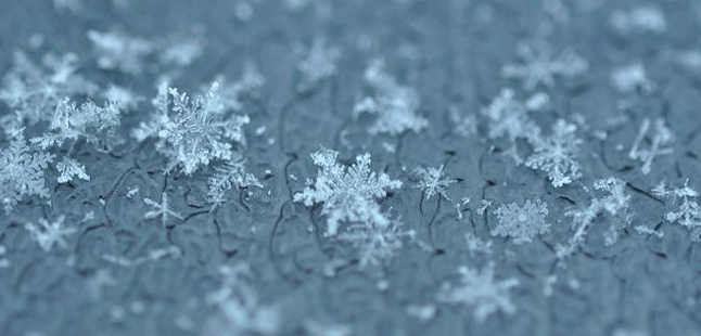
These posts contain some discussion of the white stuff, whether it be mountain snow pack or a Front Range snowstorm.

In the absence of any major storm systems approaching Colorado, this week will remain fairly quiet with primarily dry conditions. Temperatures will vary day-to-day however from the 30’s to the 50’s. We’re also watching a powerful jet that is expected to move overhead late in the week bringing widespread snowfall and blustery conditions to the Mountains.
We’ve been monitoring a weak storm system lingering off the California coastline for the last few days. Latest model guidance indicates a track that is significantly further north than what has been advertised the last few days. While there is still some uncertainty, especially in regards to temperatures and the potential for rain versus snow in our area, the chances have increased for precipitation during the day Thursday. Read our updated forecast discussion including our thoughts on snow amounts.

A milder week is expected, but there is still plenty of snow on the ground to hamper our warm-up. We detail how warm we may get, along with the threat of gusty winds, light snow/rain showers, and what skiers can expect for the week ahead. Read on for more details.
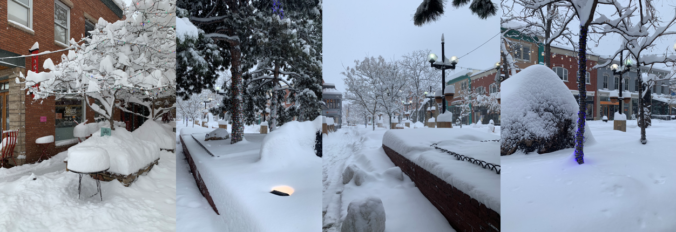
This week’s snowstorm was definitely one to remember! We review the BIG snow totals and take a look at how the ingredients came together perfectly to produce the biggest and most widespread dumping of snow for our area in nearly four years.
Wow! It’s been a busy Monday morning with our winter storm coming ashore into the Pacific Northwest overnight. We discuss the latest from the weather models this morning and ultimately why we believe historic snow totals are likely from Boulder north to Fort Collins.

We’ve already had nearly three feet of snow in Boulder this season and just about a foot and a half in Denver. The action over the last six weeks has been fast and furious to say the least, but the individual storms so far haven’t been all that memorable. This is about to change! No storm so far this winter will match the caliber of the one bearing down on the Front Range right now. We discuss the set-up, timing and snow amounts expected to fall by Tuesday evening. Let’s jump right in to the very snowy forecast!

Several waves of light snow and a dash of freezing drizzle impacted the Denver Metro area over the last 36 hours resulting from a slow-moving storm system to the southwest. We take a look at snow totals, the beautiful weekend ahead, and the strong possibility of another cold air outbreak headed our way early next week.
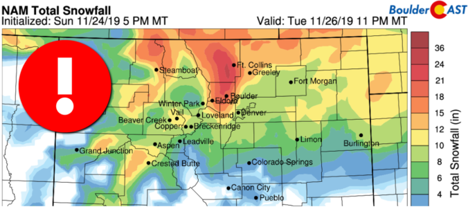
UPDATE (Friday Nov 22 at 12PM): Added discussion of official snow totals and map.

Live View of Boulder

Current Conditions

Live Radar

Recent Premium Posts

This Weekend in Colorado Weather: Early-Season Heat Ramps Up — First 90s of the Year on the Horizon
🌬️ West–northwest flow Thursday supports high‑based convection with gusts to 35 MPH; virga …
BoulderCAST Daily – Wed 06/03/26 | Scattered P.M. storms again as moisture peaks for the week
🌬️ Weak westerly flow aloft today with no major synoptic features nearby; only …
BoulderCAST Daily – Tue 06/02/26 | Storms Reload This Afternoon, But With Noticeably Less Bite
❄️ Monday delivered lots of hail to northeast Colorado, with one supercell tracking …
3-Day Forecast

Trending Content

© 2026 Front Range Weather, LLC