Category: Winter Weather (Page 88 of 139)
These posts contain some discussion of the white stuff, whether it be mountain snow pack or a Front Range snowstorm.
This week will end with a bang! A potent Pacific storm system will blast through the Front Range during the day Friday bringing possible damaging winds, a slight chance of rain/snow, and fresh powder to the High Country.
This week will favor continued northwest flow across the central and northern Rockies. We’ve got strong winds, potential 60 degree temperatures, and even snow to discuss this time around. Read on for more details.

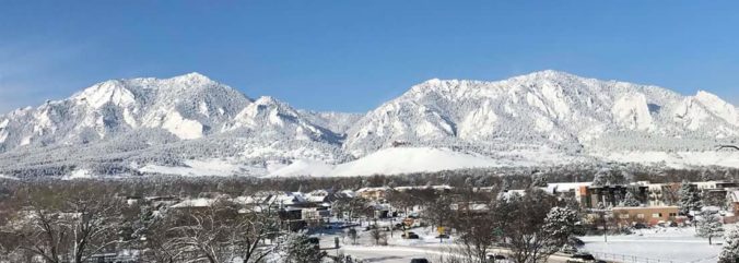
After a cold start to our week to end the month of December, the weather turns milder as we ring in the New Year. Don’t get too cozy…a return to winter-like temperatures will ensue during the latter part of the week. We also discuss the little bit of snow over the weekend which produced just enough to bump 2019 into Boulder’s top 5 snowiest calendar years.

Yikes! A surprisingly high amount of uncertainty remains regarding the incoming winter storm making for a difficult forecast heading into Saturday. We provide a quick update, including our team’s thoughts on the most recent model runs and if any tweaks are needed to our prior snowfall forecast (spoiler alert: they are!).
PREMIUM STORM UPDATE (7:00 AM Sat 12/28/19): We do a quick check on how the forecast looks early Saturday as moderate snow falls across the Front Range. We talk forecast amounts, waning snowfall intensity, and gusty winds expected later today. Click HERE to read.
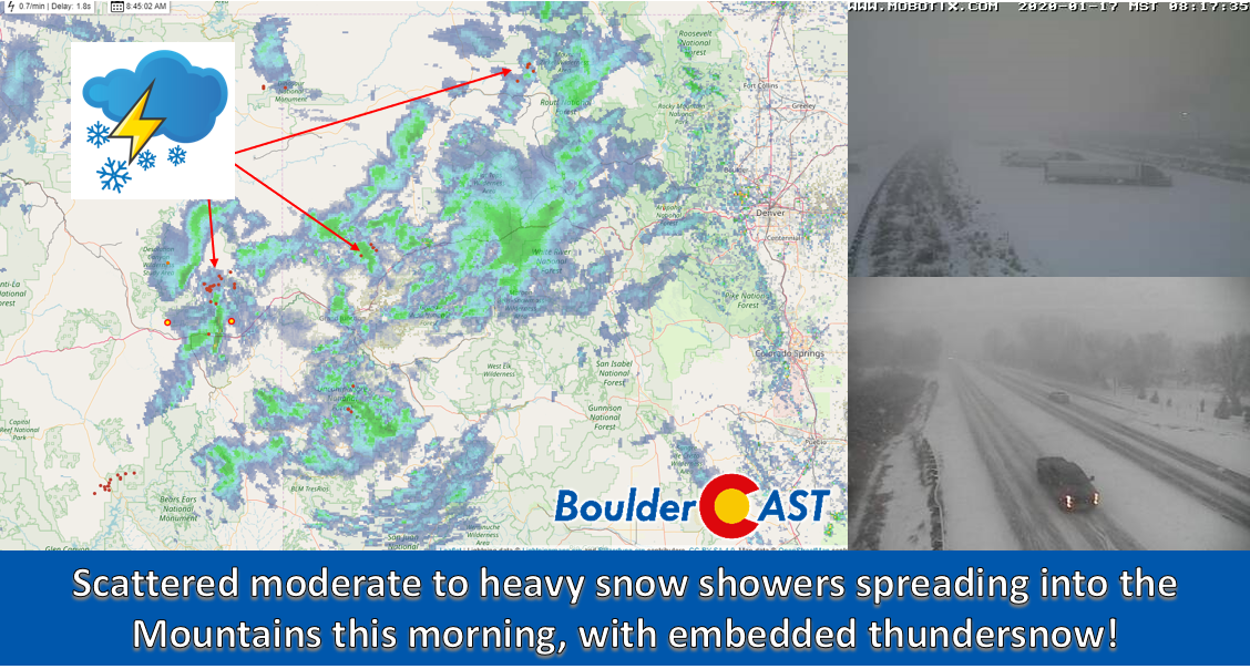
After a rather quiet month of December, our first “major” snow event in four weeks is taking shape for late Friday night into early Saturday. The bulk of the snow will bypass the Denver area, but we’re still looking at some accumulation. Read on for details on the falling temperatures, when the snowfall will begin and end, and how much white stuff to expect.
FORECAST UPDATE (Friday Dec 27 3:00 PM): Models are still having trouble with this storm, and so are we. Read our latest forecast and get our latest snowfall forecast map.

Unseasonably warm conditions will continue for the next few days before cooler and unsettled weather arrives later in the week. We’re also watching a potential winter storm but the track remains uncertain at this time.

Are you hoping for a White Christmas in 2019? Don’t hold your breath. We discuss the weather pattern that is quickly erasing any chance for a White Christmas in Denver and Boulder this year.

Live View of Boulder

Current Conditions

Live Radar

Recent Premium Posts

This Weekend in Colorado Weather: Early-Season Heat Ramps Up — First 90s of the Year on the Horizon
🌬️ West–northwest flow Thursday supports high‑based convection with gusts to 35 MPH; virga …
BoulderCAST Daily – Wed 06/03/26 | Scattered P.M. storms again as moisture peaks for the week
🌬️ Weak westerly flow aloft today with no major synoptic features nearby; only …
BoulderCAST Daily – Tue 06/02/26 | Storms Reload This Afternoon, But With Noticeably Less Bite
❄️ Monday delivered lots of hail to northeast Colorado, with one supercell tracking …
3-Day Forecast

Trending Content

© 2026 Front Range Weather, LLC
You must be logged in to post a comment.