This was undoubtedly a wild week in Front Range weather — but one which resulted in multiple good outcomes. The extreme severe weather outbreak planned for midweek got partially busted by low clouds and fog which may have ultimately saved it from becoming the costliest hailstorm in state history. Further, the deluge of rain that dumped to close out the week will go a long way towards eradicating much of the ongoing drought in the eastern half of the state. Let’s take a look back at this crazy week in Colorado weather!
Category: Winter Weather (Page 37 of 134)
These posts contain some discussion of the white stuff, whether it be mountain snow pack or a Front Range snowstorm.

After a few warm and quiet days, big changes arrive midweek as a southern-track storm system targets the Front Range. Initially we’ll be in the warm and unstable sector with the first severe weather outbreak of 2023 for Colorado taking shape on Wednesday. By late week, the main storm system will slowly move across the state inducing a prolonged period of upslope and soggy conditions across our area. What type of severe weather should we expect on Wednesday and how much rain (and snow) will fall this week? Let’s take a look.
April 2023 concluded as Boulder’s sixth consecutive month with below normal temperatures. At the same time, the Front Range area saw below normal snowfall and precipitation leading to increased drought coverage, though a soggy conclusion to the month did help things a bit. Here’s a quick and colorful graphical recap of our weather during April and how it relates to climatology.

Another wave of precipitation will accompany a cold front racing into the Front Range from the north Thursday night with rain changing to snow across the Denver Metro area. This precipitation will be joined by strong dynamics and northerly flow, making for a gusty and unsettled evening ahead, with some grassy accumulations possible across the lower elevations as snow mixes in late for some. This storm will largely favor areas south of Interstate 70, with the northern Front Range including Boulder not expected to see much. Let’s take a look.

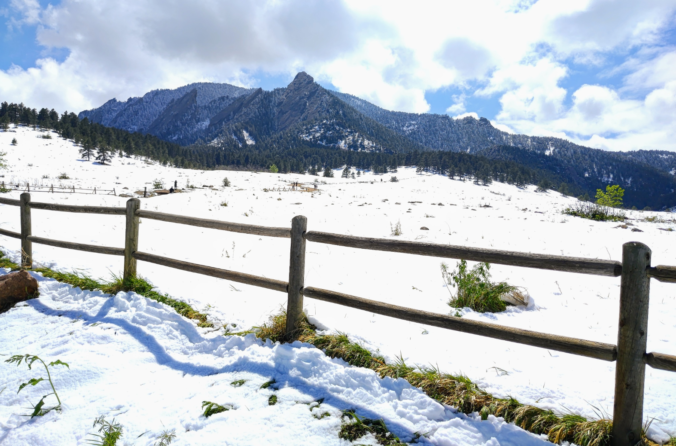
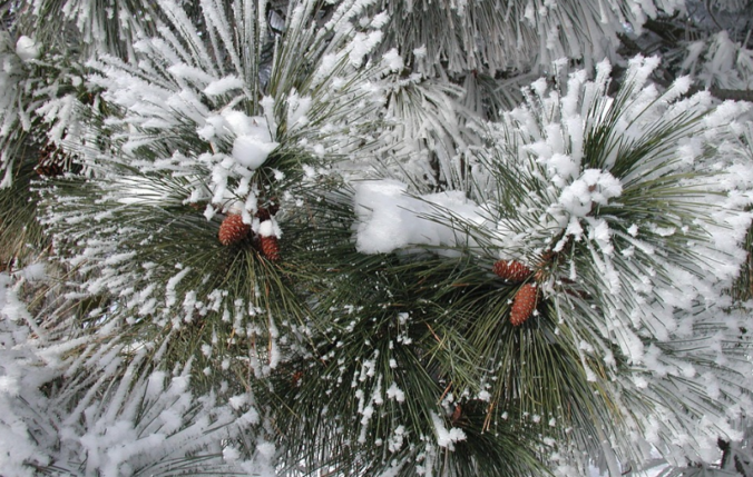
A powerful low pressure system remains on-track to impact the Front Range Tuesday afternoon into Wednesday with several hours of nearly perfect upslope in the works. While there has been a slight southward shift in the storm’s track, we still anticipate widespread soaking rain across the lower elevations and heavy wet snow in the Foothills, including some thunder thrown into the mix. Travel will become extremely difficult Tuesday evening west of town with snowfall rates of 1 to 3″ per hour. Finally, while this event will be almost exclusively just cold rain across the Plains, we may see a little wet snow in the far western and southern Metro area. Read on for all the details.
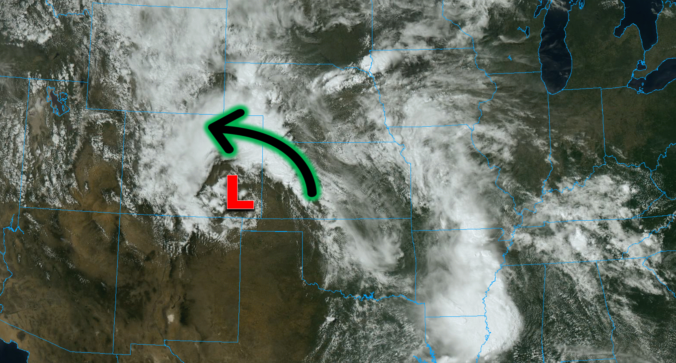
The last week of April will undoubtedly be an interesting one weatherwise across the Front Range as a potent spring storm bears down on Colorado in the coming days. While we still have some concerns about the storm’s track and exactly how low snow levels will come, this will be a classic upslope event with impacts ranging from thunderstorms to soaking rain to heavy wet snow for our area. Furthermore, there will also be another smaller but colder storm late in the week with accumulating snow chances. The Front Range forecast this week sure is busy! Let’s get into it.

Live View of Boulder

Current Conditions

Live Radar

Recent Premium Posts

BoulderCAST Daily – Thu 01/15/26 | Fire Danger Today Before a Cold Front Tonight
🔥 Fire danger rising — Warm and windy today ahead of a strong …
BoulderCAST Daily – Wed 01/14/26 | A gorgeous Wednesday ahead of increasing fire danger & a stronger cold front tomorrow
🌬️ Weak front overnight — A weak cold front slipped through around 9:30 …
BoulderCAST Daily – Tue 01/13/26 | A thick blanket of high clouds won’t stop us from reaching the 60s again
☁️ Thick cloud deck overhead — Moisture streaming in aloft brings widespread mid‑ …
3-Day Forecast

Trending Content

© 2026 Front Range Weather, LLC