Category: Winter Weather (Page 33 of 134)
These posts contain some discussion of the white stuff, whether it be mountain snow pack or a Front Range snowstorm.
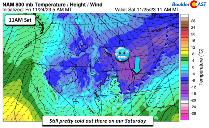
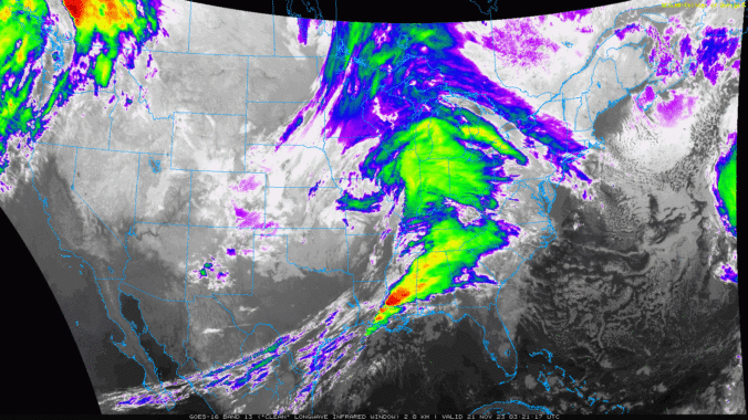
The day of giving thanks and eating delicious food is nearly upon us, and whether you are ready or not, so too are the snowflakes which will make a return to the entire Front Range beginning Thursday afternoon and evening with snowflakes staying in the forecast into Saturday. Temperatures will also plummet well below freezing the next few days. We discuss the timing of the snow, the expected snowfall totals for everyone and when travel may be most impacted.
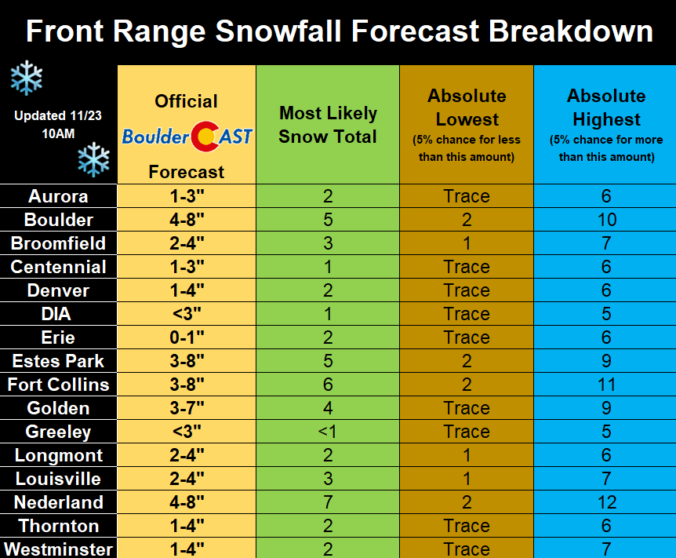
Update (Thu 11/23 7AM): Ensembles have cut back on snow amounts by about 20%, so we’ve decreased snow amounts accordingly. The biggest snow totals from this storm are still expected to be around Boulder, with much lower impacts elsewhere in the Metro area.
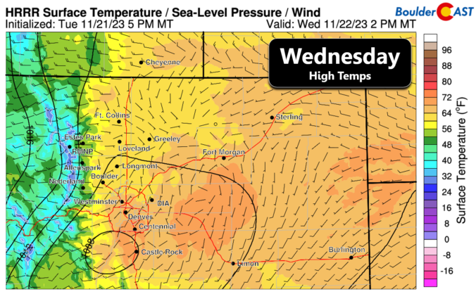

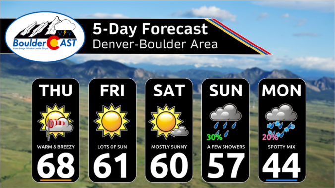
This week will offer up the most exciting weather we’ve had across the Front Range in a long time. We’ve got rain showers, high winds, freezing drizzle, bitter cold temperatures and accumulating snow headed our way, but there will still be a few beautiful days mixed in as well. Read on for the latest details on what should be a interesting week in Colorado weather!


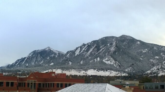
Live View of Boulder

Current Conditions

Live Radar

Recent Premium Posts

BoulderCAST Daily – Thu 01/15/26 | Fire Danger Today Before a Cold Front Tonight
🔥 Fire danger rising — Warm and windy today ahead of a strong …
BoulderCAST Daily – Wed 01/14/26 | A gorgeous Wednesday ahead of increasing fire danger & a stronger cold front tomorrow
🌬️ Weak front overnight — A weak cold front slipped through around 9:30 …
BoulderCAST Daily – Tue 01/13/26 | A thick blanket of high clouds won’t stop us from reaching the 60s again
☁️ Thick cloud deck overhead — Moisture streaming in aloft brings widespread mid‑ …
3-Day Forecast

Trending Content

© 2026 Front Range Weather, LLC