A short review of the tiny snow totals from Monday night into Tuesday morning.
Category: Verification (Page 27 of 51)
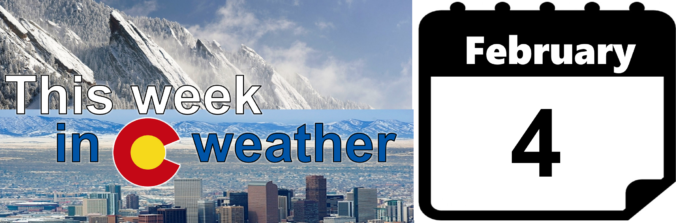
These posts take a look back at recent weather events, like snow storms or severe weather outbreaks, and evaluate how the forecast played out. We evaluate how well the models predicted what actually occurred, and offer insight into what can be learned and applied moving forward.
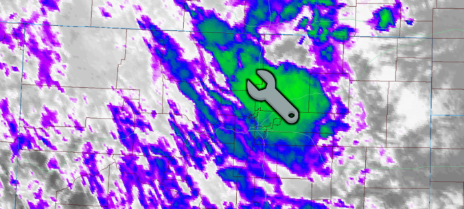
Our low-confidence snowfall forecast ended up turning out okay in most areas on Wednesday. This is despite a huge convective snow squall throwing a wrench into things late in the afternoon. Read on as we discuss what happened and review the totals from the snowfall event, which by the way was our fifth in just the last ten days.
With the conclusion of last night’s quick-hitting snow event, our fourth in just the last eight days, Boulder has now officially eclipsed the typical amount of snow that falls in an entire season, and we’re not even half way through the month of February! We take a look at how this fits into Boulder’s history, what it might tell us about the potential for snow the rest of the winter, and give a quick and dirty forecast for our next chance of snow coming on Wednesday.
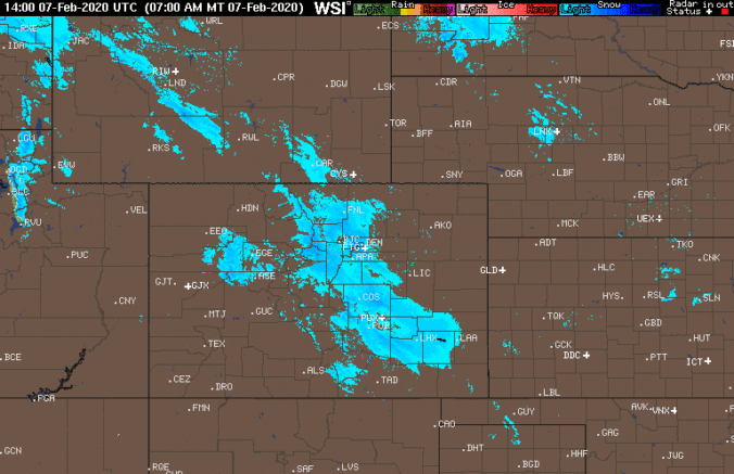
Pockets of jet-forced snow began to fall Thursday evening and continued intermittently through Friday afternoon across the Metro area. Bands of moderate to heavy snowfall were most prevalent near and south of Interstate 70 in the Denver Metro area and in the Foothills of Jefferson County where 8-16″ of snow was reported.
We take a quick peek at snowfall totals as of Friday morning, check the latest from the models, and let you know how much snow is still to come.
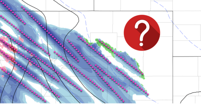
Following hot on the heels of the snowstorm earlier this week, another round of winter weather is expected Thursday evening into Friday evening across the Front Range. This one however will be a different beast, defined almost exclusively by a long window of scattered jet-forced heavy snow bands. Extreme uncertainty in the exact location and timing of the banding means potential snowfall amounts are not quite known. We discuss the setup and give our thoughts on what is sure to be a difficult forecast to end to the work-week.
Shown below is the BoulderCAST snowfall forecast map issued Sunday (February 2nd) during the afternoon with actual storm totals overlaid in boxes. Green boxes indicate that our forecast verified to within one inch of the observed snowfall. Red did not.

| Seasonal Snow Totals (Updated Feb 5 2020) |
|---|
| Boulder | Denver |
|---|---|
| 73.0" | 32.7" |
Our first widespread snowfall of 2020 is winding down, but the cold will linger for most of the week ahead. We’re also tracking our next potential chance of heavy snow resulting from the overhead jet stream in just a few days time. Read on for all the details.

Live View of Boulder

Current Conditions

Live Radar

Recent Premium Posts

BoulderCAST Daily – Sun 12/14/25 | A warmup after the chilly yesterday afternoon
🌡️ Warmth Returns with no sight of snow: Highs return close to 60 …
BoulderCAST Daily – Sat 12/13/25 | Highs in the 60s this weekend!
🌡️ October Warmth in December: Highs typical for late October will be in …
This Weekend in Colorado Weather: The December that has felt like October continues with bone dry warmth persisting into next week
🌬️ Two more breezy days ahead with gusts 15–25 MPH before the jet …
3-Day Forecast

Trending Content

© 2025 Front Range Weather, LLC
You must be logged in to post a comment.