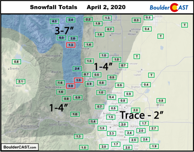
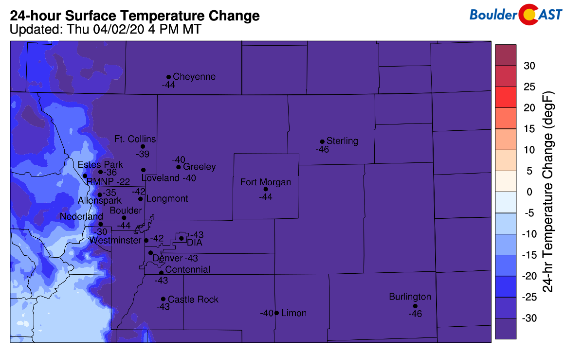
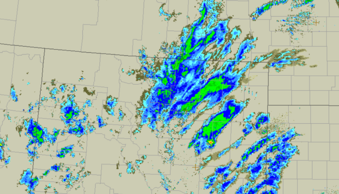
A review of the snow totals from Thursday, April 2 2020 across the Denver Metro area.
Category: Verification (Page 28 of 53)
These posts take a look back at recent weather events, like snow storms or severe weather outbreaks, and evaluate how the forecast played out. We evaluate how well the models predicted what actually occurred, and offer insight into what can be learned and applied moving forward.
From freezing drizzle, to fog and rain, to thundersnow and blizzard conditions, Friday’s storm system had it all across northeast Colorado! Or did it? As expected, its quick progression and lack of cold air ultimately left us with rather unimpressive snow totals. We take a quick look back at how Friday’s winter event played out across the Denver Metro area.

A moisture-infused spring storm dumped up to 2″ of liquid and 2 feet of wet snow in portions of the Metro area on Thursday on the first day of spring. We briefly review the atmospheric setup and take a look at the regional snow totals and blizzard-inducing wind gusts.

It’s business as usual to start the week with continued mild conditions through Wednesday. However, we are keeping close tabs on a developing winter storm later this week. It’s a complex system to say the least and our confidence in the forecast is low right now, but we could be talking up to a foot of snow in some portions of the Metro area by Friday morning. Read on for our complete outlook for the next five days.

Following a quick taste of winter Sunday night, our weather takes a turn for the better with warmer and drier conditions ensuing this week. We discuss the snow totals from Sunday night and look ahead to possible record warmth later this week into the weekend.

Though only an inch or so of snow may have fallen in your area on Wednesday, upwards of 3 to 6 inches were reported within the city limits of Boulder. We take a look at the snow totals from yet another “light” snowfall event the struck the Metro area Wednesday afternoon and evening. We also look ahead to our next, potentially more significant winter storm targeting the Front Range for the upcoming weekend.
Continue reading
A short review of the tiny snow totals from Monday night into Tuesday morning.

Live View of Boulder

Current Conditions

Live Radar

Recent Premium Posts

BoulderCAST Daily – Tue 06/02/26 | Storms Reload This Afternoon, But With Noticeably Less Bite
❄️ Monday delivered lots of hail to northeast Colorado, with one supercell tracking …
BoulderCAST Daily – Sun 05/31/26 | Dry and warm today but rain chances increase this week
🌦️ Overall dry and warm Sunday, though cannot rule out a very widely …
BoulderCAST Daily – Sat 05/30/26 | A stray shower today as most activity resides well east of Denver
🌦️ Spotty showers today, mainly well east of the Denver Metro area, where …
3-Day Forecast

Trending Content

© 2026 Front Range Weather, LLC
You must be logged in to post a comment.