Category: Tropical Weather (Page 2 of 20)
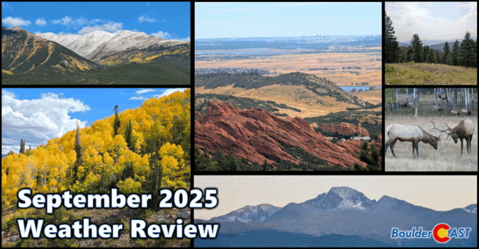
September 2025 brought a classic Colorado blend to Boulder and the Front Range: near-normal temps, wetter-than-average skies, and a lively mix of sunshine and storms. A standout precipitation event around the 23rd delivered soaking rain in the lowlands and the first real coating of snow to the Mountains. The month eased us gently into autumn, with crisp mornings, comfortable afternoons, and brilliant foliage lighting up the higher terrain. And yes—who could forget that dramatic wave of Canadian wildfire smoke that swept through, reminding us how connected we are to the broader arid landscape of western North America. Here’s a quick and colorful graphical recap of our weather during September and how it relates to climatology.
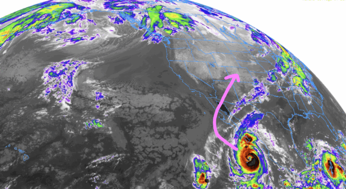
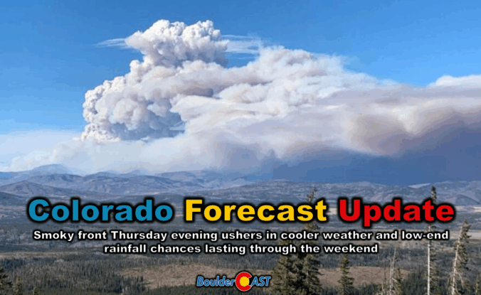
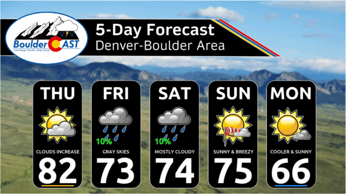
Thursday’s shaping up to be a busy weather day across the Front Range. We’re looking at hot temperatures, gusty winds, and a cold front arriving by evening that’ll bring a noticeable drop in temps — along with a wave of wildfire smoke. We’ll walk through what to expect today, how the weekend is shaping up, and whether any moisture from Hurricane Lorena might sneak into the region.
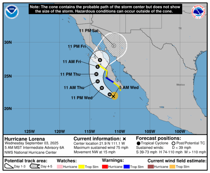
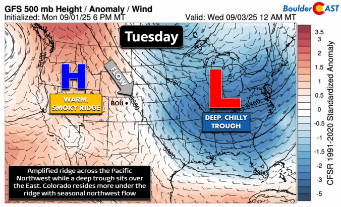

September kicks off with a mellow vibe across the Front Range — warm days and mostly dry skies are expected. But don’t let the quiet start fool you. Between drifting wildfire smoke, sneaky cold fronts, and a potential tropical system by the weekend, there’s more nuance in our forecast this week than meets the eye. Read on as we break down what to expect day by day, plus what might shake things up by the weekend.

Live View of Boulder

Current Conditions

Live Radar

Latest Smoke Forecast

Recent Premium Posts

BoulderCAST Daily – Sun 07/19/26 | Heat Advisory Continues Through Monday
🥵 Heat Advisory through Monday — Highs in the upper 90s continue today …
BoulderCAST Daily – Sat 07/18/26 | Heat Advisory Issued Sunday and Monday for the Front Range
🥵 Heat Advisory Issued — Sunday through Monday for upper 90s to low …
BoulderCAST Daily – Fri 07/17/26 | Hot and dry continues through the weekend
🥵 Heat tightens its grip this weekend — Ridge strengthens slightly over the …
3-Day Forecast

Trending Content

© 2026 Front Range Weather, LLC