Category: Premium Content (Page 142 of 451)

This content is for Premium Members only.
BoulderCAST Daily – Fri 05/12/23 | Drying up with rain ending by early afternoon

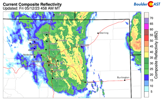
The cutoff low pressure system as of 6 am this morning shows the circulation near the Colorado/Kansas border on satellite imagery. This system will be slowly lifting east-northeast into central Nebraska this afternoon and evening, leading to improving weather conditions as early as this afternoon. The morning radar ending at 6 am showed the persistent wrap-around precipitation over the Front …

Premium Sign up to receive our daily forecasts via email!

Just a reminder that we offer notification emails to alert you when our daily forecasts are published every morning (Premium membership required). Each email will contain key weather highlights for the day, as well as a link to the full forecast discussion. An example email is shown below. Please fill out the form below to sign up now. NOTE: This …

BoulderCAST Daily – Sun 05/07/23 | Continued warm with only slight storm chances

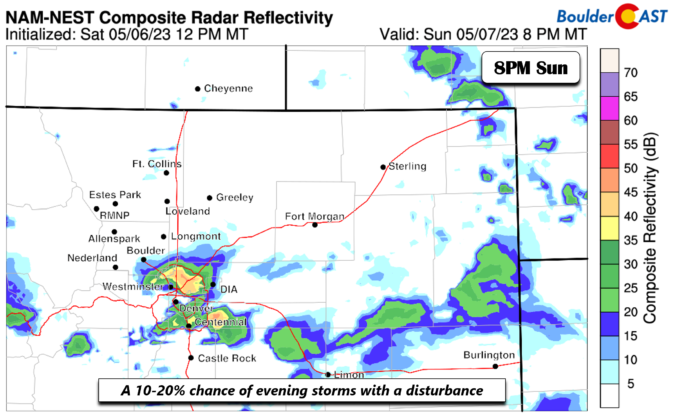
Another disturbance in the flow with a persistent trough to our west will advect through the area this evening. While the deepest lift is located to our northeast, we continue to have a slight chance of some early evening showers and thunderstorms over the Denver Metro. But before that happens, it'll be partly to mostly cloudy with highs in the …

BoulderCAST Daily – Sat 05/06/23 | Drier air works in for the weekend with less rain chances

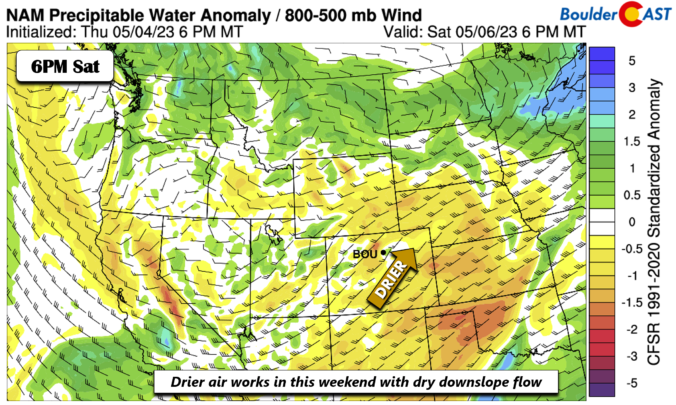
The trough out west will continue to be in place for the weekend, especially today. It will keep our atmosphere in an active pattern. However, at the surface, the chance of wet weather will be much lower than what it was compared to this past week. The reason for this is a more westerly warm, dry, downslope flow on the …

BoulderCAST Daily – Fri 05/05/23 | Low to mid 70s with a 10-20% chance of early evening storms and gusty winds

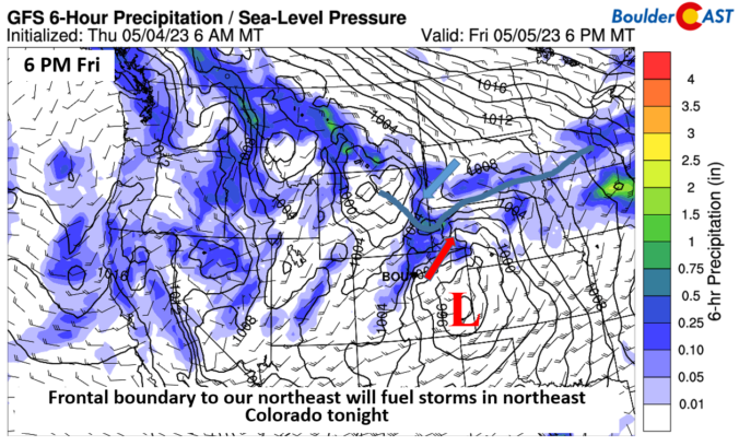
The trough out west over the central to northern Great Basin continues to churn as we end the week. Another surge of energy will stream northeast this afternoon and evening into northeast Colorado and parts of Wyoming, Nebraska, and South Dakota. At the same time, a frontal boundary will be located over the northern Plains. Convergence along this boundary with …

BoulderCAST Daily – Wed 05/03/23 | Mostly dry as we approach 80 degrees, but tomorrow will be a wetter day

Today will be more of the same across Colorado thanks to the stagnant blocking pattern across the nation right now. The mid-level height patterns from yesterday (left) and today (right) are shown below. Notice any differences? There are few if any as this truly is a stalled-out pattern in the US right now! A closer inspection of just today shows …

BoulderCAST Daily – Tue 05/02/23 | An uptick in storms today, most numerous west of Interstate 25

The pesky omega block will continue across the nation through most of the week! Why is is called an omega block you ask? Well, omega comes from the height (pressure) pattern it entails which looks like to the Greek letter "omega", and block because the highly meridional nature of this pattern tends to block up and stagnate weather systems in …

« Older posts Newer posts »