Category: Premium Content (Page 141 of 451)

This content is for Premium Members only.
BoulderCAST Daily – Sat 05/20/23 | Smoke decreases today but storm chances increase

Awarmer day along with more sunshine and less haze is in store today. High pressure over western Kansas will bring about southerly flow on the Plains this afternoon and bring a warmer airmass into the region. We should see upper 60s to lower 70s. Clouds will be on the increase later this afternoon as storms start to develop. The southerly …

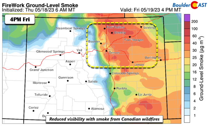
BoulderCAST Daily – Fri 05/19/23 | Chilly and gloomy with light rain/drizzle and reduced visibility

Acold front has pushed through the region. Behind it, a cooler airmass is in place. In addition to that, moist low-levels remains across the Front Range. This is very apparent in the sounding below, which shows the temperature (red line) and dewpoint (green line) very close to one another, indicating high relative humidity. This moisture aided by weak upslope and …

BoulderCAST Daily – Wed 05/17/23 | More spotty storms today, a front brings cooler weather, rain and smoke tomorrow

More of the same type of weather is expected today as largely identical conditions exist compared to yesterday with weak ridging present across the West, limited moisture in our area, and west-northwest flow over Colorado. Our next weather system is gearing up across Montana and Idaho --- that will arrive into the Front Range on Thursday. Today's similar setup means …

BoulderCAST Daily – Tue 05/16/23 | The sun finally makes an appearance but isolated storms return this afternoon/evening

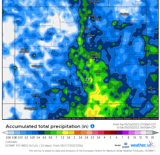
The last seven days have been incredibly wet across the Front Range, even by "climatologically wettest month of the year" standards! Just about everyone has received more than 3.5" of precipitation (mostly rainfall) since the explosion of hail and lightning in eastern Boulder County last Tuesday. Portions of the southern Metro area have seen double that amount, incredibly receiving over …

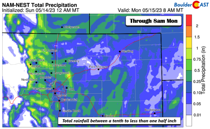
BoulderCAST Daily – Sun 05/14/23 | Periods of light showers through early Monday with highs in the 50s to near 60

Amoist upslope flow will be in place today and tonight as a weak area of low pressure resides over northern Texas. Northeasterly flow aloft and at the surface will make for a nasty, cloudy, and rainy day with highs in the upper 50s to around 60 degrees. At the surface (bottom-most figure), the upslope will also exist. Expect periods of …

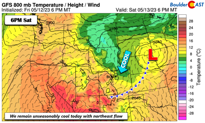
BoulderCAST Daily – Sat 05/13/23 | Unseasonably cool weather continues

We remain in a cool and below normal pattern for the start of the weekend. A surface low over eastern Nebraska has a cold front tied to it. The front is well south of us after moving through yesterday. Nevertheless, the cool airmass is largely unchanged from Friday. We should top out in the upper 50s to lower 60s as …

« Older posts Newer posts »