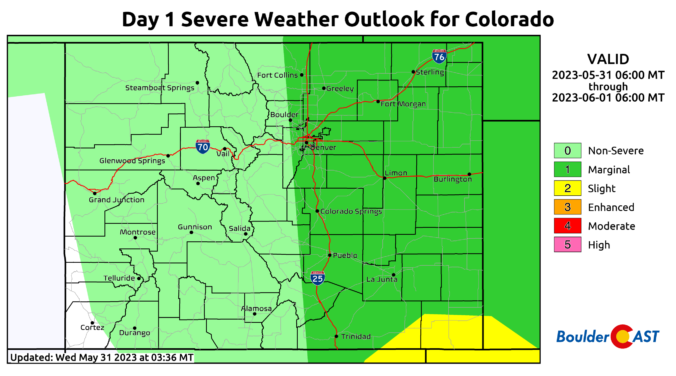
An upper-trough remains over the area today and tonight, keeping the threat of some showers and storms over the region. However, similar to yesterday, where deeper moisture was further west over the Front Range, it appears this deeper moisture has moved east along the Colorado/Kansas border. That should limit our overall coverage of showers/storms. Most high-res guidance indicates a 20-30% …
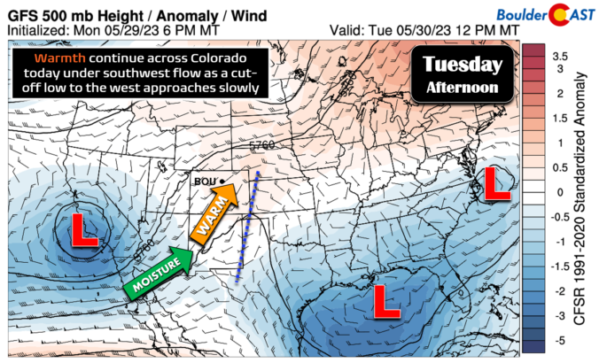
The closed-low pressure has come ashore across southern California overnight and it will continue to trek slowly eastward into northern Arizona by this evening. As it nears, flow will back from westerly to almost due southerly aloft across Colorado and moisture will continue to rise through the day at all levels. By early this evening, a strong positive moisture anomaly …
Monday had absolutely perfect holiday weather across the Front Range, save for a few isolated thunderstorms that developed in the evening hours. The cool and sunny morning was even perfect weather for the ~50,000 runners in the BolderBoulder 10K. The high temperature on Monday in Boulder was officially 81°F, with Denver reaching 82°F. If you can believe it, this was …
Drier air works in today and tonight. At mid-levels a trough is centered over northern California. Meanwhile, weak zonal flow is in place across Colorado. The moist axis is largely located from far eastern Colorado into Kansas. Given that the moisture axis is further east today than the past several days, our storm chances will be less than the past …
The atmosphere will almost work like clockwork today with a nearly identical setup. The trough will remain to our north and west, sending another ripple of energy into the region for the afternoon and evening hours. Compared to yesterday, shear is stronger, favoring not only hail and damaging winds, but also an isolated tornado threat. The Storm Prediction Center …
Another round of showers and storms are expected this afternoon and evening with large hail and damaging winds as the main threats. An elongated trough remains to our west over Nevada. To its southeast, a jet streak of around 90 mph will penetrate into southwest parts of Colorado this afternoon and evening. This jet will advect in moisture, instability, and …
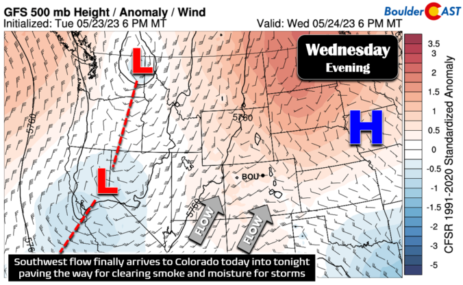
Change is finally knocking on the door for northeast Colorado today as we shift away from the dry and smoky weather that began last Friday towards a setup with cleaner air and excellent chances for daily thunderstorms! PM2.5 Air Quality sits between 85 and 110 this morning across the Boulder-Denver area, about the same as yesterday right on the cusp …