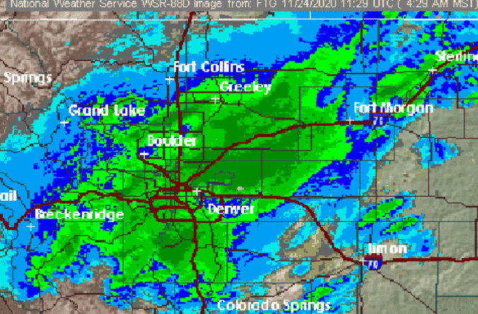
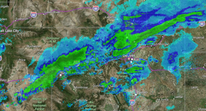
Brace for impact! The highly-anticipated early-season storm is confirmed at this point with widespread heavy wet snow expected across the entire Front Range region late Monday night into Tuesday night. We still have our concerns about how much snow will actually stick given the situation. It’s still summer after all! Nonetheless, read on for our in-depth snowfall forecast discussion and map.
PREMIUM WINTER STORM VIDEO UPDATE (10:00 AM Mon 09/07/20): Our early season winter storm remains on-track. We take a look at the latest model runs and discuss the wild weather about to unfold across the Front Range in the next 12 to 48 hours. Click HERE to watch our 40-minute video discussion.
How is it even possible to snow this early in the season? What are we thinking for snowfall amounts for the early-season snowstorm bearing down on the Front Range? What could go wrong with the storm? Listen to find out!
It’s hard to believe that we could go from sizzling record heat to snow in a little under 36 hours, but that is just what most weather models are indicating early next week! A major autumn storm system is progged to drop southward putting a giant, bitter cold bullseye right along the lee of the Rockies. With this strong and cold early-season storm system, a period of intense lift and upslope will likely unfold across the Front Range producing widespread rain showers and even the threat of snow all the way down to the lower elevations of the Boulder-Denver area. Needless to say, it’s definitely going to be an interesting forecast heading into early next week! Let’s talk about it….
We’ve got no record heat to discuss this time with a cooler pattern taking hold to end the month of August. After Monday’s chance of rain, it will be mainly dry and sunny the rest of the week with temperatures fluctuating up and down. Read on for our complete forecast of the week ahead.
Change is already unfolding across the Front Range with 90’s now a thing of the past for the time being. A series of cold fronts will bring much cooler temperatures to the area in the coming days, with even some Mountain snow sprinkled into the extended outlook. Let’s take a look at the welcomed cool-down we’ve all been anticipating for more than two months.
The week will begin with near-record high temperatures continuing across the Front Range. However, we will see a gradual downward trend in temperatures thanks to increased clouds and scattered storms over the state. We are also tracking a few cold fronts on the horizon that look to finally breakdown that persistent ridge leading to much cooler temperatures next week.
© 2026 Front Range Weather, LLC