



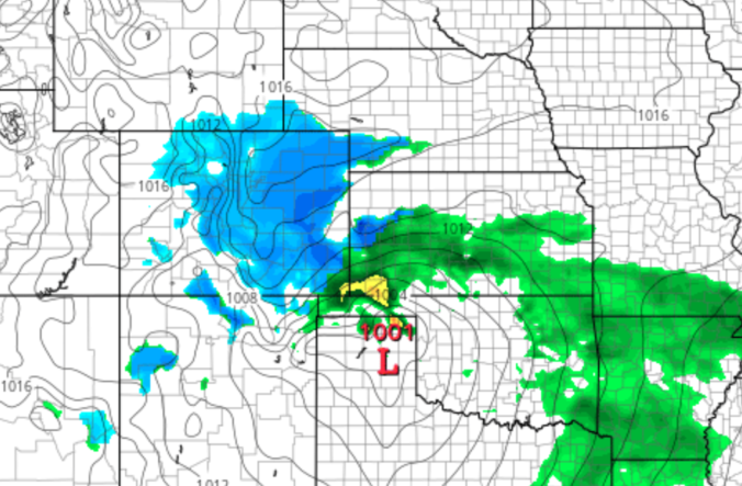
After a rather pleasant weekend concluding with a few thundershowers Sunday night, we enter a calmer pattern for the next several days as temperatures remain above normal. We are however monitoring a southern-track storm system which may bring a return of rain and snow to the Front Range late in the week.
Category: Forecast (Page 115 of 198)

Following a quick taste of winter Sunday night, our weather takes a turn for the better with warmer and drier conditions ensuing this week. We discuss the snow totals from Sunday night and look ahead to possible record warmth later this week into the weekend.

Spring is in the air! An interesting weather setup is taking shape to change rain over to snow across the Boulder-Denver area late in the day Sunday into Sunday night. In general, snow amounts will be just a few inches, but we are concerned that springtime convection and cold temperatures may combine Sunday evening to produce embedded pockets of very heavy snow, possibly accompanied by thunder. Read on for our complete forecast and our thoughts on where thundersnow is most likely Sunday evening.
A cold snap sets in to start the week, along with heavy snowfall for the higher terrain. A slow warming trend takes shape come Wednesday but doesn’t get into full-swing until the weekend. Read on for more details.
A potent southern-track storm system will scoot across southern Colorado on Sunday bringing the return of winter weather to the Front Range. While warmer temperatures will limit the overall impact, we are expecting a small amount of accumulating snow for much of the Denver Metro area. Read our latest forecast and see where your location lands on our snowfall forecast map.

Though only an inch or so of snow may have fallen in your area on Wednesday, upwards of 3 to 6 inches were reported within the city limits of Boulder. We take a look at the snow totals from yet another “light” snowfall event the struck the Metro area Wednesday afternoon and evening. We also look ahead to our next, potentially more significant winter storm targeting the Front Range for the upcoming weekend.
Continue reading
Live Radar

Trending Content


Recent Premium Posts

BoulderCAST Daily – Tue 11/10/26 | Clouds Increase Today, But Colorado’s Dry Pattern Rolls On
🌤️ A Few More Clouds Today – Mountain wave clouds are developing along …
BoulderCAST Daily – Sun 11/08/26 | Mild November Weather Continues, Even With A Cold Front Midweek
☀️ Sunny and warm for early November – Temperatures in the middle to …
BoulderCAST Daily – Sat 11/07/26 | A Pleasant Weekend With Dry Weather For a While…
☀️ Sunny and Pleasant – Highs in the lower 60s this afternoon trend …
© 2026 Front Range Weather, LLC