
We provide our final thoughts on the snow event taking shape for Wednesday evening and night, including a timeline for the storm and our snowfall forecast map.
Category: Forecast (Page 103 of 169)
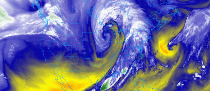
Snow is on the way as a speedy winter storm is set to impact the area Wednesday evening and night. We discuss the tricky set-up that is making for a difficult snow forecast in some areas. Of course, we do give our initial expectations for snowfall amounts as well!

The week starts out breezy and chilly, but warms up the next few days before a snow event comes together late Wednesday into Thursday. We give our early thoughts on the snow chance and discuss the pleasant end to the week thereafter.
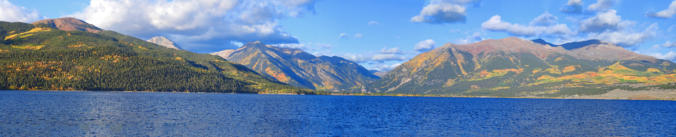
The week ahead will be mainly dry, but temperatures will be up one day and down the next. We’re also watching a series of Pacific storm systems late in the week that will bring snow to the Mountains and possibly the Plains as well over the weekend.
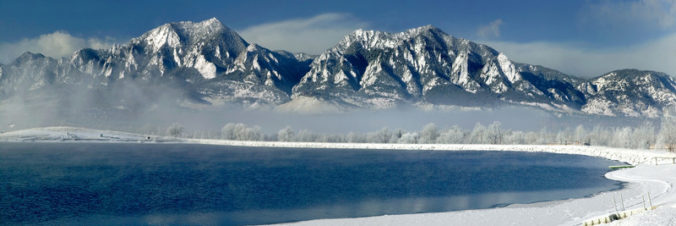
Right on schedule, a series of heavy snow bands progressed across the Front Range Thursday morning producing the season’s first snow for everyone alongside record cold temperatures. We take a look at snow totals and the impressive temperature records from across the area. We also announce the winners of our 2019 First Snow Contest.
Whether you’re ready or not, bitter cold temperatures and snow are coming to the Front Range Wednesday night into Thursday! We discuss the forecast for the winter storm that will end the growing season, obliterate temperature records, and produce our first snowfall of the season.
PREMIUM STORM UPDATE (Thu October 10th 8:00 AM): Heavy snow arrives just on schedule! Click to read.
This week begins on the warm side, but temperatures will take a major tumble as our first taste of winter arrives Wednesday night into Thursday. Our forecast calls for the first accumulating snow of the season and potentially record cold temperatures. Read on for more details.
Thanks to everyone that entered our 2019 First Snow Contest. We briefly review the entries, which actually favor a later date than Boulder’s climatology would suggest. Contest prizes and recognition will be awarded in the days following our first dumping of snow, BIG or SMALL!

Live View of Boulder

Current Conditions

Live Radar

Latest Smoke Forecast

Recent Premium Posts

This Weekend in Colorado Weather: Several More Scorching Days Ahead Before the Long‑Awaited Monsoon Pattern Arrives
☀️ Persistent heat continues — Low to mid‑90s through Saturday, spiking towards the …
BoulderCAST Daily – Wed 07/15/26 | The Ridge Rules the Rockies as Hot, Dry Pattern Holds Firm
🔥 Heat dome setup continues — A strong, stationary 500 mb ridge keeps …
BoulderCAST Daily – Tue 07/14/26 | The Front Range Continues to Bake Under Expansive Ridge
🔥 Heat streak continues — Boulder hit 97°F for the third time in …
3-Day Forecast

Trending Content

© 2026 Front Range Weather, LLC