Category: BoulderCAST Daily (Page 99 of 465)

This page contains an index of our BoulderCAST Daily forecast updates. If you are NOT a Premium member, you will only see a tiny sample of this content below. Subscribe to BoulderCAST Premium to gain access to all of our daily forecasts which get published every morning.
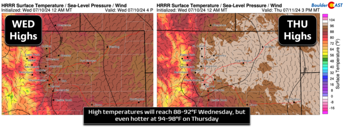
Premium BoulderCAST Daily – Wed 07/10/24 | Back into the lower 90s today with widely scattered late-day thundershowers in/near the higher terrain

Today's weather will be largely identical to Tuesday's as the broader pattern remains unchanged. The strong ridge of high pressure has shifted only slightly north and east over the last 24 hours, now located near Las Vegas. Almost due northerly flow is noted over the Front Range. Similar to yesterday, we expect to see the development of widely scattered showers …

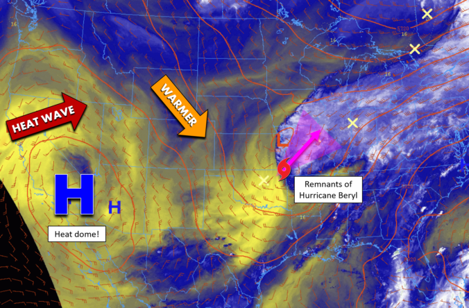
Premium BoulderCAST Daily – Tue 07/09/24 | The heat ramps up this week with upper 80s today trending towards 100° by Friday

Today will continue the slow trend upward in temperatures across the Front Range, a trend that will continue each successive day this week, eventually culminating with triple digits by Friday! The "heat dome" high pressure, which has been responsible for dozens and dozens of record high temperatures in the West, remains situated near the border of California and Arizona this …

Premium BoulderCAST Daily – Sun 07/07/24 | Much cooler with scattered showers and storms this afternoon/evening

What change we are in store for today as a pretty potent cold front for early July has pushed through the region. You can see the front below. It is going to bring a day of upslope flow and also rain chances. But we will struggle to get out of the low to mid 70s, enjoy that crisp and fresh …

Premium BoulderCAST Daily – Sat 07/06/24 | Warming up today ahead of a strong summertime cold front for Sunday

Today, there will be a few boundaries of note. The first is a weak surface trough or cool front tied to an area of low pressure over the eastern Dakotas. This boundary stretches into Nebraska and northeast sections of Colorado. While we will be warming up this afternoon as the airmass modifies, this boundary could result in some weak northeast …

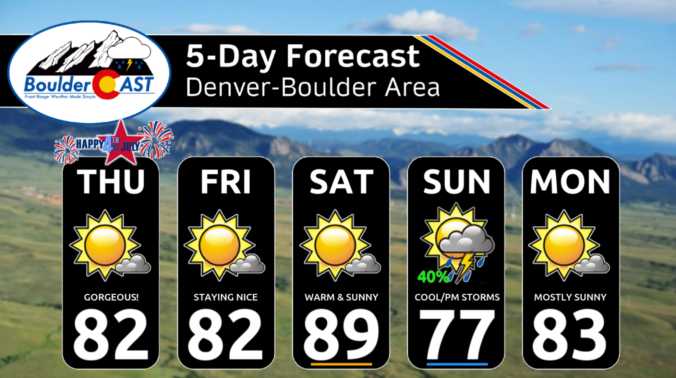
Premium BoulderCAST Daily – Fri 07/05/24 | Remaining cool for the 5th but warming up tomorrow

Yesterday's cold front now lies to our south and east across New Mexico, Texas, and Oklahoma. Even though it is well to our south, the cooler airmass remains for our Friday. Highs will be in the low 80s with lots of sunshine and no chance of rain. However, the chance of rain will return on Sunday. A cold front will …

Premium This Weekend in Colorado Weather: Last night’s impressive cold front, lovely weather for the Fourth, and details on our next chance of rain as the monsoon remains at large

Last night's cold front raced through around 10:30 PM local time packed with abnormally strong winds for July standards. Wind gusts up to 51 MPH accompanied the front, though gusts in Boulder were closer to 35 MPH. Despite the formidability of the front, this was a mostly dry passage with just a few weak showers spawning along it east of …

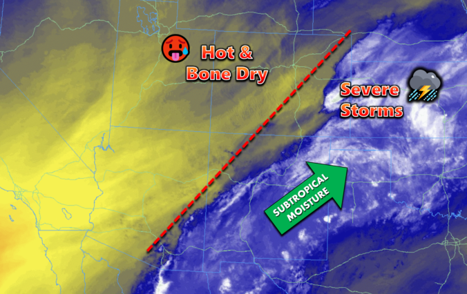
Premium BoulderCAST Daily – Wed 07/03/24 | Hot & dry today with severe storms to the east, a cold front tonight will usher in cooler & pleasant weather for the Fourth

Today begins a more substantial trend towards bone-dry conditions across the Front Range area --- something we bluntly detailed in our weekly outlook on Monday. This morning's GOES-East water vapor animation below shows bountiful dry air across central and western Colorado, as well as everywhere upstream from us to the west and southwest. This dry air will make forming any …

« Older posts Newer posts »