Category: BoulderCAST Daily (Page 97 of 465)

This page contains an index of our BoulderCAST Daily forecast updates. If you are NOT a Premium member, you will only see a tiny sample of this content below. Subscribe to BoulderCAST Premium to gain access to all of our daily forecasts which get published every morning.

Premium BoulderCAST Daily – Sat 07/27/24 | Heat starts building today

Adisturbance will be tracking through today in the southwest flow. A trough axis will be situated from Washington into California. That energy will be tracking through in the southwest flow, which is a downslope flow. As such, there will be storms around this afternoon and evening, but coverge will be highest along/east of Denver, away from the influence of the …

Premium BoulderCAST Daily – Fri 07/26/24 | Wildfire smoke exits this afternoon/evening but storms move onto the Plains

Adisturbance will be tracking through today from the westerly flow aloft and aid our best chance of storms this week. Storms will initially develop over the higher terrain and nearby Foothills. The storms will then track eastward onto the Plains in the late afternoon and early evening. Most storms will be sub-severe, but the stronger ones could certainly put out …

Premium This Weekend in Colorado Weather: Canadian smoke finally vacates the area on Friday! Unfortunately prolonged extreme heat will be its replacement…

The amplified mid-level ridge of high pressure across the West will continue to funnel smoke into Colorado today. Notice how the flow aloft is coming directly from the Canadian prairies southward into the Front Range. However, there is a closed-low pressure coming out of the Pacific Northwest along the Canadian border. This low pressure is ultimately what will cut-off the …

Premium BoulderCAST Daily – Wed 07/24/24 | Air quality improves slightly in the days to come, but worsening heat will keep things uncomfortable

We're happy to report that the end of the thick smoke is in sight across the Front Range. We should see some slight improvement today compared to Tuesday (which looks to have been the worst day of the week), with further improvement expected tomorrow before even more drastic clearing Friday into the weekend. The latest ground-level smoke forecast from the …

Premium BoulderCAST Daily – Tue 07/23/24 | Warming up with smoky skies

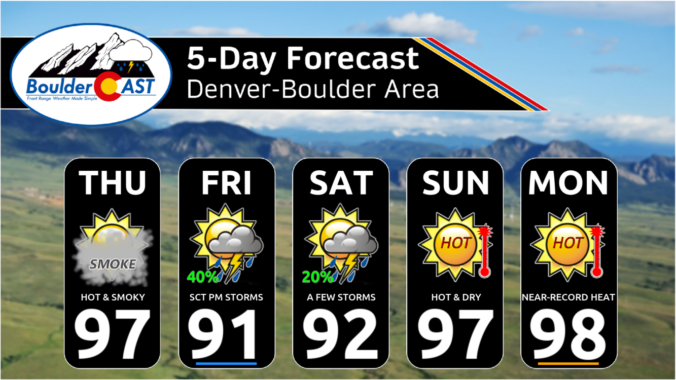
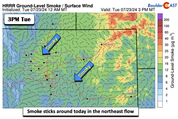
An upper-level ridge axis remains to our west today but will move slightly to the east, spelling out our highs getting back to the low 90s for most places along the Front Range. Boulder may end up just a few degrees shy in the upper 80s. The northerly flow at mid-levels will continue to bring in smoky conditions from Canada …

Premium BoulderCAST Daily – Sun 07/21/24 | More rain chances, with week trending warmer and drier

An upper-level trough axis stretching from northwest to southeast will track through from the north this afternoon and evening. Along with a northeast upslope flow at the surface and high dewpoint air (mid to upper 50s), this will fuel scattered shower and storm development once again into mid to late evening. The area to watch for flash flooding would be …

Premium BoulderCAST Daily – Sat 07/20/24 | Afternoon and evening storms again and trending cooler tomorrow

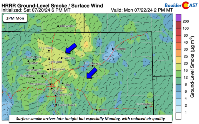
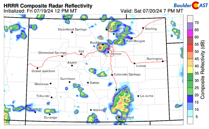
Asurface low will be over the Midwest today. As it tracks slowly to the southeast, a surface trough will extend into northern Texas. While the trough will be to our south, the northeast flow will be prominent across the Front Range today. Also, high pressure over Montana will further reinforce the northeast upslope flow. That northeast flow will favor highs …

« Older posts Newer posts »