Category: BoulderCAST Daily (Page 96 of 465)

This page contains an index of our BoulderCAST Daily forecast updates. If you are NOT a Premium member, you will only see a tiny sample of this content below. Subscribe to BoulderCAST Premium to gain access to all of our daily forecasts which get published every morning.
Premium BoulderCAST Daily – Tue 08/06/24 | Two more hot days with thunderstorms before cooler (and smokier) air arrives Thursday

Yesterday saw the development of showers and thunderstorms across the Denver Metro, aided by the evening arrival of a weak shortwave from the west. Some areas saw more than a half inch of rainfall (south of Denver). Most locations generally picked up less than a quarter inch, though. Water is water though! A flattened ridge of high pressure still resides …

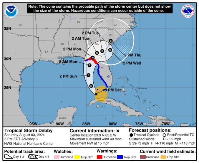
Premium BoulderCAST Daily – Sun 08/04/24 | Increasing storm chances and watching Debby

Adisturbance in the flow will increase the chance of late-day showers and storms across the Front Range. Unfortunately, the heat will still be in place ahead of any activity, with upper 90s to near 100 across Boulder and Denver. The disturbance will be tied to a trough axis over Montana and Wyoming. That axis will bring isolated to scattered storm …

Premium BoulderCAST Daily – Sat 08/03/24 | Hot and smoky weather persists

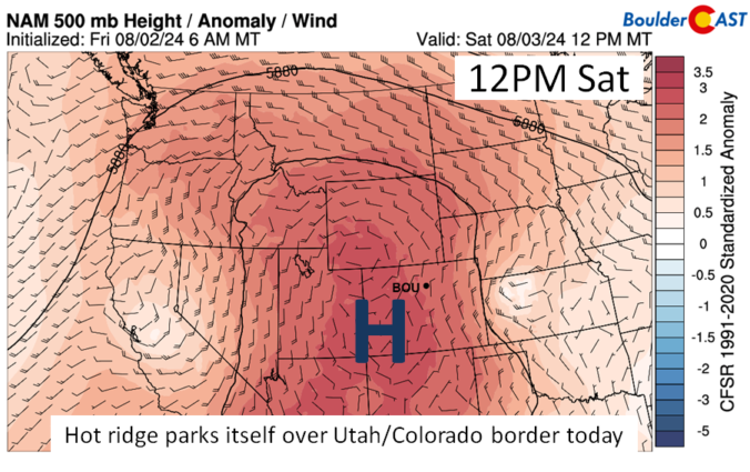
Ahot ridge of high pressure will park itself over Utah and Colorado this afternoon, spelling out a dry and hot day once again. A light northeast flow will develop during the afternoon, which could promote a 1-2 degree lower daytime high than Friday. Nevertheless, we are still hot with mid to upper 90s for most of the Denver and Boulder …

Premium BoulderCAST Daily – Fri 08/02/24 | Heat and Smoke continue

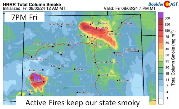
It will be another hot and smoky day across the state and Fro nt Range. The image below shows the total column smoke from the HRRR for this evening. Note the two large areas of intense smoke coverage, one just west of Ft. Collins and another in the southwest part of the state near Telluride. Unfortunately, the smoke will persist …

Premium BoulderCAST Daily – Wed 07/31/24 | The heatwave rages for at least another week as more wildfires ignite in the Front Range and smoke piles up

Boulder set a new daily record high temperature on Tuesday soaring to a cozy 99°F during the early afternoon hours. The prior record was 98°F last set in 2006. Denver hit 100° (again!) but this was not a record for the date. Fortunately Tuesday was the only day this week that we were really concerned about record heat. The overnight …

Premium BoulderCAST Daily – Tue 07/30/24 | Near-record heat once again before thick smoke from California arrives late tonight behind a “cold” front

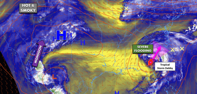
Today's weather in the Front Range will be almost identical to Monday's with completely sunny skies and near-record highs possible as our heatwave marches on --- it's not stopping for anyone. A large swath of exceptionally dry air remains over most of Colorado today, blowing in with the west-southwest aloft. This is shown by the yellow shading in the GOES-East …

Premium BoulderCAST Daily – Sun 07/28/24 | It’s getting hot

Ahot westerly flow will ensue for today and continue through much of the coming week. That is going to spell out middle 90s for us this afternoon but upper 90s to around 100 as the coming week progresses. There will be little chance of rain until later in the week. Our NowCAST shows that highs will be hottest in Denver …

« Older posts Newer posts »