Category: BoulderCAST Daily (Page 26 of 465)

This page contains an index of our BoulderCAST Daily forecast updates. If you are NOT a Premium member, you will only see a tiny sample of this content below. Subscribe to BoulderCAST Premium to gain access to all of our daily forecasts which get published every morning.
Premium BoulderCAST Daily – Tue 04/14/26 | A Pair of Storms on the Way: Rain Showers Today, Wet Snow on Friday

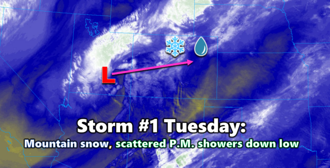
The first of two storm systems this week is sliding across Colorado today, bringing snow back to the High Country and a round of light, scattered showers for the lower elevations. Early Tuesday morning's satellite imagery shows the compact cut‑off low spinning over far southern Utah, with the center of the circulation on track to pass almost directly over Denver …

Premium BoulderCAST Daily – Sun 04/12/26 | A quiet but breezy Sunday with elevated fire danger

After several days of “late‑period” showers and thunderstorms teasing the forecast—amounting to just 0.01" in Boulder and only a trace in Denver—we finally dry out today as a much drier airmass pushes in from the southwest. GOES‑East water vapor imagery still highlights the stubborn closed low lingering just offshore of northern California, but the more relevant signal for Colorado is …

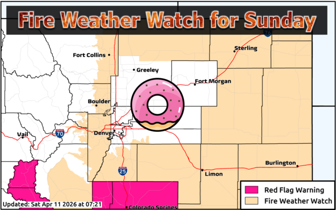
Premium BoulderCAST Daily – Sat 04/11/26 | Sporadic showers today, fire weather concerns return Sunday

Today brings another round of sporadic raindrops as our unsettled pattern continues to churn across the central and northern Rockies. A steady plume of subtropical moisture is still being funneled northward into Colorado on the eastern flank of a broad California trough. While moisture levels aren’t quite as robust as yesterday, there’s still enough juice in the column to support …

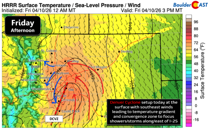
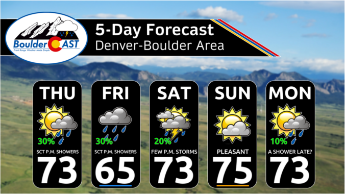
Premium BoulderCAST Daily – Fri 04/10/26 | Moisture plume arrives into Colorado fueling another round of scattered late-day showers and storms

The first rumbles of 2026 echoed across Boulder County Thursday evening as a weak, early‑season thunderstorm bubbled up over south Boulder before drifting through Superior and Broomfield and then collapsing further east. It only managed a couple minutes of rain, but the return of convective structure—lightning, updrafts, outflow winds—is a clear signal that we’re transitioning into spring mode along the …

Premium This Weekend in Colorado Weather: Daily chances for spotty April showers, but they won’t amount to much

Yesterday’s cold front jumped the gun, surging through around lunchtime—much earlier than any model suggested and far closer to what our gut had been hinting at. https://twitter.com/BoulderCAST/status/2041945279252066514 Boulder still managed to sneak into the low 70s before the boundary arrived, while spots like Denver International Airport stayed stuck in the 60s. Behind the front, breezy northeast winds mixed with a …

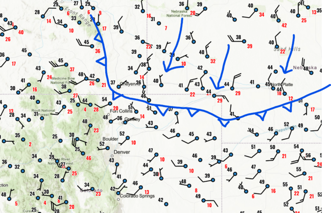
Premium BoulderCAST Daily – Wed 04/08/26 | Near-critical fire danger ahead of a cold front, rain chances tick up late-week

The main forecasting challenge for today regards the position and progression of a cold front that is moving into northeast Colorado this morning. The exact position of this boundary will determine how much of our area is exposed to very dry downslope flow from the west-northwest during the daytime hours and thus which areas will see near-critical fire danger. An …

Premium BoulderCAST Daily – Tue 04/07/26 | Highs hovering in the lower 70s the next several days with limited rain chances

Apleasant next few days as temperatures range around 6-10 degrees above normal in the upper 60s to lower 70s over much of the Denver Metro area. This morning's cold front, that has led to some chilly morning temperatures, will retreat northward as southerly flow then takes over. Our highs should top out in the low 70s with mostly sunny skies. …

« Older posts Newer posts »