Category: BoulderCAST Daily (Page 192 of 465)

This page contains an index of our BoulderCAST Daily forecast updates. If you are NOT a Premium member, you will only see a tiny sample of this content below. Subscribe to BoulderCAST Premium to gain access to all of our daily forecasts which get published every morning.
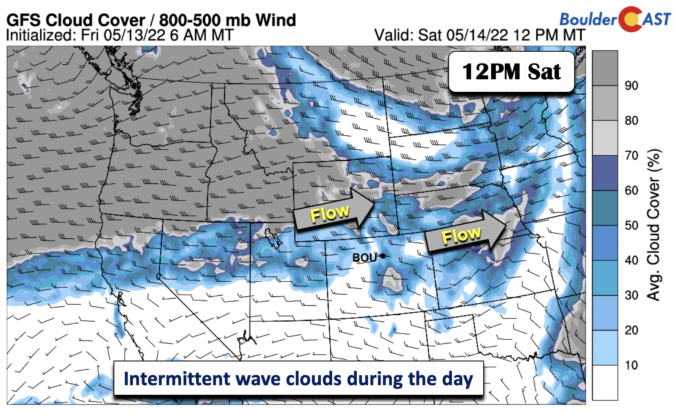
BoulderCAST Daily – Sat 05/14/22 | Intermittent wave clouds with highs near 80

Anearly zonal flow has taken over today at mid-levels. However, a west-northwest flow still exists within the pattern, as a trough of low pressure sits over the upper Mississippi Valley and Minnesota. The flow aloft is still pushing 30-40 mph so we are not fully out of the fire danger woods yet - though much better conditions than all week. …

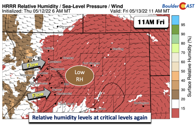
BoulderCAST Daily – Fri 05/13/22 | Relative humidity reaches critical levels again today with breezy conditions

Amid-level trough is positioned over western North Dakota today, with its trough axis extending into Wyoming and Colorado. The extension of the axis into our state will lead to another downslope scenario today. Winds aloft are strong enough to warrant another elevated fire danger. Further up the atmosphere, a jet streak approaching 90+ MPH is nearly orthogonal to the mountains …

Weekend Weather Outlook: May 12, 2022

Amoist cold front backed into the Front Range last night before midnight bringing cooler temperatures and a surge of moisture in the air. We actually had dew points above 50°F for several hours overnight --- it sure felt good if you had the windows open like we did! A look at the current surface dewpoints highlights nicely where the front …

BoulderCAST Daily – Wed 05/11/22 | The hottest day of 2022 so far arrives with a side of high fire danger

Today will certainly be the hottest day of this week...but also likely the hottest day we've seen thus far in 2022. The weather pattern across the United States is highly meridional right now, meaning there is bountiful north and south directionality in the flow. This can be seen in this morning's GOES-East water vapor animation below. Meridional flow patterns tend …

BoulderCAST Daily – Tue 05/10/22 | Mostly sunny & seasonal under a Denver Cyclone pattern; heat & fire danger return tomorrow

ADenver Cyclone setup will develop this afternoon keeping things on the cooler side for Boulder County, while areas further south and east will be warmer and windier. Recall that a Denver Cyclone forms when low-level winds from the southeast interact with the local terrain and form a counter-clockwise swirl of low pressure over the Denver Metro area. Watch the windy …

BoulderCAST Daily – Sun 05/08/22 | Highs in the upper 70s with elevated fire concerns mainly south of Denver

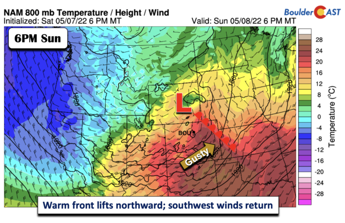
The surface cold front which has moved through the area last evening will be lifting northward later this afternoon - as a warm front. The result will be a calm wind for the start of our day, followed by increasingly southwest winds, with gusts at times to the mid 20s miles per hour. It will be another warm one, but …

BoulderCAST Daily – Sat 05/07/22 | Near-record warmth with dangerous fire conditions

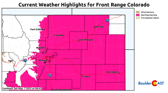
Dangerous fire conditions are in place today with a strong trough of low pressure in the Montana/Idaho Region. A strong and expansive southwest flow is in place, rotating around the system. Southwest winds will peak this afternoon over 40-45 mph at times on the Plains and up to 50-55 mph in the Foothills. At the surface, the southwest winds will …

« Older posts Newer posts »