Category: BoulderCAST Daily (Page 191 of 465)

This page contains an index of our BoulderCAST Daily forecast updates. If you are NOT a Premium member, you will only see a tiny sample of this content below. Subscribe to BoulderCAST Premium to gain access to all of our daily forecasts which get published every morning.
BoulderCAST Daily – Sun 05/22/22 | Scattered showers/thundershowers later today/tonight

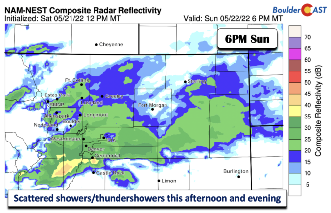
Ashortwave trough located over southeastern Idaho and western Wyoming today appears that it will bring enough mid-level energy into the state to produce scattered showers and thundershowers this afternoon and into the evening to early overnight hours. Ahead of the scattered shower activity, temperatures will turn warmer from our Saturday into the upper 50s to near 60 in spots of …

BoulderCAST Daily – Sat 05/21/22 | Snow tapers off by late morning…highs in the 40s

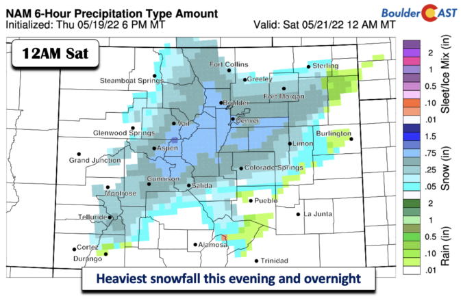
The winter storm is about to end. Below shows what the radar may look like at 6 AM. Off and on snow showers will continue into mid-morning, especially along the Foothills, western Boulder, and along the Palmer Divide. By 11 AM, or late morning, snow and precipitation should largely come to an end and shift well south of the Front …

BoulderCAST Daily – Fri 05/20/22 | Heaviest snow late this afternoon/evening into the overnight hours

Tanticipated strong and anomalous winter storm remains on track. As of 5 AM this morning, the temperature was already in the mid to upper 30s, according to our latest surface analysis, shown below. Temperatures will continue to tumble, holding largely steady in the 33-35 degree range into the mid to late afternoon hours. As for precipitation, rain will overspread the …

BoulderCAST Daily – Thu 05/19/22 | Near-record heat & windy today, snow totals are increasing for tomorrow…

Today's update will be short and sweet. There's a lot of model data to comb through this morning to fine-tune our forecast for the incoming winter storm. We'll include a short update on snow amounts in moment --- they have increased. For today, the concern is for high fire danger across all of eastern Colorado as westerly downslope flow ramps …

BoulderCAST Daily – Wed 05/18/22 | A quiet day ahead in the 80s, but a winter storm is approaching

Today will be slightly cooler than yesterday, but only by a few degrees. It may be difficult to actually perceive the "cold" front that moved through overnight. We're starting out with some clouds, but skies will clear out quickly leaving mostly sunny skies the rest of the day. Expect mild morning temperatures in the 50s with daytime highs in the …

BoulderCAST Daily – Tue 05/17/22 | Severe storms northeast of Denver today, plus an update on the late-week rainy/snowy system

Today should offer the best chance of thunderstorms across the area as several ingredients come together this afternoon into the evening. Even still, we're only looking at 10 to 20% chances across the immediate Denver Metro area as the best moisture remains off to the north and east of us. A subtle shortwave embedded in the larger westerly flow will …

BoulderCAST Daily – Sun 05/15/22 | A cooler day today in the mid to upper 70s

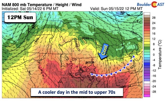
Acold front which has moved through the area earlier will settle south and east of the region tonight, near the southern Kansas and Colorado domain. Behind the front, temperatures will be some 5 degrees cooler in the mid to upper 70s - a pleasant May to enjoy the day outside. Winds will be light for a change! Overnight lows tonight …

« Older posts Newer posts »