


Category: BoulderCAST Daily (Page 179 of 465)

This page contains an index of our BoulderCAST Daily forecast updates. If you are NOT a Premium member, you will only see a tiny sample of this content below. Subscribe to BoulderCAST Premium to gain access to all of our daily forecasts which get published every morning.
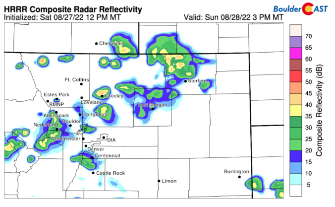
DayCAST: Sun 8/28/22 | Hot and slight chance of scattered showers

Detailed Forecast Discussion: Sunday starts a bit warmer than recent days with a morning low around 66.  Clear skies will help the day warm up faster than we've seen in the last few days.  Sunday's high will be around 90 degrees with some westerly flow and a small chance of an afternoon shower.   The HRRR and NAM-NEST models below agree …

BoulderCAST Daily – Sat 08/27/22 | Temperatures warmer near 90 with added sunshine

The trough from Friday has pushed into Canada, while the trough axis stretches from the Dakotas into far eastern Colorado. The passage of the trough, in conjunction with drier air settling in this afternoon, will produce a dry downslope flow on the Plains and also across the central to northern parts of the mountains. Both of the above mentioned factors …

BoulderCAST Daily – Fri 08/26/22 | Highs lower today with increased clouds and storms

Apotent upper-level disturbance will track through the state in the westerly flow over the Rockies. While the jet is not overly impressive, it is approaching 80 mph, which is decent for late-summer. This approach and passage of this mid-level wave will organize scattered to numerous showers and storms across the higher terrain today, moving onto the Plains later this afternoon …

Colorado Weekend Weather Outlook: August 25, 2022

Wet weather returns to the forecast today, largely resulting from a slight uptick in monsoon moisture being stirred up by a shortwave disturbance moving across Wyoming through the day. GOES-East water vapor imagery this morning shows the storm's presence in Wyoming. We no longer see the huge swath of dry air over Colorado either --- moisture and clouds are on …

BoulderCAST Daily – Wed 08/24/22 | Another dry day as temperatures creep upward

Colorado once again resides in a mostly benign northwest flow regime with relatively dry air aloft. Weak high pressure is situated near Las Vegas, with the clockwise flow around this high bringing in the drier air to our area from the northwest. This will lead to another mostly dry day across the Front Range with storms only developing across the …

BoulderCAST Daily – Tue 08/23/22 | Mostly sunny & seasonal with a few storms in the Foothills

Similar to yesterday, storm coverage will be quite limited across the Front Range, once again being confined mostly to the higher elevations. The only difference today is the steering flow. It will increase in speed out of the northwest causing any storms that develop up there to drift southeastward towards Boulder and Denver. Moisture is limited with precipitable water values …

BoulderCAST Daily – Sun 08/21/22 | Storm coverage pushes further east today across Denver

Yesterday a moist trough axis was located northwest to southeast, moving right through southwest Colorado. Today, that trough axis has pushed further to the north and east, stretching into northwest Colorado and as far east as south-central Colorado. In the center of the axis is a mesoscale, or small-scale, low pressure system. This will help to force afternoon/evening showers storms …

« Older posts Newer posts »
